Rubha Righinn

Coastal Feature, Headland, Point in Argyllshire

Scotland

Rubha Righinn

Corryvreckan, north of Jura An area of turbulence with, behind it, a dead-flat area of sea.  Photo taken mid afternoon.  I think the tide was listed as 4.0 that day.
Corryvreckan, north of Jura Credit: Patrick Hamilton

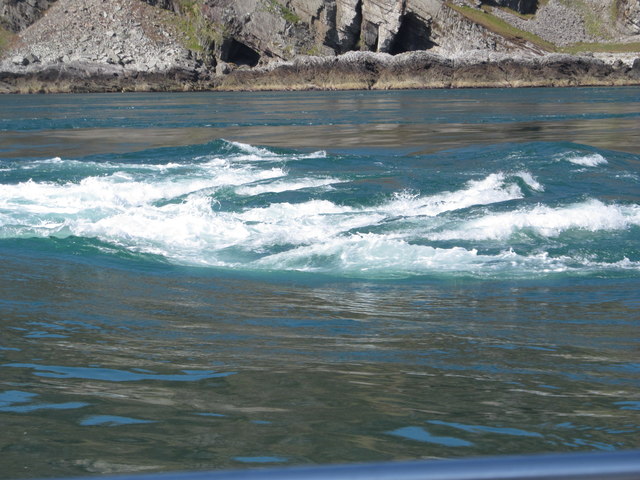
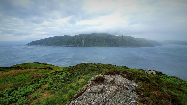
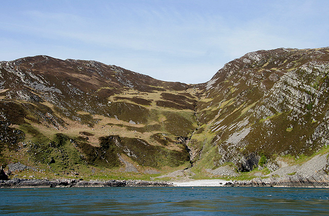
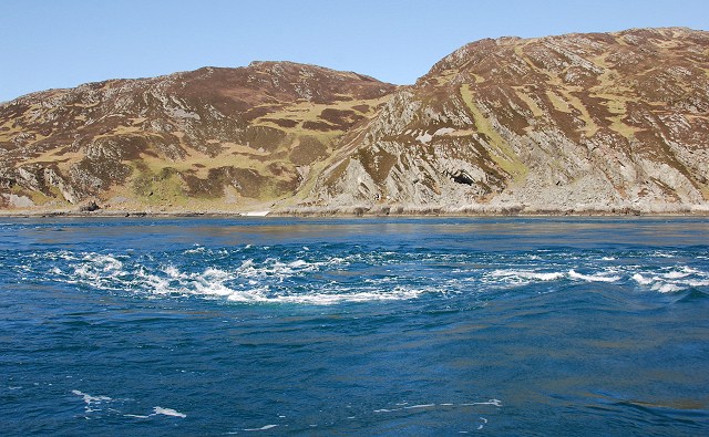
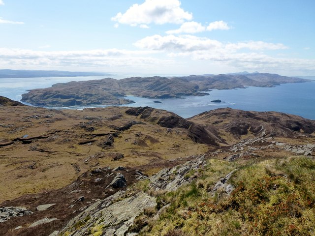
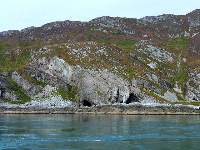
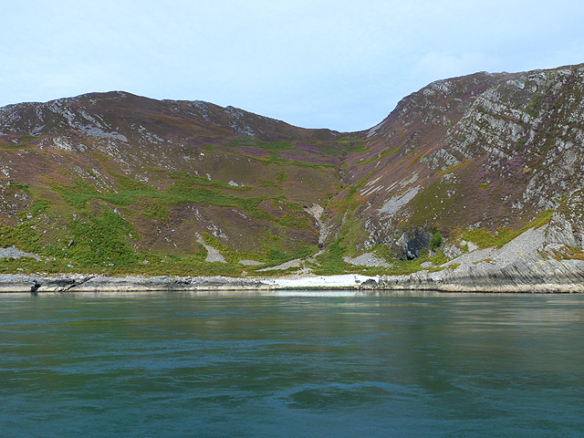
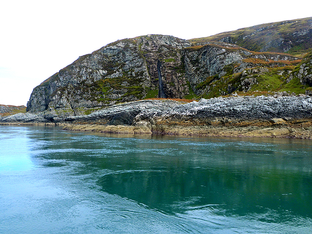
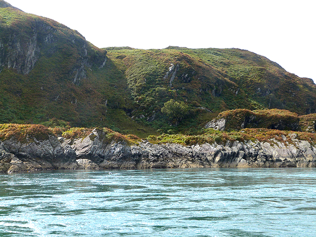
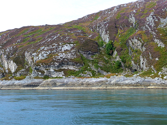
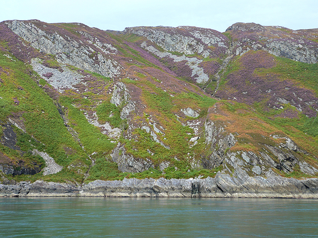
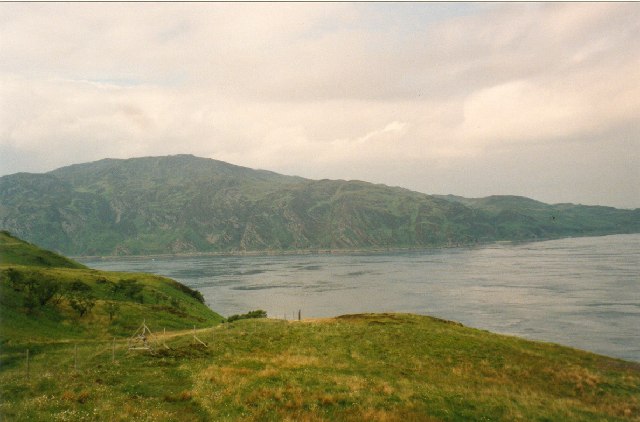
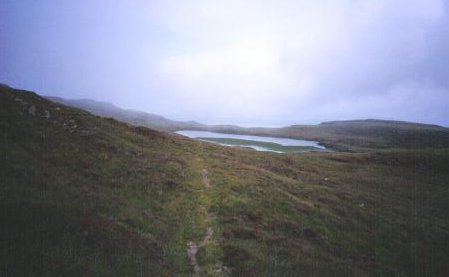
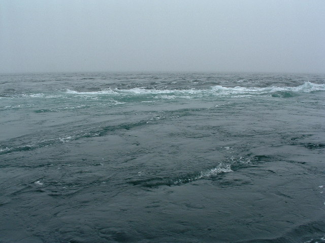
Rubha Righinn is a prominent headland located in Argyllshire, Scotland. Situated on the western coast of the country, it juts out into the Atlantic Ocean, offering stunning views of the surrounding landscape. The headland is characterized by its rugged cliffs, which rise steeply from the sea, providing a dramatic backdrop against the crashing waves below.

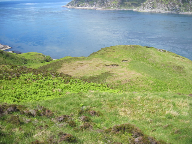
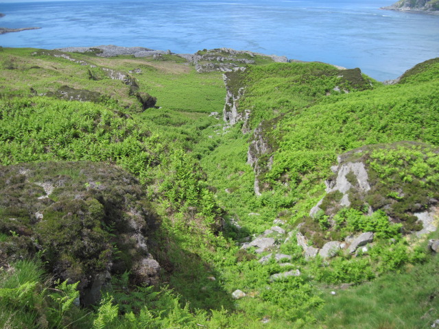
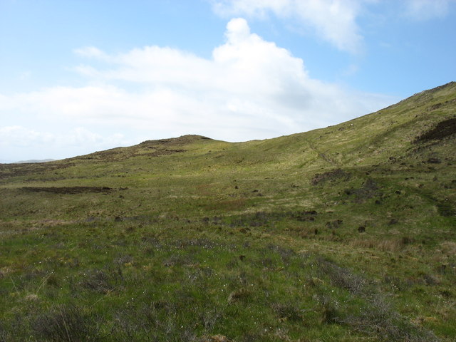
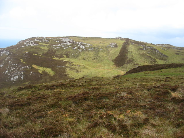
Covered in lush vegetation, Rubha Righinn is home to a diverse range of flora and fauna. The headland's coastal grasslands are particularly notable, hosting a variety of plant species adapted to the harsh coastal conditions. Wildflowers such as sea pinks and thrift can be found dotting the landscape, adding vibrant splashes of color to the area.

The headland also serves as an important habitat for seabirds, with colonies of puffins, razorbills, and guillemots nesting on its cliffs during the breeding season. Their distinctive cries can be heard echoing across the headland, creating a lively atmosphere.

Rubha Righinn is a popular destination for nature enthusiasts and hikers, offering numerous walking trails that showcase the area's natural beauty. Visitors can explore the headland's rugged coastline, enjoying panoramic views of the Atlantic Ocean and the surrounding coastline.

In addition to its natural attractions, Rubha Righinn also holds historical significance. The headland is home to the remains of an ancient fort, providing insight into the region's rich history and serving as a reminder of the area's past inhabitants.

Overall, Rubha Righinn is a captivating coastal feature, offering a blend of natural beauty, wildlife, and historical interest. Its picturesque setting and diverse ecosystem make it a must-visit destination for anyone exploring Argyllshire's stunning coastline.

If you have any feedback on the listing, please let us know in the comments section below.

Rubha Righinn Images

Images are sourced within 2km of 56.160337/-5.7006244 or Grid Reference NM7002. Thanks to Geograph Open Source API. All images are credited.

Corryvreckan, north of Jura An area of turbulence with, behind it, a dead-flat area of sea.  Photo taken mid afternoon.  I think the tide was listed as 4.0 that day.
Corryvreckan, north of Jura
An area of turbulence with, behind it, a dead-flat area of sea. Photo taken mid afternoon. I think the tide was listed as 4.0 that day.
Above Creag an t-Seòil
Gulf of Corryvreckan Looking over the gulf in the direction of Scarba from the northern tip of Jura.
Gulf of Corryvreckan
Looking over the gulf in the direction of Scarba from the northern tip of Jura.
Uamh Camas nam Bairneach on Scarba This gully with a burn running down into the Camas nan Bairneach on the south side of Scarba was viewed from a small boat in the Gulf of Corryvreckan.
Uamh Camas nam Bairneach on Scarba
This gully with a burn running down into the Camas nan Bairneach on the south side of Scarba was viewed from a small boat in the Gulf of Corryvreckan.
Corryvreckan Whirlpool Taken on a trip from Crinan with small tides and good weather.
Corryvreckan Whirlpool
Taken on a trip from Crinan with small tides and good weather.
Towards Port Gill' a' Ghairdein
Cruach Scarba Looking towards the whirlpool and Jura from below the summit of Cruach Scarba.
Cruach Scarba
Looking towards the whirlpool and Jura from below the summit of Cruach Scarba.
Sea caves on the south coast of Scarba
Camas nam Bairneach Bay and valley on the south coast of Scarba.
Camas nam Bairneach
Bay and valley on the south coast of Scarba.
Carraig Mhòr Northernmost point of the Isle of Jura.
Carraig Mhòr
Northernmost point of the Isle of Jura.
Raised beach and old sea cliffs East of Carraig Mhòr at the north end of the Isle of Jura.
Raised beach and old sea cliffs
East of Carraig Mhòr at the north end of the Isle of Jura.
South coast of Scarba
The track across Scarba The track is seen on the right, climbing gently to almost its highest point at 285m.
The track across Scarba
The track is seen on the right, climbing gently to almost its highest point at 285m.
The hills of south-west Scarba Seen from a short distance below the track, which this far west had almost disappeared.
The hills of south-west Scarba
Seen from a short distance below the track, which this far west had almost disappeared.
Scarba and the Gulf of Corryvreckan The extreme tidal race between the islands of Jura and Scarba give rise to the notorious Corryvreckan whirlpool, a condition that only occurs at a few other places in the world.  The local navigation charts describe the area as "un-navigable".
Scarba and the Gulf of Corryvreckan
The extreme tidal race between the islands of Jura and Scarba give rise to the notorious Corryvreckan whirlpool, a condition that only occurs at a few other places in the world. The local navigation charts describe the area as "un-navigable".
Loch Airidh a' Chruidh Pony path high on Scarba, heading eastward towards Loch Airidh a' Chruidh.
Loch Airidh a' Chruidh
Pony path high on Scarba, heading eastward towards Loch Airidh a' Chruidh.
Corryvreckan Whirlpool Between Scarba and Jura lies Corryvreckan, caused by a tidal race, between the two isles, meeting underwater pillars which stop just below the surface that force the waters to swell up, or sook down!
Corryvreckan Whirlpool
Between Scarba and Jura lies Corryvreckan, caused by a tidal race, between the two isles, meeting underwater pillars which stop just below the surface that force the waters to swell up, or sook down!
Show me another place!

Rubha Righinn is located at Grid Ref: NM7002 (Lat: 56.160337, Lng: -5.7006244)

Unitary Authority: Argyll and Bute

Police Authority: Argyll and West Dunbartonshire

What 3 Words

///rules.punks.qualified. Near Lochgilphead, Argyll & Bute

Related Wikis

Gulf of Corryvreckan

The Gulf of Corryvreckan (from the Gaelic Coire Bhreacain, meaning 'cauldron of the speckled seas' or 'cauldron of the plaid'), also called the Strait...

Scarba

Scarba (Scottish Gaelic: Sgarba) is an island, in Argyll and Bute, Scotland, just north of the much larger island of Jura. The island has not been permanently...

Kinuachdrachd

Kinuachdrachd or Kinuachdrach is a place about 22 miles from Craighouse on the island of Jura, in the council area of Argyll and Bute, Scotland. It comprises...

Barnhill, Jura

Barnhill is a farmhouse in the north of the island of Jura in the Scottish Inner Hebrides overlooking the Sound of Jura. It stands on the site of a larger...

Nearby Amenities

Located within 500m of 56.160337,-5.7006244
Coire Bhreacain
Natural: bay
Source: OS_OpenData_StreetView
Lat/Long: 56.1597467/-5.7033536
Ciste nan Arm
Place: locality
Source: OS_OpenData_StreetView
Lat/Long: 56.1621457/-5.6974901
Maol Rhiabhach
Place: locality
Source: OS_OpenData_StreetView
Lat/Long: 56.1627828/-5.7054693
The data included in this document is from www.openstreetmap.org. The data is made available under ODbL.

Have you been to Rubha Righinn?

Leave your review of Rubha Righinn below (or comments, questions and feedback).