Na Rubhachan Donna

Coastal Feature, Headland, Point in Argyllshire

Scotland

Na Rubhachan Donna

Corryvreckan, north of Jura An area of turbulence with, behind it, a dead-flat area of sea.  Photo taken mid afternoon.  I think the tide was listed as 4.0 that day.
Corryvreckan, north of Jura Credit: Patrick Hamilton

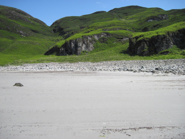
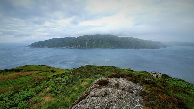
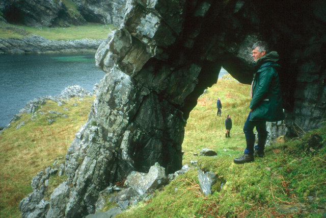
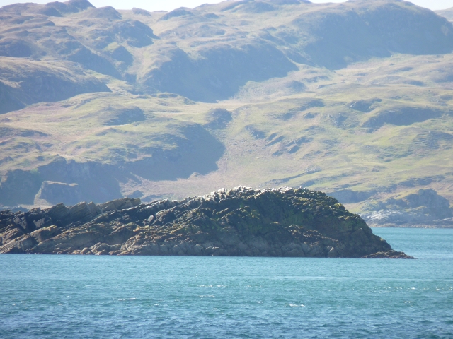
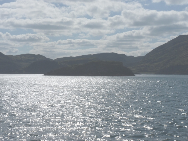
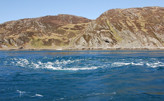
Na Rubhachan Donna is a prominent headland located in Argyllshire, Scotland. Situated on the west coast of the country, it is known for its majestic beauty and striking coastal features. The name "Na Rubhachan Donna" translates to "The Black Promontories" in English, referencing the dark cliffs that characterize the area.

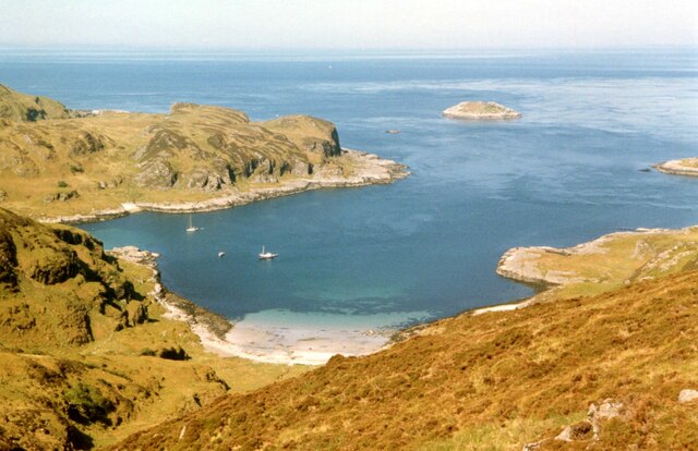
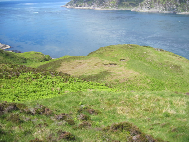
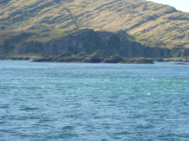
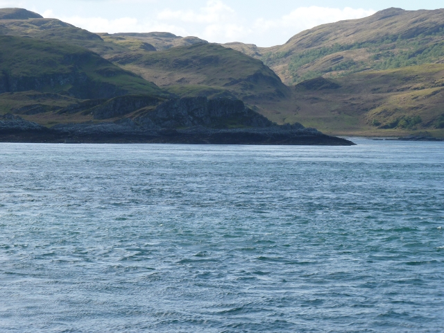
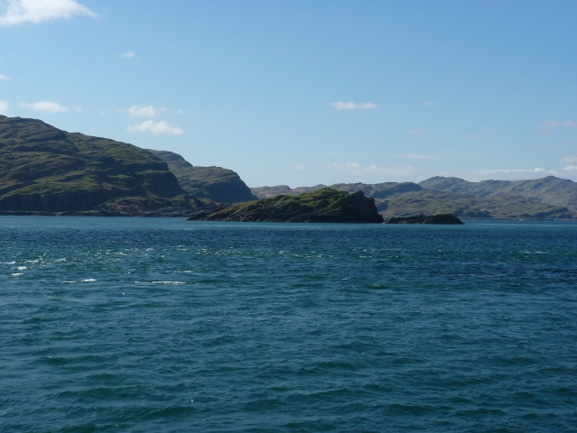
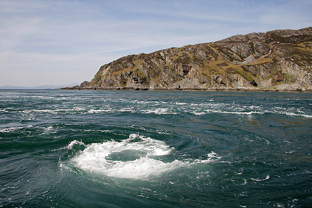
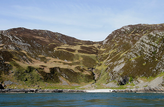
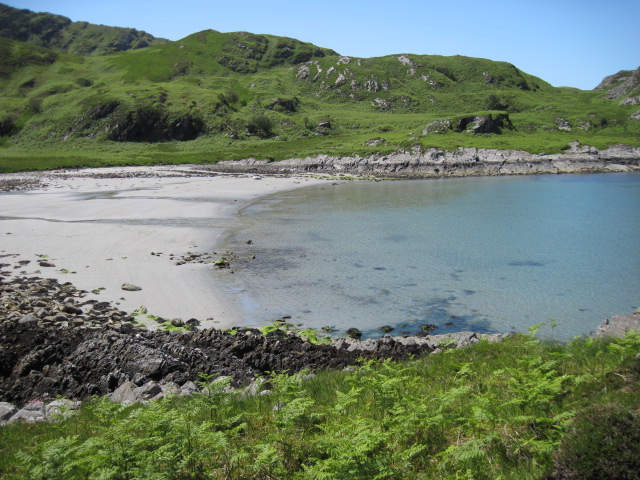
This headland is nestled between two picturesque bays, offering breathtaking views of the surrounding landscape. Its rugged cliffs, composed of volcanic rocks and sedimentary layers, are a testament to the area's geological history. The cliffs rise dramatically from the sea, reaching heights of up to 200 feet in some places, creating an awe-inspiring sight for visitors.

Na Rubhachan Donna is renowned for its diverse wildlife and natural habitats. The headland is home to a wide array of bird species, including gannets, puffins, and guillemots, making it a popular destination for birdwatching enthusiasts. The surrounding waters are also rich in marine life, with seals often seen basking on the rocks or swimming in the nearby coves.

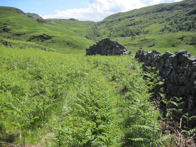
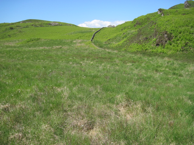
Accessible via a network of walking trails, Na Rubhachan Donna offers opportunities for outdoor activities such as hiking and photography. The headland's rugged terrain and coastal vistas provide ample opportunities for exploration and appreciation of Scotland's natural beauty.

Overall, Na Rubhachan Donna is a stunning coastal feature and headland in Argyllshire, attracting visitors from near and far with its rugged cliffs, diverse wildlife, and breathtaking views of the surrounding landscape.

If you have any feedback on the listing, please let us know in the comments section below.

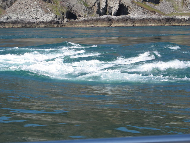
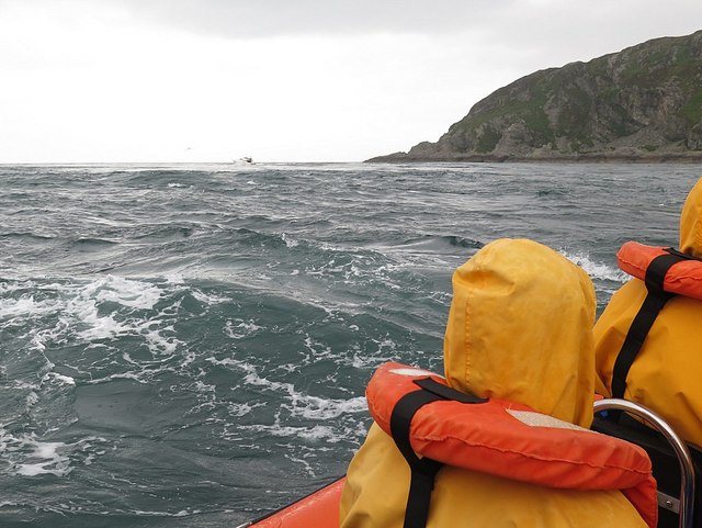
Na Rubhachan Donna Images

Images are sourced within 2km of 56.147989/-5.7207627 or Grid Reference NM6801. Thanks to Geograph Open Source API. All images are credited.

Corryvreckan, north of Jura An area of turbulence with, behind it, a dead-flat area of sea.  Photo taken mid afternoon.  I think the tide was listed as 4.0 that day.
Corryvreckan, north of Jura
An area of turbulence with, behind it, a dead-flat area of sea. Photo taken mid afternoon. I think the tide was listed as 4.0 that day.
Gulf of Corryvreckan
Bagh Gleann nam Muc The Bay of the Pig's Glen at the NW tip of Jura along with Eilean Mor and Eilean Beag, seen from An Cruachan.
Bagh Gleann nam Muc
The Bay of the Pig's Glen at the NW tip of Jura along with Eilean Mor and Eilean Beag, seen from An Cruachan.
Above Creag an t-Seòil
Beach below An Cruachan
Gulf of Corryvreckan Looking over the gulf in the direction of Scarba from the northern tip of Jura.
Gulf of Corryvreckan
Looking over the gulf in the direction of Scarba from the northern tip of Jura.
Towards ruin below Cruach Eoghainn
Gleann nam Muc towards ruin
Natural arch at Glentrosdale Bay The west coast of Jura abounds with raised coastal features.
Natural arch at Glentrosdale Bay
The west coast of Jura abounds with raised coastal features.
Eilean Beag from Corryvreckan Was this the small island (what Eilean Beag means..) that George Orwell ended up stranded on with his son after getting into difficulties with the Corryvreckan whirlpool??? If not this then presumably the nearby Eilean Mòr (Big Island)
Eilean Beag from Corryvreckan
Was this the small island (what Eilean Beag means..) that George Orwell ended up stranded on with his son after getting into difficulties with the Corryvreckan whirlpool??? If not this then presumably the nearby Eilean Mòr (Big Island)
Eilean Beag with Jura beyond Islet hardly distinguishable from Jura.
Eilean Beag with Jura beyond
Islet hardly distinguishable from Jura.
Eilean Mòr from Corryvreckan From deck of the PS Waverley at slack tide: Well, you wouldn't want to go over Corryvreckan in a 1946-built steam powered paddle-steamer when the whirlpool is at its worst.
Eilean Mòr from Corryvreckan
From deck of the PS Waverley at slack tide: Well, you wouldn't want to go over Corryvreckan in a 1946-built steam powered paddle-steamer when the whirlpool is at its worst.
Guano-topped outlier of Eilean Mòr Small bit of rock favour by sea-birds, evidently, separated at high-tide from the rest of Eilean Mòr
Guano-topped outlier of Eilean Mòr
Small bit of rock favour by sea-birds, evidently, separated at high-tide from the rest of Eilean Mòr
Eilean Mòr with Jura beyond Glentrosdale Bay is the other side of Eilean Mòr. Bit washed-out as taken into sun bouncing off sea
Eilean Mòr with Jura beyond
Glentrosdale Bay is the other side of Eilean Mòr. Bit washed-out as taken into sun bouncing off sea
The Corryvreckan Whirlpool This whirlpool effect is caused by the squeezing of the tide though the narrow Gulf of Corryvreckan between Jura and Scarba, over humps and holes in the reef, including a rock pinnacle that rises to 29m from the surface of the sea. This was taken from a small boat that sailed from Easdale.
The Corryvreckan Whirlpool
This whirlpool effect is caused by the squeezing of the tide though the narrow Gulf of Corryvreckan between Jura and Scarba, over humps and holes in the reef, including a rock pinnacle that rises to 29m from the surface of the sea. This was taken from a small boat that sailed from Easdale.
Uamh Camas nam Bairneach on Scarba This gully with a burn running down into the Camas nan Bairneach on the south side of Scarba was viewed from a small boat in the Gulf of Corryvreckan.
Uamh Camas nam Bairneach on Scarba
This gully with a burn running down into the Camas nan Bairneach on the south side of Scarba was viewed from a small boat in the Gulf of Corryvreckan.
Corryvreckan Whirlpool Taken on a trip from Crinan with small tides and good weather.
Corryvreckan Whirlpool
Taken on a trip from Crinan with small tides and good weather.
Bàgh Gleann nam Muc
Bàgh Gleann nam Muc
Show me another place!

Na Rubhachan Donna is located at Grid Ref: NM6801 (Lat: 56.147989, Lng: -5.7207627)

Unitary Authority: Argyll and Bute

Police Authority: Argyll and West Dunbartonshire

What 3 Words

///kiosk.dressing.rigid. Near Lochgilphead, Argyll & Bute

Related Wikis

Gulf of Corryvreckan

The Gulf of Corryvreckan (from the Gaelic Coire Bhreacain, meaning 'cauldron of the speckled seas' or 'cauldron of the plaid'), also called the Strait...

Kinuachdrachd

Kinuachdrachd or Kinuachdrach is a place about 22 miles from Craighouse on the island of Jura, in the council area of Argyll and Bute, Scotland. It comprises...

Scarba

Scarba (Scottish Gaelic: Sgarba) is an island, in Argyll and Bute, Scotland, just north of the much larger island of Jura. The island has not been permanently...

Barnhill, Jura

Barnhill is a farmhouse in the north of the island of Jura in the Scottish Inner Hebrides overlooking the Sound of Jura. It stands on the site of a larger...

Nearby Amenities

Located within 500m of 56.147989,-5.7207627
Na Rubhachan Donna
Natural: cape
Source: OS_OpenData_StreetView
Lat/Long: 56.1482222/-5.7214022
An Spardan
Place: locality
Source: OS_OpenData_StreetView
Lat/Long: 56.1439865/-5.7214979
Geodh' Uamh an Spardain
Natural: bay
Source: OS_OpenData_StreetView
Lat/Long: 56.1449434/-5.7243623
Port Gill' a' Ghairdein
Natural: bay
Source: OS_OpenData_StreetView
Lat/Long: 56.1484469/-5.7170539
Uamh Gill' an Duim
Natural: cave_entrance
Source: OS_OpenData_StreetView
Lat/Long: 56.1475032/-5.7163973
Uamh an Spardain
Natural: cave_entrance
Source: OS_OpenData_StreetView
Lat/Long: 56.1457855/-5.7237169
The data included in this document is from www.openstreetmap.org. The data is made available under ODbL.

Have you been to Na Rubhachan Donna?

Leave your review of Na Rubhachan Donna below (or comments, questions and feedback).