Yellow Carn

Coastal Feature, Headland, Point in Cornwall

England

Yellow Carn

Kynance Cove beach
Kynance Cove beach Credit: Tom Page

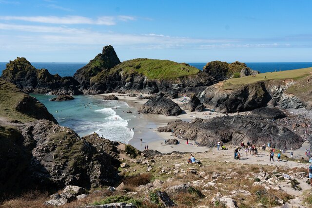
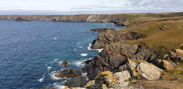
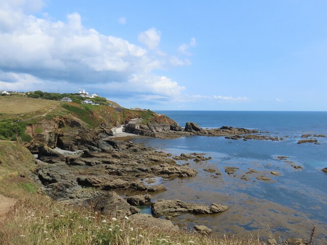
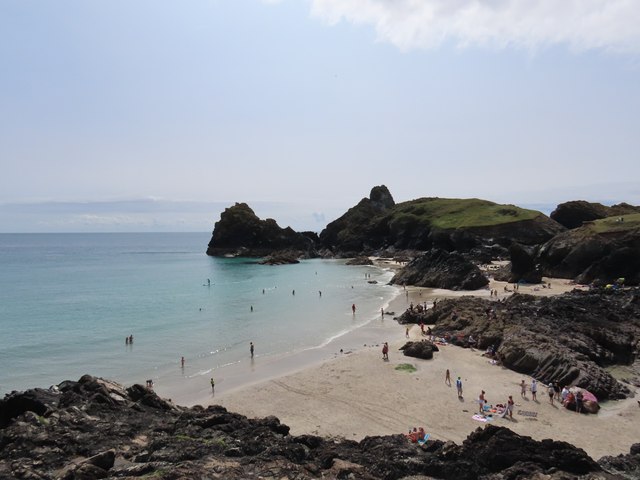
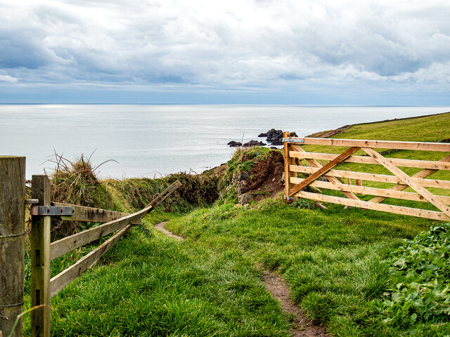
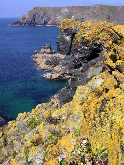
Yellow Carn is a prominent coastal feature located in Cornwall, England. It is classified as a headland or point, jutting out into the Atlantic Ocean. This geological formation is situated in the southwestern part of the county, near the town of St. Ives.

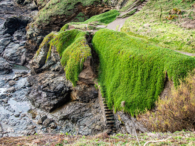
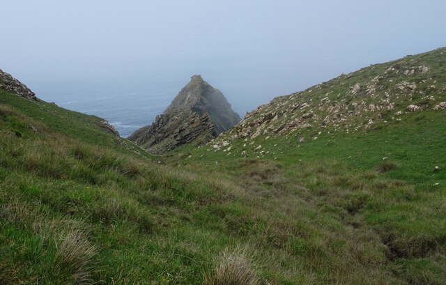
The name "Yellow Carn" is derived from the Cornish language, with "carn" meaning a rocky hill or outcrop. The headland is characterized by its distinctive yellow cliffs, which are composed of sedimentary rocks and provide a stunning contrast against the deep blue waters of the ocean.

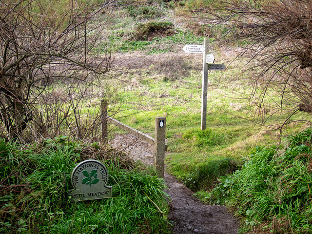
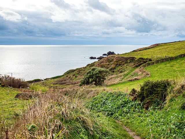
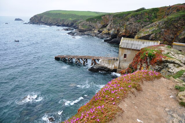
Yellow Carn offers breathtaking panoramic views of the surrounding coastline, making it a popular destination for tourists and locals alike. From its elevated position, visitors can enjoy sweeping vistas of the ocean, nearby beaches, and the rugged cliffs that stretch along the coast.

The headland is also an important site for wildlife conservation, with its diverse ecosystem supporting a variety of plant and animal species. Seabirds such as gulls, puffins, and cormorants can often be seen nesting on the cliffs, while seals and dolphins are occasionally spotted swimming in the waters below.

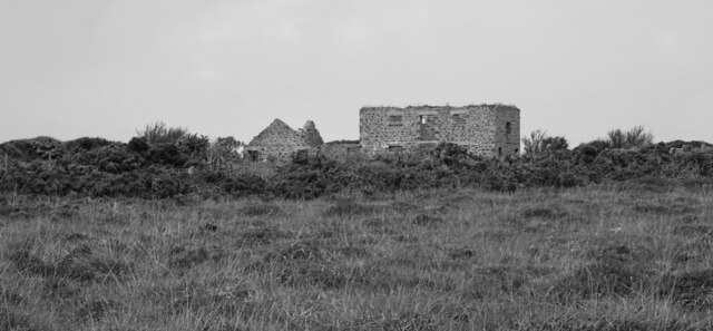
In addition to its natural beauty, Yellow Carn is also of historical significance. It is believed that the headland was once the site of an Iron Age hillfort, providing evidence of human settlement in the area dating back thousands of years.

Overall, Yellow Carn is a captivating coastal feature that offers a unique blend of natural beauty, wildlife, and historical significance.

If you have any feedback on the listing, please let us know in the comments section below.

Yellow Carn Images

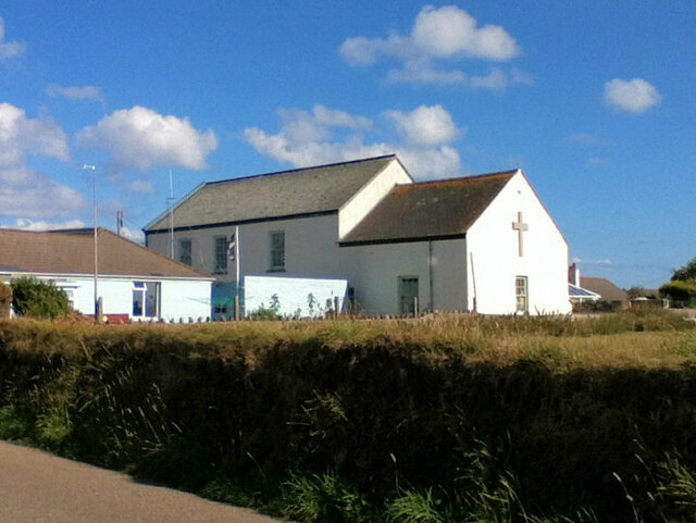
Images are sourced within 2km of 49.972828/-5.2250524 or Grid Reference SW6813. Thanks to Geograph Open Source API. All images are credited.

Kynance Cove beach
Kynance Cove beach
Cliffs below Pistil Meadow A view of the cliffs below Pistil Meadow, from the S W Coastal Path.
Cliffs below Pistil Meadow
A view of the cliffs below Pistil Meadow, from the S W Coastal Path.
Kynance Cove from Pistil Meadow headland Asparagus Island and Kynance Cove from Pistil Meadow headland.
Kynance Cove from Pistil Meadow headland
Asparagus Island and Kynance Cove from Pistil Meadow headland.
Cliffs near Pentreath Beach Some cliffs on the S W Coastal Path between Pentreath Beach and Lizard Point.
Cliffs near Pentreath Beach
Some cliffs on the S W Coastal Path between Pentreath Beach and Lizard Point.
Polpeor Cove
Polpeor Cove
Crane Ledges
Crane Ledges
Fields near Lizard village
Kynance Cove
Kynance Cove
Steps down to Polpeor Cove After you!
Steps down to Polpeor Cove
After you!
Entering Pistil Meadow Legend has it that this was the burial site of 200 souls lost in the wreck of the Royal Anne Galley in 1721. This has now probably been disproved by a study conducted in 2014-16 <span class="nowrap"><a title="https://thisismast.org//research/pistil-meadow-and-the-royal-anne.html" rel="nofollow ugc noopener" href="https://thisismast.org//research/pistil-meadow-and-the-royal-anne.html">Link</a><img style="margin-left:2px;" alt="External link" title="External link - shift click to open in new window" src="https://s1.geograph.org.uk/img/external.png" width="10" height="10"/></span>
Entering Pistil Meadow
Legend has it that this was the burial site of 200 souls lost in the wreck of the Royal Anne Galley in 1721. This has now probably been disproved by a study conducted in 2014-16 LinkExternal link
Bridleway leading from Pistil Meadow to Lizard Village
Looking down on Pistil Meadow From the bridleway down from Lizard Village.
Looking down on Pistil Meadow
From the bridleway down from Lizard Village.
Farm gates by the bridleway Down from Lizard Village.
Farm gates by the bridleway
Down from Lizard Village.
The Horse, Kynance Cliff, seen from The South West Coast Path The South West Coast Path National Trail - 630 miles of superb coastal walking. From Minehead on the edge of the Exmoor National Park to the shores of Poole Harbour in Dorset. It is the longest of all Britain's National Trails.
Website: <span class="nowrap"><a title="http://www.southwestcoastpath.com/" rel="nofollow ugc noopener" href="http://www.southwestcoastpath.com/">Link</a><img style="margin-left:2px;" alt="External link" title="External link - shift click to open in new window" src="https://s1.geograph.org.uk/img/external.png" width="10" height="10"/></span>
The Horse, Kynance Cliff, seen from The South West Coast Path
The South West Coast Path National Trail - 630 miles of superb coastal walking. From Minehead on the edge of the Exmoor National Park to the shores of Poole Harbour in Dorset. It is the longest of all Britain's National Trails. Website: LinkExternal link
Derelict buildings near Kynance Farm on The Lizard
The Lizard Lifeboat Station The Lizard Lifeboat Station at Lizard Point, below the Lighthouse.
The Lizard Lifeboat Station
The Lizard Lifeboat Station at Lizard Point, below the Lighthouse.
Lizard Methodist Church
Old lifeboat station The old lifeboat station is at the base of a very steep hill. It has been disused for some years.
Old lifeboat station
The old lifeboat station is at the base of a very steep hill. It has been disused for some years.
Show me another place!

Yellow Carn is located at Grid Ref: SW6813 (Lat: 49.972828, Lng: -5.2250524)

Unitary Authority: Cornwall

Police Authority: Devon and Cornwall

What 3 Words

///closer.refrained.state. Near Landewednack, Cornwall

Related Wikis

Kynance Cove

Kynance Cove (Cornish: Porth Keynans, meaning ravine cove) is a cove on the eastern side of Mount's Bay, Cornwall, England. It is situated on the Lizard...

Pentreath

Higher Pentreath and Lower Pentreath (Cornish: Penntreth, representing penn an treth, meaning head (of) the beach) are hamlets to the west of Praa Sands...

Asparagus Island

Asparagus Island (Cornish: Enys Merlosowen) is a small tidal island on the eastern side of Mount's Bay, within the parish of Mullion, Cornwall, United...

Rill Cove Wreck

The Rill Cove Wreck is an underwater wreck of a 16th-century Spanish cargo ship lying off the coast of Rill Cove, west of Kynance Cove, in Cornwall, England...

Nearby Amenities

Located within 500m of 49.972828,-5.2250524
Barrier: stile
Lat/Long: 49.973137/-5.2242267
Kynance Cove
Name Kw: Ben Kewnans
Natural: bay
Source: NPE
Wikidata: Q3817686
Wikipedia: en:Kynance Cove
Lat/Long: 49.9737987/-5.2301373
Bench
Backrest: yes
Source: survey
Lat/Long: 49.9745585/-5.2278843
Check Date: 2022-05-07
Source: survey
Traffic Calming: hump
Lat/Long: 49.9740115/-5.2223055
Check Date: 2022-05-07
Source: survey
Traffic Calming: hump
Lat/Long: 49.9739796/-5.2182901
Kynance Cove. ****
Tourism: viewpoint
Lat/Long: 49.9745312/-5.227806
Check Date: 2022-05-07
Information: map
Tourism: information
Lat/Long: 49.9751711/-5.2254795
Lizard Point and Kynance Cove
Contact Email: lizard@nationaltrust.org.uk
Tourism: viewpoint
Website: https://www.nationaltrust.org.uk/lizard-point-and-kynance-cove/%20Lizard%20Point%20and%20Kynance%20Cove
Lat/Long: 49.9739252/-5.2264084
Direction: ESE-NW
Tourism: viewpoint
Lat/Long: 49.9736932/-5.2259906
Parking Space
Access: disabled
Lat/Long: 49.9739022/-5.2249287
Parking Space
Access: disabled
Lat/Long: 49.9738975/-5.2249751
Parking Space
Access: disabled
Lat/Long: 49.9738897/-5.225024
Tourism: viewpoint
Lat/Long: 49.9741035/-5.2285577
Vending Machine
Check Date: 2022-05-07
Lat/Long: 49.9742565/-5.2253225
Barrier: swing_gate
Swing Gate Type: single
Vehicle: private
Lat/Long: 49.9743638/-5.2246962
Bicycle Parking
Bicycle Parking: stands
Capacity: 4
Lat/Long: 49.9741989/-5.2247489
The data included in this document is from www.openstreetmap.org. The data is made available under ODbL.

Have you been to Yellow Carn?

Leave your review of Yellow Carn below (or comments, questions and feedback).