Baulk Head

Coastal Feature, Headland, Point in Cornwall

England

Baulk Head

Direction Sign – Signpost at Chyvarloe turn in Gunwalloe parish Located on a grass triangle at Chyvarloe turn in Gunwalloe parish. 3 arms and pyramid finial. Arms all replaced since <a title="https://www.geograph.org.uk/photo/6043649" href="https://www.geograph.org.uk/photo/6043649">Link</a>. 

Milestone Society National ID: CW_SW6523
Direction Sign – Signpost at Chyvarloe turn in Gunwalloe parish Credit: M Hatton

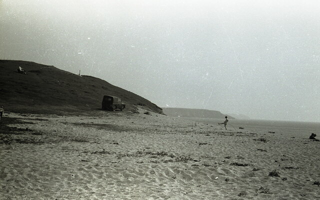
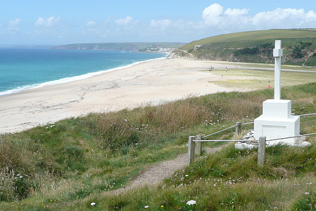
Baulk Head is a prominent headland located on the southern coast of Cornwall, England. Situated near the small village of Baulk, this coastal feature offers stunning views of the surrounding landscape and the Atlantic Ocean.

With its rugged cliffs and rocky terrain, Baulk Head stands as a natural barrier between the land and sea. It is known for its dramatic rock formations, which have been shaped by the relentless waves over centuries. These formations provide a habitat for a variety of marine life, making it a popular spot for diving and snorkeling enthusiasts.

The headland is easily accessible by foot, with several walking trails that lead visitors to its highest point. From this vantage point, one can enjoy panoramic views of the coastline, including nearby sandy beaches and picturesque coves. The area is also renowned for its vibrant wildlife, with seabirds nesting along the cliffs and seals often spotted basking on the rocks below.

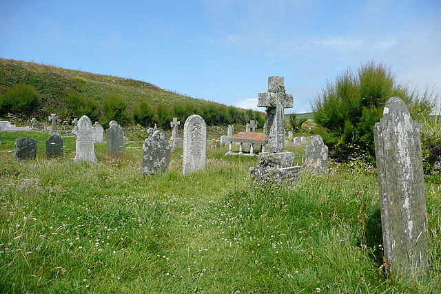
Baulk Head is a popular destination for hikers and nature lovers, as it offers a peaceful retreat away from the bustling towns and cities. Visitors can explore the headland's rugged beauty, taking in the fresh sea air and immersing themselves in the natural surroundings. The area is also rich in history, with remnants of ancient settlements and mining activities visible along the coastline.

Overall, Baulk Head is a captivating coastal feature that showcases the raw beauty of Cornwall's landscape. Its unique rock formations, diverse wildlife, and panoramic views make it a must-visit destination for anyone seeking an authentic coastal experience.

If you have any feedback on the listing, please let us know in the comments section below.
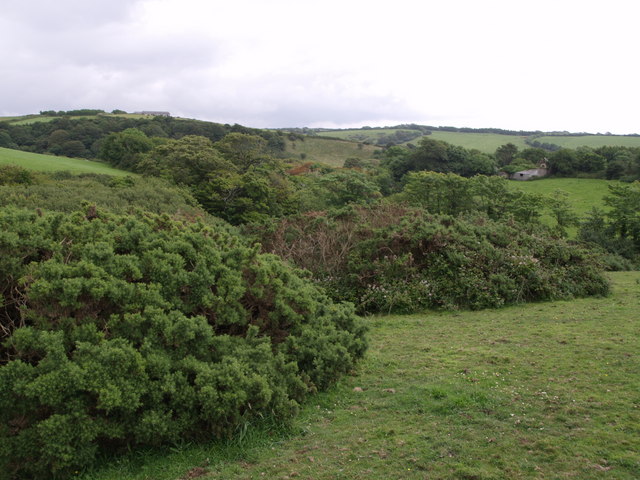
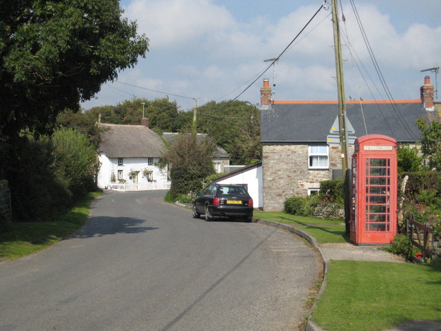
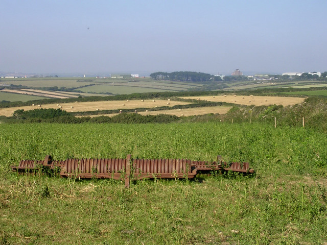
Baulk Head Images

Images are sourced within 2km of 50.052892/-5.2790169 or Grid Reference SW6522. Thanks to Geograph Open Source API. All images are credited.

Direction Sign – Signpost at Chyvarloe turn in Gunwalloe parish Located on a grass triangle at Chyvarloe turn in Gunwalloe parish. 3 arms and pyramid finial. Arms all replaced since <a title="https://www.geograph.org.uk/photo/6043649" href="https://www.geograph.org.uk/photo/6043649">Link</a>. 

Milestone Society National ID: CW_SW6523
Direction Sign – Signpost at Chyvarloe turn in Gunwalloe parish
Located on a grass triangle at Chyvarloe turn in Gunwalloe parish. 3 arms and pyramid finial. Arms all replaced since Link. Milestone Society National ID: CW_SW6523
On Loe Bar The HMS Anson memorial is visible on the left - as described in <a href="https://www.geograph.org.uk/photo/40910">SW6423 : H.M.S. Anson monument, Loe Bar</a>.
On Loe Bar
The HMS Anson memorial is visible on the left - as described in SW6423 : H.M.S. Anson monument, Loe Bar.
Jangye-ryn and Pedngwinian under attack With nothing to shelter the West coast of the Lizard Peninsula from the Atlantic. these breakers have a long fetch.
Jangye-ryn and Pedngwinian under attack
With nothing to shelter the West coast of the Lizard Peninsula from the Atlantic. these breakers have a long fetch.
Gunwalloe Church Cove
Church Cove A popular beach spot with a large expanse of sand.  It is also unusual in having a church adjacent.  The church, dedicated to St Winwaloe, is a former smugglers' church, and ironically is now at risk from the sea, protected only by a headland and sand dune.
Church Cove
A popular beach spot with a large expanse of sand. It is also unusual in having a church adjacent. The church, dedicated to St Winwaloe, is a former smugglers' church, and ironically is now at risk from the sea, protected only by a headland and sand dune.
Churchyard of St Winwaloe's church It is believed that there has been worship here since the 5th century.  The burial ground shows the strong Celtic influence with its crosses.
Churchyard of St Winwaloe's church
It is believed that there has been worship here since the 5th century. The burial ground shows the strong Celtic influence with its crosses.
Rough seas at Jangye-ryn Taken from the coastal path and looking down on a rough bit of coastline at the strangely named Jangye-ryn.  The offshore rocks show up on larger scale maps.
Rough seas at Jangye-ryn
Taken from the coastal path and looking down on a rough bit of coastline at the strangely named Jangye-ryn. The offshore rocks show up on larger scale maps.
Coastline at Jangye-ryn There are various small coves and rocky headlands all along this coast . The view from the coastal path changes constantly.
Coastline at Jangye-ryn
There are various small coves and rocky headlands all along this coast . The view from the coastal path changes constantly.
View from Halzephron Cliff The coastal path makes a right-angled turn here; just as well as straight on is a steep drop towards this cove, and the Pedngwinian offshore rocks just in the next square.
View from Halzephron Cliff
The coastal path makes a right-angled turn here; just as well as straight on is a steep drop towards this cove, and the Pedngwinian offshore rocks just in the next square.
Towards Halzephron Cove The view from Halzephron Cliff towards the cove of the same name, and the eponymous house above it, which is a high quality holiday home.
Towards Halzephron Cove
The view from Halzephron Cliff towards the cove of the same name, and the eponymous house above it, which is a high quality holiday home.
Along Halzephron Cliff From above Halzephron Cove this view is along the cliff of the same name.  The coastal path says on the top, with good views seawards.  The beach here is virtually inaccessible from the land.
Along Halzephron Cliff
From above Halzephron Cove this view is along the cliff of the same name. The coastal path says on the top, with good views seawards. The beach here is virtually inaccessible from the land.
Gunwaloe Fishing Cove The house nearest to us appears to be a holiday home.  It has the Union flag flying but a German-registered car in the drive.  This is the most southerly section of the sands that go all the way to Porthleven, but are not always accessible at the Blue Rocks headland in the middle distance.
Gunwaloe Fishing Cove
The house nearest to us appears to be a holiday home. It has the Union flag flying but a German-registered car in the drive. This is the most southerly section of the sands that go all the way to Porthleven, but are not always accessible at the Blue Rocks headland in the middle distance.
House at Gunwaloe Fishing Cove This house on the cliff above the cove is being done up, perhaps to be a holiday let.  It has a stunning location above the cove and by the coastal path.
House at Gunwaloe Fishing Cove
This house on the cliff above the cove is being done up, perhaps to be a holiday let. It has a stunning location above the cove and by the coastal path.
Coastal Path near Chyvarloe A small section of the coastal path above Porthleven Sands goes through this square.  Such a small amount that this view is almost identical to Philip Halling's take on the same place a few months earlier <a href="https://www.geograph.org.uk/photo/2111778">SW6523 : Coast path above Porthleven Sands</a>
Coastal Path near Chyvarloe
A small section of the coastal path above Porthleven Sands goes through this square. Such a small amount that this view is almost identical to Philip Halling's take on the same place a few months earlier SW6523 : Coast path above Porthleven Sands
Coast at Blue Rocks Blue Rocks are to our right, and the extension of Porthleven Sands from here is called Gunwalloe Fishing Cove beach, after the hamlet at the far end of the sands.
Coast at Blue Rocks
Blue Rocks are to our right, and the extension of Porthleven Sands from here is called Gunwalloe Fishing Cove beach, after the hamlet at the far end of the sands.
Coastal path towards Loe Bar The path drops gently towards the monument, in this square, and the Low Bar, mainly in <a href="https://www.geograph.org.uk/gridref/SW6424">SW6424</a>.  The contrast between the sea, salt water, to the left, and The Loe, fresh water, to the right, is best seen from up here.
Coastal path towards Loe Bar
The path drops gently towards the monument, in this square, and the Low Bar, mainly in SW6424. The contrast between the sea, salt water, to the left, and The Loe, fresh water, to the right, is best seen from up here.
HMS Anson Monument and Loe Bar This monument commemorates the men of HMS Anson, who were drowned when the ship ran around here in 1807 and they could not get ashore.  As a result local man Henry Trengrouse invented the rock life-saving apparatus, which has prevented similar deaths.
Beyond is Loe Bar, originally an inlet to the River Loe that allowed ships to reach Helston, but subsequently partly naturally and partly man-assisted was closed off by this bar.
HMS Anson Monument and Loe Bar
This monument commemorates the men of HMS Anson, who were drowned when the ship ran around here in 1807 and they could not get ashore. As a result local man Henry Trengrouse invented the rock life-saving apparatus, which has prevented similar deaths. Beyond is Loe Bar, originally an inlet to the River Loe that allowed ships to reach Helston, but subsequently partly naturally and partly man-assisted was closed off by this bar.
Fishing Cove at Gunwalloe,  Cornwall This lovely unspoilt cove has fine sand and clear blue sea. Though on the day this was taken the waves were a bit too heavy for safe bathing. Nevertheless there were a few brave surfers out there.   The bay curves round to the Northwest towards Porthleven in the distance. See also <a href="https://www.geograph.org.uk/photo/2609673">SW6522 : Fishing Cove at Gunwalloe,  Cornwall</a>
Fishing Cove at Gunwalloe, Cornwall
This lovely unspoilt cove has fine sand and clear blue sea. Though on the day this was taken the waves were a bit too heavy for safe bathing. Nevertheless there were a few brave surfers out there. The bay curves round to the Northwest towards Porthleven in the distance. See also SW6522 : Fishing Cove at Gunwalloe, Cornwall
Show me another place!

Baulk Head is located at Grid Ref: SW6522 (Lat: 50.052892, Lng: -5.2790169)

Unitary Authority: Cornwall

Police Authority: Devon and Cornwall

What 3 Words

///tripling.refuse.outwit. Near Mullion, Cornwall

Related Wikis

Gunwalloe

Gunwalloe ( Cornish: Pluw Wynnwalow) is a coastal civil parish in Cornwall, England, United Kingdom. It is situated on the Lizard Peninsula three miles...

St Anthony (ship)

St Anthony or Santo António was a Portuguese carrack that foundered in Gunwalloe Bay, Cornwall, in 1527 en route from Lisbon to Antwerp. She had a mixed...

Chyanvounder

Chyanvounder is a hamlet in the parish of Gunwalloe, Cornwall, England. Chyanvounder is situated 3.4 miles (5.5 km) south of Helston on the Lizard Peninsula...

Berepper

Berepper is a coastal village in south Cornwall, England, United Kingdom. It is situated on the west side of the Lizard peninsula four miles (6 km) south...

Chyvarloe

Chyvarloe is a hamlet in the parish of Gunwalloe, Cornwall, England. Chyvarloe is situated 3 miles (4.8 km) south-west of Helston on the Lizard Peninsula...

Loe Bar Wreck

The remains of a seventeenth century cargo vessel were identified in Gunwalloe fishing cove, Cornwall in 1998. The site was designated under the Protection...

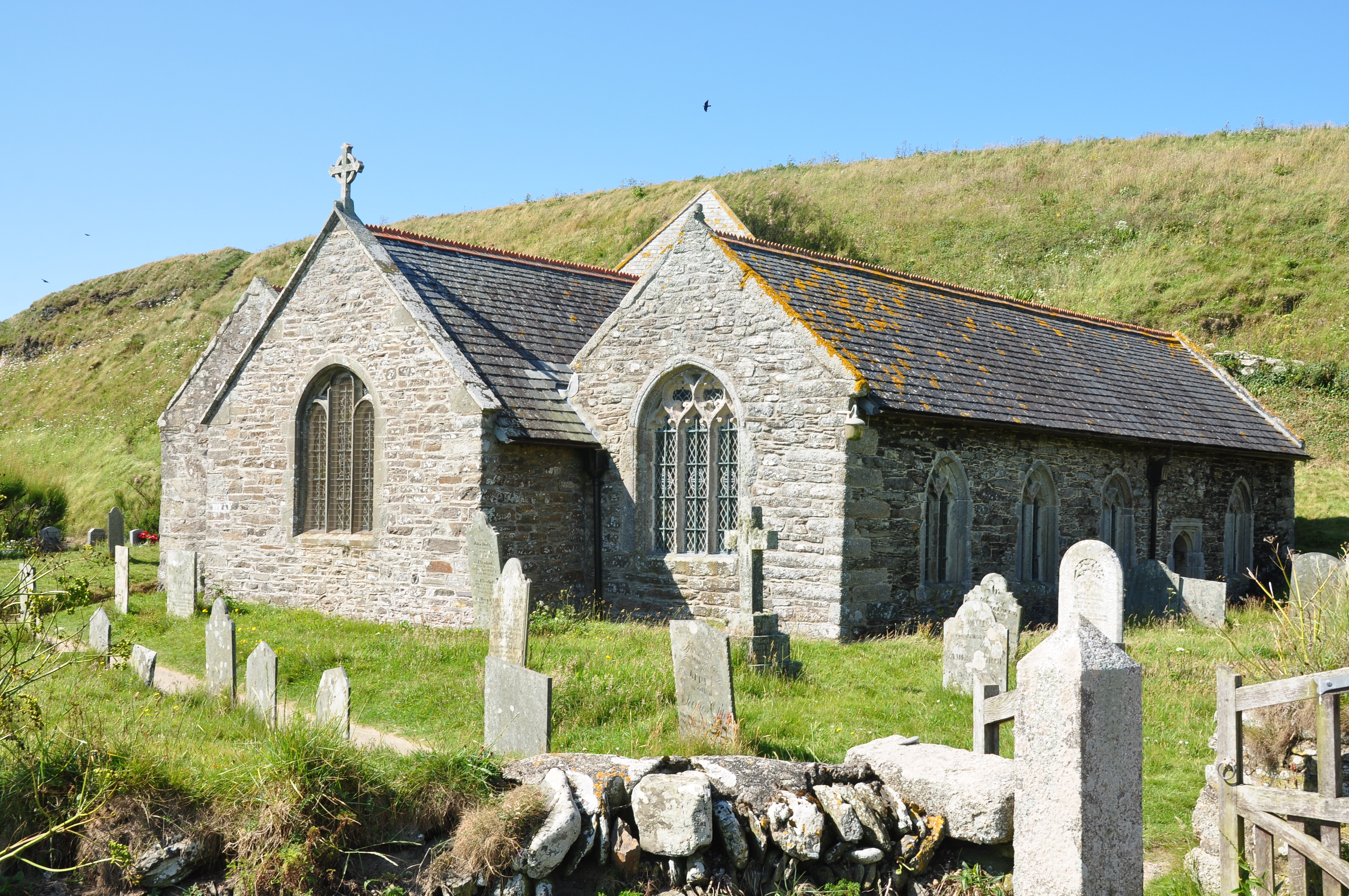
St Winwaloe's Church, Gunwalloe

The Church of Saint Winwaloe is the Grade I listed parish church of Gunwalloe in Cornwall, England. == History == The church is in the Church of England...

Baulk Head to Mullion

Baulk Head to Mullion is a coastal Site of Special Scientific Interest (SSSI) in Cornwall, England, UK, noted for both its biological and geological characteristics...

Nearby Amenities

Located within 500m of 50.052892,-5.2790169
Created By: almien_coastlines
Source: PGS
Lat/Long: 50.056434/-5.280586
Created By: almien_coastlines
Source: PGS
Lat/Long: 50.05593/-5.280164
Created By: almien_coastlines
Source: PGS
Lat/Long: 50.055425/-5.279742
Created By: almien_coastlines
Source: PGS
Lat/Long: 50.054921/-5.27932
Source: PGS
Lat/Long: 50.05416/-5.278885
Source: PGS
Lat/Long: 50.0535958/-5.2793174
Source: PGS
Lat/Long: 50.0532364/-5.2798113
Source: PGS
Lat/Long: 50.0530826/-5.27924
Source: PGS
Lat/Long: 50.0525542/-5.2791211
Source: PGS
Lat/Long: 50.0521397/-5.2786205
Source: PGS
Lat/Long: 50.0523057/-5.2781629
Source: PGS
Lat/Long: 50.0519601/-5.2778132
Source: PGS
Lat/Long: 50.0514944/-5.2777673
Source: PGS
Lat/Long: 50.0513196/-5.2779002
Created By: almien_coastlines
Source: PGS
Lat/Long: 50.051099/-5.278143
Created By: almien_coastlines
Source: PGS
Lat/Long: 50.050847/-5.277932
Source: PGS
Lat/Long: 50.0506447/-5.277653
Source: PGS
Lat/Long: 50.0502342/-5.2770418
Source: PGS
Lat/Long: 50.0500812/-5.276502
Source: PGS
Lat/Long: 50.0500522/-5.2758635
Source: PGS
Lat/Long: 50.0496971/-5.2757322
Chyanvounder
Is In: Cornwall, England, UK
Is In Country: England
Is In Country Code: GB
Is In County: Cornwall
Name Kw: Chi an Vownder
Place: hamlet
Source: npe
Wikidata: Q5118510
Lat/Long: 50.0559048/-5.2748594
Barrier: stile
Foot: yes
Lat/Long: 50.0572387/-5.2796234
Barrier: stile
Material: stone
Step Count: 2
Stile: stepover
Lat/Long: 50.0508296/-5.2753896
Pub
Halzephron Inn
Addr City: Helston
Addr Place: Gunwalloe
Addr Postcode: TR12 7QB
Fhrs Id: 547110
Indoor Seating: yes
Outdoor Seating: yes
Lat/Long: 50.0557346/-5.2744097
Cafe
Gunwalloe Cove Cafe
Note: seasonal
Lat/Long: 50.0551933/-5.2778969
Parking
Access: customers
Fee: no
Parking: surface
Lat/Long: 50.056025/-5.274391
Waste Basket
Survey Date: 2023-10-08
Waste: dog_excrement
Lat/Long: 50.0550638/-5.2778291
Life Ring
Emergency: life_ring
Survey Date: 2023-10-08
Waste: dog_excrement
Lat/Long: 50.0550133/-5.2780991
Fire Hydrant
Emergency: fire_hydrant
Fire Hydrant Position: lane
Fire Hydrant Type: underground
Survey Date: 2023-10-08
Waste: dog_excrement
Lat/Long: 50.0514818/-5.2750573
Fire Hydrant
Emergency: fire_hydrant
Fire Hydrant Position: lane
Fire Hydrant Type: underground
Survey Date: 2023-10-08
Lat/Long: 50.0560233/-5.274597
Barrier: stile
Lat/Long: 50.0518037/-5.2765898
The data included in this document is from www.openstreetmap.org. The data is made available under ODbL.

Have you been to Baulk Head?

Leave your review of Baulk Head below (or comments, questions and feedback).