Gunwalloe

Settlement in Cornwall

England

Gunwalloe

Direction Sign – Signpost at Chyvarloe turn in Gunwalloe parish Located on a grass triangle at Chyvarloe turn in Gunwalloe parish. 3 arms and pyramid finial. Arms all replaced since <a title="https://www.geograph.org.uk/photo/6043649" href="https://www.geograph.org.uk/photo/6043649">Link</a>. 

Milestone Society National ID: CW_SW6523
Direction Sign – Signpost at Chyvarloe turn in Gunwalloe parish Credit: M Hatton

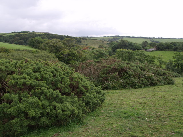
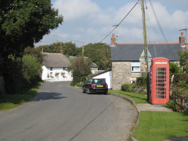
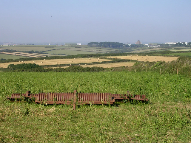
Gunwalloe is a coastal village located on the Lizard Peninsula in Cornwall, England. Situated in the southwestern part of the country, Gunwalloe is renowned for its stunning natural beauty and rich historical heritage. The village is surrounded by picturesque countryside, with vast stretches of rolling hills and rugged cliffs overlooking the Atlantic Ocean.

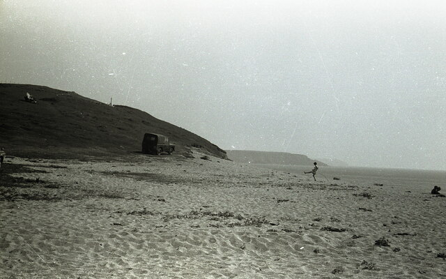
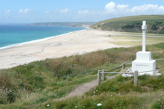
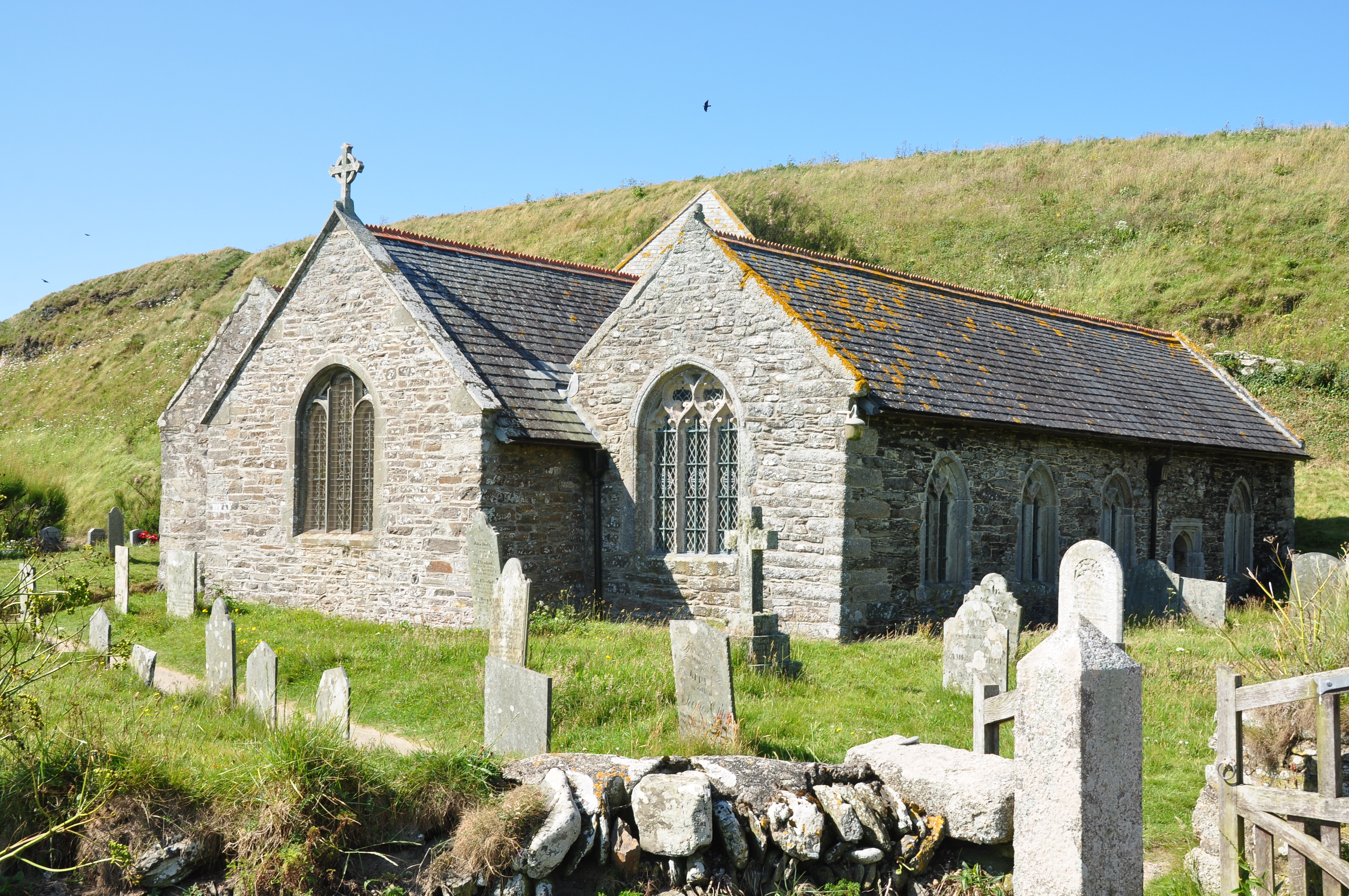
One of the main attractions in Gunwalloe is its pristine beaches. The village boasts two sandy beaches, Church Cove and Dollar Cove, both offering visitors a tranquil and idyllic seaside experience. Church Cove is named after the 15th-century St. Winwaloe Church, which sits on the cliffs above the beach, adding a touch of historical charm. Dollar Cove, on the other hand, is known for its intriguing shipwreck legends and tales of hidden treasure, dating back to the 18th century.

In addition to its natural beauty, Gunwalloe is steeped in history. The area has evidence of human settlement dating back to the Bronze Age, and remnants of ancient settlements and burial mounds can still be found in the surrounding landscape. The village is also home to Gunwalloe Fishing Cove, a historic fishing harbor that has been in use for centuries.

For outdoor enthusiasts, Gunwalloe offers a plethora of activities such as coastal walks, water sports, and bird watching. The village is part of the Lizard National Nature Reserve, renowned for its diverse flora and fauna. From rare wildflowers to seabird colonies, nature lovers are treated to a wealth of natural wonders.

Overall, Gunwalloe is a charming coastal village that seamlessly combines natural beauty with a rich historical heritage, making it a must-visit destination for those seeking a quintessential Cornish experience.

If you have any feedback on the listing, please let us know in the comments section below.

Gunwalloe Images

Images are sourced within 2km of 50.057676/-5.275956 or Grid Reference SW6522. Thanks to Geograph Open Source API. All images are credited.

Direction Sign – Signpost at Chyvarloe turn in Gunwalloe parish Located on a grass triangle at Chyvarloe turn in Gunwalloe parish. 3 arms and pyramid finial. Arms all replaced since <a title="https://www.geograph.org.uk/photo/6043649" href="https://www.geograph.org.uk/photo/6043649">Link</a>. 

Milestone Society National ID: CW_SW6523
Direction Sign – Signpost at Chyvarloe turn in Gunwalloe parish
Located on a grass triangle at Chyvarloe turn in Gunwalloe parish. 3 arms and pyramid finial. Arms all replaced since Link. Milestone Society National ID: CW_SW6523
On Loe Bar With Bar Lodge in view.
On Loe Bar
With Bar Lodge in view.
On Loe Bar The HMS Anson memorial is visible on the left - as described in <a href="https://www.geograph.org.uk/photo/40910">SW6423 : H.M.S. Anson monument, Loe Bar</a>.
On Loe Bar
The HMS Anson memorial is visible on the left - as described in SW6423 : H.M.S. Anson monument, Loe Bar.
Loe Bar near Porthleven
Carminowe Creek
Carminowe Creek
Rough seas at Jangye-ryn Taken from the coastal path and looking down on a rough bit of coastline at the strangely named Jangye-ryn.  The offshore rocks show up on larger scale maps.
Rough seas at Jangye-ryn
Taken from the coastal path and looking down on a rough bit of coastline at the strangely named Jangye-ryn. The offshore rocks show up on larger scale maps.
Coastline at Jangye-ryn There are various small coves and rocky headlands all along this coast . The view from the coastal path changes constantly.
Coastline at Jangye-ryn
There are various small coves and rocky headlands all along this coast . The view from the coastal path changes constantly.
View from Halzephron Cliff The coastal path makes a right-angled turn here; just as well as straight on is a steep drop towards this cove, and the Pedngwinian offshore rocks just in the next square.
View from Halzephron Cliff
The coastal path makes a right-angled turn here; just as well as straight on is a steep drop towards this cove, and the Pedngwinian offshore rocks just in the next square.
Towards Halzephron Cove The view from Halzephron Cliff towards the cove of the same name, and the eponymous house above it, which is a high quality holiday home.
Towards Halzephron Cove
The view from Halzephron Cliff towards the cove of the same name, and the eponymous house above it, which is a high quality holiday home.
Along Halzephron Cliff From above Halzephron Cove this view is along the cliff of the same name.  The coastal path says on the top, with good views seawards.  The beach here is virtually inaccessible from the land.
Along Halzephron Cliff
From above Halzephron Cove this view is along the cliff of the same name. The coastal path says on the top, with good views seawards. The beach here is virtually inaccessible from the land.
Gunwaloe Fishing Cove The house nearest to us appears to be a holiday home.  It has the Union flag flying but a German-registered car in the drive.  This is the most southerly section of the sands that go all the way to Porthleven, but are not always accessible at the Blue Rocks headland in the middle distance.
Gunwaloe Fishing Cove
The house nearest to us appears to be a holiday home. It has the Union flag flying but a German-registered car in the drive. This is the most southerly section of the sands that go all the way to Porthleven, but are not always accessible at the Blue Rocks headland in the middle distance.
House at Gunwaloe Fishing Cove This house on the cliff above the cove is being done up, perhaps to be a holiday let.  It has a stunning location above the cove and by the coastal path.
House at Gunwaloe Fishing Cove
This house on the cliff above the cove is being done up, perhaps to be a holiday let. It has a stunning location above the cove and by the coastal path.
Coastal Path near Chyvarloe A small section of the coastal path above Porthleven Sands goes through this square.  Such a small amount that this view is almost identical to Philip Halling's take on the same place a few months earlier <a href="https://www.geograph.org.uk/photo/2111778">SW6523 : Coast path above Porthleven Sands</a>
Coastal Path near Chyvarloe
A small section of the coastal path above Porthleven Sands goes through this square. Such a small amount that this view is almost identical to Philip Halling's take on the same place a few months earlier SW6523 : Coast path above Porthleven Sands
Coast at Blue Rocks Blue Rocks are to our right, and the extension of Porthleven Sands from here is called Gunwalloe Fishing Cove beach, after the hamlet at the far end of the sands.
Coast at Blue Rocks
Blue Rocks are to our right, and the extension of Porthleven Sands from here is called Gunwalloe Fishing Cove beach, after the hamlet at the far end of the sands.
Coastal path towards Loe Bar The path drops gently towards the monument, in this square, and the Low Bar, mainly in <a href="https://www.geograph.org.uk/gridref/SW6424">SW6424</a>.  The contrast between the sea, salt water, to the left, and The Loe, fresh water, to the right, is best seen from up here.
Coastal path towards Loe Bar
The path drops gently towards the monument, in this square, and the Low Bar, mainly in SW6424. The contrast between the sea, salt water, to the left, and The Loe, fresh water, to the right, is best seen from up here.
HMS Anson Monument and Loe Bar This monument commemorates the men of HMS Anson, who were drowned when the ship ran around here in 1807 and they could not get ashore.  As a result local man Henry Trengrouse invented the rock life-saving apparatus, which has prevented similar deaths.
Beyond is Loe Bar, originally an inlet to the River Loe that allowed ships to reach Helston, but subsequently partly naturally and partly man-assisted was closed off by this bar.
HMS Anson Monument and Loe Bar
This monument commemorates the men of HMS Anson, who were drowned when the ship ran around here in 1807 and they could not get ashore. As a result local man Henry Trengrouse invented the rock life-saving apparatus, which has prevented similar deaths. Beyond is Loe Bar, originally an inlet to the River Loe that allowed ships to reach Helston, but subsequently partly naturally and partly man-assisted was closed off by this bar.
Fishing Cove at Gunwalloe,  Cornwall This lovely unspoilt cove has fine sand and clear blue sea. Though on the day this was taken the waves were a bit too heavy for safe bathing. Nevertheless there were a few brave surfers out there.   The bay curves round to the Northwest towards Porthleven in the distance. See also <a href="https://www.geograph.org.uk/photo/2609673">SW6522 : Fishing Cove at Gunwalloe,  Cornwall</a>
Fishing Cove at Gunwalloe, Cornwall
This lovely unspoilt cove has fine sand and clear blue sea. Though on the day this was taken the waves were a bit too heavy for safe bathing. Nevertheless there were a few brave surfers out there. The bay curves round to the Northwest towards Porthleven in the distance. See also SW6522 : Fishing Cove at Gunwalloe, Cornwall
Fishing Cove at Gunwalloe,  Cornwall Windy day, clear conditions but very heavy sea kept the bathers away
See also <a href="https://www.geograph.org.uk/photo/2609662">SW6522 : Fishing Cove at Gunwalloe,  Cornwall</a>
Fishing Cove at Gunwalloe, Cornwall
Windy day, clear conditions but very heavy sea kept the bathers away See also SW6522 : Fishing Cove at Gunwalloe, Cornwall
Show me another place!

Gunwalloe is located at Grid Ref: SW6522 (Lat: 50.057676, Lng: -5.275956)

Unitary Authority: Cornwall

Police Authority: Devon and Cornwall

What 3 Words

///sheds.scratches.replace. Near Mullion, Cornwall

Related Wikis

Gunwalloe

Gunwalloe ( Cornish: Pluw Wynnwalow) is a coastal civil parish in Cornwall, England, United Kingdom. It is situated on the Lizard Peninsula three miles...

Chyanvounder

Chyanvounder is a hamlet in the parish of Gunwalloe, Cornwall, England. Chyanvounder is situated 3.4 miles (5.5 km) south of Helston on the Lizard Peninsula...

Berepper

Berepper is a coastal village in south Cornwall, England, United Kingdom. It is situated on the west side of the Lizard peninsula four miles (6 km) south...

Chyvarloe

Chyvarloe is a hamlet in the parish of Gunwalloe, Cornwall, England. Chyvarloe is situated 3 miles (4.8 km) south-west of Helston on the Lizard Peninsula...

St Anthony (ship)

St Anthony or Santo António was a Portuguese carrack that foundered in Gunwalloe Bay, Cornwall, in 1527 en route from Lisbon to Antwerp. She had a mixed...

Loe Bar Wreck

The remains of a seventeenth century cargo vessel were identified in Gunwalloe fishing cove, Cornwall in 1998. The site was designated under the Protection...

St Winwaloe's Church, Gunwalloe

The Church of Saint Winwaloe is the Grade I listed parish church of Gunwalloe in Cornwall, England. == History == The church is in the Church of England...

The Loe

The Loe (Cornish: An Logh), also known as Loe Pool, is the largest natural freshwater lake (50 hectares (120 acres)) in Cornwall, United Kingdom. The earliest...

Nearby Amenities

Located within 500m of 50.057676,-5.275956
Created By: almien_coastlines
Source: PGS
Lat/Long: 50.0587/-5.282685
Created By: almien_coastlines
Source: PGS
Lat/Long: 50.057567/-5.281635
Created By: almien_coastlines
Source: PGS
Lat/Long: 50.056434/-5.280586
Created By: almien_coastlines
Source: PGS
Lat/Long: 50.05593/-5.280164
Created By: almien_coastlines
Source: PGS
Lat/Long: 50.055425/-5.279742
Created By: almien_coastlines
Source: PGS
Lat/Long: 50.054921/-5.27932
Source: PGS
Lat/Long: 50.05416/-5.278885
Berepper
Is In: Cornwall, England, UK
Is In Country: England
Is In Country Code: GB
Is In County: Cornwall
Name En: Berepper
Name Kw: Argelteg
Place: hamlet
Source: npe
Wikidata: Q4891289
Lat/Long: 50.0605862/-5.2739589
Chyanvounder
Is In: Cornwall, England, UK
Is In Country: England
Is In Country Code: GB
Is In County: Cornwall
Name Kw: Chi an Vownder
Place: hamlet
Source: npe
Wikidata: Q5118510
Lat/Long: 50.0559048/-5.2748594
Barrier: stile
Foot: yes
Lat/Long: 50.0572387/-5.2796234
Pub
Halzephron Inn
Addr City: Helston
Addr Place: Gunwalloe
Addr Postcode: TR12 7QB
Fhrs Id: 547110
Indoor Seating: yes
Outdoor Seating: yes
Lat/Long: 50.0557346/-5.2744097
Cafe
Gunwalloe Cove Cafe
Note: seasonal
Lat/Long: 50.0551933/-5.2778969
Bus Stop
Gunwalloe
Bench: yes
Bin: no
Check Date Shelter: 2023-08-15
Naptan AtcoCode: 0800COC30443
Naptan Bearing: NE
Naptan CommonName: Berepper Cross
Naptan NaptanCode: corajpjm
Naptan Street: Unclassified
Naptan Name: Berepper Cross
Shelter: yes
Source: naptan_import
Tactile Paving: no
Lat/Long: 50.0589381/-5.2763057
Post Box
Brand: Royal Mail
Brand Wikidata: Q638098
Collection Times: Mo-Fr 09:00; Sa 07:00; Su off
Drive Through: no
Operator: Royal Mail
Operator Wikidata: Q638098
Post Box Mounting: pier
Post Box Type: lamp
Ref: TR12 62D
Royal Cypher: EIIR
Royal Cypher Wikidata: Q33102113
Source: survey;streetlevel imagery;aerial imagery
Lat/Long: 50.0588858/-5.2762034
Bench
Backrest: yes
Lat/Long: 50.05866/-5.2789271
Barrier: entrance
Lat/Long: 50.0588655/-5.276424
Barrier: entrance
Lat/Long: 50.0588406/-5.2762116
Parking
Access: customers
Fee: no
Parking: surface
Lat/Long: 50.056025/-5.274391
Waste Basket
Lat/Long: 50.0588708/-5.2761986
Barrier: stile
Lat/Long: 50.0608423/-5.2768692
Barrier: stile
Lat/Long: 50.0616295/-5.2773804
Direction: SE
Generator Method: photovoltaic
Generator Output Electricity: small_installation
Generator Source: solar
Generator Type: solar_photovoltaic_panel
Location: roof
Power: generator
Source: bing
Lat/Long: 50.0600442/-5.2742918
Direction: SE
Generator Method: photovoltaic
Generator Output Electricity: small_installation
Generator Source: solar
Generator Type: solar_photovoltaic_panel
Location: roof
Power: generator
Source: bing
Lat/Long: 50.057955/-5.2756369
Direction: SE
Generator Method: photovoltaic
Generator Output Electricity: small_installation
Generator Source: solar
Generator Type: solar_photovoltaic_panel
Location: roof
Power: generator
Source: bing
Lat/Long: 50.0577406/-5.2754518
Direction: SE
Generator Method: photovoltaic
Generator Output Electricity: small_installation
Generator Source: solar
Generator Type: solar_photovoltaic_panel
Location: roof
Power: generator
Source: bing
Lat/Long: 50.0578061/-5.2752802
Waste Basket
Survey Date: 2023-10-08
Waste: dog_excrement
Lat/Long: 50.0550638/-5.2778291
Life Ring
Emergency: life_ring
Survey Date: 2023-10-08
Waste: dog_excrement
Lat/Long: 50.0550133/-5.2780991
Fire Hydrant
Emergency: fire_hydrant
Fire Hydrant Position: lane
Fire Hydrant Type: underground
Survey Date: 2023-10-08
Lat/Long: 50.0560233/-5.274597
Fire Hydrant
Emergency: fire_hydrant
Fire Hydrant Position: lane
Fire Hydrant Type: underground
Survey Date: 2023-10-08
Lat/Long: 50.0577226/-5.2758958
Waste Basket
Survey Date: 2023-10-08
Waste: dog_excrement
Lat/Long: 50.0588121/-5.2761831
The data included in this document is from www.openstreetmap.org. The data is made available under ODbL.

Have you been to Gunwalloe?

Leave your review of Gunwalloe below (or comments, questions and feedback).