Uirigh Bheithe

Coastal Feature, Headland, Point in Argyllshire

Scotland

Uirigh Bheithe

Toward Rubha nam Fear headland
Toward Rubha nam Fear headland Credit: Tony Page

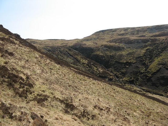
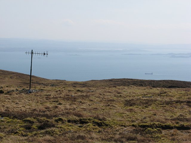
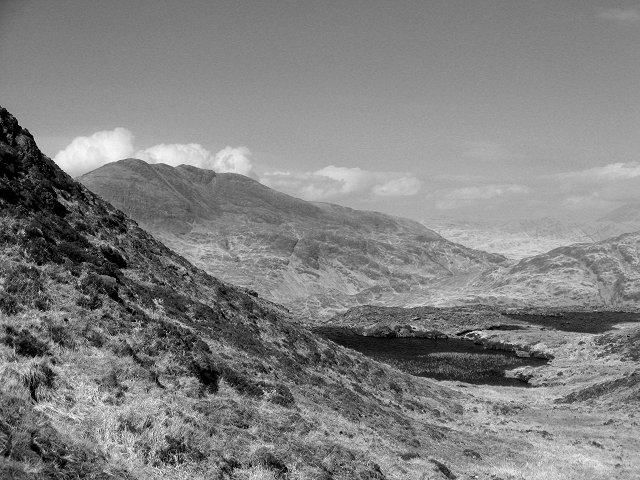
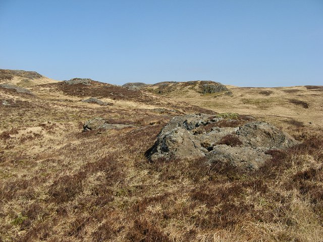
Uirigh Bheithe is a prominent headland located in Argyllshire, Scotland. Situated along the rugged coastline, this coastal feature offers stunning views of the surrounding landscape and the vast expanse of the Atlantic Ocean. The headland is characterized by its steep cliffs, rocky outcrops, and lush greenery, making it a popular destination for hikers and nature enthusiasts.

At the tip of the headland, visitors can find a small, secluded beach where they can relax and enjoy the sound of the crashing waves. Uirigh Bheithe is also home to a variety of wildlife, including seabirds, seals, and occasionally dolphins and whales that can be spotted from the shore.

The headland is easily accessible by car, with a designated parking area nearby. There are also walking paths and trails that lead visitors to various viewpoints and lookout spots, providing panoramic views of the surrounding coastline and the open sea.

Overall, Uirigh Bheithe is a picturesque and tranquil coastal feature that offers a peaceful retreat for those looking to explore the natural beauty of Argyllshire.

If you have any feedback on the listing, please let us know in the comments section below.

Uirigh Bheithe Images

Images are sourced within 2km of 56.321449/-5.8174465 or Grid Reference NM6420. Thanks to Geograph Open Source API. All images are credited.

Toward Rubha nam Fear headland
The southernmost point of the Laggan peninsula Taken from the small sound between Mull and Frank Lockwood's Island, this marks the point where a sea kayaker paddling towards Loch Buie turns the corner onto more exposed coast towards the end of an already long exposed passage. A week in early March saw unusually stable high pressure over Britain, with no wind, and hardly any swell in the Firth of Lorn, so this committing stretch of coast was unexpectedly easy for this early in the season, enabling me not only to paddle, but to take lots of photographs on the way.
The southernmost point of the Laggan peninsula
Taken from the small sound between Mull and Frank Lockwood's Island, this marks the point where a sea kayaker paddling towards Loch Buie turns the corner onto more exposed coast towards the end of an already long exposed passage. A week in early March saw unusually stable high pressure over Britain, with no wind, and hardly any swell in the Firth of Lorn, so this committing stretch of coast was unexpectedly easy for this early in the season, enabling me not only to paddle, but to take lots of photographs on the way.
Mesozoic sediments on Rubha nan Fear The banded sedimentary rocks that form the lowest part of the cliffs of the southern tip of the Laggan peninsula, and Frank Lockwood's Island, predate the volcanic rocks which dominate most of Mull. These come from the Mesozoic era, and dip slightly northwards into the land. They had been uncovered and eroded before the great Tertiary volcanic eruptions which extended over much of the west of Scotland presaging the opening of the Atlantic Ocean. The overlying lava flows thus covered an uneven surface, basalt filling in dips and hollows in the original landscape. This unconformity sinks below sea level north of Rubha nan Fear, so all the more distant, grey, rock outcrops are basalt.
Mesozoic sediments on Rubha nan Fear
The banded sedimentary rocks that form the lowest part of the cliffs of the southern tip of the Laggan peninsula, and Frank Lockwood's Island, predate the volcanic rocks which dominate most of Mull. These come from the Mesozoic era, and dip slightly northwards into the land. They had been uncovered and eroded before the great Tertiary volcanic eruptions which extended over much of the west of Scotland presaging the opening of the Atlantic Ocean. The overlying lava flows thus covered an uneven surface, basalt filling in dips and hollows in the original landscape. This unconformity sinks below sea level north of Rubha nan Fear, so all the more distant, grey, rock outcrops are basalt.
West ridge of Druim Fada beyond trig point The ridge extending to the west from the cylindrical, 'Vanessa style', trig point.
Creach Beinn is the mountain in the distance.
West ridge of Druim Fada beyond trig point
The ridge extending to the west from the cylindrical, 'Vanessa style', trig point. Creach Beinn is the mountain in the distance.
Seascape off Rubha na Codha, Mull
Port Ohirnie, Mull
Port Ohirnie, Mull
Beinn a' Bhainne The western slopes of Beinn a' Bhainne in the Laggan  Forest.
Beinn a' Bhainne
The western slopes of Beinn a' Bhainne in the Laggan Forest.
Allt Shios Breac-achadh Burn draining the south and west of Beinn a' Bhainne.
Allt Shios Breac-achadh
Burn draining the south and west of Beinn a' Bhainne.
Allt Shios Breac-achadh view of the burn from the slopes of Beinn a' Bhainne.
Allt Shios Breac-achadh
view of the burn from the slopes of Beinn a' Bhainne.
Beinn a' Bhainne The summit plateau and view to the south. There are an assortment of aerials up here including this television aerial with a long cable down to Laggan.
Beinn a' Bhainne
The summit plateau and view to the south. There are an assortment of aerials up here including this television aerial with a long cable down to Laggan.
Beinn a'  Bhainne, the summit Rock strewn summit of Beinn a' Bhainne - view eastwards towards Druim Fada.
Beinn a' Bhainne, the summit
Rock strewn summit of Beinn a' Bhainne - view eastwards towards Druim Fada.
Allt an Tiadhain The Allt an Tiadhain drains a glen on the south side of the Laggan Forest. The land is mostly grass covered.
Allt an Tiadhain
The Allt an Tiadhain drains a glen on the south side of the Laggan Forest. The land is mostly grass covered.
Lochan an Tobar Pair of lochans on Beinn a' Bhainne.
Lochan an Tobar
Pair of lochans on Beinn a' Bhainne.
Lochan an Tobar Ben Buie from the Laggan Forest.
Lochan an Tobar
Ben Buie from the Laggan Forest.
Lochan na Croibhe-caoruinn The Rowan Loch is missing its tree now.  A lochan on Druim Fada.
Lochan na Croibhe-caoruinn
The Rowan Loch is missing its tree now. A lochan on Druim Fada.
Laggan Forest The plateau of the Laggan Forest, the strange shaped peninsula on the south coast of Mull is mostly grassy with basalt outcrops.
Laggan Forest
The plateau of the Laggan Forest, the strange shaped peninsula on the south coast of Mull is mostly grassy with basalt outcrops.
Druim Fada Druim Fada is Laggan's highest hill at 405m. The south side is steep before rolling down to the Firth of Lorne. Below this scarp is a narrow lochan unnamed on the OS map.
Druim Fada
Druim Fada is Laggan's highest hill at 405m. The south side is steep before rolling down to the Firth of Lorne. Below this scarp is a narrow lochan unnamed on the OS map.
Druim Fada The flat summit of the peninsula with a vanessa trig pillar.
Druim Fada
The flat summit of the peninsula with a vanessa trig pillar.
Show me another place!

Uirigh Bheithe is located at Grid Ref: NM6420 (Lat: 56.321449, Lng: -5.8174465)

Unitary Authority: Argyll and Bute

Police Authority: Argyll and West Dunbartonshire

What 3 Words

///hostels.basically.chains. Near Lochbuie, Argyll & Bute

Related Wikis

Loch Buie

Loch Buie (Scottish Gaelic: Locha Buidhe, meaning "yellow loch") is a sea loch on the south coast of the Isle of Mull, off the west coast of Scotland....

Firth of Lorn

The Firth of Lorn or Lorne (Scottish Gaelic: An Linne Latharnach) is the inlet of the sea between the south-east coast of the Isle of Mull and the mainland...

Moy Castle

Moy Castle is a ruined castle near Lochbuie on the Isle of Mull, Scotland. The site is now a scheduled monument. == History == The land upon which Moy...

Lochbuie, Mull

Lochbuie (Scottish Gaelic: Locha Buidhe, meaning "yellow loch") is a settlement on the Isle of Mull in Scotland about 22 kilometres (14 mi) west of Craignure...

Nearby Amenities

Located within 500m of 56.321449,-5.8174465
Source: PGS
Lat/Long: 56.319089/-5.8108513
Source: PGS
Lat/Long: 56.3189602/-5.8114763
Source: PGS
Lat/Long: 56.3189932/-5.811869
Created By: dmgroom_coastlines
Source: PGS
Lat/Long: 56.318758/-5.815882
Created By: dmgroom_coastlines
Source: PGS
Lat/Long: 56.318791/-5.816188
Source: PGS
Lat/Long: 56.3189022/-5.816772
Source: PGS
Lat/Long: 56.3185976/-5.8172001
Source: PGS
Lat/Long: 56.3183084/-5.8181024
Source: PGS
Lat/Long: 56.3183138/-5.8183567
Source: PGS
Lat/Long: 56.3181867/-5.8187472
Source: PGS
Lat/Long: 56.3177503/-5.820451
Source: PGS
Lat/Long: 56.3175757/-5.8214648
The data included in this document is from www.openstreetmap.org. The data is made available under ODbL.

Have you been to Uirigh Bheithe?

Leave your review of Uirigh Bheithe below (or comments, questions and feedback).