Rubha Breacaichte

Coastal Feature, Headland, Point in Inverness-shire

Scotland

Rubha Breacaichte

Meall Mor, Eilean Tigh Looking from the 111m summit of Eilean Tigh to the very northernmost tip of Raasay. On the left is Caol Rona and on the right is Loch a' Sguirr. In the distance, centre, are the hills of Kylerhea at the east of Skye, with the Crowlin Islands in front of them and part of Applecross on the left.
Meall Mor, Eilean Tigh Credit: Michael Earnshaw

Rubha Breacaichte is a stunning headland located in Inverness-shire, Scotland. This coastal feature is situated on the western coast of the Scottish Highlands, overlooking the vast expanse of the Atlantic Ocean. Its name, which translates to "speckled point" in Gaelic, accurately describes its unique appearance.

The headland is characterized by its rugged and dramatic cliffs, which jut out into the sea, providing breathtaking panoramic views of the surrounding landscape. These cliffs, composed of ancient rock formations, are known for their distinctive patterns of colors, giving the headland its name. The interplay of light and shadow on the cliffs creates a mesmerizing spectacle for visitors.

Rubha Breacaichte is also home to a diverse range of flora and fauna. The headland's coastal heathland supports a variety of plant species, including heather, gorse, and wildflowers. Birdwatchers can delight in spotting various seabirds such as gannets, puffins, and razorbills, which nest in the cliffs during the breeding season.

Visitors to Rubha Breacaichte can explore its rugged coastline through a network of walking trails, allowing them to appreciate its natural beauty up close. The headland is a popular destination for hikers and photographers, who are drawn to its picturesque landscapes and stunning sunsets. Additionally, the headland offers opportunities for fishing and rock climbing for those seeking more adventurous activities.

Overall, Rubha Breacaichte is a captivating coastal feature that showcases the raw beauty of the Scottish Highlands. Its dramatic cliffs, diverse wildlife, and scenic vistas make it an ideal destination for nature lovers and outdoor enthusiasts alike.

If you have any feedback on the listing, please let us know in the comments section below.

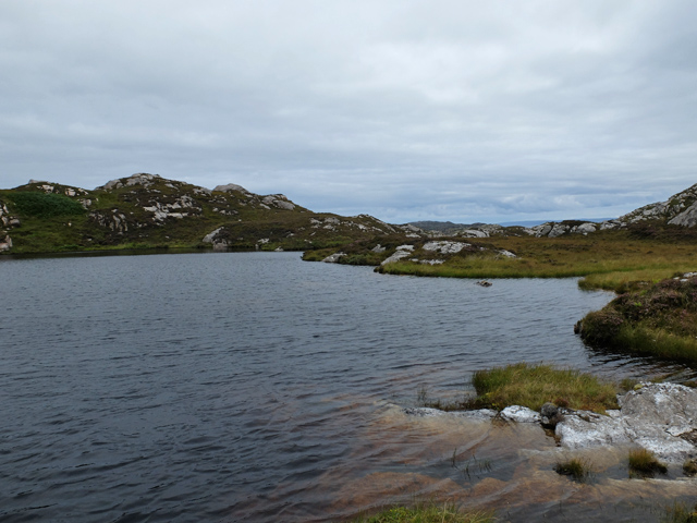
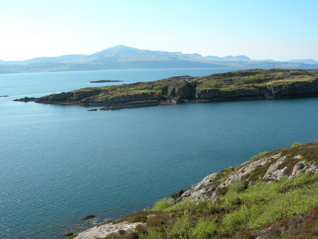
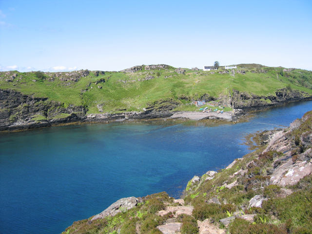
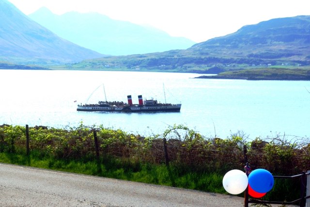
Rubha Breacaichte Images

Images are sourced within 2km of 57.489346/-6.0110211 or Grid Reference NG5951. Thanks to Geograph Open Source API. All images are credited.

Meall Mor, Eilean Tigh Looking from the 111m summit of Eilean Tigh to the very northernmost tip of Raasay. On the left is Caol Rona and on the right is Loch a' Sguirr. In the distance, centre, are the hills of Kylerhea at the east of Skye, with the Crowlin Islands in front of them and part of Applecross on the left.
Meall Mor, Eilean Tigh
Looking from the 111m summit of Eilean Tigh to the very northernmost tip of Raasay. On the left is Caol Rona and on the right is Loch a' Sguirr. In the distance, centre, are the hills of Kylerhea at the east of Skye, with the Crowlin Islands in front of them and part of Applecross on the left.
Ruined houses at Doire Dubh Marked on some maps as shielings, these were in fact permanent dwellings.
Ruined houses at Doire Dubh
Marked on some maps as shielings, these were in fact permanent dwellings.
Kyle of Rona Footpath on the Isle of Raasay View along the footpath from Arnish to the Kyle of Rona at the northern end of the Isle of Raasay.  The view here is facing east along the path from the saddle point just the south of Beinn na h-Iolaire, the hill of the eagle.  The land across the water is mainland Britain.
Kyle of Rona Footpath on the Isle of Raasay
View along the footpath from Arnish to the Kyle of Rona at the northern end of the Isle of Raasay. The view here is facing east along the path from the saddle point just the south of Beinn na h-Iolaire, the hill of the eagle. The land across the water is mainland Britain.
North end of the Isle of Raasay, Scotland View facing south from near the summit of the hill Beinn na h-Iolaire, at the north end of the Isle of Raasay, in the Hebridean Sea, Scotland.
North end of the Isle of Raasay, Scotland
View facing south from near the summit of the hill Beinn na h-Iolaire, at the north end of the Isle of Raasay, in the Hebridean Sea, Scotland.
The eastern coast A rocky outcrop at the coast.  The Applecross peninsula on the mainland in the background.
The eastern coast
A rocky outcrop at the coast. The Applecross peninsula on the mainland in the background.
Junction of the Umachan path The marker shows where the indistinct path to Umachan leaves the track from Torran to Caol Rona.
Junction of the Umachan path
The marker shows where the indistinct path to Umachan leaves the track from Torran to Caol Rona.
Bridge on the path to Umachan A well constructed bridge on a well constructed path that is seldom used today. It was once the access route to the now deserted township of Umachan.
Bridge on the path to Umachan
A well constructed bridge on a well constructed path that is seldom used today. It was once the access route to the now deserted township of Umachan.
Ruin at Umachan The best preserved of the 14 buildings in the deserted township, which lies at the end of a rough track and path about 4km from the end of the public road at Arnish. It is situated on a terrace some 60m above the Inner Sound. There are very few areas here that would have been suitable for cultivation. Most of it must have been confined to small areas on the surrounding terraces.
A close shot of the construction can be seen here: <a href="https://www.geograph.org.uk/photo/923074">NG6049 : Stonework on a ruin at Umachan</a>
Ruin at Umachan
The best preserved of the 14 buildings in the deserted township, which lies at the end of a rough track and path about 4km from the end of the public road at Arnish. It is situated on a terrace some 60m above the Inner Sound. There are very few areas here that would have been suitable for cultivation. Most of it must have been confined to small areas on the surrounding terraces. A close shot of the construction can be seen here: NG6049 : Stonework on a ruin at Umachan
Stonework on a ruin at Umachan Detail of the front wall of <a href="https://www.geograph.org.uk/photo/923070">NG6049 : Ruin at Umachan</a> showing the complexity of the construction.
Stonework on a ruin at Umachan
Detail of the front wall of NG6049 : Ruin at Umachan showing the complexity of the construction.
Bealach a' Chruidh A steep approach to the pass on the Caol Rona path. The upper section of the single zigzag is seen in the centre of the picture.
Bealach a' Chruidh
A steep approach to the pass on the Caol Rona path. The upper section of the single zigzag is seen in the centre of the picture.
The path to Caol Rona A fairly good foot track leads from the end of the motor road at Arnish, crossing varied and interesting terrain for around 7 km to reach the northern tip of Raasay.
The path to Caol Rona
A fairly good foot track leads from the end of the motor road at Arnish, crossing varied and interesting terrain for around 7 km to reach the northern tip of Raasay.
Lochan gun Ghrunnd The name means the bottomless wee loch. It certainly looks deep.
Lochan gun Ghrunnd
The name means the bottomless wee loch. It certainly looks deep.
House and sheep fanks There are many ruins around here but, other than the MBA bothy further north <a href="https://www.geograph.org.uk/photo/4123612">NG6152 : Taigh Thormoid Dhuibh</a>, this is the only  one in the area with a roof.  It doesn't look as though it has too many years left in it though.
House and sheep fanks
There are many ruins around here but, other than the MBA bothy further north NG6152 : Taigh Thormoid Dhuibh, this is the only one in the area with a roof. It doesn't look as though it has too many years left in it though.
Taigh Thormoid Dhuibh An MBA bothy at the north end of Raasay, well used by walkers and kayakers.
Taigh Thormoid Dhuibh
An MBA bothy at the north end of Raasay, well used by walkers and kayakers.
Inside Taigh Thormoid Dhuibh Black Norman's House - an MBA bothy. This is a view of the sleeping platform at the southern end of the house.
Inside Taigh Thormoid Dhuibh
Black Norman's House - an MBA bothy. This is a view of the sleeping platform at the southern end of the house.
Ruin in north Raasay The walls of this substantial ruined house are almost fully intact.
Ruin in north Raasay
The walls of this substantial ruined house are almost fully intact.
Skye from Raasay
Skye from Raasay
Beach at Fladda Fladda or Fladday is separated from Raasay by a tidal channel. This shows it at low tide, when the veach is exposed.
Beach at Fladda
Fladda or Fladday is separated from Raasay by a tidal channel. This shows it at low tide, when the veach is exposed.
Show me another place!

Rubha Breacaichte is located at Grid Ref: NG5951 (Lat: 57.489346, Lng: -6.0110211)

Unitary Authority: Highland

Police Authority: Highlands and Islands

What 3 Words

///scary.contoured.loosed. Near Portree, Highland

Nearby Locations

Rubha Breacaichte

Related Wikis

Eilean Fladday

Eilean Fladday (also Fladda; Scottish Gaelic: Eilean Fladaigh) is a previously populated tidal island off Raasay, near the Isle of Skye, Scotland. ��2...

Eilean Tigh

Eilean Tigh (Scottish Gaelic: Eilean Taighe) is a tidal island in the Sound of Raasay of Scotland, that lies between Rona and Raasay. Approximately 54...

Sound of Raasay

The Sound of Raasay (Scottish Gaelic: Linne Ratharsair) is the sound between the islands of Raasay and Skye. == See also == Inner Sound, Scotland Isle...

South Rona

Rona (Scottish Gaelic: Rònaigh), sometimes called South Rona to distinguish it from North Rona (a small uninhabited island to the northwest of Cape Wrath...

Nearby Amenities

Located within 500m of 57.489346,-6.0110211
Created By: dmgroom_coastlines
Source: PGS
Lat/Long: 57.49084/-6.01819
Created By: dmgroom_coastlines
Source: PGS
Lat/Long: 57.49009/-6.0192
Created By: dmgroom_coastlines
Source: PGS
Lat/Long: 57.49007/-6.01825
Created By: dmgroom_coastlines
Source: PGS
Lat/Long: 57.48954/-6.01805
Created By: dmgroom_coastlines
Source: PGS
Lat/Long: 57.48903/-6.01762
Created By: dmgroom_coastlines
Source: PGS
Lat/Long: 57.48877/-6.01763
Created By: dmgroom_coastlines
Source: PGS
Lat/Long: 57.48852/-6.01766
Created By: dmgroom_coastlines
Source: PGS
Lat/Long: 57.48801/-6.01771
Created By: dmgroom_coastlines
Source: PGS
Lat/Long: 57.48724/-6.01777
Created By: dmgroom_coastlines
Source: PGS
Lat/Long: 57.48673/-6.01781
Source: PGS
Lat/Long: 57.4860167/-6.0150768
Source: PGS
Lat/Long: 57.4860996/-6.0149559
Source: PGS
Lat/Long: 57.4864249/-6.0140634
Source: PGS
Lat/Long: 57.4868306/-6.0136787
Created By: dmgroom_coastlines
Source: PGS
Lat/Long: 57.4879/-6.01296
Source: PGS
Lat/Long: 57.4880233/-6.012911
Source: PGS
Lat/Long: 57.4881566/-6.0127801
Source: PGS
Lat/Long: 57.4890682/-6.0118559
Source: PGS
Lat/Long: 57.4899687/-6.0111082
Created By: dmgroom_coastlines
Source: PGS
Lat/Long: 57.48949/-6.01022
Source: PGS
Lat/Long: 57.4893309/-6.0091347
Source: PGS
Lat/Long: 57.4891474/-6.008147
Source: PGS
Lat/Long: 57.4897487/-6.0066152
Source: PGS
Lat/Long: 57.4900693/-6.0049727
Source: PGS
Lat/Long: 57.4905969/-6.0050944
Source: PGS
Lat/Long: 57.4903101/-6.0040979
Source: PGS
Lat/Long: 57.4903928/-6.0032122
An Rubha Breacaichte
Natural: cape
Lat/Long: 57.4898307/-6.0110019
The data included in this document is from www.openstreetmap.org. The data is made available under ODbL.

Have you been to Rubha Breacaichte?

Leave your review of Rubha Breacaichte below (or comments, questions and feedback).