Cladach an Eilein

Coastal Feature, Headland, Point in Ross-shire

Scotland

Cladach an Eilein

Skaraval at Port Nis View along the coast from Skaraval at Port Nis.
Skaraval at Port Nis Credit: Ajay Tegala

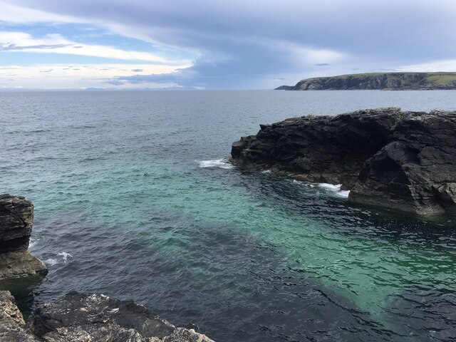
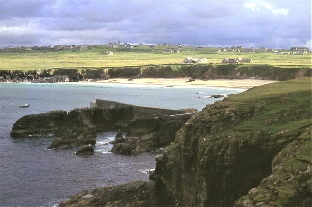
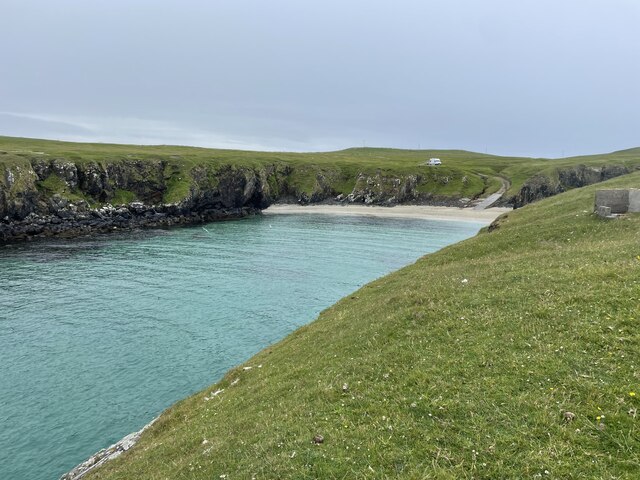
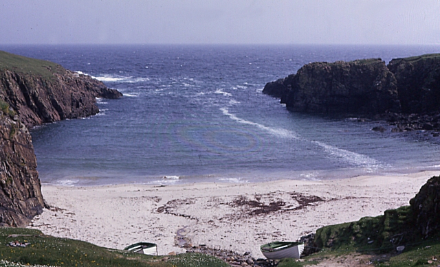
Cladach an Eilein, located in Ross-shire, Scotland, is a stunning coastal feature known for its picturesque headland and point. Situated along the northwestern coastline of the country, this natural beauty spot is a popular destination for locals and tourists alike.

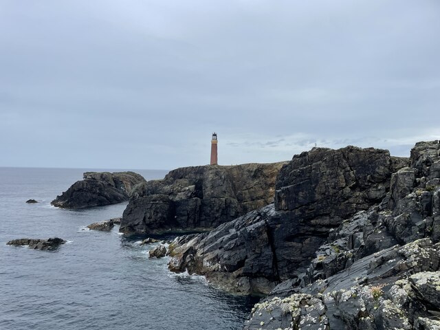
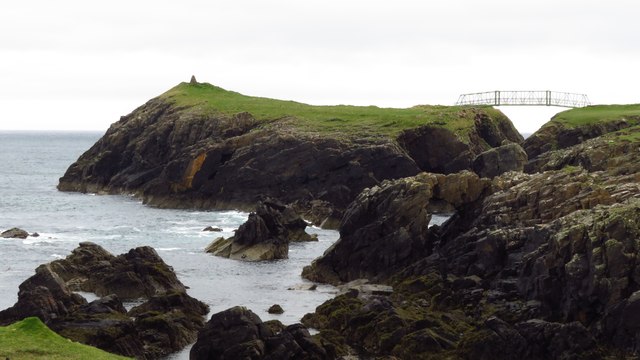
The name "Cladach an Eilein" translates to "shore of the island," referring to the nearby Isle of Skye, which can be seen from the headland. The rugged coastline is characterized by towering cliffs and rocky outcrops, providing a dramatic and breathtaking backdrop.

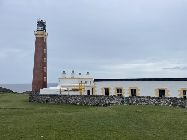
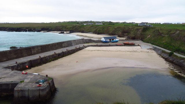
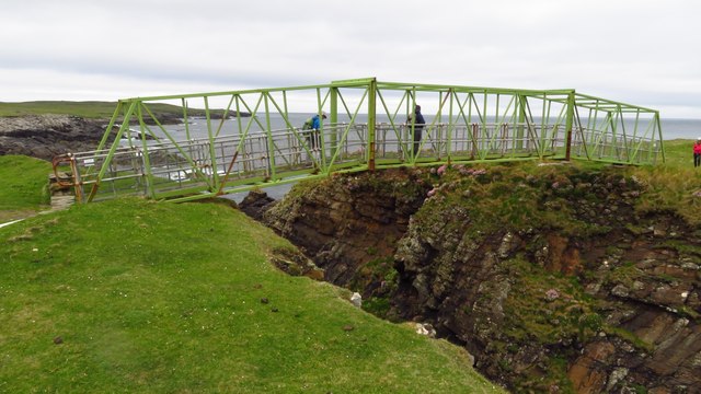
The headland is a prominent feature, jutting out into the sea and offering panoramic views of the surrounding landscape. From this vantage point, visitors can witness the crashing waves of the Atlantic Ocean, observe a variety of seabirds, and, on a clear day, catch a glimpse of marine wildlife such as seals and dolphins.

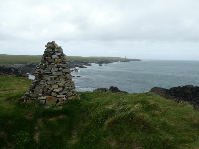
Cladach an Eilein is a paradise for hikers and nature enthusiasts. The area is dotted with walking trails, allowing visitors to explore the diverse flora and fauna that call this coastal region home. Moss-covered rocks, colorful wildflowers, and hardy grasses create a vibrant tapestry against the backdrop of the deep blue sea.

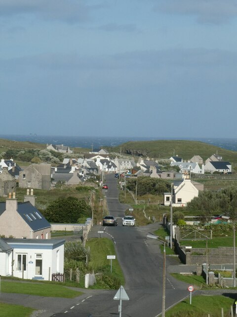
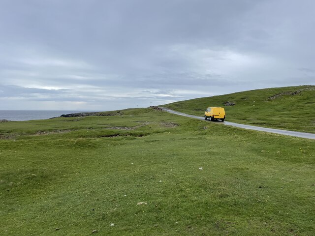
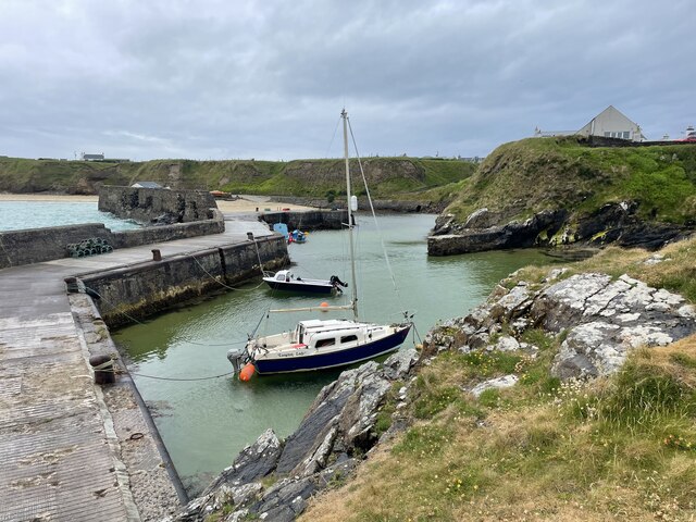
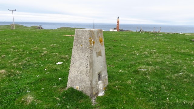
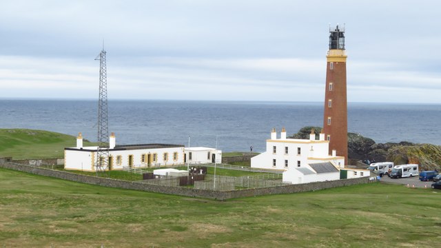
As a popular tourist destination, Cladach an Eilein is equipped with visitor amenities, including a car park and information boards detailing the history and geology of the area. The site is easily accessible by road and is often included as part of scenic coastal road trips in the region.

In conclusion, Cladach an Eilein in Ross-shire is a remarkable coastal feature with its impressive headland and stunning views of the surrounding scenery. Its natural beauty, combined with its accessibility, makes it a must-visit destination for anyone exploring the Scottish coastline.

If you have any feedback on the listing, please let us know in the comments section below.

Cladach an Eilein Images

Images are sourced within 2km of 58.506312/-6.242098 or Grid Reference NB5265. Thanks to Geograph Open Source API. All images are credited.

Skaraval at Port Nis View along the coast from Skaraval at Port Nis.
Skaraval at Port Nis
View along the coast from Skaraval at Port Nis.
Dun Eistean cairn with distant view of Butt of Lewis lighthouse
Dun Eistean bridge and houses in Knockaird
Port of Ness
Port of Ness
Port of Ness Post Office
Rocky headland at Port of Ness Houses at Callicvol sit above the beach.
Rocky headland at Port of Ness
Houses at Callicvol sit above the beach.
Butt of Lewis Lighthouse The Butt of Lewis is the northernmost point of the Isle of Lewis in the Outer Hebrides. There is a lighthouse designed and built by David & Thomas Stevenson (sons of Robert and brother of Alan - all lighthouse engineers) and constructed in 1862. It is 37m (121ft) tall at an elevation of 52m (170ft) with a nominal range of 25 nautical miles. It flashes a white light every five seconds, and since 1998 is fully automated, being one of the last four Scottish lighthouses to dispense with the services of their keepers. It is looked after by the Northern Lighthouse Board (the Scottish equivalent to Trinity House) and is monitored remotely from Edinburgh.
The Butt of Lewis has appeared in the Guinness Book of Records as the windiest place in the United Kingdom, sticking out as it does into the North Atlantic.
Butt of Lewis Lighthouse
The Butt of Lewis is the northernmost point of the Isle of Lewis in the Outer Hebrides. There is a lighthouse designed and built by David & Thomas Stevenson (sons of Robert and brother of Alan - all lighthouse engineers) and constructed in 1862. It is 37m (121ft) tall at an elevation of 52m (170ft) with a nominal range of 25 nautical miles. It flashes a white light every five seconds, and since 1998 is fully automated, being one of the last four Scottish lighthouses to dispense with the services of their keepers. It is looked after by the Northern Lighthouse Board (the Scottish equivalent to Trinity House) and is monitored remotely from Edinburgh. The Butt of Lewis has appeared in the Guinness Book of Records as the windiest place in the United Kingdom, sticking out as it does into the North Atlantic.
Road to the lighthouse The Butt of Lewis is the northernmost point of the Isle of Lewis in the Outer Hebrides. There is a lighthouse designed and built by David & Thomas Stevenson (sons of Robert and brother of Alan - all lighthouse engineers) and constructed in 1862. It is 37m (121ft) tall at an elevation of 52m (170ft) with a nominal range of 25 nautical miles. It flashes a white light every five seconds, and since 1998 is fully automated, being one of the last four Scottish lighthouses to dispense with the services of their keepers. It is looked after by the Northern Lighthouse Board (the Scottish equivalent to Trinity House) and is monitored remotely from Edinburgh.
The Butt of Lewis has appeared in the Guinness Book of Records as the windiest place in the United Kingdom, sticking out as it does into the North Atlantic.
Road to the lighthouse
The Butt of Lewis is the northernmost point of the Isle of Lewis in the Outer Hebrides. There is a lighthouse designed and built by David & Thomas Stevenson (sons of Robert and brother of Alan - all lighthouse engineers) and constructed in 1862. It is 37m (121ft) tall at an elevation of 52m (170ft) with a nominal range of 25 nautical miles. It flashes a white light every five seconds, and since 1998 is fully automated, being one of the last four Scottish lighthouses to dispense with the services of their keepers. It is looked after by the Northern Lighthouse Board (the Scottish equivalent to Trinity House) and is monitored remotely from Edinburgh. The Butt of Lewis has appeared in the Guinness Book of Records as the windiest place in the United Kingdom, sticking out as it does into the North Atlantic.
Port Stoth Geocaching is a type of global treasure hunt of people looking for caches, or hidden stashes of objects. Geocaching may also be described as a series of hide-and-seek games, where hiders provide online clues for seekers. Seekers use global positioning system (GPS) devices to find hidden caches
Port Stoth
Geocaching is a type of global treasure hunt of people looking for caches, or hidden stashes of objects. Geocaching may also be described as a series of hide-and-seek games, where hiders provide online clues for seekers. Seekers use global positioning system (GPS) devices to find hidden caches
Port Nis In around 1999, the Ordnance Survey replaced English-language placenames in the Western Isles with Gaelic-language names. Some of the more prominent features (e.g. Isle of Barra; Stornoway; Sound of Harris) do have bilingual labels but, on the whole, villages, lochs, peaks etc. generally have the Gaelic names on the modern-day mapping.

Because the English versions have a tendency not to appear on the maps any more, I have decided to use them in my image titles and, as such, a translation will be readily available from the Gaelic labelling on the map. 

(NB I have not translated some of the more minor loch and river names, where I have not easily found the English version.)
Port Nis
In around 1999, the Ordnance Survey replaced English-language placenames in the Western Isles with Gaelic-language names. Some of the more prominent features (e.g. Isle of Barra; Stornoway; Sound of Harris) do have bilingual labels but, on the whole, villages, lochs, peaks etc. generally have the Gaelic names on the modern-day mapping. Because the English versions have a tendency not to appear on the maps any more, I have decided to use them in my image titles and, as such, a translation will be readily available from the Gaelic labelling on the map. (NB I have not translated some of the more minor loch and river names, where I have not easily found the English version.)
St Molveg's Church, Eoropie
A857 entering Port of Ness
Harbour at Port of Ness
Footbridge linking Lewis with Dun Eistean
Dun Eistean & connecting bridge near Butt of Lewis
Trig point at Butt of Lewis
Butt of Lewis Lighthouse
Show me another place!

Cladach an Eilein is located at Grid Ref: NB5265 (Lat: 58.506312, Lng: -6.242098)

Unitary Authority: Na h-Eileanan an Iar

Police Authority: Highlands and Islands

What 3 Words

///structure.parks.decently. Near North Tolsta, Na h-Eileanan Siar

Related Wikis

Dùn Èistean

Dùn Èistean is a multi-period archaeological site on an inter-tidal sea stack on the north east coast of the Isle of Lewis, near the village of Knockaird...

Port Stoth

Port Stoth, known locally as Stoth and pronounced Stow, is a sheltered inlet just southeast of the Butt of Lewis in the Outer Hebrides, Scotland. It is...

Fivepenny

Fivepenny (Scottish Gaelic: Na Còig Peighinnean) is one of the many villages in the Lewis district of Ness (Nis in Gaelic) and part of the Isle of Lewis...

Knockaird

Knockaird (Scottish Gaelic: An Cnoc Àrd) is a village on the Isle of Lewis in the parish of Ness, in the Outer Hebrides, Scotland. It is the highest point...

Have you been to Cladach an Eilein?

Leave your review of Cladach an Eilein below (or comments, questions and feedback).