Port Stoth

Sea, Estuary, Creek in Ross-shire

Scotland

Port Stoth

Dun Eistean cairn with distant view of Butt of Lewis lighthouse
Dun Eistean cairn with distant view of Butt of Lewis lighthouse Credit: Catherine Morgan

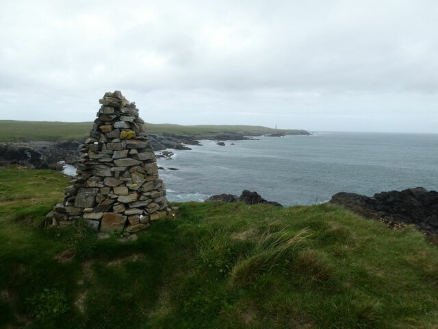
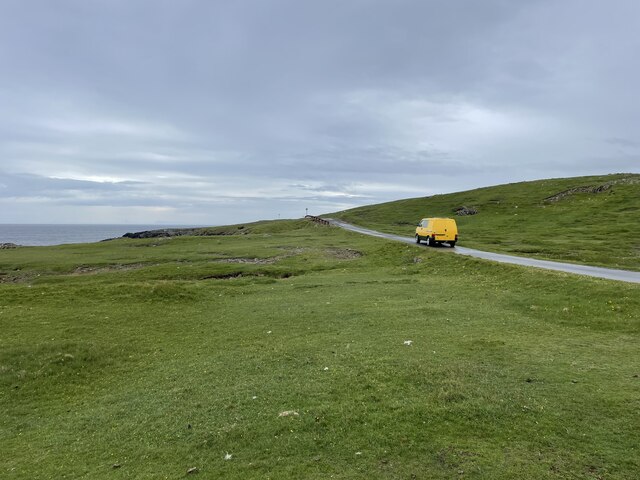
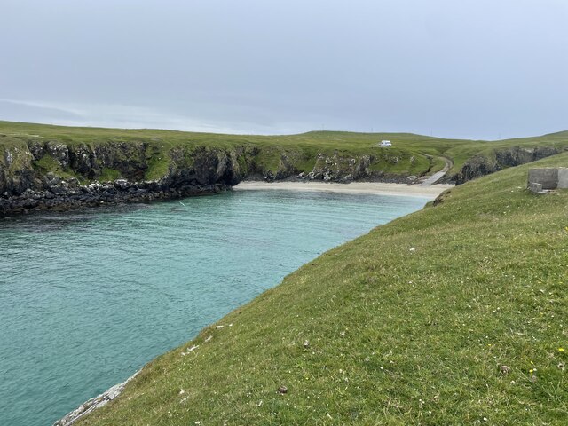
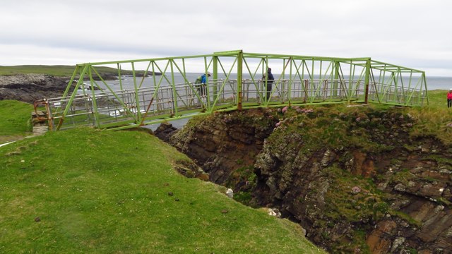
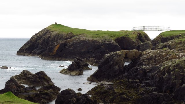
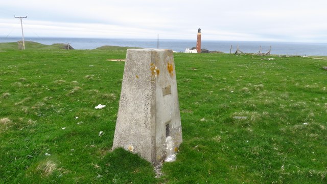
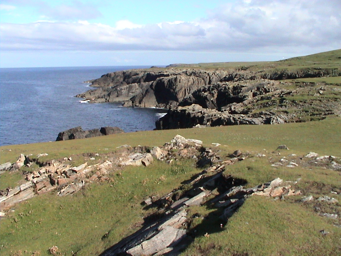
Port Stoth is a small coastal village located in Ross-shire, Scotland. Situated on the eastern coast, it is nestled between the North Sea and the estuary of a nearby creek. The village is known for its picturesque setting and serene environment.

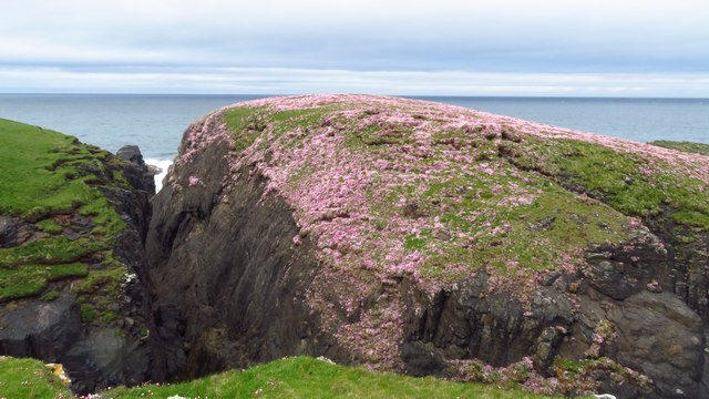
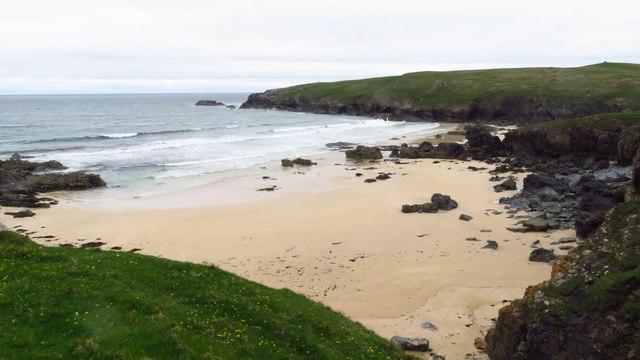
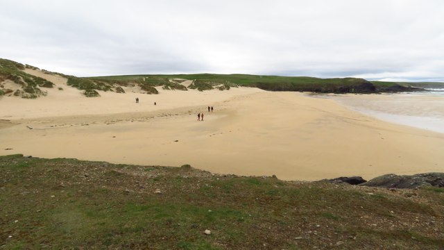
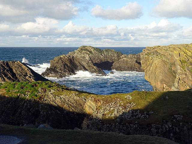
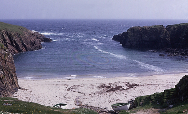
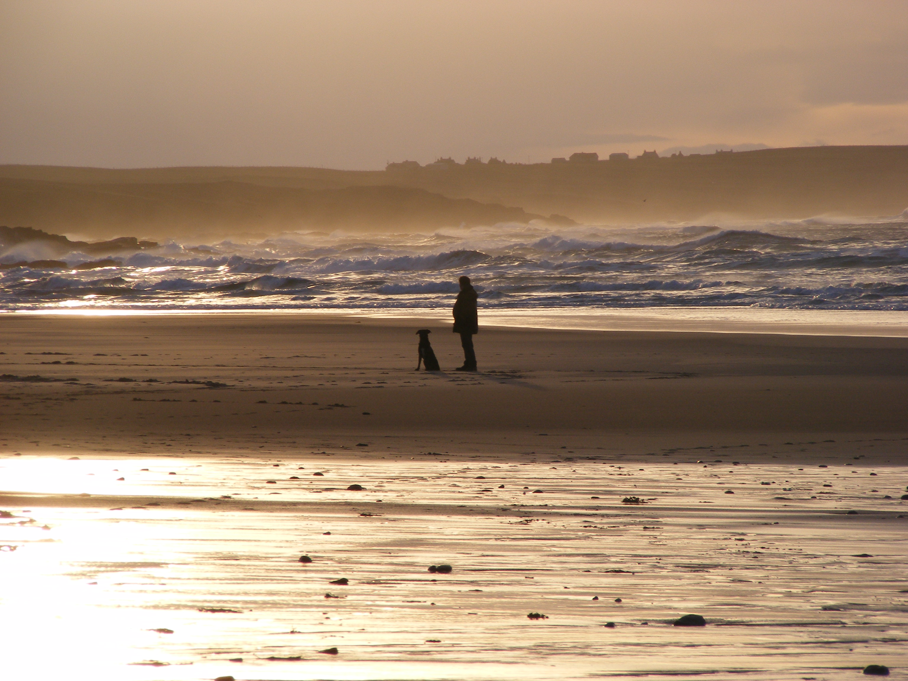
The sea surrounding Port Stoth offers breathtaking views and is a popular spot for recreational activities such as fishing, boating, and water sports. The sandy beaches along the coastline attract visitors and locals alike, providing an ideal setting for picnics and leisurely strolls.

The estuary of the creek adds to the charm of Port Stoth, with its calm waters and abundant wildlife. It serves as a haven for various bird species, making it a popular destination for birdwatching enthusiasts. The estuary also supports a diverse ecosystem, with various marine life thriving in its waters.

The village itself is small but vibrant, with a close-knit community. It offers a range of amenities, including a few local shops, cafes, and restaurants, where visitors can enjoy traditional Scottish cuisine. The friendly atmosphere and warm hospitality of the locals make Port Stoth a welcoming destination for tourists.

Overall, Port Stoth is a hidden gem in Ross-shire, offering a tranquil escape from the hustle and bustle of city life. Its stunning coastline, estuary, and creek provide a perfect backdrop for outdoor activities, making it an ideal destination for nature lovers and those seeking a peaceful retreat.

If you have any feedback on the listing, please let us know in the comments section below.

Port Stoth Images

Images are sourced within 2km of 58.511118/-6.251735 or Grid Reference NB5265. Thanks to Geograph Open Source API. All images are credited.

Dun Eistean cairn with distant view of Butt of Lewis lighthouse
Dun Eistean bridge and houses in Knockaird
Butt of Lewis Lighthouse The Butt of Lewis is the northernmost point of the Isle of Lewis in the Outer Hebrides. There is a lighthouse designed and built by David & Thomas Stevenson (sons of Robert and brother of Alan - all lighthouse engineers) and constructed in 1862. It is 37m (121ft) tall at an elevation of 52m (170ft) with a nominal range of 25 nautical miles. It flashes a white light every five seconds, and since 1998 is fully automated, being one of the last four Scottish lighthouses to dispense with the services of their keepers. It is looked after by the Northern Lighthouse Board (the Scottish equivalent to Trinity House) and is monitored remotely from Edinburgh.
The Butt of Lewis has appeared in the Guinness Book of Records as the windiest place in the United Kingdom, sticking out as it does into the North Atlantic.
Butt of Lewis Lighthouse
The Butt of Lewis is the northernmost point of the Isle of Lewis in the Outer Hebrides. There is a lighthouse designed and built by David & Thomas Stevenson (sons of Robert and brother of Alan - all lighthouse engineers) and constructed in 1862. It is 37m (121ft) tall at an elevation of 52m (170ft) with a nominal range of 25 nautical miles. It flashes a white light every five seconds, and since 1998 is fully automated, being one of the last four Scottish lighthouses to dispense with the services of their keepers. It is looked after by the Northern Lighthouse Board (the Scottish equivalent to Trinity House) and is monitored remotely from Edinburgh. The Butt of Lewis has appeared in the Guinness Book of Records as the windiest place in the United Kingdom, sticking out as it does into the North Atlantic.
Road to the lighthouse The Butt of Lewis is the northernmost point of the Isle of Lewis in the Outer Hebrides. There is a lighthouse designed and built by David & Thomas Stevenson (sons of Robert and brother of Alan - all lighthouse engineers) and constructed in 1862. It is 37m (121ft) tall at an elevation of 52m (170ft) with a nominal range of 25 nautical miles. It flashes a white light every five seconds, and since 1998 is fully automated, being one of the last four Scottish lighthouses to dispense with the services of their keepers. It is looked after by the Northern Lighthouse Board (the Scottish equivalent to Trinity House) and is monitored remotely from Edinburgh.
The Butt of Lewis has appeared in the Guinness Book of Records as the windiest place in the United Kingdom, sticking out as it does into the North Atlantic.
Road to the lighthouse
The Butt of Lewis is the northernmost point of the Isle of Lewis in the Outer Hebrides. There is a lighthouse designed and built by David & Thomas Stevenson (sons of Robert and brother of Alan - all lighthouse engineers) and constructed in 1862. It is 37m (121ft) tall at an elevation of 52m (170ft) with a nominal range of 25 nautical miles. It flashes a white light every five seconds, and since 1998 is fully automated, being one of the last four Scottish lighthouses to dispense with the services of their keepers. It is looked after by the Northern Lighthouse Board (the Scottish equivalent to Trinity House) and is monitored remotely from Edinburgh. The Butt of Lewis has appeared in the Guinness Book of Records as the windiest place in the United Kingdom, sticking out as it does into the North Atlantic.
Port Stoth Geocaching is a type of global treasure hunt of people looking for caches, or hidden stashes of objects. Geocaching may also be described as a series of hide-and-seek games, where hiders provide online clues for seekers. Seekers use global positioning system (GPS) devices to find hidden caches
Port Stoth
Geocaching is a type of global treasure hunt of people looking for caches, or hidden stashes of objects. Geocaching may also be described as a series of hide-and-seek games, where hiders provide online clues for seekers. Seekers use global positioning system (GPS) devices to find hidden caches
St Molveg's Church, Eoropie
Footbridge linking Lewis with Dun Eistean
Dun Eistean & connecting bridge near Butt of Lewis
Trig point at Butt of Lewis
Butt of Lewis Lighthouse
Sea thrift on islet at Geodha nan Each, Butt of Lewis
Beach at Cunndal, Eoropie
Cunndal Drownings Memorial, Eoropie This is a memorial to the men lost here on 5th March 1885, when the local fishing fleet was caught in a terrible gale. Two boats attempted to seek shelter at Cunndal, just north of this point. Both boats and twelve men – all from Eoropie - were lost.
Cunndal Drownings Memorial, Eoropie
This is a memorial to the men lost here on 5th March 1885, when the local fishing fleet was caught in a terrible gale. Two boats attempted to seek shelter at Cunndal, just north of this point. Both boats and twelve men – all from Eoropie - were lost.
Traigh Shanndaigh, Eoropie
Butt of Lewis Lighthouse I did consider correcting the converging verticals in this shot but then I got an attack of acrophobia so could no longer look at it!
Butt of Lewis Lighthouse
I did consider correcting the converging verticals in this shot but then I got an attack of acrophobia so could no longer look at it!
Cleite Gile Rocks at the Butt of Lewis.
Cleite Gile
Rocks at the Butt of Lewis.
Butt of Lewis lighthouse
Show me another place!

Port Stoth is located at Grid Ref: NB5265 (Lat: 58.511118, Lng: -6.251735)

Unitary Authority: Na h-Eileanan an Iar

Police Authority: Highlands and Islands

What 3 Words

///hobbyists.snuggled.surround. Near North Tolsta, Na h-Eileanan Siar

Related Wikis

Port Stoth

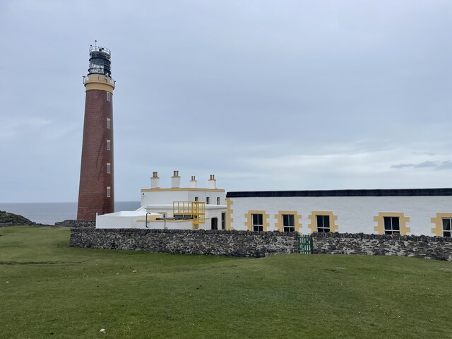
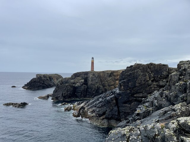
Port Stoth, known locally as Stoth and pronounced Stow, is a sheltered inlet just southeast of the Butt of Lewis in the Outer Hebrides, Scotland. It is...
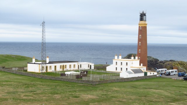
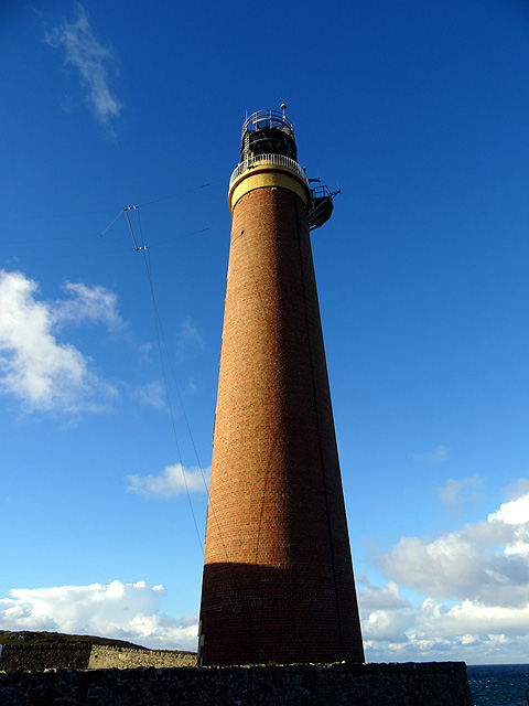
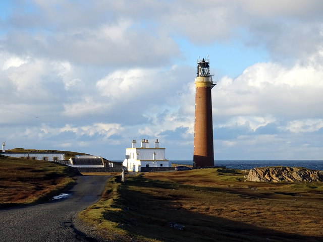
Butt of Lewis

The Butt of Lewis (Scottish Gaelic: Rubha Robhanais) is the most northerly point of Lewis in the Outer Hebrides. The headland, which lies in the North...

Teampall Mholuaidh

St Moluag's church (Scottish Gaelic: Teampall Mholuaidh) is a church in the village of Eoropie in Ness in the Isle of Lewis in Scotland. It is one of the...

Eoropie

Eoropie (Scottish Gaelic: Eòrapaidh) is the most northerly village on the Isle of Lewis in the parish of Ness, in the Outer Hebrides, Scotland. Eoropie...

Nearby Amenities

Located within 500m of 58.511118,-6.251735
Barrier: cattle_grid
Lat/Long: 58.5096676/-6.2564631
Power: pole
Lat/Long: 58.5104369/-6.2601526
Power: pole
Lat/Long: 58.5109929/-6.2601874
Power: pole
Lat/Long: 58.5117185/-6.2601955
Isgeir
Natural: cape
Lat/Long: 58.5124542/-6.2494069
Stàthanais
Natural: cape
Lat/Long: 58.5143707/-6.2551575
Passing Place
Lat/Long: 58.5083893/-6.2580067
Passing Place
Lat/Long: 58.5097313/-6.2563871
Port Stoth
Natural: bay
Lat/Long: 58.5110959/-6.2524495
The data included in this document is from www.openstreetmap.org. The data is made available under ODbL.

Have you been to Port Stoth?

Leave your review of Port Stoth below (or comments, questions and feedback).