Flod Sgeir

Coastal Feature, Headland, Point in Inverness-shire

Scotland

Flod Sgeir

Rubha na Crannaig
Rubha na Crannaig Credit: Alan Reid

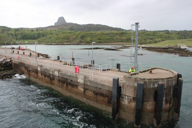
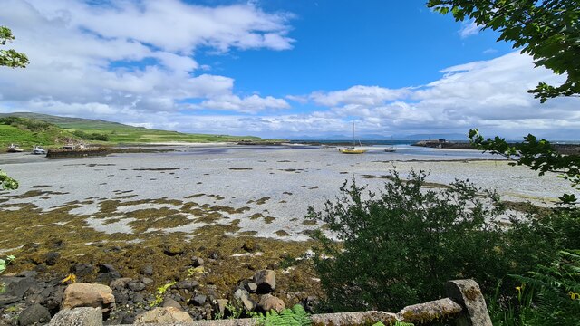
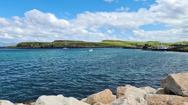
Flod Sgeir is a prominent coastal feature located in Inverness-shire, Scotland. It is a headland or point that juts out into the North Atlantic Ocean, offering stunning views of the surrounding area. The name "Flod Sgeir" translates to "flat rock" in the local Gaelic language, which accurately describes the geography of the area.

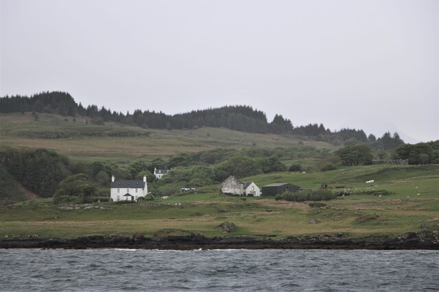
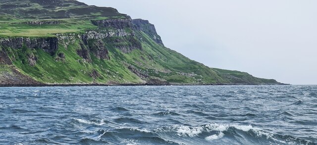
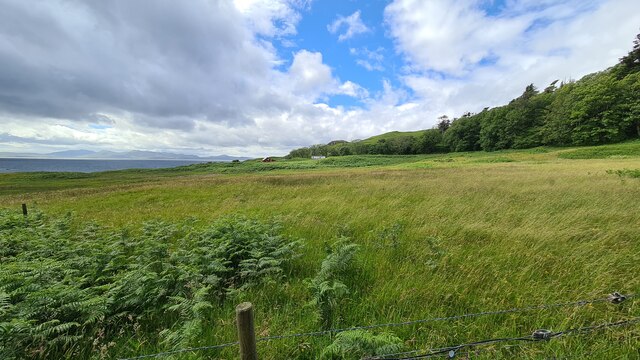
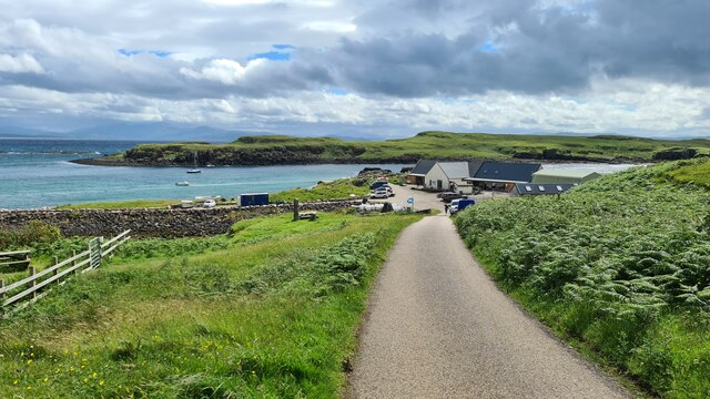
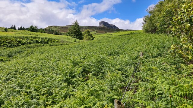
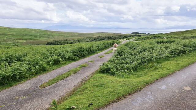
Situated on the western coast of Inverness-shire, Flod Sgeir is known for its rugged and dramatic landscape. The headland is composed of rocky cliffs and outcrops, which provide a habitat for a variety of seabirds, including puffins, gannets, and guillemots. This makes it a popular spot for birdwatching and wildlife enthusiasts.

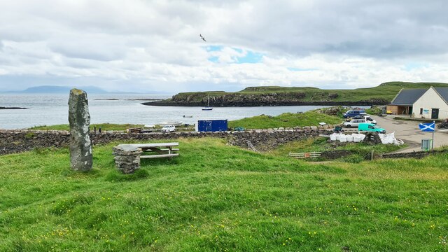
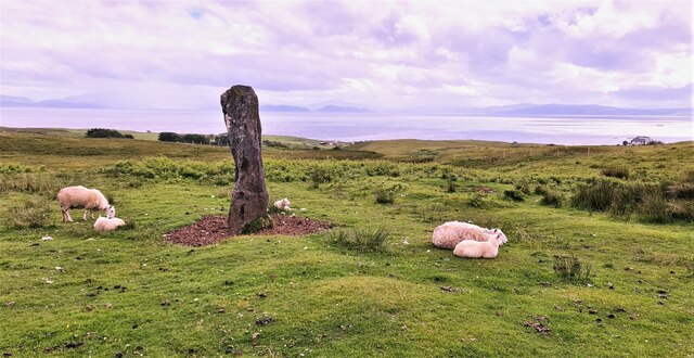
The area around Flod Sgeir is also rich in history and cultural heritage. There are several ancient archaeological sites nearby, including standing stones and burial cairns, which provide evidence of human occupation in the area dating back thousands of years. These historical sites add to the allure of Flod Sgeir and make it a fascinating destination for those interested in Scotland's past.

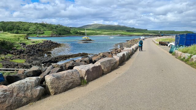
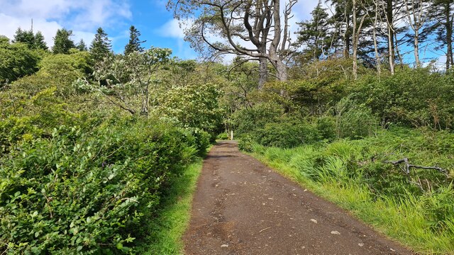
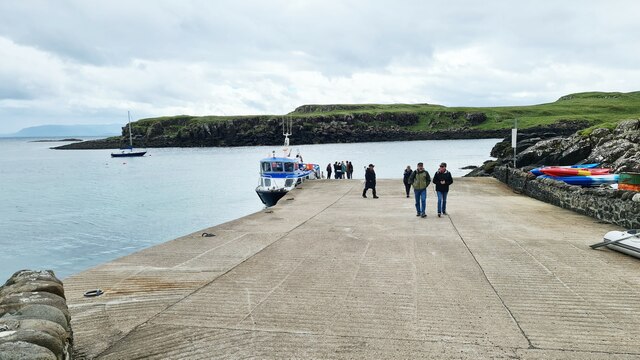
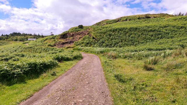
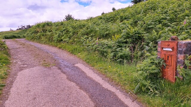
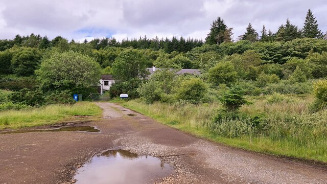
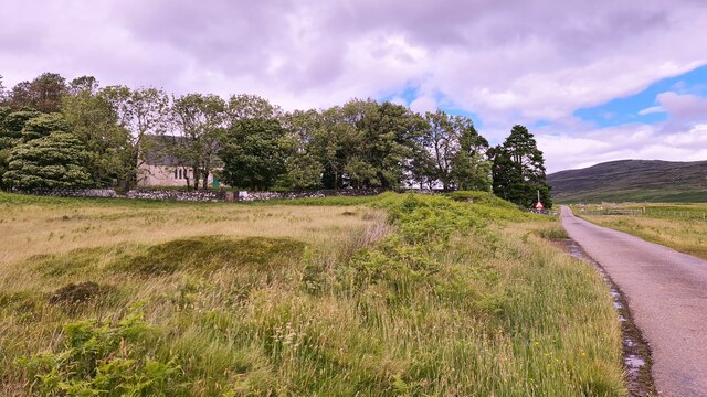
Access to Flod Sgeir is relatively easy, with a well-maintained footpath leading to the headland. Visitors can enjoy a leisurely walk along the coastal path, taking in the breathtaking views of the ocean and the surrounding countryside. It is advisable to wear appropriate footwear and take caution as the terrain can be uneven and slippery.

Overall, Flod Sgeir is a captivating coastal feature in Inverness-shire, offering a unique blend of natural beauty and historical significance. Whether one is interested in birdwatching, hiking, or exploring ancient sites, Flod Sgeir has something to offer for everyone.

If you have any feedback on the listing, please let us know in the comments section below.

Flod Sgeir Images

Images are sourced within 2km of 56.881856/-6.122592 or Grid Reference NM4884. Thanks to Geograph Open Source API. All images are credited.

Rubha na Crannaig
Rubha na Crannaig
New pier, Isle of Eigg
Cal Mac pier and slipway, Galmisdale, Eigg
Track near Galmisdale, Eigg
Approaching Eigg
Approaching Eigg
Standing stone, Galmisdale, Eigg
Slip way Galmisdale Ferry from Arisaig just arrived
Slip way Galmisdale
Ferry from Arisaig just arrived
Eigg near Galmisdale
Galmisdale Bay, slipway and Cafe
Galmisdale Bay, Eigg Near low tide
Galmisdale Bay, Eigg
Near low tide
Track to The Lodge
Track to The Lodge
Missed the last post
Valley of Allt Eas Chuthain, Eigg An Sgurr in background
Valley of Allt Eas Chuthain, Eigg
An Sgurr in background
Small Isles Medical Centre, Eigg Well hidden away
Small Isles Medical Centre, Eigg
Well hidden away
Eigg church Church of Scotland
Eigg church
Church of Scotland
Standing stone, Eigg Near the road from Galmisdale to Cleadale with fantastic views to the South and East. CalMac's Small Islands ferry is just visible to the right.
Standing stone, Eigg
Near the road from Galmisdale to Cleadale with fantastic views to the South and East. CalMac's Small Islands ferry is just visible to the right.
Road junction, Eigg Left for Kildonan, right for Galmisdale
Road junction, Eigg
Left for Kildonan, right for Galmisdale
Ferry for Arisaig at Galmisdale slipway The Sheerwater
Ferry for Arisaig at Galmisdale slipway
The Sheerwater
Show me another place!

Flod Sgeir is located at Grid Ref: NM4884 (Lat: 56.881856, Lng: -6.122592)

Unitary Authority: Highland

Police Authority: Highlands and Islands

What 3 Words

///jets.iterative.clip. Near Arisaig, Highland

Related Wikis

Galmisdale

Galmisdale is the main port of the island of Eigg, one of the Small Isles of the Inner Hebrides. It is in the Scottish council area of Highland. ��2�...

Eilean Chathastail

Eilean Chathastail (Eng: Castle Island) is one of the Small Isles in the Inner Hebrides of Scotland. == Geography == Eilean Chathastail...

An Sgùrr (Eigg)

An Sgùrr is the highest hill on the Inner Hebridean island of Eigg, Lochaber, Highland, Scotland. It was formed 58.72 ± 0.07 million years ago; the result...

Eigg

Eigg ( eg; Scottish Gaelic: Eige; Scots: Eigg) is one of the Small Isles in the Scottish Inner Hebrides. It lies to the south of the Isle of Skye and to...

Nearby Amenities

Located within 500m of 56.881856,-6.122592
Source: PGS
Lat/Long: 56.8859144/-6.1193244
Source: PGS
Lat/Long: 56.8857409/-6.119511
Source: PGS
Lat/Long: 56.8853755/-6.1197799
Source: PGS
Lat/Long: 56.8853562/-6.1200094
Source: PGS
Lat/Long: 56.8854093/-6.1202875
Source: PGS
Lat/Long: 56.88559/-6.1206542
Source: PGS
Lat/Long: 56.8861598/-6.1202566
Source: PGS
Lat/Long: 56.8846351/-6.1280927
Source: PGS
Lat/Long: 56.8838982/-6.1270881
Source: PGS
Lat/Long: 56.88341/-6.1264833
Source: PGS
Lat/Long: 56.8833127/-6.1263263
Source: PGS
Lat/Long: 56.8828881/-6.1266722
Source: PGS
Lat/Long: 56.8827599/-6.1268286
Source: PGS
Lat/Long: 56.8826286/-6.1272903
Source: PGS
Lat/Long: 56.8823374/-6.1281209
Source: PGS
Lat/Long: 56.8819234/-6.1290909
Source: PGS
Lat/Long: 56.8819133/-6.1302768
Ferry Terminal
Eigg
Ferry: yes
Public Transport: station
Lat/Long: 56.8797535/-6.126792
Source: PGS
Lat/Long: 56.8839616/-6.127456
Source: PGS
Lat/Long: 56.8843739/-6.127957
Source: PGS
Lat/Long: 56.881559/-6.1297327
Seamark Light 1 Category: directional
Seamark Light 1 Character: Fl
Seamark Light 1 Colour: green
Seamark Light 1 Height: 9
Seamark Light 1 Period: 3
Seamark Light 1 Range: 11
Seamark Light 1 Sector End: 244
Seamark Light 1 Sector Start: 242.5
Seamark Light 2 Category: directional
Seamark Light 2 Character: Fl
Seamark Light 2 Colour: white
Seamark Light 2 Height: 9
Seamark Light 2 Period: 3
Seamark Light 2 Range: 14
Seamark Light 2 Sector End: 246
Seamark Light 2 Sector Start: 244
Seamark Light 3 Category: directional
Seamark Light 3 Character: Fl
Seamark Light 3 Colour: red
Seamark Light 3 Height: 9
Seamark Light 3 Period: 3
Seamark Light 3 Sector End: 247.5
Seamark Light 3 Sector Start: 246
Seamark Name: Sgeir nam Bagha (Ferry Terminal)
Seamark Type: light_major
Lat/Long: 56.8798118/-6.1260729
The data included in this document is from www.openstreetmap.org. The data is made available under ODbL.

Have you been to Flod Sgeir?

Leave your review of Flod Sgeir below (or comments, questions and feedback).