Rubh' an t-Sailleir

Coastal Feature, Headland, Point in Inverness-shire

Scotland

Rubh' an t-Sailleir

The Hunish from Meall Tuath
The Hunish from Meall Tuath Credit: Clive Nicholson

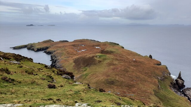
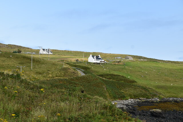
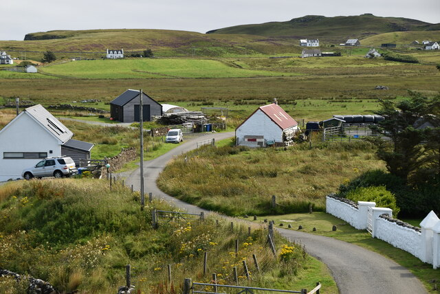
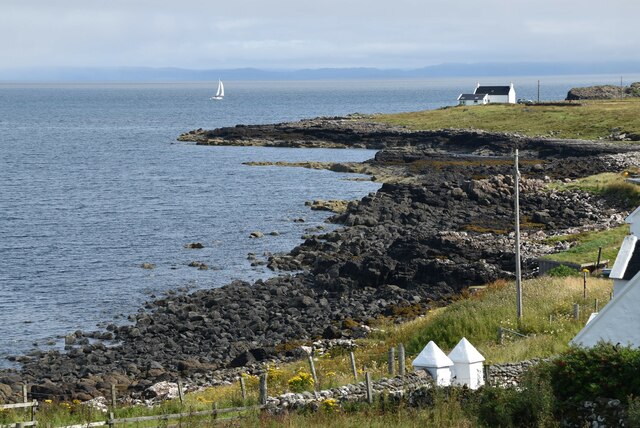
Rubh' an t-Sailleir, also known as Sallachy Point, is a prominent coastal feature located in Inverness-shire, Scotland. This headland juts out into the waters of Loch Ness, offering stunning panoramic views of the surrounding landscape.

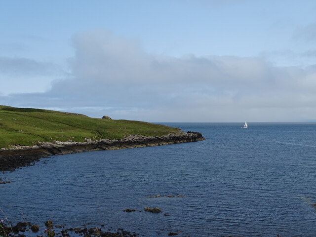
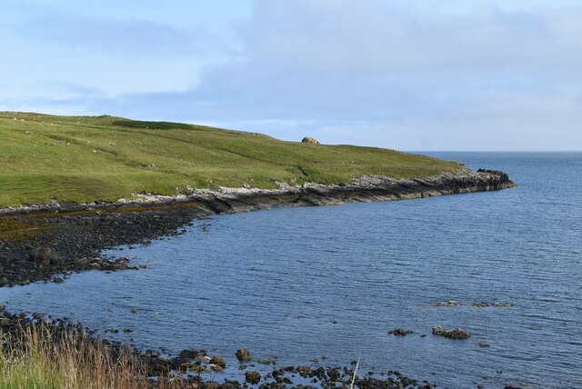
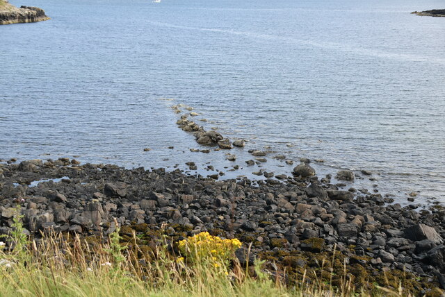
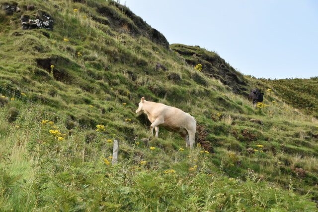
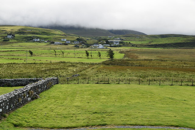
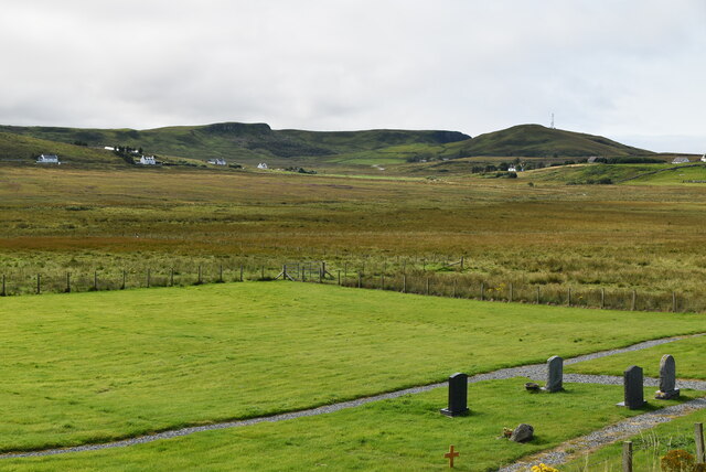
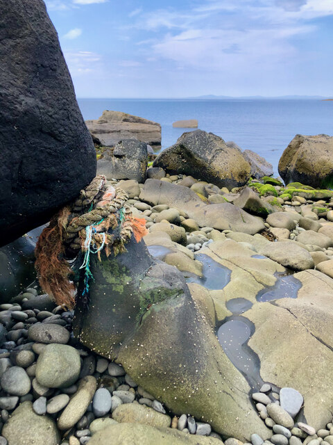
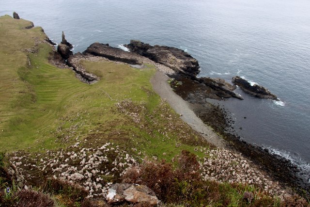
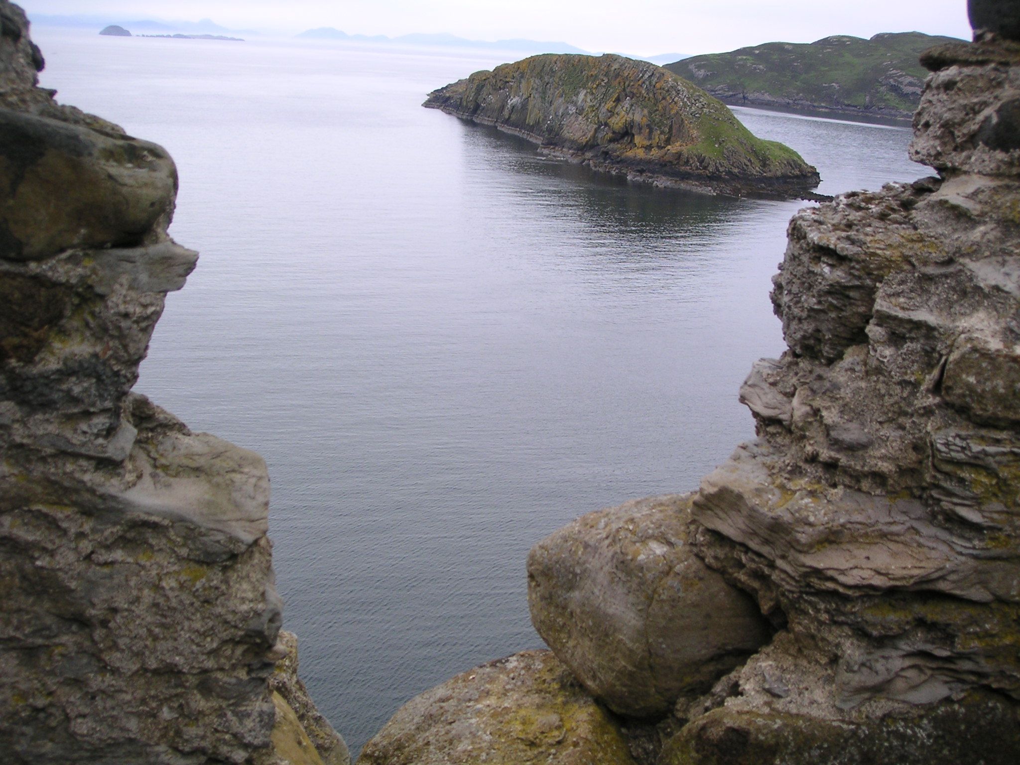
Situated on the southwestern shore of the famous Loch Ness, Rubh' an t-Sailleir is characterized by its rugged cliffs and rocky terrain. The headland is composed of ancient granite and offers a dramatic contrast to the calm waters of the loch. The area is rich in diverse flora and fauna, with various species of seabirds, including guillemots and puffins, often spotted nesting along the cliffs.

Visitors to Rubh' an t-Sailleir can enjoy a variety of activities. The headland is popular among hikers and nature enthusiasts, who can explore the coastal paths and take in the breathtaking views. The area also offers opportunities for wildlife watching, as seals and dolphins can occasionally be spotted swimming in the waters below.

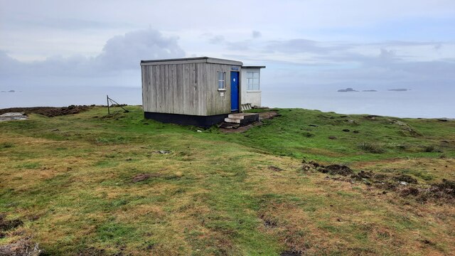
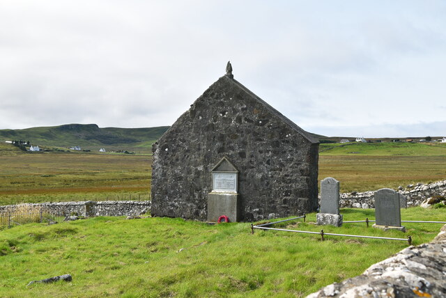
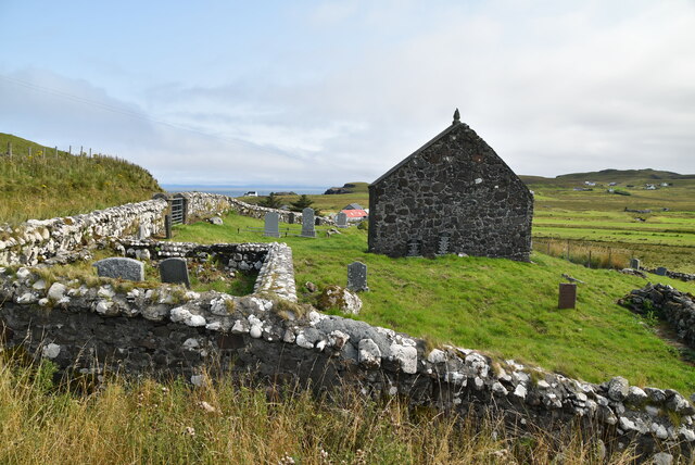
In addition to its natural beauty, Rubh' an t-Sailleir holds historical significance. The headland is home to the ruins of Castle Sallachy, a 16th-century tower house that once stood as a stronghold. The castle played a role in the turbulent history of the region, witnessing conflicts and power struggles throughout the centuries.

Overall, Rubh' an t-Sailleir is a captivating coastal feature that showcases the raw beauty of the Scottish Highlands. Its rugged cliffs, diverse wildlife, and historical ruins make it a must-visit destination for nature lovers and history enthusiasts alike.

If you have any feedback on the listing, please let us know in the comments section below.

Rubh' an t-Sailleir Images

Images are sourced within 2km of 57.705878/-6.3145759 or Grid Reference NG4376. Thanks to Geograph Open Source API. All images are credited.

The Hunish from Meall Tuath
The Lookout, Meall Tuath Former coastguard watch station which is now a bothy.
The Lookout, Meall Tuath
Former coastguard watch station which is now a bothy.
Port Gobhlaig
Port Gobhlaig
St Moluag's Church
St Moluag's Church
Lower Aird
Lower Aird
Port Gobhlaig
Port Gobhlaig
Rocky beach, Port Gobhlaig
Lone cow
Lone cow
The Byre
The Byre
St Moluag's Church In the United Kingdom, a scheduled monument is a 'nationally important' archaeological site or historic building, given protection against unauthorised change.
There are about 20,000 scheduled monuments in England representing about 37,000 heritage assets. Of the tens of thousands of scheduled monuments in the UK, most are inconspicuous archaeological sites, but some are large ruins.
Wikipedia: <span class="nowrap"><a title="https://en.wikipedia.org/wiki/Scheduled_monument" rel="nofollow ugc noopener" href="https://en.wikipedia.org/wiki/Scheduled_monument">Link</a><img style="margin-left:2px;" alt="External link" title="External link - shift click to open in new window" src="https://s1.geograph.org.uk/img/external.png" width="10" height="10"/></span>
St Moluag's Church
In the United Kingdom, a scheduled monument is a 'nationally important' archaeological site or historic building, given protection against unauthorised change. There are about 20,000 scheduled monuments in England representing about 37,000 heritage assets. Of the tens of thousands of scheduled monuments in the UK, most are inconspicuous archaeological sites, but some are large ruins. Wikipedia: LinkExternal link
Kilmaluag Cemetery
Kilmaluag Cemetery
St Moluag's Church In the United Kingdom, a scheduled monument is a 'nationally important' archaeological site or historic building, given protection against unauthorised change.
There are about 20,000 scheduled monuments in England representing about 37,000 heritage assets. Of the tens of thousands of scheduled monuments in the UK, most are inconspicuous archaeological sites, but some are large ruins.
Wikipedia: <span class="nowrap"><a title="https://en.wikipedia.org/wiki/Scheduled_monument" rel="nofollow ugc noopener" href="https://en.wikipedia.org/wiki/Scheduled_monument">Link</a><img style="margin-left:2px;" alt="External link" title="External link - shift click to open in new window" src="https://s1.geograph.org.uk/img/external.png" width="10" height="10"/></span>
St Moluag's Church
In the United Kingdom, a scheduled monument is a 'nationally important' archaeological site or historic building, given protection against unauthorised change. There are about 20,000 scheduled monuments in England representing about 37,000 heritage assets. Of the tens of thousands of scheduled monuments in the UK, most are inconspicuous archaeological sites, but some are large ruins. Wikipedia: LinkExternal link
St Moluag's Church and graveyard In the United Kingdom, a scheduled monument is a 'nationally important' archaeological site or historic building, given protection against unauthorised change.
There are about 20,000 scheduled monuments in England representing about 37,000 heritage assets. Of the tens of thousands of scheduled monuments in the UK, most are inconspicuous archaeological sites, but some are large ruins.
Wikipedia: <span class="nowrap"><a title="https://en.wikipedia.org/wiki/Scheduled_monument" rel="nofollow ugc noopener" href="https://en.wikipedia.org/wiki/Scheduled_monument">Link</a><img style="margin-left:2px;" alt="External link" title="External link - shift click to open in new window" src="https://s1.geograph.org.uk/img/external.png" width="10" height="10"/></span>
St Moluag's Church and graveyard
In the United Kingdom, a scheduled monument is a 'nationally important' archaeological site or historic building, given protection against unauthorised change. There are about 20,000 scheduled monuments in England representing about 37,000 heritage assets. Of the tens of thousands of scheduled monuments in the UK, most are inconspicuous archaeological sites, but some are large ruins. Wikipedia: LinkExternal link
Farmland
Farmland
Kilmaluag cemetery
Kilmaluag cemetery
Southern shore of Port Gobhlaig
Rope's Exquisite Embrace of Mighty Boulders
Port Lag a' Bhleodhainn A small stony bay with some protection from the open sea afforded by a rib of rock on the northeast side.
Port Lag a' Bhleodhainn
A small stony bay with some protection from the open sea afforded by a rib of rock on the northeast side.
Show me another place!

Rubh' an t-Sailleir is located at Grid Ref: NG4376 (Lat: 57.705878, Lng: -6.3145759)

Unitary Authority: Highland

Police Authority: Highlands and Islands

What 3 Words

///compiler.inspected.bucked. Near Uig, Highland

Related Wikis

Eilean Trodday

Eilean Trodday is an island in The Minch just off the north coast of the Trotternish peninsula of Skye in Scotland. Eilean Trodday is about 38 hectares...

Kilmaluag

Kilmaluag (Scottish Gaelic: Cill Moluaig, meaning St. Moluag's Cell, Church or Chapel) is a township made up of several small settlements on the most northerly...

Duntulm

Duntulm (Scottish Gaelic: Dùn Thuilm) is a township on the most northerly point of the Trotternish peninsula of the Isle of Skye made up of Shulista (north...

Hebridean Terrane

The Hebridean Terrane is one of the terranes that form part of the Caledonian orogenic belt in northwest Scotland. Its boundary with the neighbouring Northern...

Nearby Amenities

Located within 500m of 57.705878,-6.3145759
Created By: dmgroom_coastlines
Source: PGS
Lat/Long: 57.70722/-6.30666
Created By: dmgroom_coastlines
Source: PGS
Lat/Long: 57.7075/-6.30759
Created By: dmgroom_coastlines
Source: PGS
Lat/Long: 57.70751/-6.30807
Created By: dmgroom_coastlines
Source: PGS
Lat/Long: 57.70727/-6.30905
Created By: dmgroom_coastlines
Source: PGS
Lat/Long: 57.70729/-6.31
Created By: dmgroom_coastlines
Source: PGS
Lat/Long: 57.7073/-6.31048
Created By: dmgroom_coastlines
Source: PGS
Lat/Long: 57.70706/-6.31098
Created By: dmgroom_coastlines
Source: PGS
Lat/Long: 57.70707/-6.31145
Created By: dmgroom_coastlines
Source: PGS
Lat/Long: 57.70708/-6.31241
Created By: dmgroom_coastlines
Source: PGS
Lat/Long: 57.70684/-6.31291
Rubh' an t-Sailleir
Natural: cape
Lat/Long: 57.70673/-6.31339
Created By: dmgroom_coastlines
Source: PGS
Lat/Long: 57.70596/-6.31345
Created By: dmgroom_coastlines
Source: PGS
Lat/Long: 57.70585/-6.31441
Created By: dmgroom_coastlines
Source: PGS
Lat/Long: 57.70562/-6.31539
Created By: dmgroom_coastlines
Source: PGS
Lat/Long: 57.70564/-6.31587
Source: PGS
Lat/Long: 57.7054688/-6.3160935
Source: PGS
Lat/Long: 57.7053654/-6.3170758
Source: PGS
Lat/Long: 57.7050793/-6.3178835
Source: PGS
Lat/Long: 57.7047634/-6.3180537
Source: PGS
Lat/Long: 57.7044046/-6.3179366
Created By: dmgroom_coastlines
Source: PGS
Lat/Long: 57.70415/-6.31885
Source: PGS
Lat/Long: 57.7040808/-6.3193957
Source: PGS
Lat/Long: 57.7038495/-6.3195338
Source: PGS
Lat/Long: 57.7033539/-6.31937
Source: PGS
Lat/Long: 57.7034888/-6.3203132
Source: PGS
Lat/Long: 57.7033562/-6.3210916
The data included in this document is from www.openstreetmap.org. The data is made available under ODbL.

Have you been to Rubh' an t-Sailleir?

Leave your review of Rubh' an t-Sailleir below (or comments, questions and feedback).