Rubha Buidhe

Coastal Feature, Headland, Point in Argyllshire

Scotland

Rubha Buidhe

Port Askaig/Port Asgaig
Port Askaig/Port Asgaig Credit: Mick Garratt

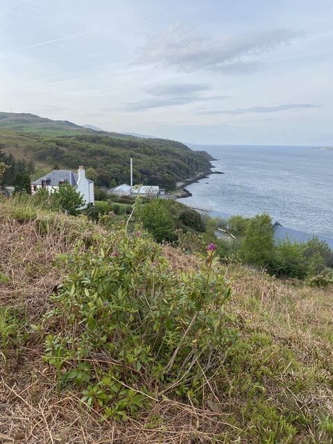
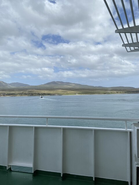
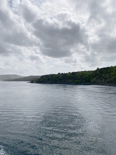
Rubha Buidhe is a striking coastal feature located in Argyllshire, Scotland. Situated on the western coast of the Scottish mainland, this headland juts out into the vast expanse of the Atlantic Ocean, offering breathtaking views and a rich natural environment. With its rugged cliffs and panoramic vistas, Rubha Buidhe attracts visitors from far and wide.

The headland is characterized by its dramatic cliffs, which rise steeply from the sea to a height of approximately 100 meters. These cliffs are composed of ancient rock formations, showcasing layers of sedimentary rock that have been shaped by the elements over millions of years. The exposed nature of Rubha Buidhe means that it is often subject to strong winds and crashing waves, creating a captivating and dynamic landscape.

The point is also home to a diverse range of flora and fauna, making it a haven for nature enthusiasts. The coastal heathland surrounding Rubha Buidhe is dotted with wildflowers, including vibrant yellow gorse and delicate sea pinks. Seabirds such as gannets, fulmars, and kittiwakes can be spotted nesting on the cliffs, while seals and dolphins can often be seen frolicking in the waters below.

Access to Rubha Buidhe is relatively straightforward, with a well-maintained walking trail leading visitors along the coastline. This trail offers stunning viewpoints and opportunities for wildlife spotting. Additionally, the headland is part of a larger nature reserve, providing the opportunity for further exploration and discovery of the surrounding area.

Overall, Rubha Buidhe is a captivating coastal feature, combining dramatic cliffs, breathtaking views, and a rich biodiversity. Whether visitors are seeking a peaceful walk along the rugged coastline or a chance to marvel at the forces of nature, this headland provides an unforgettable experience.

If you have any feedback on the listing, please let us know in the comments section below.
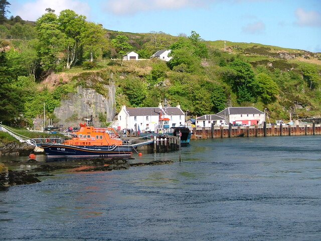
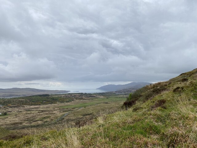
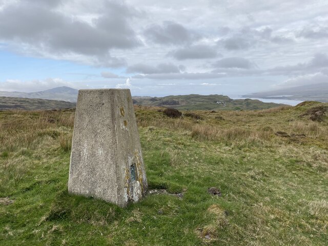
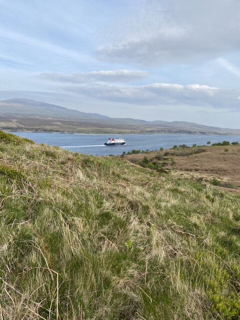
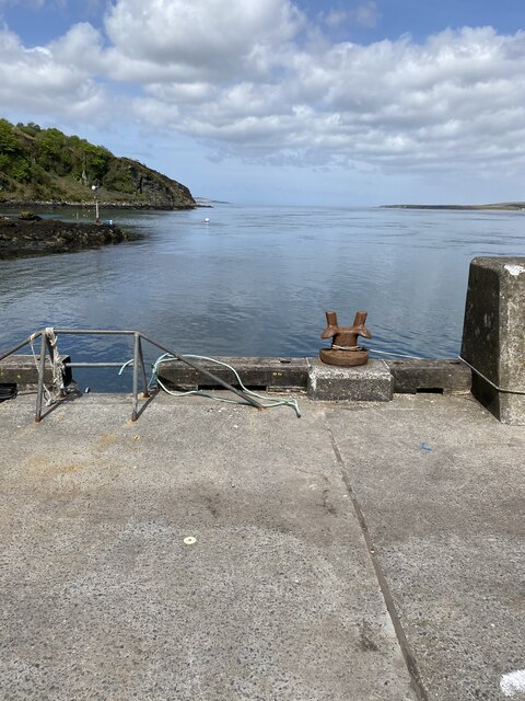
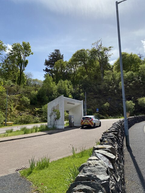
Rubha Buidhe Images

Images are sourced within 2km of 55.853619/-6.1066213 or Grid Reference NR4369. Thanks to Geograph Open Source API. All images are credited.

Port Askaig/Port Asgaig
Views from slopes below Persabus Trig Point
Persabus Trig Point Flush Bracket S9074
View of ferry from Coal Ila
Coal Ila Distellery
Coal Ila Distellery
Port Askaig Pipe <span class="nowrap"><a title="http://trigpointing.uk/trig/9492" rel="nofollow ugc noopener" href="http://trigpointing.uk/trig/9492">Link</a><img style="margin-left:2px;" alt="External link" title="External link - shift click to open in new window" src="https://s1.geograph.org.uk/img/external.png" width="10" height="10"/></span>
<span class="nowrap"><a title="http://trigpointing.uk/wiki/Pipe" rel="nofollow ugc noopener" href="http://trigpointing.uk/wiki/Pipe">Link</a><img style="margin-left:2px;" alt="External link" title="External link - shift click to open in new window" src="https://s1.geograph.org.uk/img/external.png" width="10" height="10"/></span>
Not much is known about pipes. There are 21 listed on T:UK, all in Scotland.
Lewis and Harris (1)
Islay (16)
Gigha (3)
Kintyre Peninsula (1)
Port Askaig Pipe
LinkExternal link LinkExternal link Not much is known about pipes. There are 21 listed on T:UK, all in Scotland. Lewis and Harris (1) Islay (16) Gigha (3) Kintyre Peninsula (1)
Port Askaig with Jura in the background
OS Bolt - Port Askaig, Pier <span class="nowrap"><a title="https://www.bench-marks.org.uk/bm58114" rel="nofollow ugc noopener" href="https://www.bench-marks.org.uk/bm58114">Link</a><img style="margin-left:2px;" alt="External link" title="External link - shift click to open in new window" src="https://s1.geograph.org.uk/img/external.png" width="10" height="10"/></span>
OS Bolt - Port Askaig, Pier
Location of OS Bolt - Port Askaig, Pier
Petrol station shelter with cut out map of Islay
Jura from ferry
Jura from ferry
Views to Islay from the ferry
A846, near Feolin
A846, near Feolin
OS Rivet: Jura, McDougall's Bay, Rock - Close Up <span class="nowrap"><a title="https://www.bench-marks.org.uk/bm167342" rel="nofollow ugc noopener" href="https://www.bench-marks.org.uk/bm167342">Link</a><img style="margin-left:2px;" alt="External link" title="External link - shift click to open in new window" src="https://s1.geograph.org.uk/img/external.png" width="10" height="10"/></span>
OS Rivet: Jura, McDougall's Bay, Rock - Close Up
OS Rivet: Jura, McDougall's Bay, Rock <span class="nowrap"><a title="https://www.bench-marks.org.uk/bm167342" rel="nofollow ugc noopener" href="https://www.bench-marks.org.uk/bm167342">Link</a><img style="margin-left:2px;" alt="External link" title="External link - shift click to open in new window" src="https://s1.geograph.org.uk/img/external.png" width="10" height="10"/></span>
OS Rivet: Jura, McDougall's Bay, Rock
Location of OS Rivet: Jura, McDougall's Bay, Rock
A846, near Feolin
A846, near Feolin
Feolin OS Pipe <span class="nowrap"><a title="https://trigpointing.uk/trig/9493" rel="nofollow ugc noopener" href="https://trigpointing.uk/trig/9493">Link</a><img style="margin-left:2px;" alt="External link" title="External link - shift click to open in new window" src="https://s1.geograph.org.uk/img/external.png" width="10" height="10"/></span>
<span class="nowrap"><a title="https://trigpointing.uk/wiki/Pipe" rel="nofollow ugc noopener" href="https://trigpointing.uk/wiki/Pipe">Link</a><img style="margin-left:2px;" alt="External link" title="External link - shift click to open in new window" src="https://s1.geograph.org.uk/img/external.png" width="10" height="10"/></span>
Feolin OS Pipe
Show me another place!

Rubha Buidhe is located at Grid Ref: NR4369 (Lat: 55.853619, Lng: -6.1066213)

Unitary Authority: Argyll and Bute

Police Authority: Argyll and West Dunbartonshire

What 3 Words

///physics.resists.polygraph. Near Port Askaig, Argyll & Bute

Related Wikis

Caol Ila distillery

Caol Ila distillery (; Scottish Gaelic: Taigh-staile Chaol Ìle [t̪ʰəˈs̪t̪alə xɯːlˈiːlə], "Sound of Islay Distillery") is a Scotch whisky distillery near...

Sound of Islay

The Sound of Islay (Scottish Gaelic: Caol Ìle) is a narrow strait between the islands of Islay and Jura off the west coast of Scotland. It is about 30...

Port Askaig

Port Askaig (Scottish Gaelic: Port Asgaig) is a port village on the east coast of the island of Islay, in Scotland. The village lies on the Sound of Islay...

Dunlossit House

Dunlossit House is a Category C listed country house near Port Askaig, Islay in the county of Argyll, in western Scotland.. == History and architecture... ==

Nearby Amenities

Located within 500m of 55.853619,-6.1066213
Source: PGS
Lat/Long: 55.8537669/-6.108059
Source: PGS
Lat/Long: 55.8551488/-6.1093391
Created By: Merkaartor 0.11
Lat/Long: 55.8531192/-6.1103512
Post Box
Ref: PA46 22
Lat/Long: 55.8524609/-6.1120587
Power: pole
Lat/Long: 55.8514997/-6.1136397
Power: pole
Lat/Long: 55.8532614/-6.112663
Power: pole
Lat/Long: 55.8522854/-6.112495
Power: pole
Lat/Long: 55.8530853/-6.1122261
Material: wood
Power: pole
Lat/Long: 55.8532645/-6.1114137
Power: pole
Lat/Long: 55.8539141/-6.1123487
Power: pole
Lat/Long: 55.852096/-6.1133091
Power: pole
Lat/Long: 55.8526786/-6.1129861
Power: pole
Lat/Long: 55.8532561/-6.112666
Power: pole
Lat/Long: 55.8499839/-6.1066813
Power: pole
Lat/Long: 55.849247/-6.1062332
Caol Ila
Alt Name En: Caolila
Name En: Caol Ila
Name Gd: Ruadhphort
Place: hamlet
Lat/Long: 55.8531336/-6.1108571
The data included in this document is from www.openstreetmap.org. The data is made available under ODbL.

Have you been to Rubha Buidhe?

Leave your review of Rubha Buidhe below (or comments, questions and feedback).