Carn Bosistow

Coastal Feature, Headland, Point in Cornwall

England

Carn Bosistow

Lower Bosistow Cliff path approaching Nanjizal Beach
Lower Bosistow Cliff path approaching Nanjizal Beach Credit: Tom Page

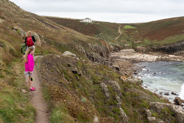
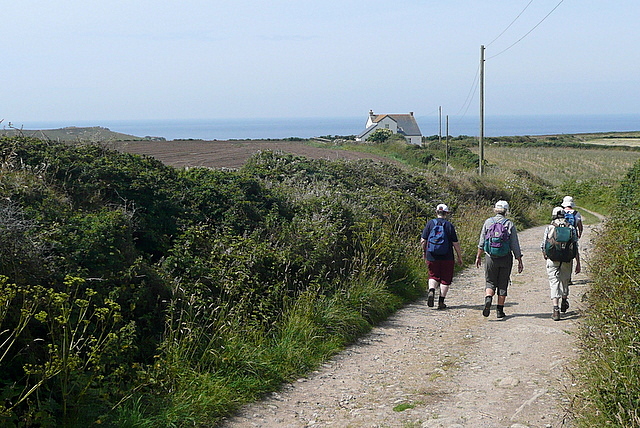
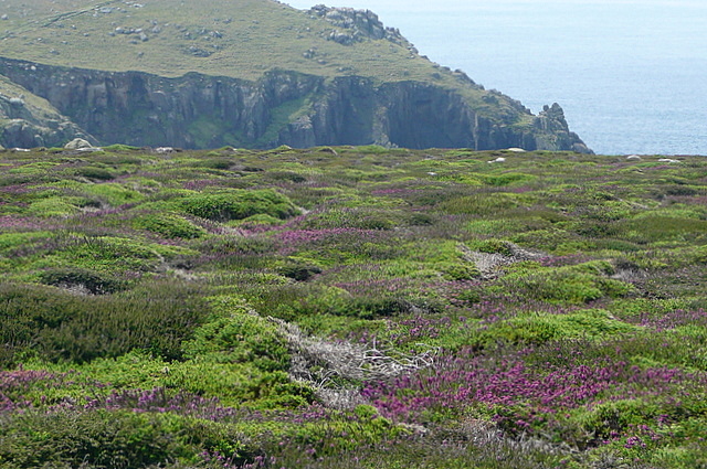
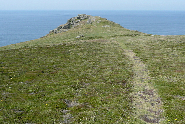
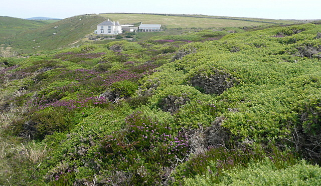
Carn Bosistow is a captivating coastal feature located in Cornwall, England. Situated on the west coast of the county, it is a prominent headland that extends into the Atlantic Ocean. With its breathtaking cliffs and stunning views, it is a popular destination for both locals and tourists.

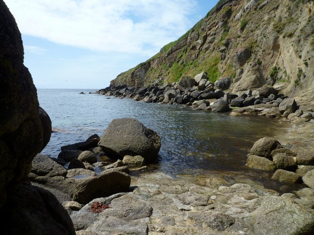
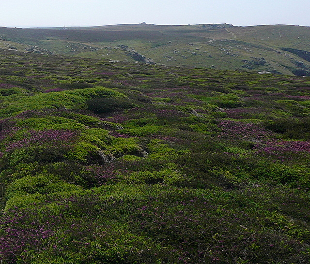
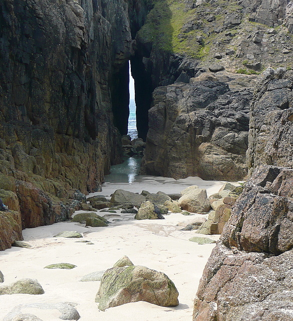
The headland is characterized by its rugged and dramatic landscape. The cliffs, which reach heights of up to 60 meters, are composed of rugged granite rock formations that have been shaped over centuries by the relentless power of the ocean waves.

Carn Bosistow offers a unique vantage point to observe the surrounding coastline. On clear days, visitors can enjoy panoramic views of the Atlantic Ocean, as well as the pristine sandy beaches that stretch for miles in both directions. The headland is also known for its picturesque rock formations, including the famous "Dinosaur's Footprint" – a natural rock formation resembling the footprint of a dinosaur.

In addition to its natural beauty, Carn Bosistow also holds historical significance. The headland is home to ancient remains, including a Bronze Age burial mound. These archaeological features serve as a reminder of the area's rich and diverse past.

For nature enthusiasts, Carn Bosistow is a haven for wildlife. The headland provides a habitat for various seabirds, including puffins, gulls, and razorbills. It is also a popular spot for birdwatching, particularly during the breeding season when the cliffs come alive with the sounds of nesting seabirds.

Overall, Carn Bosistow is a captivating coastal feature that offers a blend of natural beauty, historical significance, and abundant wildlife. Whether one seeks solitude amidst breathtaking scenery or an opportunity to explore Cornwall's diverse heritage, this headland is a must-visit destination.

If you have any feedback on the listing, please let us know in the comments section below.

Carn Bosistow Images

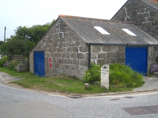
Images are sourced within 2km of 50.049735/-5.6902335 or Grid Reference SW3523. Thanks to Geograph Open Source API. All images are credited.

Lower Bosistow Cliff path approaching Nanjizal Beach
The B3315 at Polgigga village sign
Polgigga village pond
The B3315 at junction for Trebehor
Milestone on the bend at Polgigga On the B3315, which runs from Newlyn to Land's End.
Milestone on the bend at Polgigga
On the B3315, which runs from Newlyn to Land's End.
Shoreline at Porthgwarra, reached through the cliff tunnel
Misty bridge Footbridge at Land's End on a slightly misty day.
Misty bridge
Footbridge at Land's End on a slightly misty day.
Footpath west of Polgigga A group of walkers enjoys the straight, level and tarmaced sufrace of this footpath west of Polgigga, that leads towards Bosistow then Mill Bay.
Footpath west of Polgigga
A group of walkers enjoys the straight, level and tarmaced sufrace of this footpath west of Polgigga, that leads towards Bosistow then Mill Bay.
Lower Bosistow A lovely Georgian farmhouse on the way to Mill Bay.
Lower Bosistow
A lovely Georgian farmhouse on the way to Mill Bay.
Towards Bosistow Cliffs A group of walkers descends the track, a bridleway, from Higher Bosistow towards the coast at Carn Lês Boel.
Towards Bosistow Cliffs
A group of walkers descends the track, a bridleway, from Higher Bosistow towards the coast at Carn Lês Boel.
Heather on Higher Bosistow Cliffs There are two well-defined tracks across the heather, the coastal path and an inland route towards Higher Bosistow.  This is the area of heather moorland in between.
Heather on Higher Bosistow Cliffs
There are two well-defined tracks across the heather, the coastal path and an inland route towards Higher Bosistow. This is the area of heather moorland in between.
Higher Bosistow Cliffs There is a stretch of heather moorland above the coastal path, which runs below the first horizon.
Higher Bosistow Cliffs
There is a stretch of heather moorland above the coastal path, which runs below the first horizon.
Towards Carn Lês Boel This is an ancient promontory name, at a location where there used to be a fort, probably Iron Age.  The coastal path runs just in front of us, having come down the bridleway from Higher Bosistow.
Towards Carn Lês Boel
This is an ancient promontory name, at a location where there used to be a fort, probably Iron Age. The coastal path runs just in front of us, having come down the bridleway from Higher Bosistow.
Mill Bay or Nanjizal This view from High Bosistow Cliff shows most of Mill Bay and the north-western part of the square, with the coastal path continuing over Trevilley Cliff beyond towards Lands End.  The buildings at Lands End <a href="https://www.geograph.org.uk/gridref/SW3424">SW3424</a> can be seen on the horizon.  The alternative name for Mill Bay, Nanjizal, is also given to the nearby house.  I cannot find the origin of the name though.
Mill Bay or Nanjizal
This view from High Bosistow Cliff shows most of Mill Bay and the north-western part of the square, with the coastal path continuing over Trevilley Cliff beyond towards Lands End. The buildings at Lands End SW3424 can be seen on the horizon. The alternative name for Mill Bay, Nanjizal, is also given to the nearby house. I cannot find the origin of the name though.
Nanjizal Holiday cottage with a view.  This is Nanjizal, a remote house with a stunning position above Mill Bay.
Nanjizal
Holiday cottage with a view. This is Nanjizal, a remote house with a stunning position above Mill Bay.
The Song of the Sea That is the name of this cove, adjacent to Mill Bay or Nanjizal beach, where the sea has cut through the rock to form a narrow passage.  

Someone who has been there writes on Wikipedia "Inside the cove are large rockpools with many types of sea anemones and seaweeds, although the rocks are very slippery and the cove dark and damp. Several of the rocks appear to be covered with a purple substance."
The Song of the Sea
That is the name of this cove, adjacent to Mill Bay or Nanjizal beach, where the sea has cut through the rock to form a narrow passage. Someone who has been there writes on Wikipedia "Inside the cove are large rockpools with many types of sea anemones and seaweeds, although the rocks are very slippery and the cove dark and damp. Several of the rocks appear to be covered with a purple substance."
Mill Bay or Nanjizal A wonderfully secluded beach.  When the weather is fine this is a great place to be, and to stay being.  But it faces due west, so when those Atlantic storms roll in it is probably not so pleasant.
Mill Bay or Nanjizal
A wonderfully secluded beach. When the weather is fine this is a great place to be, and to stay being. But it faces due west, so when those Atlantic storms roll in it is probably not so pleasant.
Footpath towards Mill Bay The group I was leading was mainly German, and they were surprised that we could walk straight across this field.  So I explained our footpath system and that this route had been kept clear by the farmer.  The field probably had a crop recently planted, but nothing was visible above ground.
Footpath towards Mill Bay
The group I was leading was mainly German, and they were surprised that we could walk straight across this field. So I explained our footpath system and that this route had been kept clear by the farmer. The field probably had a crop recently planted, but nothing was visible above ground.
Show me another place!

Carn Bosistow is located at Grid Ref: SW3523 (Lat: 50.049735, Lng: -5.6902335)

Unitary Authority: Cornwall

Police Authority: Devon and Cornwall

What 3 Words

///remake.kilowatt.equal. Near Sennen, Cornwall

Related Wikis

Nanjizal

Nanjizal (Cornish: Porth Nansusel, meaning "cove of the howling valley"), also known as Mill Bay, is a beach and cove in the civil parish of St Levan,...

Porthgwarra to Pordenack Point

Porthgwarra to Pordenack Point is a coastal Site of Special Scientific Interest (SSSI) in west Cornwall, England, noted for its biological characteristics...

Trevescan

Trevescan is a hamlet in west Cornwall, England, United Kingdom. It is situated between the village of Sennen and the settlement at Land's End, 8 miles...

Gwennap Head

Gwennap Head (Cornish: Toll Pedn Pennwydh, meaning holed head of Penwith; grid reference SW3621) is a headland on the south coast of the Penwith peninsula...

Nearby Amenities

Located within 500m of 50.049735,-5.6902335
Source: PGS
Lat/Long: 50.0537953/-5.6924039
Source: PGS
Lat/Long: 50.0535318/-5.6924918
Source: PGS
Lat/Long: 50.0533312/-5.6929605
Barrier: kissing_gate
Foot: yes
Lat/Long: 50.0530544/-5.6916918
Ardensaweth Cliff
Is In: Cornwall, England, UK
Place: locality
Source: OS 1:25k
Lat/Long: 50.0457191/-5.688763
Carn Trevean
Is In: Cornwall, England, UK
Place: locality
Source: OS 1:25k
Lat/Long: 50.047538/-5.6881192
Pendower Cove
Is In: Cornwall, England, UK
Place: locality
Source: OS 1:25k
Lat/Long: 50.0481994/-5.6884197
Zawn Kelly
Is In: Cornwall, England, UK
Place: locality
Source: OS 1:25k
Lat/Long: 50.0455262/-5.6895354
Carn Lês Boel
Is In: Cornwall, England, UK
Place: locality
Source: OS 1:25k
Lat/Long: 50.0505969/-5.6945995
Source: PGS
Lat/Long: 50.0480368/-5.6887073
Zawn Pyg Rock Arch
Access: yes
Alt Name: Song of the Sea Rock Arch
Cave Difficulty: easy
Cave Size: small
Cave Through Trip: yes
Direction: 40
Ele: 0
Fee: no
Natural: cave_entrance
Lat/Long: 50.0528851/-5.6937785
Life Ring
Emergency: life_ring
Survey Date: 2022-07-03
Lat/Long: 50.0535539/-5.6922395
The data included in this document is from www.openstreetmap.org. The data is made available under ODbL.

Have you been to Carn Bosistow?

Leave your review of Carn Bosistow below (or comments, questions and feedback).