Gortantaoid Point
Coastal Feature, Headland, Point in Argyllshire
Scotland
Gortantaoid Point

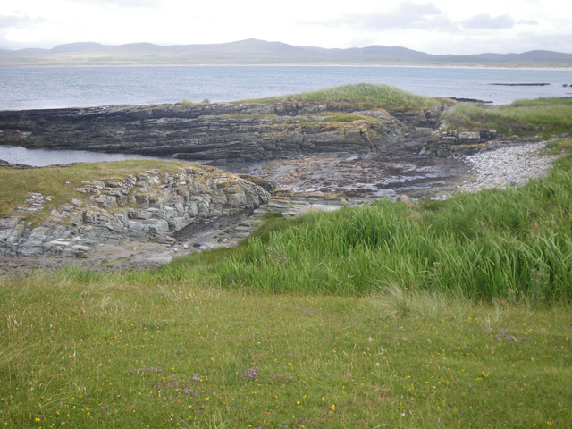
Gortantaoid Point is a prominent coastal feature located in Argyllshire, Scotland. As a headland, it juts out into the Atlantic Ocean, forming a distinct point along the rugged coastline. The point is situated on the western side of the Kintyre Peninsula, offering breathtaking views of the surrounding landscape.
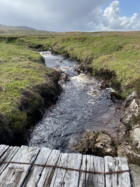
The topography of Gortantaoid Point is characterized by steep cliffs that tower above the crashing waves below. The cliffs are composed of ancient rock formations, providing a glimpse into the geological history of the area. The rugged terrain is also adorned with lush vegetation, including hardy grasses and shrubs that cling to the rocky surface.
The point is a popular destination for outdoor enthusiasts, offering opportunities for hiking, birdwatching, and photography. Its elevated position provides an excellent vantage point to observe a variety of seabirds, including gannets, fulmars, and kittiwakes, as they soar above the ocean. The coastal waters surrounding Gortantaoid Point are also known for their rich marine life, with seals often spotted basking on nearby rocky outcrops.
Visitors to Gortantaoid Point can access the area via a well-maintained footpath that winds its way along the coastline. The path offers stunning panoramas of the surrounding seascape and provides access to secluded coves and beaches, perfect for a peaceful picnic or a refreshing swim.
Overall, Gortantaoid Point is a captivating coastal feature in Argyllshire, offering visitors a chance to immerse themselves in the natural beauty and tranquility of the Scottish coastline.
If you have any feedback on the listing, please let us know in the comments section below.
Gortantaoid Point Images
Images are sourced within 2km of 55.888376/-6.2710983 or Grid Reference NR3374. Thanks to Geograph Open Source API. All images are credited.


Gortantaoid Point is located at Grid Ref: NR3374 (Lat: 55.888376, Lng: -6.2710983)
Unitary Authority: Argyll and Bute
Police Authority: Argyll and West Dunbartonshire
What 3 Words
///rental.sundial.pressing. Near Ballygrant, Argyll & Bute
Nearby Locations
Related Wikis
Ardnave Point
Ardnave Point (Scottish Gaelic, Àird an Naoimh) is a coastal promontory on the northwest of Islay, a Scottish island. This landform has a rocky northern...

Loch Gruinart
Loch Gruinart (Scottish Gaelic: Loch Gruinneard from the Old Norse, meaning "shallow fjord") is a sea loch on the northern coast of isle of Islay in Scotland...

Nave Island
Nave Island lies to the north of Islay in the Inner Hebrides near the mouth of Loch Gruinart. It is uninhabited. == Geography == The island is all but...

Finlaggan
Finlaggan (NR 388 680, Scottish Gaelic: Port an Eilein) is a historic site on Eilean Mòr in Loch Finlaggan. The Loch, the island, and Finlaggan Castle...

Gruinart Flats
The Gruinart Flats is a low-lying landform on the western part of the isle of Islay in Scotland. The locale is an important conservation area, having been...

Bunnahabhain
Bunnahabhain ( BOO-nə-HAV-in; from Scottish Gaelic Bun na h-Abhainne ([punəˈhavɪɲə], English: ), meaning 'foot of the river') is a village on the northeast...

Battle of Traigh Ghruinneart
The Battle of Traigh Ghruinneart or in Scottish Gaelic Blàr Tràigh Ghruineart or sometimes called the Battle of Gruinart Strand was a Scottish clan battle...

Bunnahabhain distillery
Bunnahabhain distillery (Scottish Gaelic: Taigh-staile Bun na h-Abhainne, [t̪əˈs̪t̪alə punəˈhavɪɲ]) was founded in 1881 near Port Askaig on Islay. The...
Have you been to Gortantaoid Point?
Leave your review of Gortantaoid Point below (or comments, questions and feedback).