Sgùrr nan Uan

Coastal Feature, Headland, Point in Inverness-shire

Scotland

Sgùrr nan Uan

Fiskavaig Bay A cloudless sky and bright winter sunshine, shortly after noon on Christmas Day 2021.
Fiskavaig Bay Credit: Richard Dorrell

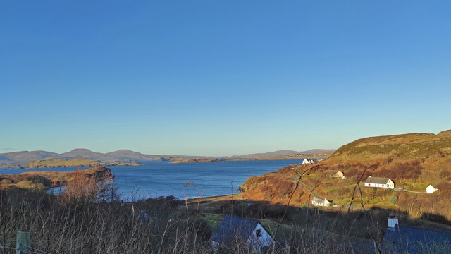
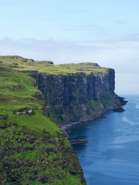
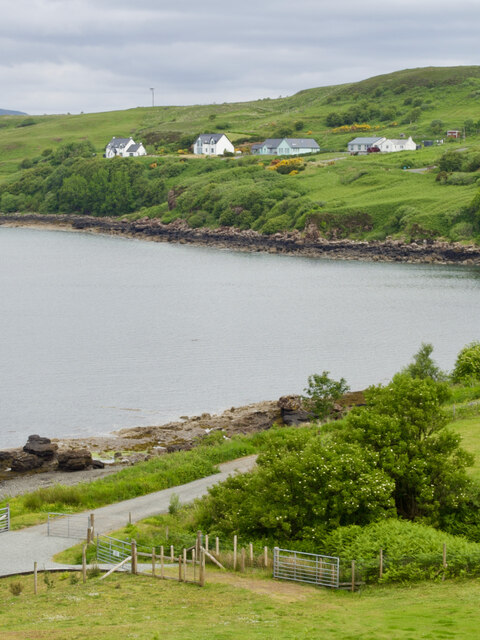
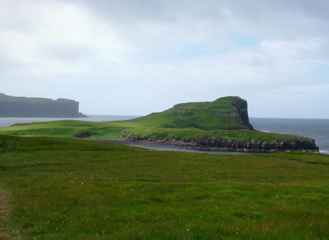
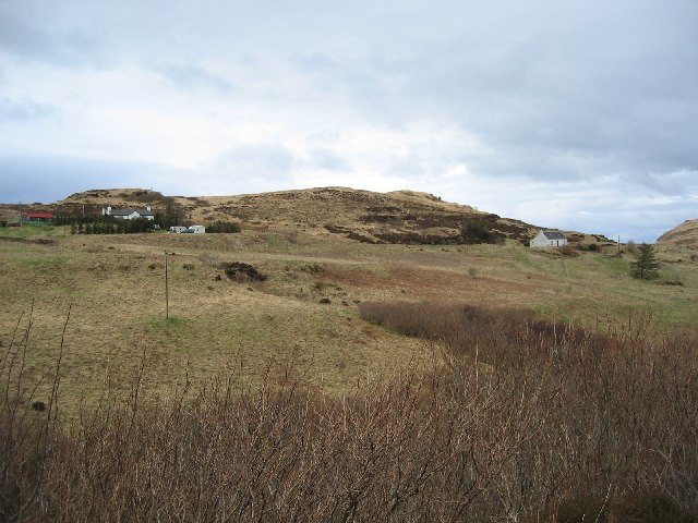
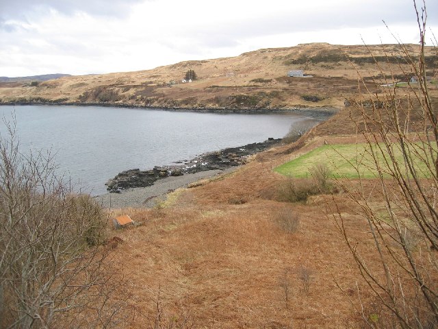
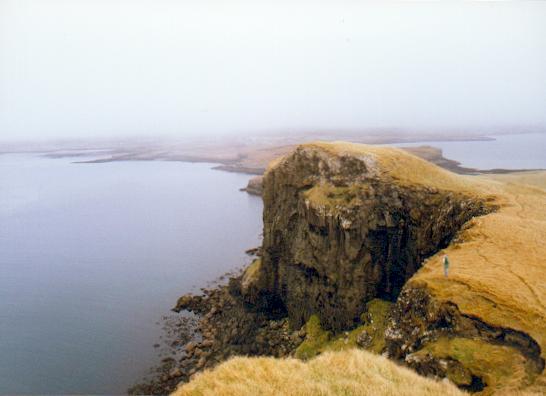
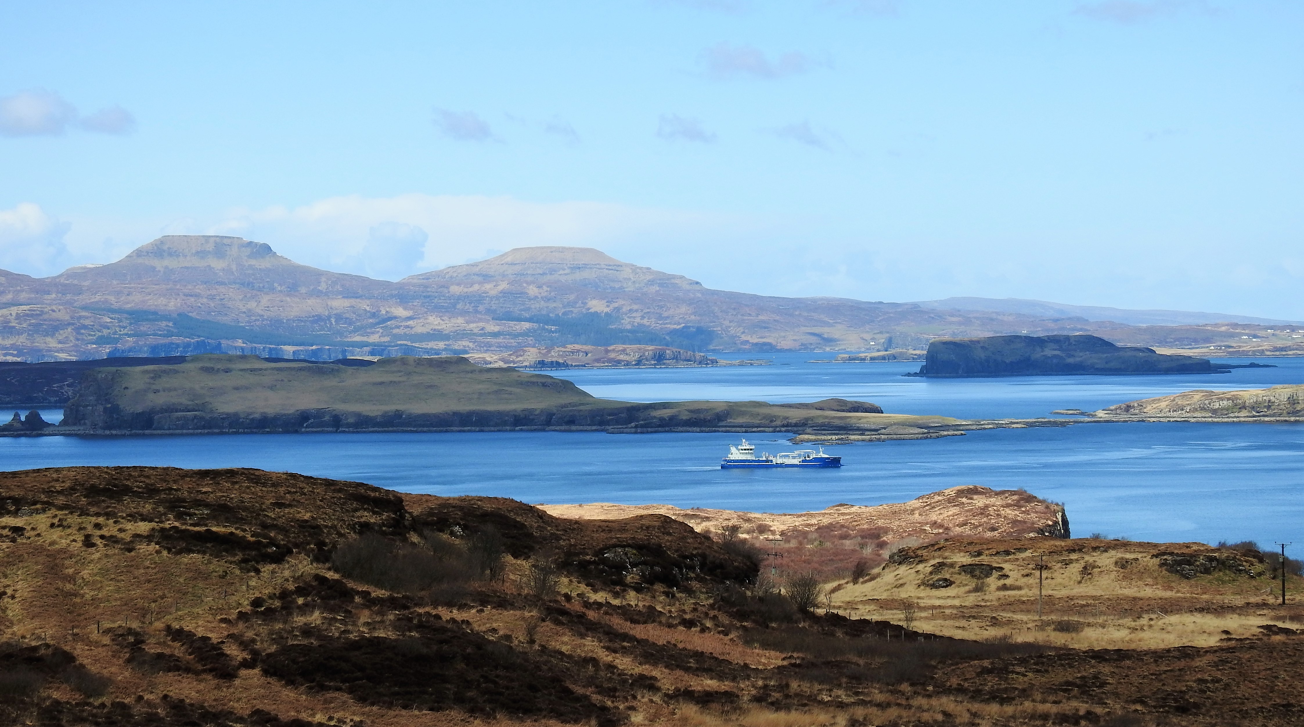
Sgùrr nan Uan is a prominent coastal feature located in Inverness-shire, Scotland. It is a headland that juts out into the sea, forming a distinct point along the rugged coastline.

Rising to an elevation of approximately 400 meters (1,312 feet), Sgùrr nan Uan offers breathtaking views of the surrounding landscape. Its steep cliffs and rocky terrain make it an impressive sight, providing a dramatic backdrop to the crashing waves of the Atlantic Ocean.

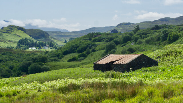
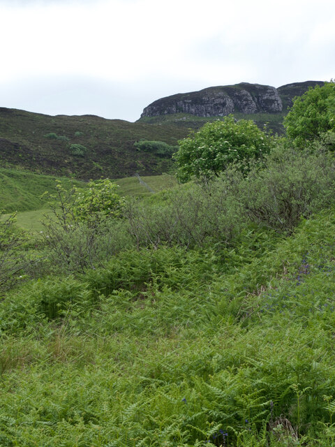
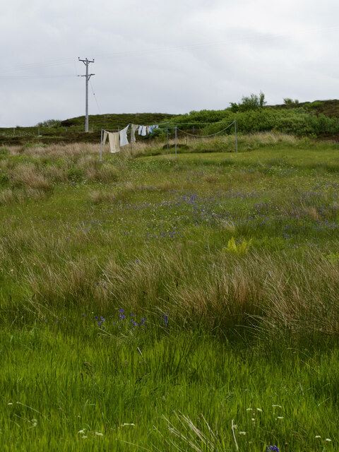
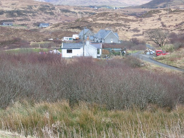
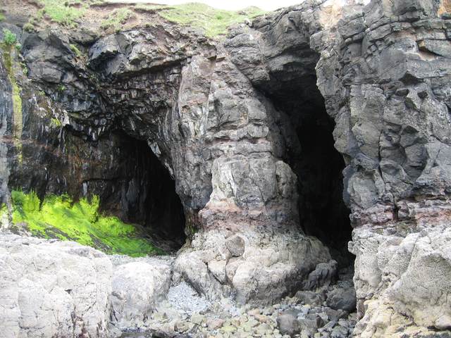
The headland is characterized by its rugged and wild beauty, with its exposed rock formations and grassy slopes. It is a popular destination for outdoor enthusiasts and nature lovers, who come to explore its diverse flora and fauna. The area is home to a variety of bird species, including seabirds such as gulls and puffins, making it a haven for birdwatchers.

Access to Sgùrr nan Uan is relatively easy, with several walking trails and footpaths leading to the headland. These paths offer visitors the chance to immerse themselves in the stunning natural surroundings, as well as learn about the area's history and geology. The headland is also a popular spot for rock climbing, attracting climbers who seek the thrill of scaling its vertical cliffs.

Overall, Sgùrr nan Uan is a striking coastal feature that showcases the rugged beauty of Inverness-shire. Its impressive cliffs, diverse wildlife, and stunning views make it a must-visit destination for nature enthusiasts and adventure seekers alike.

If you have any feedback on the listing, please let us know in the comments section below.

Sgùrr nan Uan Images

Images are sourced within 2km of 57.326138/-6.4384215 or Grid Reference NG3234. Thanks to Geograph Open Source API. All images are credited.

Fiskavaig Bay A cloudless sky and bright winter sunshine, shortly after noon on Christmas Day 2021.
Fiskavaig Bay
A cloudless sky and bright winter sunshine, shortly after noon on Christmas Day 2021.
Amidst the encroaching bracken, an abandoned barn succumbs to rusty ruin
Flotsam and jetsam
Flotsam and jetsam
Rest and relaxation for the woolly elite
On top of the world—overlooking Rubha nan Clach's coastal splendour
Àird an t-Sabhail—An abandoned tractor, a dilapidated outbuilding, and a modern garage beyond
Low tide's secrets—Unveiling Camas Àird an t-Sabhail
Behold, the majestic Dirivallan that just loves hiding behind 700 metres of Scottish scrub
Coille-ghuail—Where one rebel resident refused to paint his house white
Postcard from Heatherbrae—Washing dancing on the moorland
Lobster pots A pier exists at the end of the road out to Portnalong.
Lobster pots
A pier exists at the end of the road out to Portnalong.
View of Oronsay from Ullinish Point
The End of the Fiskavaig Road Two houses near the end of the public road at Fiskavaig.
The End of the Fiskavaig Road
Two houses near the end of the public road at Fiskavaig.
Houses at Fiskavaig The nearest house is in the normal style for this part of Skye. It is heavily influenced in design by immigration from Harris. Behind are new builds.
Houses at Fiskavaig
The nearest house is in the normal style for this part of Skye. It is heavily influenced in design by immigration from Harris. Behind are new builds.
Fiskavaig Bay Looking ENE
Fiskavaig Bay
Looking ENE
Portnalong Free Church of Scotland With Cnoc Glas Heilla behind.
Portnalong Free Church of Scotland
With Cnoc Glas Heilla behind.
Oronsay, Skye View from the highest point on Oronsay in Loch Bracadale, Skye.
Oronsay, Skye
View from the highest point on Oronsay in Loch Bracadale, Skye.
Double Sea Cave on Oronsay An impressive feature, not easily reached without climbing down the rock face. Not marked on OS.
Double Sea Cave on Oronsay
An impressive feature, not easily reached without climbing down the rock face. Not marked on OS.
Show me another place!

Sgùrr nan Uan is located at Grid Ref: NG3234 (Lat: 57.326138, Lng: -6.4384215)

Unitary Authority: Highland

Police Authority: Highlands and Islands

What 3 Words

///homecare.prowess.cope. Near Carbost, Highland

Related Wikis

Fiskavaig

Fiskavaig or Fiscavaig (Scottish Gaelic: Fiosgabhaig) is a picturesque crofting settlement on the north-west shore of the Minginish peninsula, Isle of...

Dun Ardtreck

Dun Ardtreck is a D-shaped dun, or "semi-broch", located on the west coast of the island of Skye, in Scotland (grid reference NG33503581). == Location... ==

Oronsay, Loch Bracadale

Oronsay (Scottish Gaelic: Orasaigh) is an uninhabited tidal island in Loch Bracadale on the west coast of Skye, Scotland. It is c.1,000 metres (0.7miles...

Portnalong

Portnalong (Scottish Gaelic: Port nan Long) is a small village on north west of the Isle of Skye on the shore of Loch Harport. Portnalong is Gaelic for...

Struan, Skye

Struan (Scottish Gaelic: An Sruthan) is a small village on the west coast of the island of Skye, on the shores of Loch Beag, itself an inlet of Loch Bracadale...

Ullinish

Ullinish (Gaelic: Uilfhinis) is a crofting township on Loch Bracadale, on the southwest coast of Skye, Scotland. The only promontory fort on Skye is located...

Dun Beag

Dun Beag is an iron-age broch located about 1 kilometre northwest of the village of Struan on the west coast of the island of Skye, in Scotland. ��2�...

A863 road

The A863 road is one of the principal roads of the Isle of Skye in the Inner Hebrides off the west coast of mainland Scotland.It connects the town of Dunvegan...

Nearby Amenities

Located within 500m of 57.326138,-6.4384215
Source: PGS
Lat/Long: 57.3248423/-6.4339006
Source: PGS
Lat/Long: 57.3248974/-6.4338668
Source: PGS
Lat/Long: 57.3258806/-6.4353136
Source: PGS
Lat/Long: 57.3260413/-6.4356215
Source: PGS
Lat/Long: 57.3261418/-6.4359225
Source: PGS
Lat/Long: 57.3264045/-6.4366863
Source: PGS
Lat/Long: 57.3266017/-6.4370431
Source: PGS
Lat/Long: 57.326668/-6.4374379
Created By: dmgroom_coastlines
Source: PGS
Lat/Long: 57.3267/-6.43922
Created By: dmgroom_coastlines
Source: PGS
Lat/Long: 57.32644/-6.439
Created By: dmgroom_coastlines
Source: PGS
Lat/Long: 57.32617/-6.43878
Created By: dmgroom_coastlines
Source: PGS
Lat/Long: 57.32607/-6.43974
Created By: dmgroom_coastlines
Source: PGS
Lat/Long: 57.32595/-6.44022
Created By: dmgroom_coastlines
Source: PGS
Lat/Long: 57.32442/-6.44056
Created By: dmgroom_coastlines
Source: PGS
Lat/Long: 57.32417/-6.44082
Created By: dmgroom_coastlines
Source: PGS
Lat/Long: 57.32431/-6.44128
Created By: dmgroom_coastlines
Source: PGS
Lat/Long: 57.32432/-6.44175
Created By: dmgroom_coastlines
Source: PGS
Lat/Long: 57.32422/-6.44318
Created By: dmgroom_coastlines
Source: PGS
Lat/Long: 57.32345/-6.443
Created By: dmgroom_coastlines
Source: PGS
Lat/Long: 57.32319/-6.44302
Created By: dmgroom_coastlines
Source: PGS
Lat/Long: 57.32269/-6.44305
Created By: dmgroom_coastlines
Source: PGS
Lat/Long: 57.32242/-6.44283
Source: PGS
Lat/Long: 57.3244166/-6.4339945
Source: PGS
Lat/Long: 57.3239109/-6.4331507
Source: PGS
Lat/Long: 57.3247699/-6.4337788
Source: PGS
Lat/Long: 57.3240908/-6.433236
Source: PGS
Lat/Long: 57.3241887/-6.4333615
Source: PGS
Lat/Long: 57.3245185/-6.4340411
The data included in this document is from www.openstreetmap.org. The data is made available under ODbL.

Have you been to Sgùrr nan Uan?

Leave your review of Sgùrr nan Uan below (or comments, questions and feedback).