Coroghon Mòr

Coastal Feature, Headland, Point in Argyllshire

Scotland

Coroghon Mòr

Church of Scotland, Canna
Church of Scotland, Canna Credit: John Ferguson

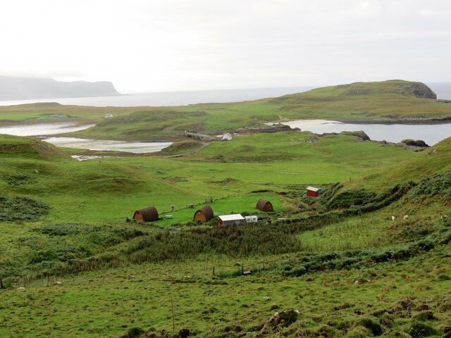
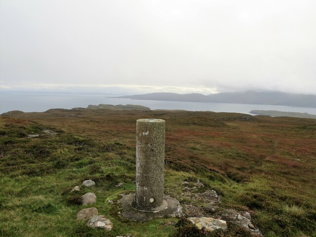
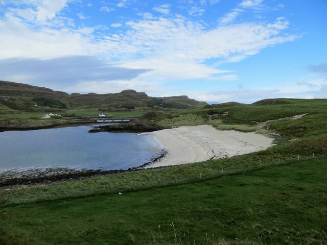
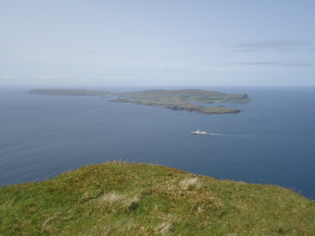
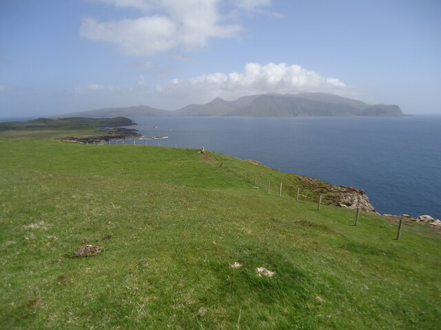
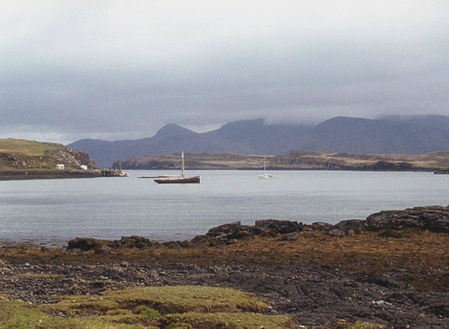
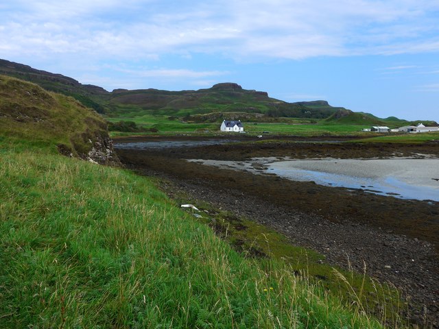
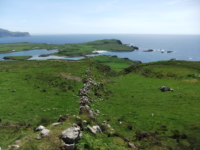
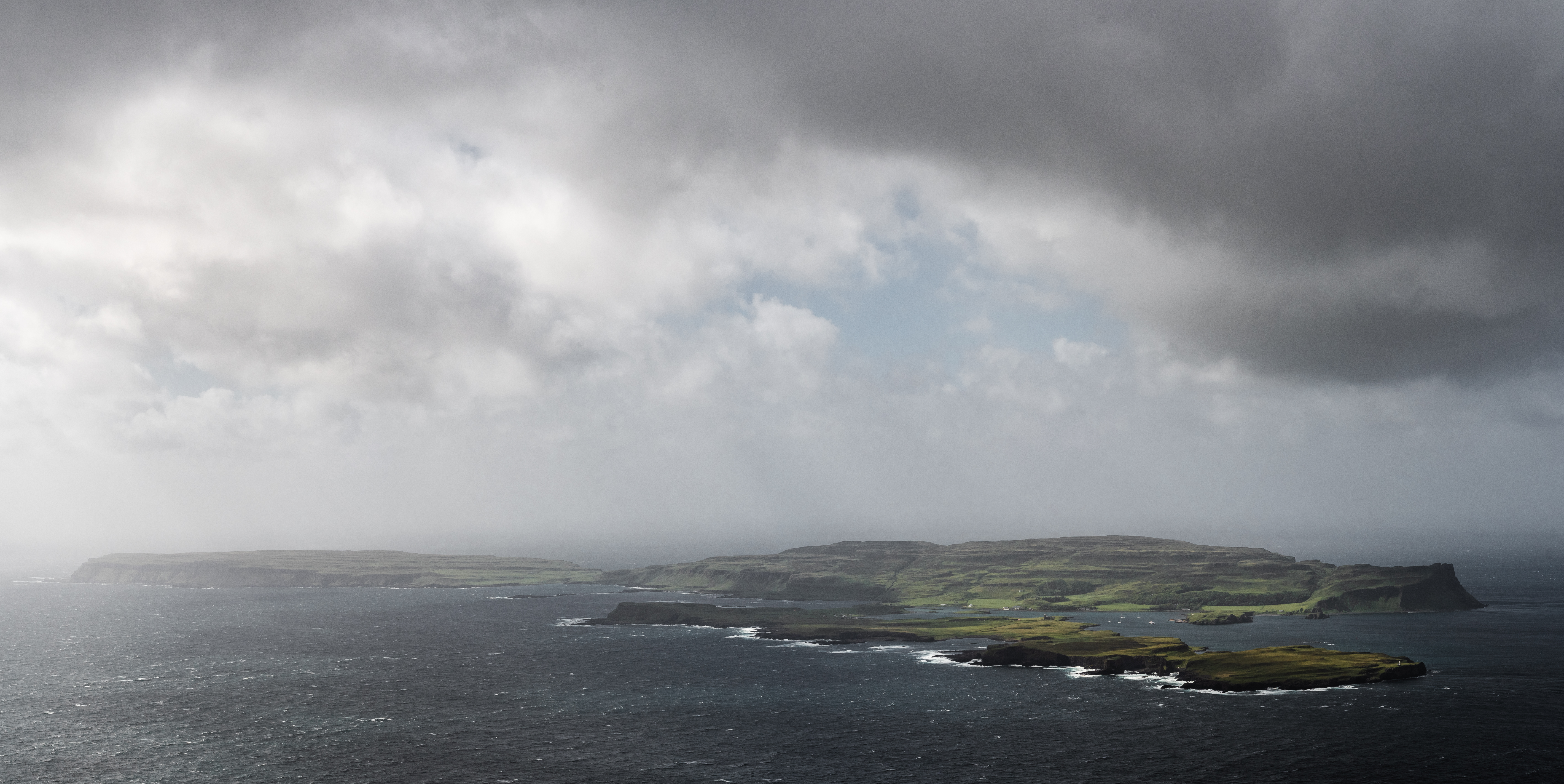
Coroghon Mòr is a prominent headland located in Argyllshire, Scotland. Situated on the picturesque western coast, it juts out into the Atlantic Ocean, offering breathtaking views of the surrounding landscape and the nearby islands of Mull and Jura. The headland is characterized by its rugged cliffs, which rise dramatically from the sea, reaching heights of up to 100 meters in some areas.

The rocky terrain of Coroghon Mòr is composed mainly of ancient metamorphic rocks, which have been shaped and sculpted by the forces of erosion over millions of years. This geological feature adds to the headland's charm and uniqueness, making it a popular destination for nature enthusiasts and photographers.

The headland is also known for its diverse wildlife, with numerous species of seabirds, including gannets, puffins, and guillemots, nesting along the cliffs. It is not uncommon to spot seals and even dolphins swimming in the waters surrounding Coroghon Mòr.

Access to Coroghon Mòr is possible via a well-maintained footpath that winds its way along the coastline, offering hikers and walkers an opportunity to explore the area's natural beauty up close. The headland's remote location ensures that it remains relatively untouched and provides a peaceful and tranquil setting for visitors.

Overall, Coroghon Mòr is a captivating coastal feature that showcases the raw beauty of Scotland's western coastline. Its towering cliffs, diverse wildlife, and stunning views make it a must-visit destination for those seeking a true Scottish coastal experience.

If you have any feedback on the listing, please let us know in the comments section below.

Coroghon Mòr Images

Images are sourced within 2km of 57.060313/-6.4886671 or Grid Reference NG2705. Thanks to Geograph Open Source API. All images are credited.

Church of Scotland, Canna
Pods at Canna Campsite With Sanday Island beyond and Rum behind that
Pods at Canna Campsite
With Sanday Island beyond and Rum behind that
Trig pillar on Carn a' Ghaill 210m, Canna The highest point on the island
Trig pillar on Carn a' Ghaill 210m, Canna
The highest point on the island
Sandy beach on Sanday Island The bridge in the distance connects Sanday to Canna
Sandy beach on Sanday Island
The bridge in the distance connects Sanday to Canna
Saint Columba's chapel, Canna
Canna House Currently being restored
Canna House
Currently being restored
Canna and Sanday from Bloodstone Hill, Rum Bloodstone Hill, 388m, is north-west of Orval and almost at the extreme west of Rum.  Here we are looking north-west towards Canna, the most distant of the Small Isles from the mainland. It is 7km long but only about 1.5km wide. In front of it is the low-lying island of Sanday, which is tidal but connected to Canna by a bridge. And the Royal Navy are active in the Sound of Canna.

As is my normal practice in cases like this, I give as the subject grid reference that of the highest point of Canna, which is Carn a' Ghaill, 210m.

For a view in the opposite direction, from Sanday to Mull, see <a href="https://www.geograph.org.uk/photo/7522796">NG2604 : North-west Rum from Sanday</a>.
Canna and Sanday from Bloodstone Hill, Rum
Bloodstone Hill, 388m, is north-west of Orval and almost at the extreme west of Rum. Here we are looking north-west towards Canna, the most distant of the Small Isles from the mainland. It is 7km long but only about 1.5km wide. In front of it is the low-lying island of Sanday, which is tidal but connected to Canna by a bridge. And the Royal Navy are active in the Sound of Canna. As is my normal practice in cases like this, I give as the subject grid reference that of the highest point of Canna, which is Carn a' Ghaill, 210m. For a view in the opposite direction, from Sanday to Mull, see NG2604 : North-west Rum from Sanday.
North-west Rum from Sanday Taken from the highest point of Sanday, Tallabric 59m. To the left is the southern shore of Sanday. Across the Sound of Canna are the hills of north-west Rum. The pyramid in the centre is Fionchra, 463m in <a href="https://www.geograph.org.uk/gridref/NG3300">NG3300</a>, and Bloodstone Hill is the darker one to the right. Behind Bloodstone Hill (388m in <a href="https://www.geograph.org.uk/gridref/NG3100">NG3100</a>) is a range of hills of which the highest is Orval, 571m in <a href="https://www.geograph.org.uk/gridref/NM3399">NM3399</a>.

For a view in the opposite direction, from Bloodstone Hill to Canna and Sanday, see <a href="https://www.geograph.org.uk/photo/7522759">NG2606 : Canna and Sanday from Bloodstone Hill, Rum</a>.
North-west Rum from Sanday
Taken from the highest point of Sanday, Tallabric 59m. To the left is the southern shore of Sanday. Across the Sound of Canna are the hills of north-west Rum. The pyramid in the centre is Fionchra, 463m in NG3300, and Bloodstone Hill is the darker one to the right. Behind Bloodstone Hill (388m in NG3100) is a range of hills of which the highest is Orval, 571m in NM3399. For a view in the opposite direction, from Bloodstone Hill to Canna and Sanday, see NG2606 : Canna and Sanday from Bloodstone Hill, Rum.
Across Canna Harbour
Canna's church
Canna's church
The Loch Nevis ferry arriving in Canna Harbour Because of tight manoeuvring space, she comes into the harbour going astern.  Note the perch midway between the ferry and the jetty, marking a patch of shoal water very close to the ro-ro slip.
The Loch Nevis ferry arriving in Canna Harbour
Because of tight manoeuvring space, she comes into the harbour going astern. Note the perch midway between the ferry and the jetty, marking a patch of shoal water very close to the ro-ro slip.
The Loch Nevis ferry in Canna Harbour Note the perch to the right of the ferry, marking a patch of shoal water very close to the ro-ro slip
The Loch Nevis ferry in Canna Harbour
Note the perch to the right of the ferry, marking a patch of shoal water very close to the ro-ro slip
Drying bay at Canna Harbour The large white building extreme right is the main farm and also generating station for Canna and Sanday.
Drying bay at Canna Harbour
The large white building extreme right is the main farm and also generating station for Canna and Sanday.
The school on Sanday (Canna) in August 2016 The figure in blue is the teacher who told us that this was the second day of term at the school and also his second day of teaching in Canna, having previously taught in Glasgow.   He has three pupils.

Compare with <a href="https://www.geograph.org.uk/photo/42148">NG2604 : The School, Canna</a>
The school on Sanday (Canna) in August 2016
The figure in blue is the teacher who told us that this was the second day of term at the school and also his second day of teaching in Canna, having previously taught in Glasgow. He has three pupils. Compare with NG2604 : The School, Canna
Canna post office Just a wooden shed but it does the job for the 20 or so residents and the visitors who arrive by ferry from Mallaig (who perhaps are more appreciative of the phone box, since mobile coverage is patchy, to say the least!).
Canna post office
Just a wooden shed but it does the job for the 20 or so residents and the visitors who arrive by ferry from Mallaig (who perhaps are more appreciative of the phone box, since mobile coverage is patchy, to say the least!).
Ancient wall on Canna
Shop and cafe, Canna
The bridge to Sanday The bridge dates from April 2006 when it replaced a footbridge that had been destroyed by storms. It connects the tidal island of Sanday to its larger neighbour, Canna.
The bridge to Sanday
The bridge dates from April 2006 when it replaced a footbridge that had been destroyed by storms. It connects the tidal island of Sanday to its larger neighbour, Canna.
Show me another place!

Coroghon Mòr is located at Grid Ref: NG2705 (Lat: 57.060313, Lng: -6.4886671)

Unitary Authority: Highland

Police Authority: Highlands and Islands

What 3 Words

///seagulls.sharpened.shot. Near Elgol, Highland

Related Wikis

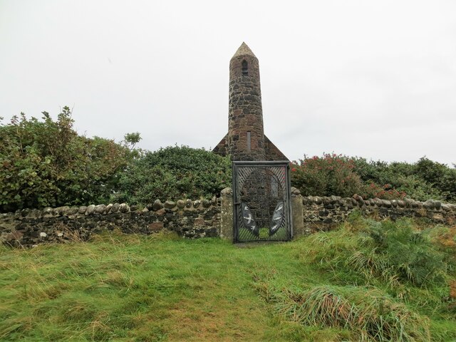
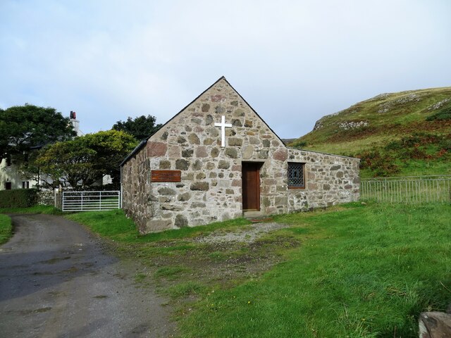
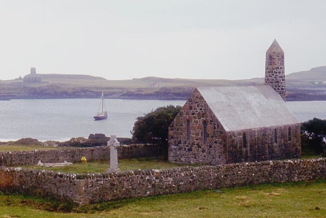
St Columba's Church, Canna

St Columba's Church is a Category B listed building on the isle of Canna, in the Small Isles, Highland, Scotland. == History == Prior to the building of...

St Edward's Church, Sanday

St Edward's Church, Sanday, is a deconsecrated, and now disused church on the small isle of Sanday, Inner Hebrides, Scotland. The church was a gift to...

Sanday, Inner Hebrides

Sanday (Scottish Gaelic: Sandaigh; Scots: Sandee) is one of the Small Isles, in the Scottish Inner Hebrides. It is a tidal island linked to its larger...

A' Chill

A' Chill was a village on Canna, in the Scottish Small Isles. The name means "the cell", referring to a Culdee church, and is often anglicised as "Kil...

Canna, Scotland

Canna (; Scottish Gaelic: Canaigh, Eilean Chanaigh) is the westernmost of the Small Isles archipelago, in the Scottish Inner Hebrides. It is linked to...

Nearby Amenities

Located within 500m of 57.060313,-6.4886671
Source: PGS
Lat/Long: 57.059548/-6.4880552
Source: PGS
Lat/Long: 57.0597696/-6.488067
Source: PGS
Lat/Long: 57.0599245/-6.4872253
Source: PGS
Lat/Long: 57.0594966/-6.4871481
Source: PGS
Lat/Long: 57.06383/-6.4858
Source: PGS
Lat/Long: 57.06371/-6.48605
Source: PGS
Lat/Long: 57.06358/-6.48629
Source: PGS
Lat/Long: 57.06282/-6.48658
Source: PGS
Lat/Long: 57.062445/-6.487648
Source: PGS
Lat/Long: 57.0615198/-6.488295
Source: PGS
Lat/Long: 57.06055/-6.48838
Source: PGS
Lat/Long: 57.0600888/-6.4884473
Source: PGS
Lat/Long: 57.0600928/-6.4890835
Source: PGS
Lat/Long: 57.0599485/-6.4895454
Source: PGS
Lat/Long: 57.0597654/-6.4899851
Source: PGS
Lat/Long: 57.0588566/-6.4909037
Source: PGS
Lat/Long: 57.0584573/-6.490386
Source: PGS
Lat/Long: 57.05802/-6.48972
Source: PGS
Lat/Long: 57.0578196/-6.4895165
Source: PGS
Lat/Long: 57.0574255/-6.4882344
Ferry Terminal
Canna Pier
Ferry: yes
Operator: Caledonian MacBrayne
Public Transport: station
Source: PGS
Lat/Long: 57.0561482/-6.4914201
Source: PGS
Lat/Long: 57.05677/-6.49144
Source: PGS
Lat/Long: 57.0571831/-6.4920297
Source: PGS
Lat/Long: 57.05769/-6.49256
Source: PGS
Lat/Long: 57.05799/-6.4934148
Source: PGS
Lat/Long: 57.058595/-6.4940168
Source: PGS
Lat/Long: 57.0585705/-6.4945644
Source: PGS
Lat/Long: 57.0594563/-6.4943842
Source: PGS
Lat/Long: 57.0596643/-6.4949358
Source: PGS
Lat/Long: 57.0597147/-6.4952697
Source: PGS
Lat/Long: 57.05955/-6.49573
Source: PGS
Lat/Long: 57.0591394/-6.496617
Source: npe
Lat/Long: 57.0566823/-6.4913071
Source: npe
Lat/Long: 57.0603058/-6.4912603
An Coroghon
Place: locality
Source: OS_OpenData_StreetView
Lat/Long: 57.060536/-6.4930703
Bual Thial-sgorr
Place: locality
Source: OS_OpenData_StreetView
Lat/Long: 57.0641165/-6.4928107
Coroghon Mor
Place: locality
Source: OS_OpenData_StreetView
Lat/Long: 57.0603343/-6.4883823
Garbh Asgarnish
Place: locality
Source: OS_OpenData_StreetView
Lat/Long: 57.062829/-6.4866038
Rubha Carr-innis
Place: locality
Source: OS_OpenData_StreetView
Lat/Long: 57.0570939/-6.4898899
Ele: 30
Natural: peak
Lat/Long: 57.056924/-6.4901793
Source: PGS
Lat/Long: 57.0593273/-6.4966616
Source: PGS
Lat/Long: 57.0594703/-6.4963876
Seamark Mooring Category: buoy
Seamark Mooring Colour: orange
Seamark Mooring Shape: barrel
Seamark Name: VisitorsMooring
Seamark Type: mooring
Lat/Long: 57.0570143/-6.494025
Coroghon Castle
Heritage: yes
Historic: castle
Wikidata: Q56661701
Lat/Long: 57.0603353/-6.4885587
Source: PGS
Lat/Long: 57.0607056/-6.4890856
Man Made: antenna
Lat/Long: 57.0641442/-6.4889893
The data included in this document is from www.openstreetmap.org. The data is made available under ODbL.

Have you been to Coroghon Mòr?

Leave your review of Coroghon Mòr below (or comments, questions and feedback).