Rubha nam Feannag

Coastal Feature, Headland, Point in Argyllshire

Scotland

Rubha nam Feannag

Church of Scotland, Canna
Church of Scotland, Canna Credit: John Ferguson

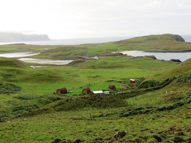
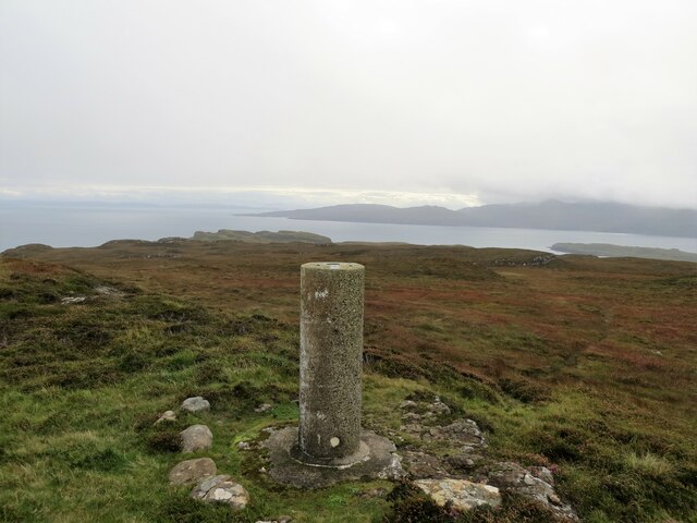
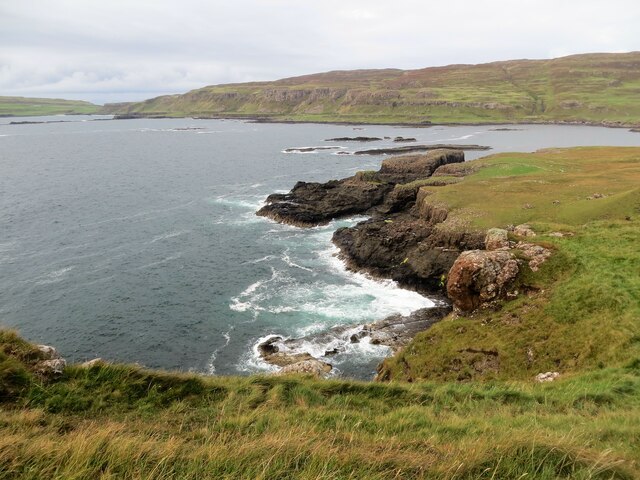
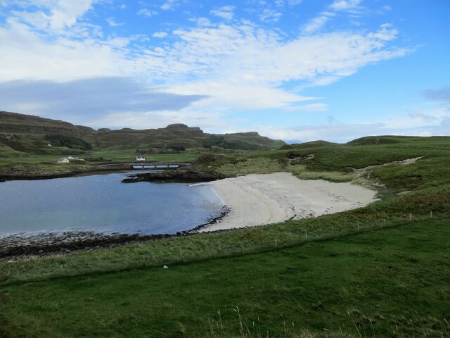
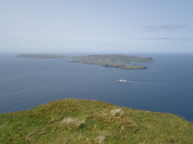
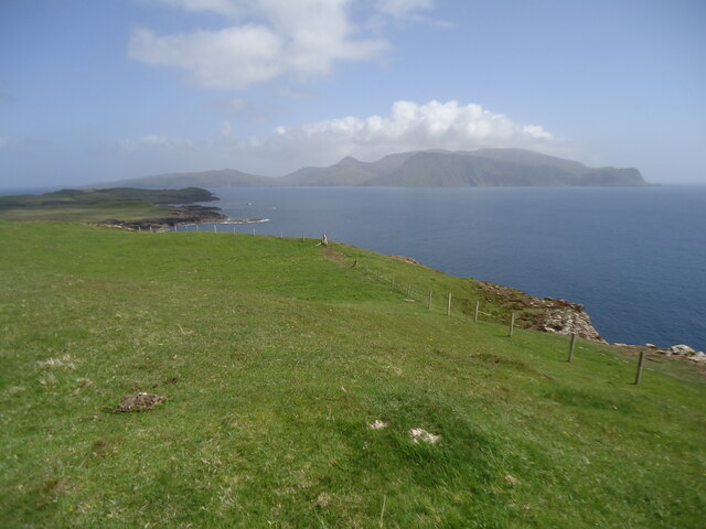
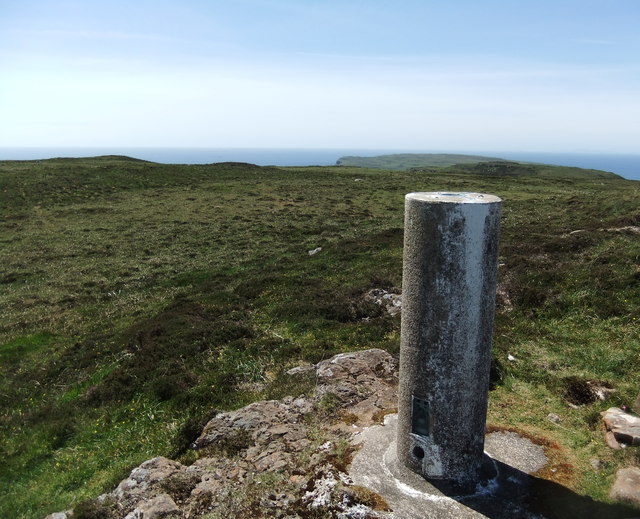
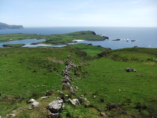
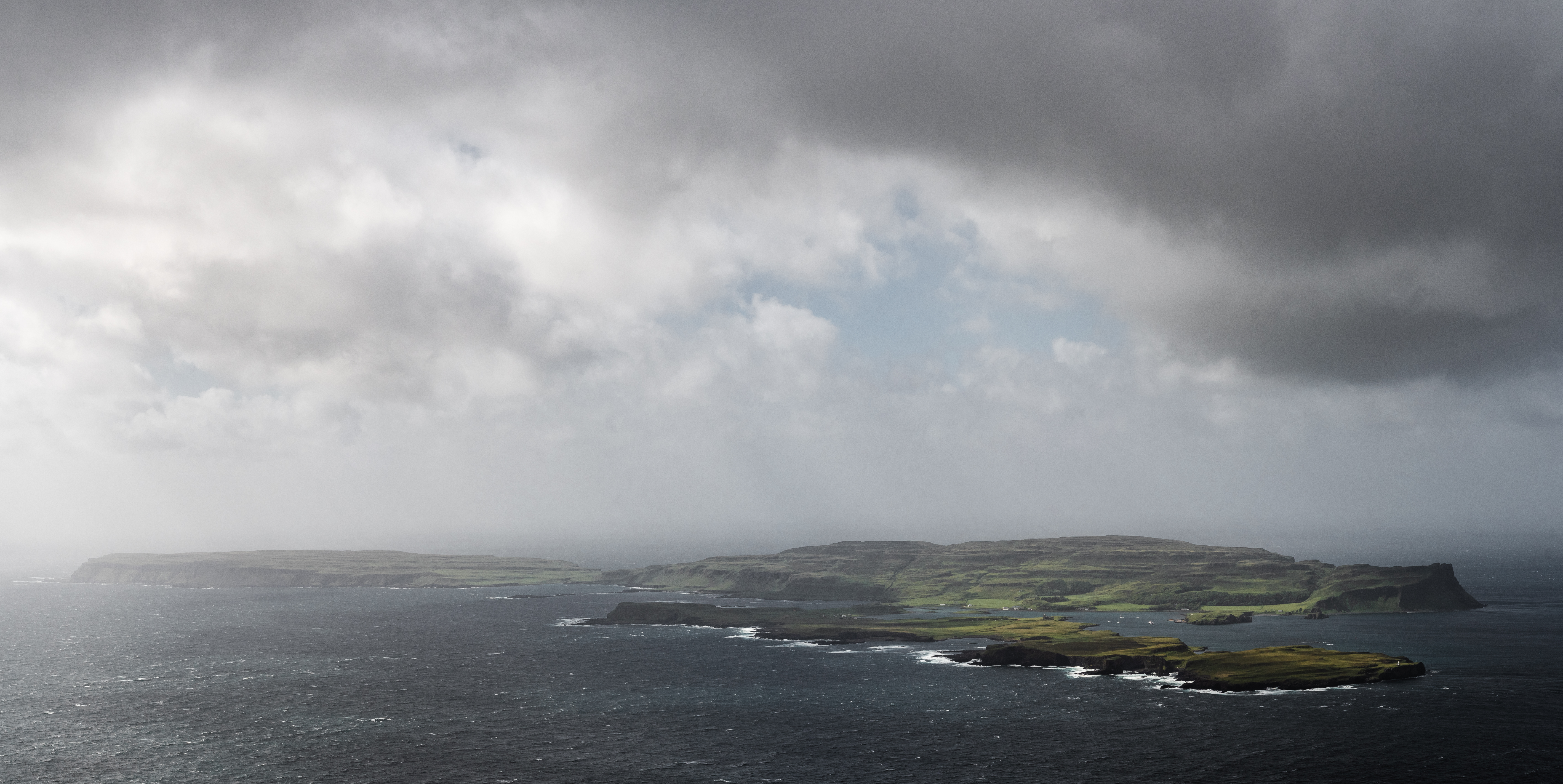
Rubha nam Feannag is a prominent coastal feature located in Argyllshire, Scotland. This headland, also known as The Point, juts out into the Sound of Jura, offering breathtaking views of the surrounding landscape. With its rugged cliffs, rocky shores, and lush vegetation, Rubha nam Feannag is a haven for nature enthusiasts and photographers alike.

The headland is characterized by its steep slopes and jagged coastline, which provide nesting sites for various seabird species. Visitors to Rubha nam Feannag can often spot colonies of guillemots, razorbills, and kittiwakes perched on the cliffs, as well as the occasional sighting of puffins during the breeding season. The area's diverse flora includes wildflowers, heather, and grasses, creating a vibrant and picturesque setting.

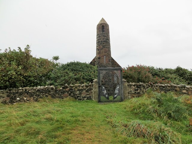
The Point is also rich in history, with evidence of ancient settlements and structures dating back centuries. Ruins of stone buildings and defensive walls can be found scattered across the headland, providing a glimpse into the area's past. These remnants, combined with the dramatic natural landscape, create an atmospheric and captivating setting for visitors to explore and appreciate.

Access to Rubha nam Feannag is relatively easy, with a well-maintained coastal path that leads visitors around the headland. This path offers stunning panoramic views of the surrounding sea, nearby islands, and distant mountains. The Point is a popular spot for hiking, birdwatching, and picnicking, attracting both locals and tourists seeking a tranquil and scenic escape.

In conclusion, Rubha nam Feannag is a captivating headland in Argyllshire, Scotland, offering breathtaking views, diverse wildlife, and a glimpse into the region's rich history. It is a must-visit destination for nature lovers and those seeking a serene coastal experience.

If you have any feedback on the listing, please let us know in the comments section below.

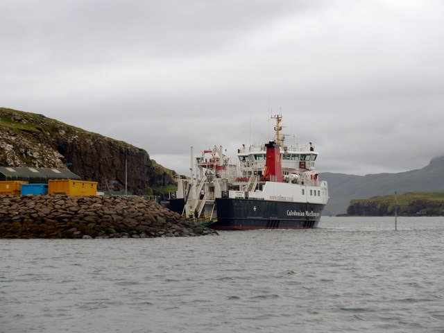
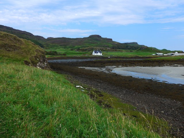
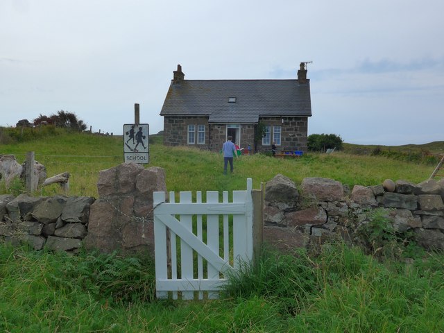
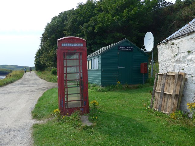
Rubha nam Feannag Images

Images are sourced within 2km of 57.055562/-6.4969896 or Grid Reference NG2705. Thanks to Geograph Open Source API. All images are credited.

Church of Scotland, Canna
Pods at Canna Campsite With Sanday Island beyond and Rum behind that
Pods at Canna Campsite
With Sanday Island beyond and Rum behind that
Trig pillar on Carn a' Ghaill 210m, Canna The highest point on the island
Trig pillar on Carn a' Ghaill 210m, Canna
The highest point on the island
Coastline on Sanday below Tallabric Island of Canna beyond
Coastline on Sanday below Tallabric
Island of Canna beyond
Sandy beach on Sanday Island The bridge in the distance connects Sanday to Canna
Sandy beach on Sanday Island
The bridge in the distance connects Sanday to Canna
Saint Columba's chapel, Canna
Canna House Currently being restored
Canna House
Currently being restored
Canna and Sanday from Bloodstone Hill, Rum Bloodstone Hill, 388m, is north-west of Orval and almost at the extreme west of Rum.  Here we are looking north-west towards Canna, the most distant of the Small Isles from the mainland. It is 7km long but only about 1.5km wide. In front of it is the low-lying island of Sanday, which is tidal but connected to Canna by a bridge. And the Royal Navy are active in the Sound of Canna.

As is my normal practice in cases like this, I give as the subject grid reference that of the highest point of Canna, which is Carn a' Ghaill, 210m.

For a view in the opposite direction, from Sanday to Mull, see <a href="https://www.geograph.org.uk/photo/7522796">NG2604 : North-west Rum from Sanday</a>.
Canna and Sanday from Bloodstone Hill, Rum
Bloodstone Hill, 388m, is north-west of Orval and almost at the extreme west of Rum. Here we are looking north-west towards Canna, the most distant of the Small Isles from the mainland. It is 7km long but only about 1.5km wide. In front of it is the low-lying island of Sanday, which is tidal but connected to Canna by a bridge. And the Royal Navy are active in the Sound of Canna. As is my normal practice in cases like this, I give as the subject grid reference that of the highest point of Canna, which is Carn a' Ghaill, 210m. For a view in the opposite direction, from Sanday to Mull, see NG2604 : North-west Rum from Sanday.
North-west Rum from Sanday Taken from the highest point of Sanday, Tallabric 59m. To the left is the southern shore of Sanday. Across the Sound of Canna are the hills of north-west Rum. The pyramid in the centre is Fionchra, 463m in <a href="https://www.geograph.org.uk/gridref/NG3300">NG3300</a>, and Bloodstone Hill is the darker one to the right. Behind Bloodstone Hill (388m in <a href="https://www.geograph.org.uk/gridref/NG3100">NG3100</a>) is a range of hills of which the highest is Orval, 571m in <a href="https://www.geograph.org.uk/gridref/NM3399">NM3399</a>.

For a view in the opposite direction, from Bloodstone Hill to Canna and Sanday, see <a href="https://www.geograph.org.uk/photo/7522759">NG2606 : Canna and Sanday from Bloodstone Hill, Rum</a>.
North-west Rum from Sanday
Taken from the highest point of Sanday, Tallabric 59m. To the left is the southern shore of Sanday. Across the Sound of Canna are the hills of north-west Rum. The pyramid in the centre is Fionchra, 463m in NG3300, and Bloodstone Hill is the darker one to the right. Behind Bloodstone Hill (388m in NG3100) is a range of hills of which the highest is Orval, 571m in NM3399. For a view in the opposite direction, from Bloodstone Hill to Canna and Sanday, see NG2606 : Canna and Sanday from Bloodstone Hill, Rum.
Across Canna Harbour
Canna's church
Canna's church
The Loch Nevis ferry arriving in Canna Harbour Because of tight manoeuvring space, she comes into the harbour going astern.  Note the perch midway between the ferry and the jetty, marking a patch of shoal water very close to the ro-ro slip.
The Loch Nevis ferry arriving in Canna Harbour
Because of tight manoeuvring space, she comes into the harbour going astern. Note the perch midway between the ferry and the jetty, marking a patch of shoal water very close to the ro-ro slip.
The Loch Nevis ferry in Canna Harbour Note the perch to the right of the ferry, marking a patch of shoal water very close to the ro-ro slip
The Loch Nevis ferry in Canna Harbour
Note the perch to the right of the ferry, marking a patch of shoal water very close to the ro-ro slip
Drying bay at Canna Harbour The large white building extreme right is the main farm and also generating station for Canna and Sanday.
Drying bay at Canna Harbour
The large white building extreme right is the main farm and also generating station for Canna and Sanday.
The school on Sanday (Canna) in August 2016 The figure in blue is the teacher who told us that this was the second day of term at the school and also his second day of teaching in Canna, having previously taught in Glasgow.   He has three pupils.

Compare with <a href="https://www.geograph.org.uk/photo/42148">NG2604 : The School, Canna</a>
The school on Sanday (Canna) in August 2016
The figure in blue is the teacher who told us that this was the second day of term at the school and also his second day of teaching in Canna, having previously taught in Glasgow. He has three pupils. Compare with NG2604 : The School, Canna
Canna post office Just a wooden shed but it does the job for the 20 or so residents and the visitors who arrive by ferry from Mallaig (who perhaps are more appreciative of the phone box, since mobile coverage is patchy, to say the least!).
Canna post office
Just a wooden shed but it does the job for the 20 or so residents and the visitors who arrive by ferry from Mallaig (who perhaps are more appreciative of the phone box, since mobile coverage is patchy, to say the least!).
Carn a' Ghaill Cairn of the stranger
Carn a' Ghaill
Cairn of the stranger
Ancient wall on Canna
Show me another place!

Rubha nam Feannag is located at Grid Ref: NG2705 (Lat: 57.055562, Lng: -6.4969896)

Unitary Authority: Highland

Police Authority: Highlands and Islands

What 3 Words

///void.typically.unwell. Near Elgol, Highland

Related Wikis

St Edward's Church, Sanday

St Edward's Church, Sanday, is a deconsecrated, and now disused church on the small isle of Sanday, Inner Hebrides, Scotland. The church was a gift to...

St Columba's Church, Canna

St Columba's Church is a Category B listed building on the isle of Canna, in the Small Isles, Highland, Scotland. == History == Prior to the building of...

Sanday, Inner Hebrides

Sanday (Scottish Gaelic: Sandaigh; Scots: Sandee) is one of the Small Isles, in the Scottish Inner Hebrides. It is a tidal island linked to its larger...

A' Chill

A' Chill was a village on Canna, in the Scottish Small Isles. The name means "the cell", referring to a Culdee church, and is often anglicised as "Kil...

Canna, Scotland

Canna (; Scottish Gaelic: Canaigh, Eilean Chanaigh) is the westernmost of the Small Isles archipelago, in the Scottish Inner Hebrides. It is linked to...

Nearby Amenities

Located within 500m of 57.055562,-6.4969896
Ferry Terminal
Canna Pier
Ferry: yes
Operator: Caledonian MacBrayne
Public Transport: station
Source: PGS
Lat/Long: 57.0561482/-6.4914201
Source: PGS
Lat/Long: 57.05677/-6.49144
Source: PGS
Lat/Long: 57.0571831/-6.4920297
Source: PGS
Lat/Long: 57.05769/-6.49256
Source: PGS
Lat/Long: 57.05799/-6.4934148
Source: PGS
Lat/Long: 57.058595/-6.4940168
Source: PGS
Lat/Long: 57.0585705/-6.4945644
Source: PGS
Lat/Long: 57.0594563/-6.4943842
Source: PGS
Lat/Long: 57.0596643/-6.4949358
Source: PGS
Lat/Long: 57.0597147/-6.4952697
Source: PGS
Lat/Long: 57.05955/-6.49573
Source: PGS
Lat/Long: 57.0591394/-6.496617
Source: PGS
Lat/Long: 57.05893/-6.49695
Source: PGS
Lat/Long: 57.0586812/-6.4973211
Source: PGS
Lat/Long: 57.05807/-6.49865
Source: PGS
Lat/Long: 57.05783/-6.49961
Source: PGS
Lat/Long: 57.0575012/-6.5003423
Source: PGS
Lat/Long: 57.0573543/-6.5006417
Source: PGS
Lat/Long: 57.05697/-6.50107
Source: PGS
Lat/Long: 57.0567322/-6.5023589
Source: PGS
Lat/Long: 57.05627/-6.5043777
Source: PGS
Lat/Long: 57.0566576/-6.50486
Source: npe
Lat/Long: 57.0566823/-6.4913071
Canna Harbour
Natural: bay
Place: locality
Source Name: OS_OpenData_StreetView
Lat/Long: 57.0555313/-6.4941056
Buaile na h-Uamha
Place: locality
Source: OS_OpenData_StreetView
Lat/Long: 57.0522281/-6.492271
Camas an Ail
Place: locality
Source: OS_OpenData_StreetView
Lat/Long: 57.0544652/-6.4947514
Cnoc an Tionail
Place: locality
Source: OS_OpenData_StreetView
Lat/Long: 57.0518751/-6.4988136
Creag Liath
Place: locality
Source: OS_OpenData_StreetView
Lat/Long: 57.0517574/-6.4964851
Greod
Place: locality
Source: OS_OpenData_StreetView
Lat/Long: 57.0516845/-6.4947335
Rubha -na Cor
Place: locality
Source: OS_OpenData_StreetView
Lat/Long: 57.0563819/-6.5028899
Rubha na Lion
Place: locality
Source: OS_OpenData_StreetView
Lat/Long: 57.05386/-6.492124
Rubha nam Feannag
Place: locality
Source: OS_OpenData_StreetView
Lat/Long: 57.0551039/-6.4967502
St Edwards Centre
Place: locality
Source: OS_OpenData_StreetView
Lat/Long: 57.0533287/-6.4950706
Rubha Carr-innis
Place: locality
Source: OS_OpenData_StreetView
Lat/Long: 57.0570939/-6.4898899
Ele: 30
Natural: peak
Lat/Long: 57.056924/-6.4901793
Source: PGS
Lat/Long: 57.0590665/-6.496794
Source: PGS
Lat/Long: 57.0591015/-6.4966921
Source: PGS
Lat/Long: 57.0593273/-6.4966616
Source: PGS
Lat/Long: 57.0594703/-6.4963876
Seamark Mooring Category: buoy
Seamark Mooring Colour: orange
Seamark Mooring Shape: barrel
Seamark Name: VisitorsMooring
Seamark Type: mooring
Lat/Long: 57.0570143/-6.494025
Seamark Mooring Category: buoy
Seamark Mooring Colour: orange
Seamark Mooring Shape: barrel
Seamark Name: VisitorsMooring
Seamark Type: mooring
Lat/Long: 57.0568509/-6.4942449
Seamark Mooring Category: buoy
Seamark Mooring Colour: orange
Seamark Mooring Shape: barrel
Seamark Name: VisitorsMooring
Seamark Type: mooring
Lat/Long: 57.056705/-6.4945453
Seamark Mooring Category: buoy
Seamark Mooring Colour: orange
Seamark Mooring Shape: barrel
Seamark Name: VisitorsMooring
Seamark Type: mooring
Lat/Long: 57.0565446/-6.4949209
Crossing
Lat/Long: 57.0594495/-6.4972633
A' Chill
Place: village
Source: OS Open Names
Wikidata: Q4646804
Wikipedia: en:A' Chill
Lat/Long: 57.0576192/-6.5008012
Telephone
Booth: K6
Covered: booth
Lat/Long: 57.0576261/-6.5006115
Post Box
Operator: Royal Mail
Operator Type: private
Operator Wikidata: Q638098
Post Box Mounting: pier
Post Box Type: lamp
Ref: PH44 125
Lat/Long: 57.05764/-6.5006887
The data included in this document is from www.openstreetmap.org. The data is made available under ODbL.

Have you been to Rubha nam Feannag?

Leave your review of Rubha nam Feannag below (or comments, questions and feedback).