Canna

Heritage Site in Argyllshire

Scotland

Canna

Church of Scotland, Canna
Church of Scotland, Canna Credit: John Ferguson

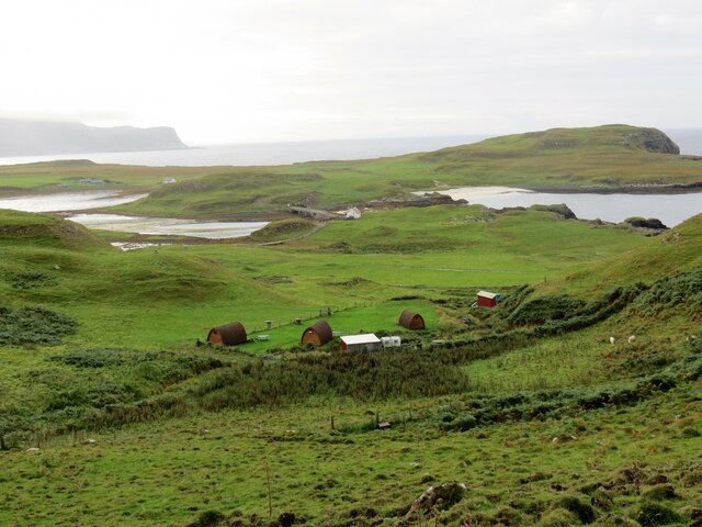
Canna, located in Argyllshire, Scotland, is a picturesque island that holds significant cultural and historical importance. It is recognized as a designated heritage site due to its rich and diverse natural landscapes, archaeological sites, and historical buildings.

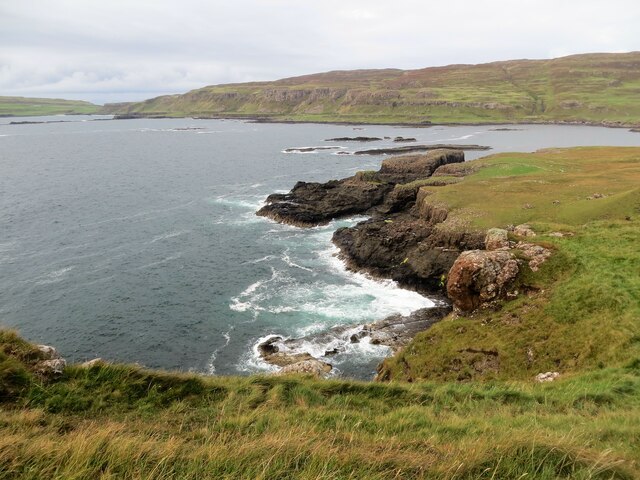
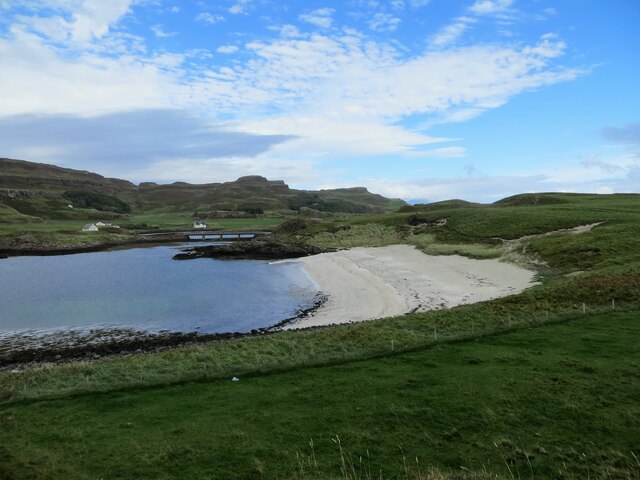
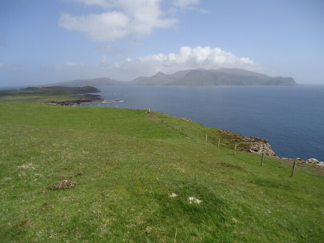
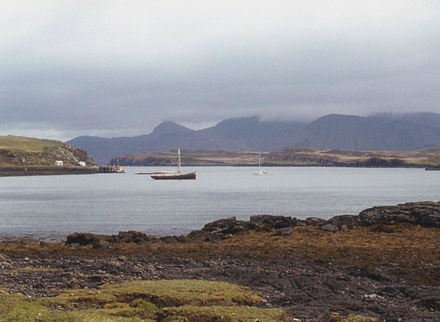
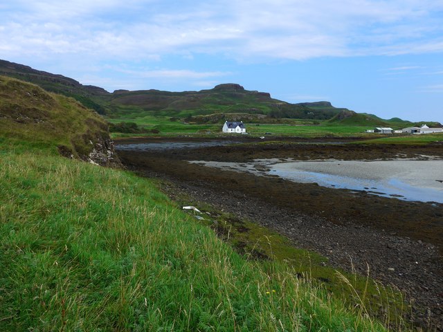
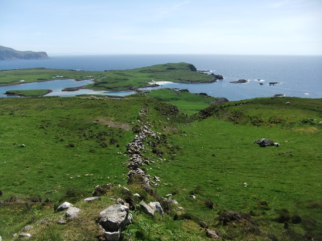
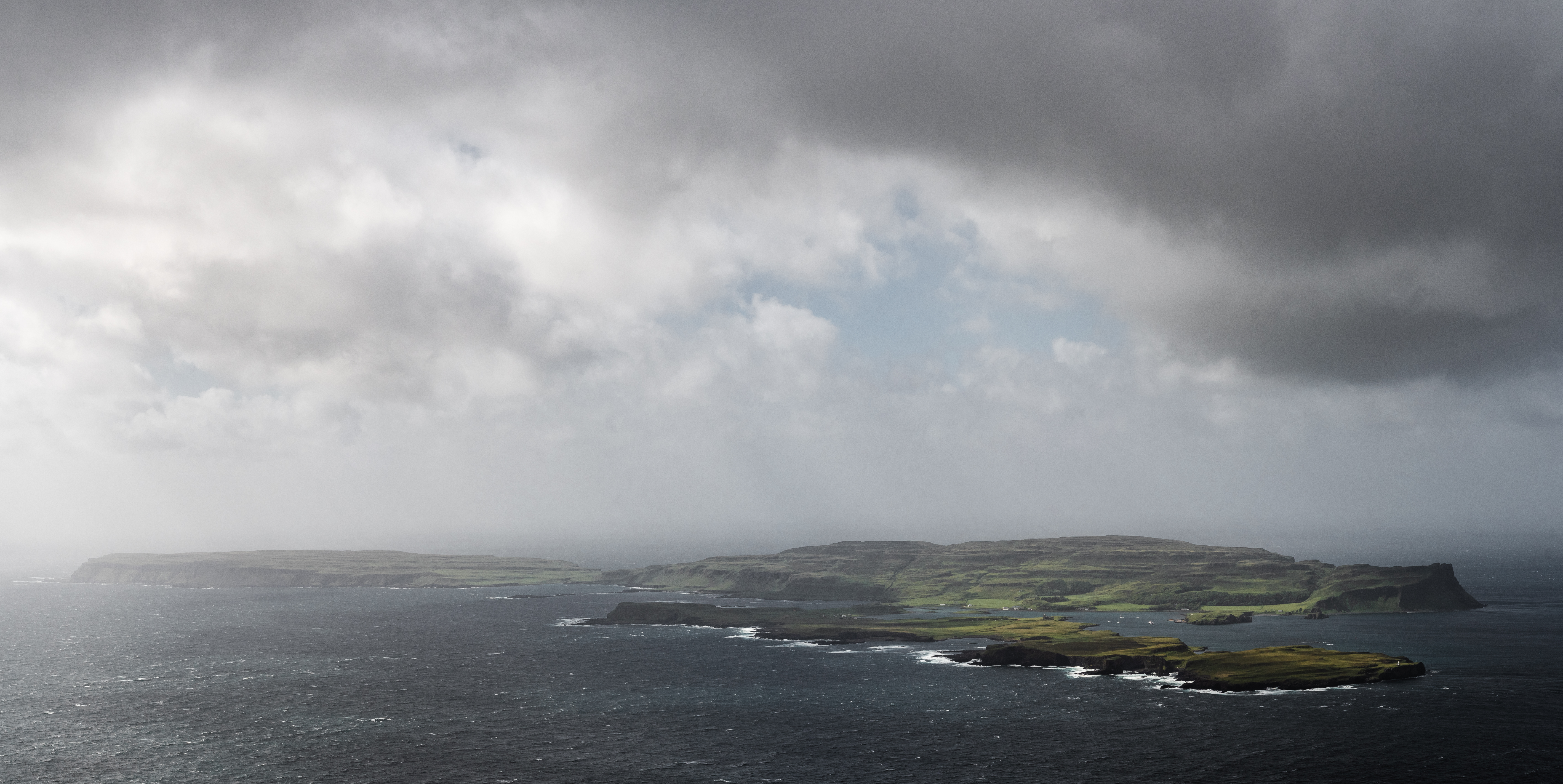
The island is approximately 7.4 square kilometers in size and is part of the Inner Hebrides archipelago. It is primarily composed of volcanic rock, creating dramatic cliffs and rugged coastlines. Canna is known for its stunning biodiversity, boasting a wealth of rare plant species and providing a haven for various bird species, including puffins and sea eagles.

Canna is home to several archaeological sites that date back to prehistoric times, including chambered cairns and standing stones. These ancient structures provide valuable insights into the island's early inhabitants and their way of life.

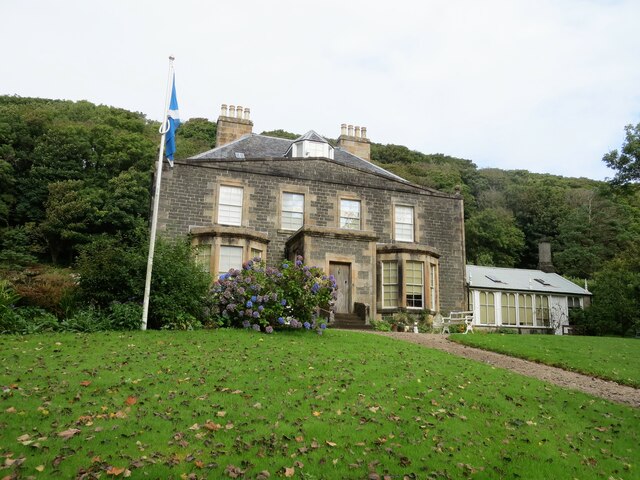
The island is also renowned for its historical buildings, most notably the Canna House. This Georgian mansion, built in the early 19th century, is an architectural gem and houses a significant collection of art and artifacts. It provides a glimpse into the lives of the previous owners, the MacLeod family, who were prominent landowners in the area.

In recognition of its outstanding natural and cultural heritage, Canna has been designated as a National Nature Reserve and a Site of Special Scientific Interest. It is managed by the National Trust for Scotland, which ensures the preservation and conservation of its unique features.

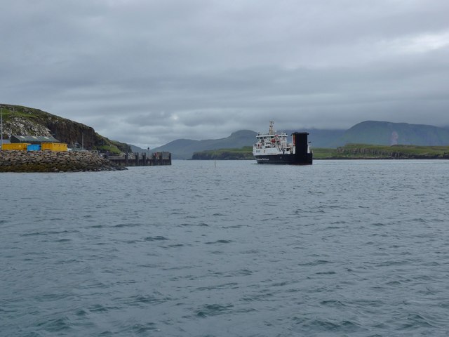
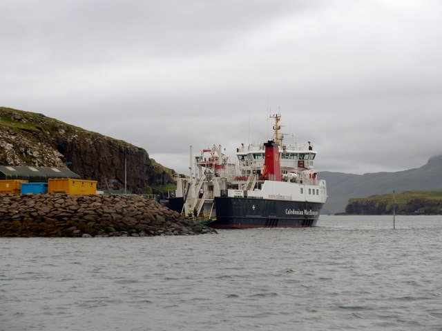
Visitors to Canna can explore its stunning landscapes, hike along its trails, and immerse themselves in its rich history and natural beauty. The island offers a unique opportunity to experience Scotland's diverse heritage in a tranquil and awe-inspiring setting.

If you have any feedback on the listing, please let us know in the comments section below.

Canna Images

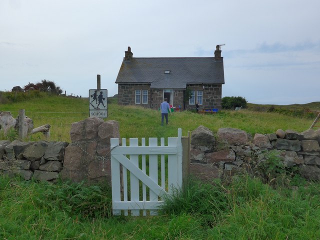
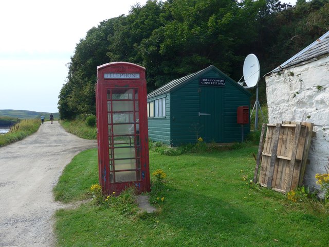
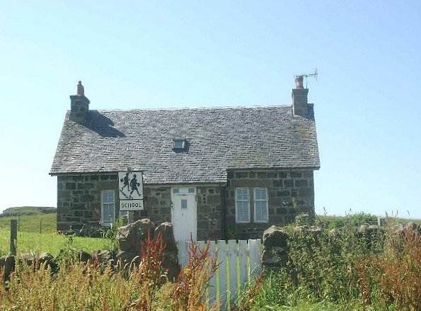
Images are sourced within 2km of 57.056/-6.49 or Grid Reference NG2705. Thanks to Geograph Open Source API. All images are credited.

Church of Scotland, Canna
Pods at Canna Campsite With Sanday Island beyond and Rum behind that
Pods at Canna Campsite
With Sanday Island beyond and Rum behind that
Coastline on Sanday below Tallabric Island of Canna beyond
Coastline on Sanday below Tallabric
Island of Canna beyond
Sandy beach on Sanday Island The bridge in the distance connects Sanday to Canna
Sandy beach on Sanday Island
The bridge in the distance connects Sanday to Canna
Saint Columba's chapel, Canna
Canna House Currently being restored
Canna House
Currently being restored
North-west Rum from Sanday Taken from the highest point of Sanday, Tallabric 59m. To the left is the southern shore of Sanday. Across the Sound of Canna are the hills of north-west Rum. The pyramid in the centre is Fionchra, 463m in <a href="https://www.geograph.org.uk/gridref/NG3300">NG3300</a>, and Bloodstone Hill is the darker one to the right. Behind Bloodstone Hill (388m in <a href="https://www.geograph.org.uk/gridref/NG3100">NG3100</a>) is a range of hills of which the highest is Orval, 571m in <a href="https://www.geograph.org.uk/gridref/NM3399">NM3399</a>.

For a view in the opposite direction, from Bloodstone Hill to Canna and Sanday, see <a href="https://www.geograph.org.uk/photo/7522759">NG2606 : Canna and Sanday from Bloodstone Hill, Rum</a>.
North-west Rum from Sanday
Taken from the highest point of Sanday, Tallabric 59m. To the left is the southern shore of Sanday. Across the Sound of Canna are the hills of north-west Rum. The pyramid in the centre is Fionchra, 463m in NG3300, and Bloodstone Hill is the darker one to the right. Behind Bloodstone Hill (388m in NG3100) is a range of hills of which the highest is Orval, 571m in NM3399. For a view in the opposite direction, from Bloodstone Hill to Canna and Sanday, see NG2606 : Canna and Sanday from Bloodstone Hill, Rum.
Across Canna Harbour
Canna's church
Canna's church
The Loch Nevis ferry arriving in Canna Harbour Because of tight manoeuvring space, she comes into the harbour going astern.  Note the perch midway between the ferry and the jetty, marking a patch of shoal water very close to the ro-ro slip.
The Loch Nevis ferry arriving in Canna Harbour
Because of tight manoeuvring space, she comes into the harbour going astern. Note the perch midway between the ferry and the jetty, marking a patch of shoal water very close to the ro-ro slip.
The Loch Nevis ferry in Canna Harbour Note the perch to the right of the ferry, marking a patch of shoal water very close to the ro-ro slip
The Loch Nevis ferry in Canna Harbour
Note the perch to the right of the ferry, marking a patch of shoal water very close to the ro-ro slip
Drying bay at Canna Harbour The large white building extreme right is the main farm and also generating station for Canna and Sanday.
Drying bay at Canna Harbour
The large white building extreme right is the main farm and also generating station for Canna and Sanday.
The school on Sanday (Canna) in August 2016 The figure in blue is the teacher who told us that this was the second day of term at the school and also his second day of teaching in Canna, having previously taught in Glasgow.   He has three pupils.

Compare with <a href="https://www.geograph.org.uk/photo/42148">NG2604 : The School, Canna</a>
The school on Sanday (Canna) in August 2016
The figure in blue is the teacher who told us that this was the second day of term at the school and also his second day of teaching in Canna, having previously taught in Glasgow. He has three pupils. Compare with NG2604 : The School, Canna
Canna post office Just a wooden shed but it does the job for the 20 or so residents and the visitors who arrive by ferry from Mallaig (who perhaps are more appreciative of the phone box, since mobile coverage is patchy, to say the least!).
Canna post office
Just a wooden shed but it does the job for the 20 or so residents and the visitors who arrive by ferry from Mallaig (who perhaps are more appreciative of the phone box, since mobile coverage is patchy, to say the least!).
Ancient wall on Canna
Shop and cafe, Canna
The bridge to Sanday The bridge dates from April 2006 when it replaced a footbridge that had been destroyed by storms. It connects the tidal island of Sanday to its larger neighbour, Canna.
The bridge to Sanday
The bridge dates from April 2006 when it replaced a footbridge that had been destroyed by storms. It connects the tidal island of Sanday to its larger neighbour, Canna.
Former Catholic church of St Edward, Sanday The church building, now deconsecrated, is owned by the National Trust for Scotland. It was restored and converted into a hostel, gaelic library and study centre by the Hebridean Trust. Since then, leaks have forced the removal of the archives and the closure of the building.
Former Catholic church of St Edward, Sanday
The church building, now deconsecrated, is owned by the National Trust for Scotland. It was restored and converted into a hostel, gaelic library and study centre by the Hebridean Trust. Since then, leaks have forced the removal of the archives and the closure of the building.
Show me another place!

Canna is located at Grid Ref: NG2705 (Lat: 57.056, Lng: -6.49)

Unitary Authority: Highland

Police Authority: Highlands and Islands

What 3 Words

///thudding.bound.spent. Near Elgol, Highland

Related Wikis

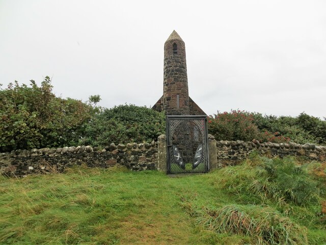
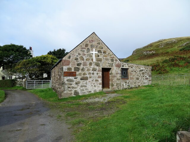
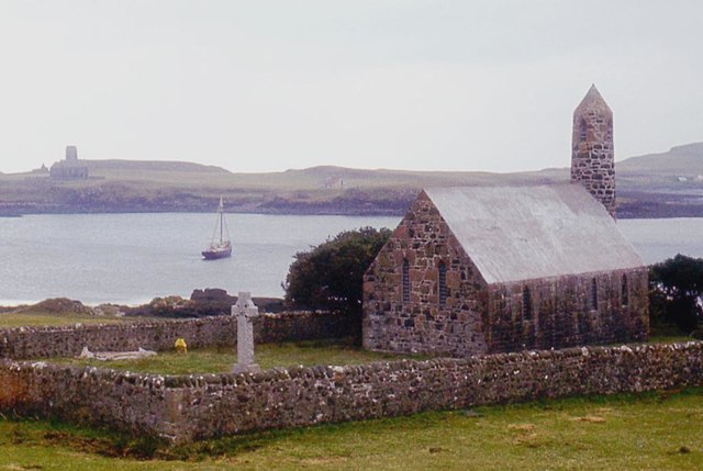
St Columba's Church, Canna

St Columba's Church is a Category B listed building on the isle of Canna, in the Small Isles, Highland, Scotland. == History == Prior to the building of...

St Edward's Church, Sanday

St Edward's Church, Sanday, is a deconsecrated, and now disused church on the small isle of Sanday, Inner Hebrides, Scotland. The church was a gift to...

Sanday, Inner Hebrides

Sanday (Scottish Gaelic: Sandaigh; Scots: Sandee) is one of the Small Isles, in the Scottish Inner Hebrides. It is a tidal island linked to its larger...

A' Chill

A' Chill was a village on Canna, in the Scottish Small Isles. The name means "the cell", referring to a Culdee church, and is often anglicised as "Kil...

Canna, Scotland

Canna (; Scottish Gaelic: Canaigh, Eilean Chanaigh) is the westernmost of the Small Isles archipelago, in the Scottish Inner Hebrides. It is linked to...

Nearby Amenities

Located within 500m of 57.056,-6.49
Source: PGS
Lat/Long: 57.059548/-6.4880552
Source: PGS
Lat/Long: 57.0597696/-6.488067
Source: PGS
Lat/Long: 57.0599245/-6.4872253
Source: PGS
Lat/Long: 57.0594966/-6.4871481
Source: PGS
Lat/Long: 57.0600888/-6.4884473
Source: PGS
Lat/Long: 57.0600928/-6.4890835
Source: PGS
Lat/Long: 57.0599485/-6.4895454
Source: PGS
Lat/Long: 57.0597654/-6.4899851
Source: PGS
Lat/Long: 57.0588566/-6.4909037
Source: PGS
Lat/Long: 57.0584573/-6.490386
Source: PGS
Lat/Long: 57.05802/-6.48972
Source: PGS
Lat/Long: 57.0578196/-6.4895165
Source: PGS
Lat/Long: 57.0574255/-6.4882344
Source: PGS
Lat/Long: 57.0557251/-6.4882332
Source: PGS
Lat/Long: 57.0556399/-6.4884407
Ferry Terminal
Canna Pier
Ferry: yes
Operator: Caledonian MacBrayne
Public Transport: station
Source: PGS
Lat/Long: 57.0561482/-6.4914201
Source: PGS
Lat/Long: 57.05677/-6.49144
Source: PGS
Lat/Long: 57.0571831/-6.4920297
Source: PGS
Lat/Long: 57.05769/-6.49256
Source: PGS
Lat/Long: 57.05799/-6.4934148
Source: PGS
Lat/Long: 57.058595/-6.4940168
Source: PGS
Lat/Long: 57.0585705/-6.4945644
Source: PGS
Lat/Long: 57.0594563/-6.4943842
Source: npe
Lat/Long: 57.0566823/-6.4913071
Source: npe
Lat/Long: 57.0603058/-6.4912603
Canna Harbour
Natural: bay
Place: locality
Source Name: OS_OpenData_StreetView
Lat/Long: 57.0555313/-6.4941056
Buaile na h-Uamha
Place: locality
Source: OS_OpenData_StreetView
Lat/Long: 57.0522281/-6.492271
Camas an Ail
Place: locality
Source: OS_OpenData_StreetView
Lat/Long: 57.0544652/-6.4947514
Rubha na Lion
Place: locality
Source: OS_OpenData_StreetView
Lat/Long: 57.05386/-6.492124
Rubha nam Feannag
Place: locality
Source: OS_OpenData_StreetView
Lat/Long: 57.0551039/-6.4967502
St Edwards Centre
Place: locality
Source: OS_OpenData_StreetView
Lat/Long: 57.0533287/-6.4950706
Coroghon Mor
Place: locality
Source: OS_OpenData_StreetView
Lat/Long: 57.0603343/-6.4883823
Rubha Carr-innis
Place: locality
Source: OS_OpenData_StreetView
Lat/Long: 57.0570939/-6.4898899
Ele: 30
Natural: peak
Lat/Long: 57.056924/-6.4901793
Seamark Mooring Category: buoy
Seamark Mooring Colour: orange
Seamark Mooring Shape: barrel
Seamark Name: VisitorsMooring
Seamark Type: mooring
Lat/Long: 57.0570143/-6.494025
Seamark Mooring Category: buoy
Seamark Mooring Colour: orange
Seamark Mooring Shape: barrel
Seamark Name: VisitorsMooring
Seamark Type: mooring
Lat/Long: 57.0568509/-6.4942449
Seamark Mooring Category: buoy
Seamark Mooring Colour: orange
Seamark Mooring Shape: barrel
Seamark Name: VisitorsMooring
Seamark Type: mooring
Lat/Long: 57.056705/-6.4945453
Seamark Mooring Category: buoy
Seamark Mooring Colour: orange
Seamark Mooring Shape: barrel
Seamark Name: VisitorsMooring
Seamark Type: mooring
Lat/Long: 57.0565446/-6.4949209
Coroghon Castle
Heritage: yes
Historic: castle
Wikidata: Q56661701
Lat/Long: 57.0603353/-6.4885587
The data included in this document is from www.openstreetmap.org. The data is made available under ODbL.

Have you been to Canna?

Leave your review of Canna below (or comments, questions and feedback).