Lochaline

Settlement in Argyllshire

Scotland

Lochaline

Ferry arrival, Lochaline Ferry from Mull.
Ferry arrival, Lochaline Credit: Richard Webb

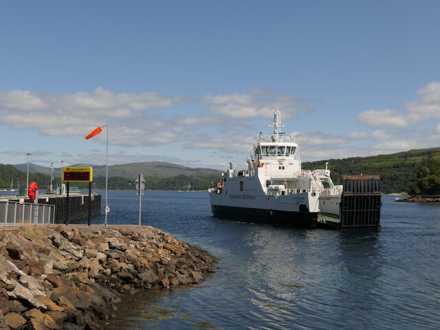
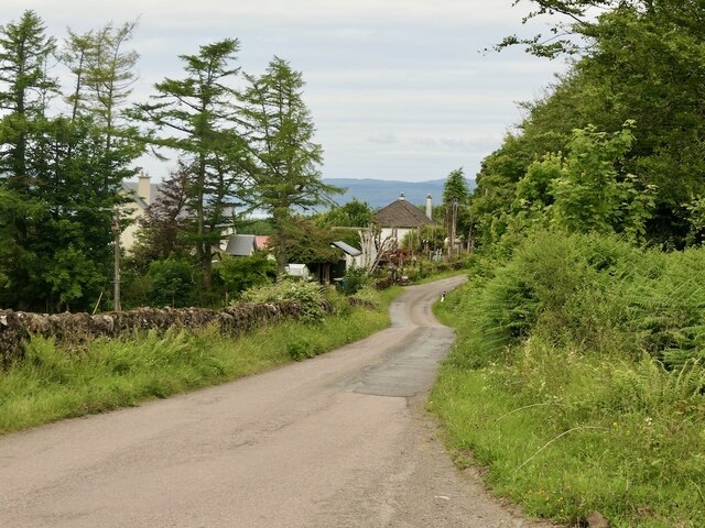
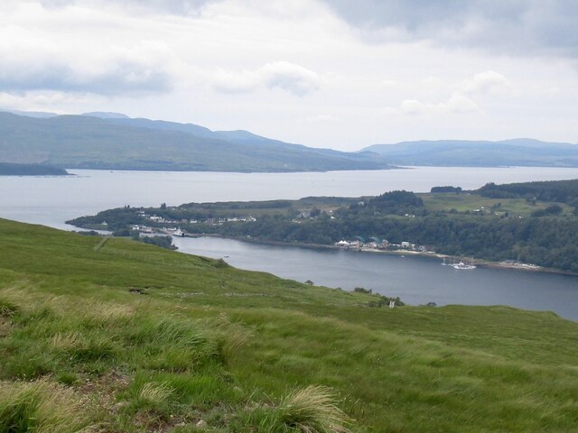
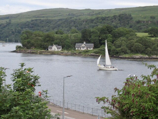
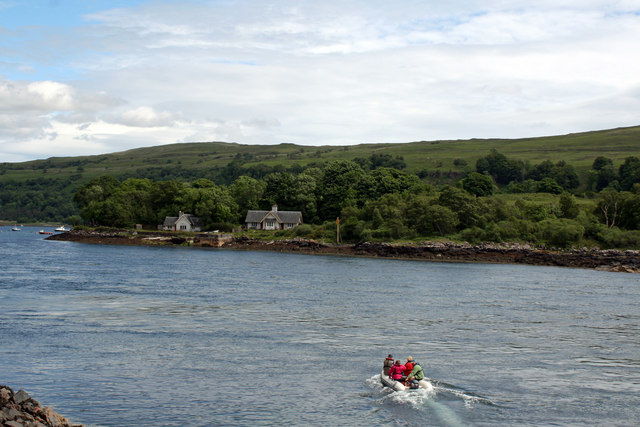
Lochaline is a small village located on the western coast of Scotland, specifically in the region of Argyllshire. Situated on the picturesque Morvern Peninsula, Lochaline offers stunning views of the surrounding mountains and the crystal-clear waters of the Sound of Mull.

With a population of around 200 residents, Lochaline is known for its tranquil and remote atmosphere, making it an ideal destination for those seeking a peaceful retreat. The village is accessible by road, with the A884 providing a direct link to the nearby town of Fort William.

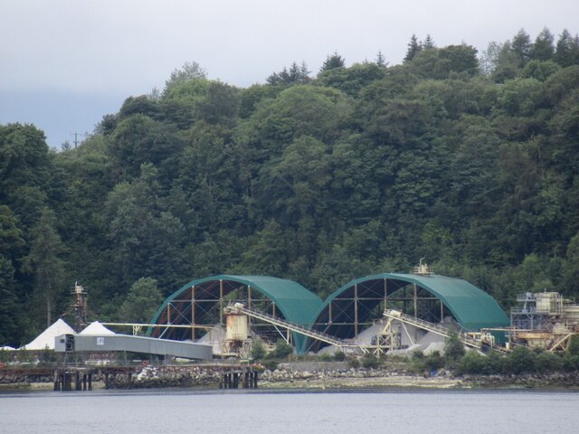
One of the main attractions in Lochaline is its proximity to the Lochaline Quartz Sand Mine. This mine, the only underground silica sand mine in the UK, has been in operation since 1940 and is a significant source of high-quality silica sand used in various industries, including glass manufacturing and renewable energy.

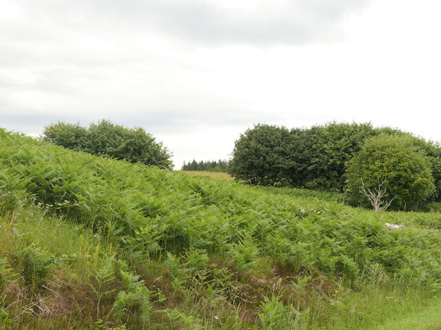
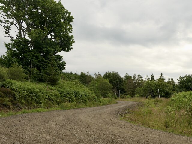
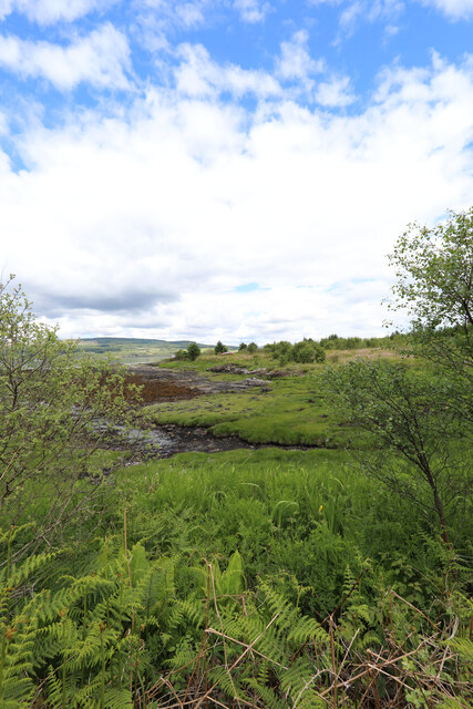
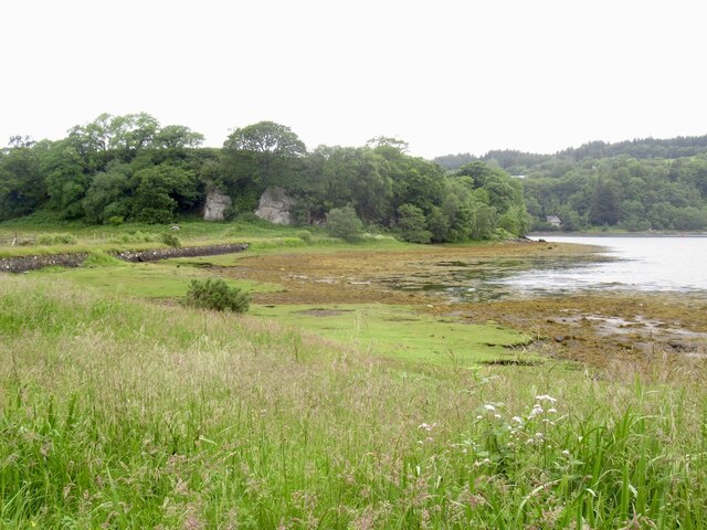
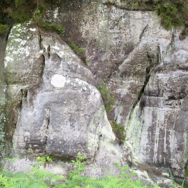
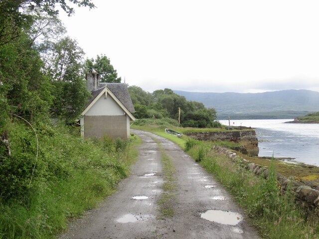
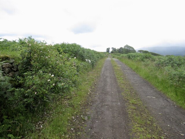
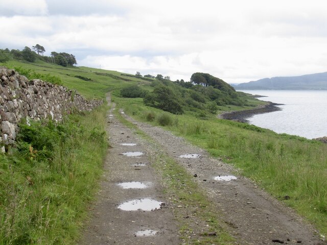
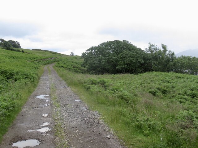
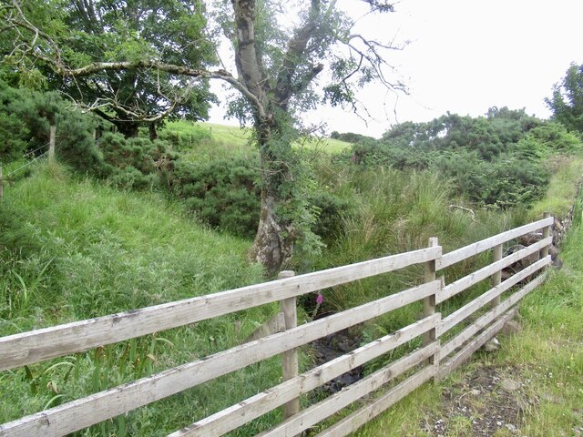
Nature enthusiasts will find plenty to explore in Lochaline, with numerous hiking trails and nature reserves in the area. The nearby Lochaline Forest offers a range of walking routes, allowing visitors to immerse themselves in the breathtaking Scottish countryside.

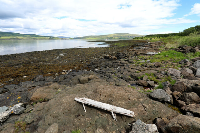
For those interested in marine life, the waters around Lochaline are teeming with wildlife. The village is a popular spot for diving enthusiasts, who come to explore the diverse underwater ecosystems and the wreck of the SS Shuna.

Overall, Lochaline is a charming and secluded village that offers a unique blend of natural beauty, historic significance, and recreational opportunities for all who visit.

If you have any feedback on the listing, please let us know in the comments section below.

Lochaline Images

Images are sourced within 2km of 56.530095/-5.7904874 or Grid Reference NM6744. Thanks to Geograph Open Source API. All images are credited.

Ferry arrival, Lochaline Ferry from Mull.
Ferry arrival, Lochaline
Ferry from Mull.
On the ferry, Lochaline Rules for the open deck short route ferries - disease prevention by staying in the vehicle.  The black objects are chocks.

I don't like to take pictures from inside the car, but them's the rules!
On the ferry, Lochaline
Rules for the open deck short route ferries - disease prevention by staying in the vehicle. The black objects are chocks. I don't like to take pictures from inside the car, but them's the rules!
Bracken covered ground, Lochaline
Logging road, Lochaline
B849, Lochaline The road to Drimnin.
B849, Lochaline
The road to Drimnin.
Time out waiting for the Mull ferry Whilst people in camper vans who just missed the ferry to Lochaline seemed mainly to sit in the queue, those in smaller cars seemed more drawn to the picnic area just along the forest track. Such places often have a height barrier to deter overnight camping, though I didn't notice one here - the restriction to small vehicles seemed entirely voluntary in the middle of the day.
Time out waiting for the Mull ferry
Whilst people in camper vans who just missed the ferry to Lochaline seemed mainly to sit in the queue, those in smaller cars seemed more drawn to the picnic area just along the forest track. Such places often have a height barrier to deter overnight camping, though I didn't notice one here - the restriction to small vehicles seemed entirely voluntary in the middle of the day.
Looking across Sgeir Mhòr to the Sound of Mull
Lochaline seen from Goirtein Dearg Sound of Mull beyond.
Lochaline seen from Goirtein Dearg
Sound of Mull beyond.
Caolas na h-Àirde The narrows at the mouth of Loch Aline. As expected there can be a bit of a tidal stream here.
Caolas na h-Àirde
The narrows at the mouth of Loch Aline. As expected there can be a bit of a tidal stream here.
Silica mine, Lochaline Developed during World War II as a domestic source of pure quartz for optics. Most sand contains metals, this is near 100% silicon dioxide and is an exceptional deposit. The mine closed in 2008 but has since resumed production. 

The sands date back to shallow seas in the Cretaceous and were preserved from later erosion by the lava flows during the Tertiary volcanic episode.
Silica mine, Lochaline
Developed during World War II as a domestic source of pure quartz for optics. Most sand contains metals, this is near 100% silicon dioxide and is an exceptional deposit. The mine closed in 2008 but has since resumed production. The sands date back to shallow seas in the Cretaceous and were preserved from later erosion by the lava flows during the Tertiary volcanic episode.
View towards Cnap a' Chaolais The crags are of Cretaceous sandstone, related to the silica deposits mined across the loch.
View towards Cnap a' Chaolais
The crags are of Cretaceous sandstone, related to the silica deposits mined across the loch.
Sandstone crag, Cnap a' Chaolais The crag is of Cretaceous sandstone, related to the silica deposits mined across the loch.
Sandstone crag, Cnap a' Chaolais
The crag is of Cretaceous sandstone, related to the silica deposits mined across the loch.
Ferry House, Loch Aline
Road to Old Ardtornish
Burn, Old Ardtornish
Ardtornish Estate Ferry House over Caolas na h-Airde The right hand building is a Category C Listed building of 1879 by Samuel Barnham. Formerly the Caolas Ferry House; sited opposite the Caolas Ferry pier linking (Old) Ardtornish with Lochaline. Caolas Cottage was former stables and is not included in listing.
Ardtornish Estate Ferry House over Caolas na h-Airde
The right hand building is a Category C Listed building of 1879 by Samuel Barnham. Formerly the Caolas Ferry House; sited opposite the Caolas Ferry pier linking (Old) Ardtornish with Lochaline. Caolas Cottage was former stables and is not included in listing.
Show me another place!

Lochaline is located at Grid Ref: NM6744 (Lat: 56.530095, Lng: -5.7904874)

Unitary Authority: Highland

Police Authority: Highlands and Islands

What 3 Words

///allies.closets.tens. Near Lochaline, Highland

Nearby Locations

Lochaline Loch Alainn

Related Wikis

Lochaline

Lochaline (Scottish Gaelic: Loch Àlainn) is the main village in the Morvern area of Highland, Scotland. The coastal village is situated at the mouth of...

Lochaline Mine

Lochaline Mine is a mine on the Morvern peninsula of the Highland area of Scotland. The mine works a white cretaceous sandstone to produce high grade silica...

Fishnish

Fishnish (Scottish Gaelic: Finnsinis) is a ferry terminal on the Isle of Mull, roughly halfway between Tobermory and Craignure. It is owned and operated...

Ardtornish Castle

Ardtornish Castle is situated in the grounds of the Ardtornish estate in Morvern, on the west coast of Scotland. It stands at the seaward end of a promontory...

Loch Aline

Loch Aline (Scottish Gaelic: Loch Àlainn) is a small salt water loch home to fish, birds and game, located in Morvern, Lochaber, Scotland. Key features...

Ardtornish Bay

Ardtornish Bay is coastal embayment, on a chord of 0.89 miles, on a 161° orientation, in the Morvern peninsula in Lochaber, in the western coast of Scotland...

Ardtornish

Ardtornish (Scottish Gaelic: Àird Tòirinis) is a Highland estate in Scotland located in Morvern, Lochaber. Ardtornish House is famous for its gardens...
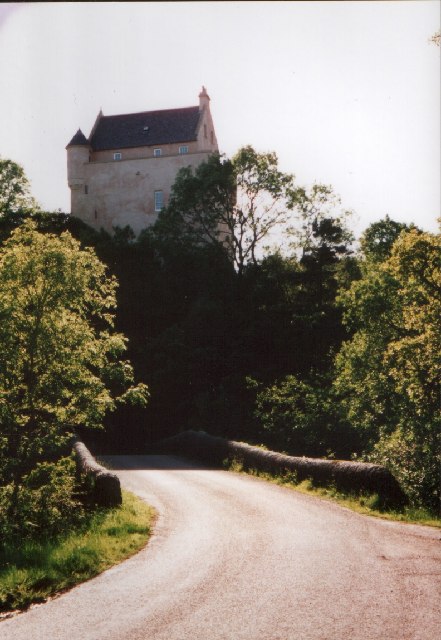
Kinlochaline Castle

Kinlochaline Castle is a 15th-century Scottish tower house on the Ardtornish estate in Morvern in the Highland council area. It is also known as Caisteal...

Nearby Amenities

Located within 500m of 56.530095,-5.7904874
Created By: dmgroom_coastlines
Source: PGS
Lat/Long: 56.532765/-5.788639
Location Transition: yes
Power: pole
Lat/Long: 56.5343351/-5.7926728
Seamark Construction: metal
Seamark Light Category: vertical
Seamark Light Character: F
Seamark Light Colour: green
Seamark Light Height: 4
Seamark Light Multiple: 2
Seamark Light Range: 2
Seamark Name: Lochaline pier
Seamark Type: light_minor
Lat/Long: 56.5322657/-5.7852789
The data included in this document is from www.openstreetmap.org. The data is made available under ODbL.

Have you been to Lochaline?

Leave your review of Lochaline below (or comments, questions and feedback).