Lochanhully
Settlement in Inverness-shire
Scotland
Lochanhully

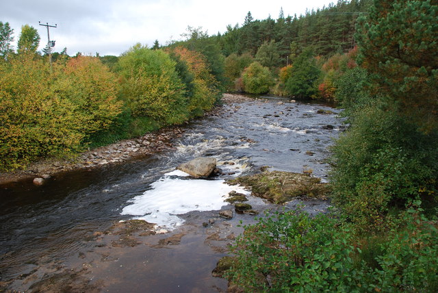
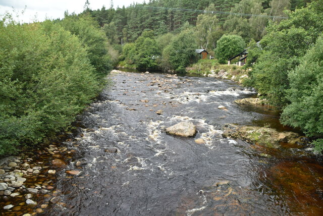
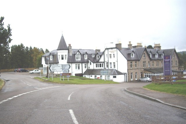
Lochanhully is a small village located in the county of Inverness-shire, Scotland. Situated in the picturesque Scottish Highlands, it is known for its stunning natural beauty and tranquil atmosphere. The village is nestled beside Loch Morlich, a freshwater loch surrounded by lush greenery and majestic mountains.
Lochanhully is a popular tourist destination, offering visitors a peaceful retreat away from the hustle and bustle of city life. The village is characterized by its charming traditional Scottish architecture, with many buildings constructed from local stone. It is also home to a small community of residents who enjoy the quiet and idyllic surroundings.
One of the main attractions in Lochanhully is the Lochanhully Woodland Club, a holiday resort located on the outskirts of the village. The resort offers a range of accommodations, including self-catering lodges and cottages, providing visitors with a comfortable and cozy place to stay. The resort also boasts a variety of amenities such as a swimming pool, tennis courts, and a restaurant.
Nature enthusiasts will find plenty to explore in and around Lochanhully. The area is renowned for its scenic hiking trails, allowing visitors to immerse themselves in the breathtaking Highland landscape. Loch Morlich offers opportunities for fishing and boating, while the surrounding mountains provide excellent terrain for climbing and mountaineering.
In summary, Lochanhully is a charming village in Inverness-shire that offers a peaceful and picturesque getaway for visitors. With its natural beauty, outdoor activities, and tranquil atmosphere, it is the perfect destination for those seeking a relaxing break in the heart of the Scottish Highlands.
If you have any feedback on the listing, please let us know in the comments section below.
Lochanhully Images
Images are sourced within 2km of 57.288762/-3.799226 or Grid Reference NH9123. Thanks to Geograph Open Source API. All images are credited.


Lochanhully is located at Grid Ref: NH9123 (Lat: 57.288762, Lng: -3.799226)
Unitary Authority: Highland
Police Authority: Highlands and Islands
What 3 Words
///gilding.home.epic. Near Aviemore, Highland
Nearby Locations
Related Wikis
Packhorse bridge
A packhorse bridge is a bridge intended to carry packhorses (horses loaded with sidebags or panniers) across a river or stream. Typically a packhorse bridge...
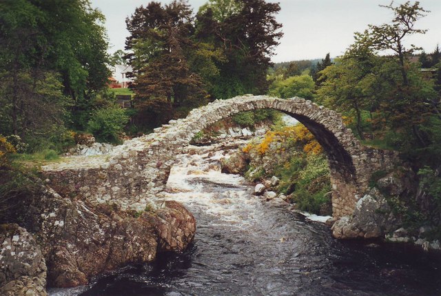
Carrbridge Packhorse Bridge
Carrbridge Packhorse Bridge, also known as Coffin Bridge, is a bridge in the village of Carrbridge in the Highlands of Scotland. The bridge was built in...
Carrbridge
Carrbridge (Scots: Carrbrig, Scottish Gaelic: Drochaid Chàrr) is a village in Badenoch and Strathspey in the Scottish Highlands. It lies off the A9 on...

Landmark Forest Adventure Park
Landmark Forest Adventure Park is a nature-based theme and adventure park in the village of Carrbridge, Highlands, Scotland. == Attractions == == References... ==
Bogroy
Bogroy is a small crofting village, located 0.5 miles northwest of Carrbridge, in Strathspey, in the county of Inverness-shire, Scottish Highlands and...

Duthil
Duthil (Scottish Gaelic: Daothal) is a small village, bypassed by the A938 road, at the junction with the road B9007, near Carrbridge in Inverness-shire...

Carrbridge railway station
Carrbridge railway station serves the village of Carrbridge, Highland, Scotland. The railway station is managed by ScotRail and is on the Highland Main...
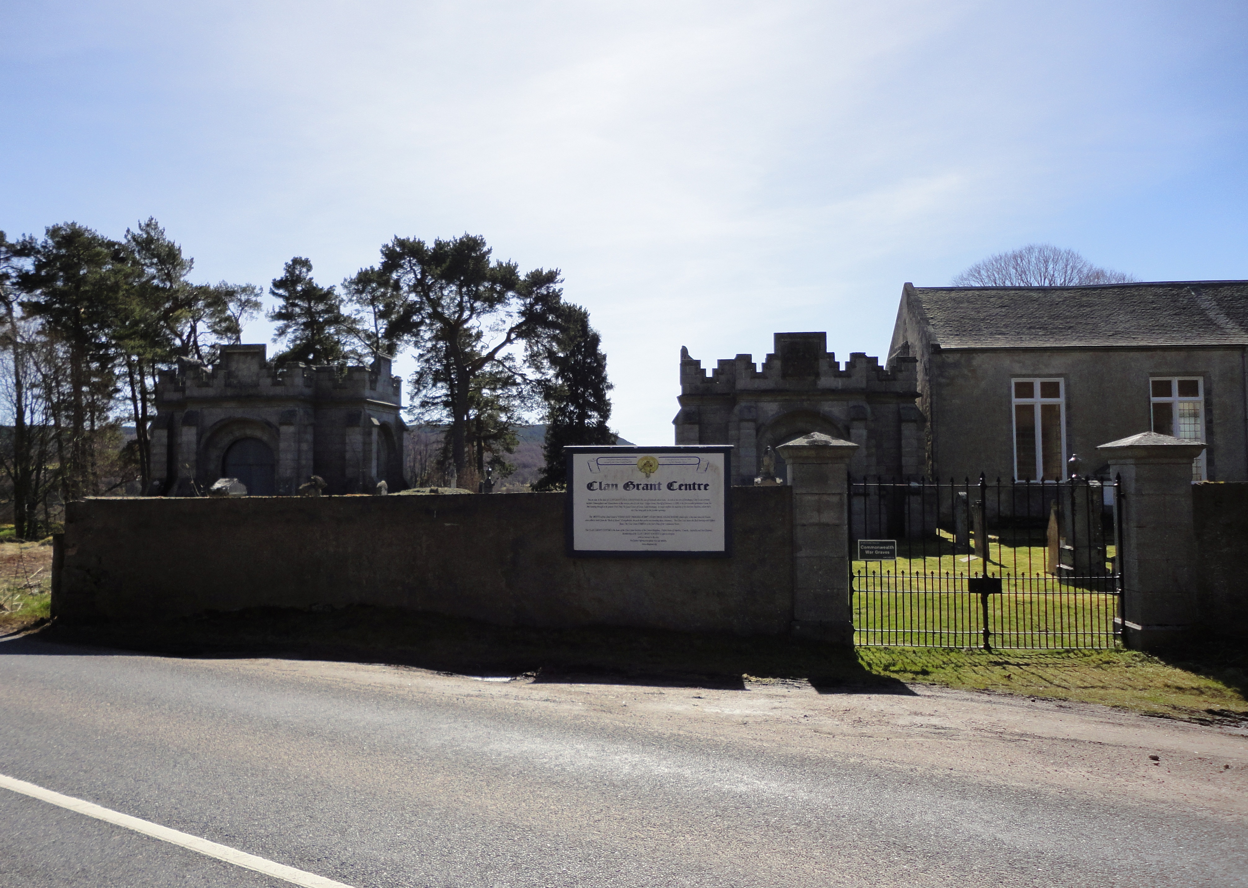
Duthil Old Parish Church and Churchyard
Duthil Old Parish Church and Churchyard is a historic site at the centre of the historical parish of Duthil (Scottish Gaelic: Daothal), near Carrbridge...
Nearby Amenities
Located within 500m of 57.288762,-3.799226Have you been to Lochanhully?
Leave your review of Lochanhully below (or comments, questions and feedback).