Gob a' Chuthail
Coastal Feature, Headland, Point in Ross-shire
Scotland
Gob a' Chuthail

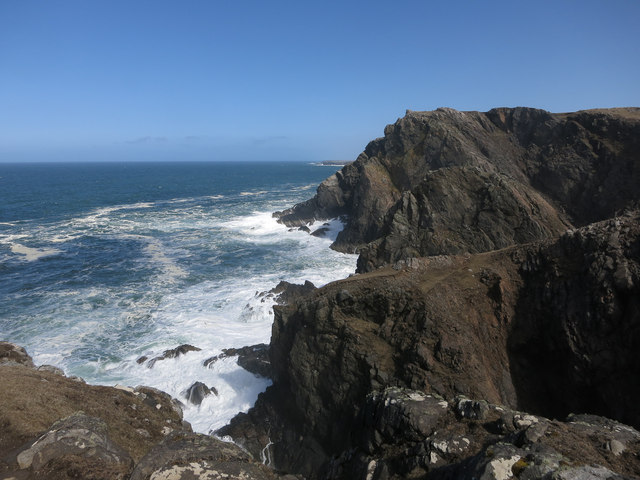
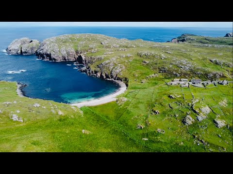
Gob a' Chuthail, located in Ross-shire, Scotland, is a prominent coastal feature known as a headland or point. Situated on the northern coast of the country, Gob a' Chuthail offers breathtaking views of the North Sea and is a popular destination for both locals and tourists.
This headland is characterized by its rugged cliffs and rocky shoreline, which have been shaped by centuries of erosion from the relentless waves. The cliffs stand tall, providing a dramatic backdrop to the crashing waves below. The area is known for its diverse wildlife, including seabirds such as puffins and gannets, which can be observed nesting on the cliffs during the breeding season.
Gob a' Chuthail is also notable for its historical significance. Ruins of an ancient fort, believed to have been occupied during the Iron Age, can be found on the headland. These remnants serve as a reminder of the area's rich cultural heritage.
The headland is easily accessible by foot, with a well-maintained path leading visitors along the coastline. Hikers and nature enthusiasts flock to Gob a' Chuthail to enjoy its natural beauty and the serenity it offers. The site is particularly popular for coastal walks, birdwatching, and photography.
Overall, Gob a' Chuthail is a stunning coastal feature that showcases the raw beauty of the Scottish coastline. Its dramatic cliffs, diverse wildlife, and historical significance make it a must-visit destination for anyone exploring the Ross-shire region.
If you have any feedback on the listing, please let us know in the comments section below.
Gob a' Chuthail Images
Images are sourced within 2km of 58.304259/-6.8039495 or Grid Reference NB1845. Thanks to Geograph Open Source API. All images are credited.


Gob a' Chuthail is located at Grid Ref: NB1845 (Lat: 58.304259, Lng: -6.8039495)
Unitary Authority: Na h-Eileanan an Iar
Police Authority: Highlands and Islands
What 3 Words
///geek.frosted.furnish. Near Carloway, Na h-Eileanan Siar
Nearby Locations
Related Wikis

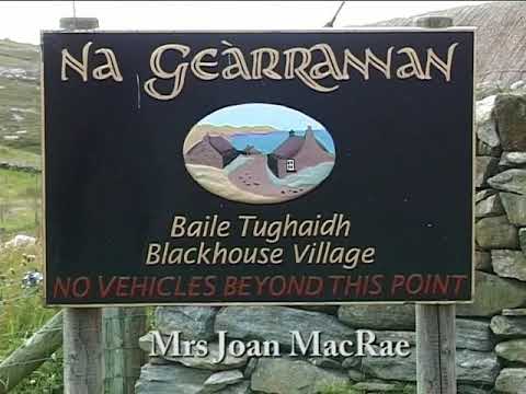
Garenin
Garenin (Scottish Gaelic: Na Gearrannan) is a crofting township on the west coast of the Isle of Lewis in the Outer Hebrides of Scotland. Garenin is in...

Borrowston, Lewis
Borrowston (Scottish Gaelic: Borghastan), with a population of about 50, is a crofting township situated on the Isle of Lewis, on the Outer Hebrides of...

Carloway
Carloway (Scottish Gaelic: Càrlabhagh [ˈkʰaːɾɫ̪ə.ɤː]) is a crofting township and a district on the west coast of the Isle of Lewis, in the Outer Hebrides...

Siadar Wave Power Station
The Siadar Wave Power Station (also known as Siadar Wave Energy Project or SWEP) was a proposed 4 MW wave farm 400 metres (1,300 ft) off the shore of Siadar...

Dun Carloway
Dun Carloway (Scottish Gaelic: Dùn Chàrlabhaigh) is a broch situated in the district of Carloway, on the west coast of the Isle of Lewis, Scotland (grid...

Campaigh
Campaigh or Campay is a steep and rocky islet in outer Loch Ròg, Lewis, Scotland that lies north of Cealasaigh and Little Bernera. A huge natural arch...
Cealasaigh
Cealasaigh or Kealasay is an islet in outer Loch Ròg, Lewis, Scotland that lies north of Traigh Mhór on Little Bernera and south of Campaigh. To the west...

Little Bernera
Little Bernera (Scottish Gaelic: Beàrnaraigh Beag) is a small island situated off the west coast of the Isle of Lewis in the Outer Hebrides.Little Bernera...
Related Videos

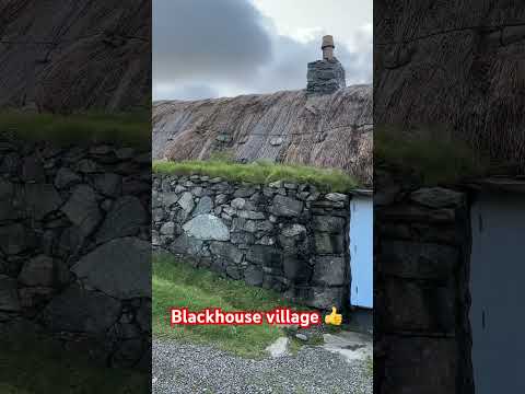
Gearrannan village of traditional houses
Gearrannan Black House village on the Isle of Lewis.
Pipe Major Bill Hepburn Jnr. at the Black Houses, Na Gearrannan, Isle of Lewis - 'Mrs Joan Macrae'.
Pipe Major Bill Hepburn Jnr. plays the pipe tune 'Mrs Joan Macrae' at the Black Houses of Na Gearrannan on the west coast of ...
🇬🇧🏴 Isle Of Lewis & Harris (Outer Hebrides) - Na Gearrannan Blackhouse Village
Na Gearrannan Blackhouse Village, Isle Of Lewis & Harris (Outer Hebrides), Western Isles, U.K..
Have you been to Gob a' Chuthail?
Leave your review of Gob a' Chuthail below (or comments, questions and feedback).