Carraig Chas

Coastal Feature, Headland, Point in Argyllshire

Scotland

Carraig Chas

Tidal channel to the north of Eilean Dubh An hour after low water, it was still possible to ford this channel to the island in the foreground, which lies in the inlet of Port na h-Eathar.
Tidal channel to the north of Eilean Dubh Credit: Oliver Dixon

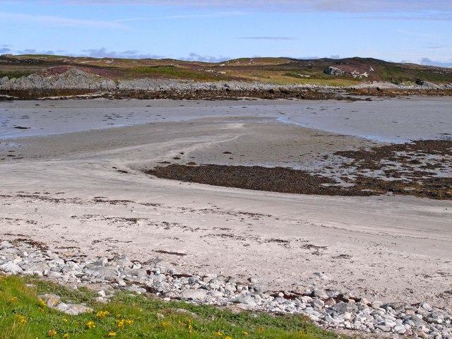
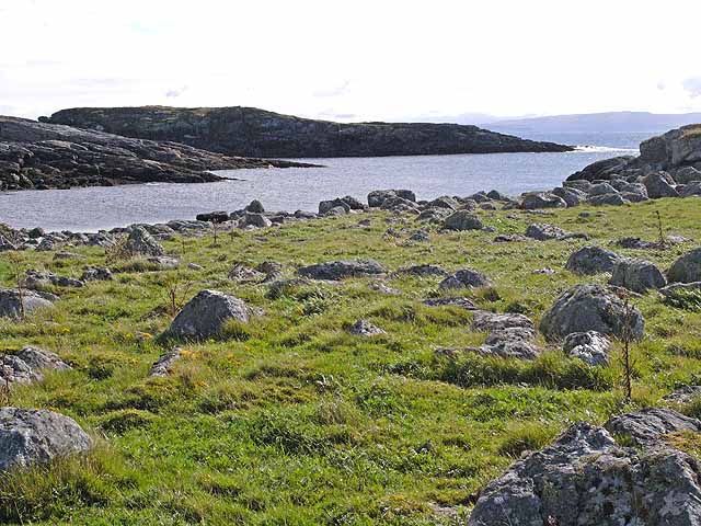
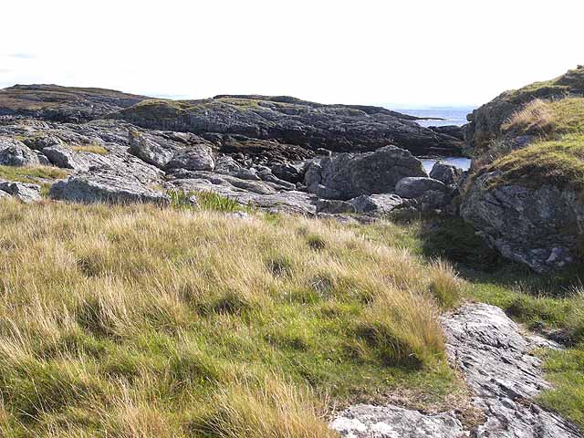
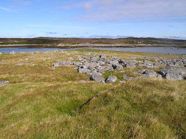
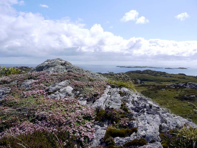
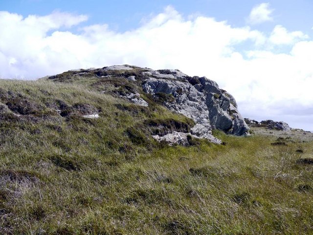
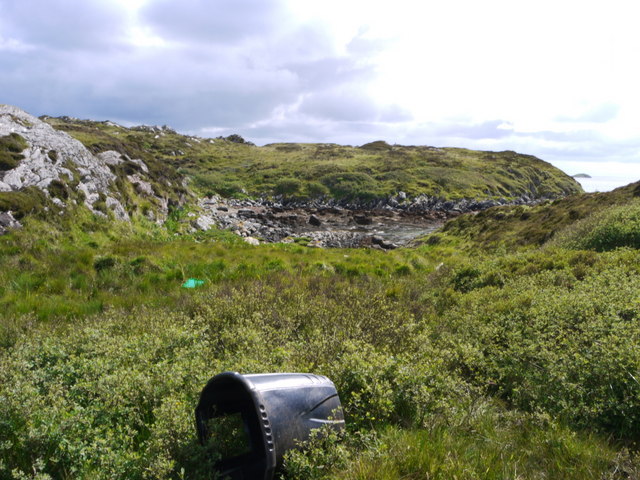
Carraig Chas is a prominent coastal feature located in Argyllshire, Scotland. It is primarily known as a headland or point, jutting out into the sea and offering stunning views of the surrounding landscape. The word "Carraig Chas" is derived from Scottish Gaelic, with "carraig" meaning rock and "chas" meaning headland.

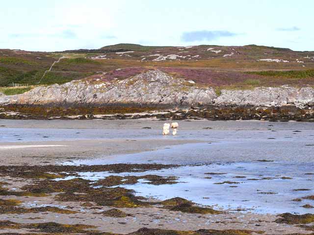
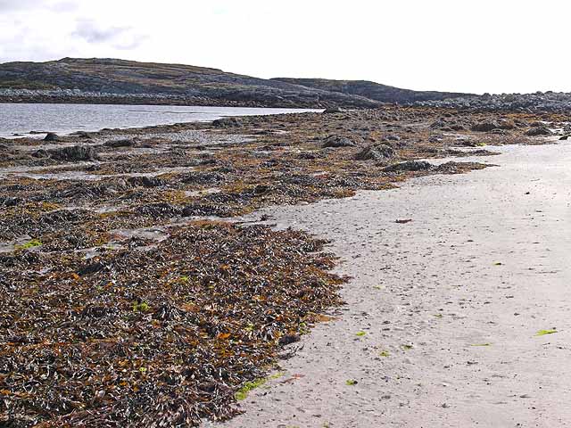
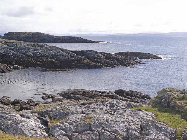
This coastal feature is characterized by its rugged cliffs, which have been shaped over centuries by the relentless pounding of the waves. The cliffs are composed of a variety of rock types, including granite and basalt, which add to the dramatic beauty of the area. The height of the cliffs varies, reaching up to 100 meters in some sections, providing a breathtaking backdrop for the crashing waves below.

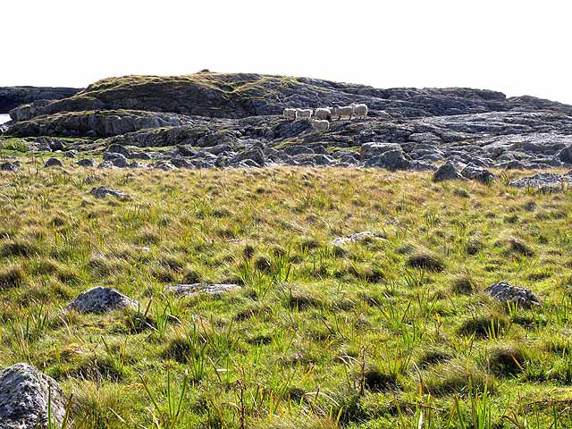
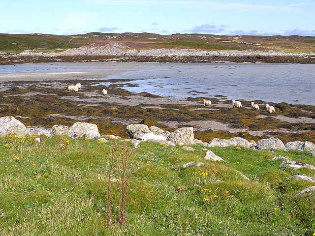
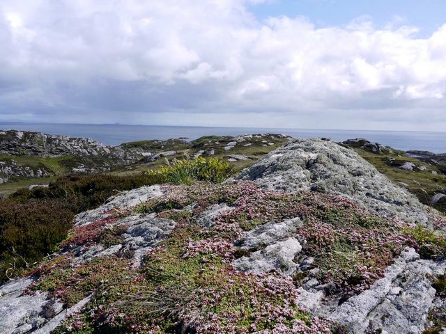
Carraig Chas is also home to a diverse range of flora and fauna. The cliff face provides nesting sites for various seabirds, including puffins, guillemots, and razorbills. Visitors can witness these birds in their natural habitat during the breeding season, which typically occurs in spring and early summer. The surrounding waters are abundant in marine life, with seals and dolphins frequently sighted in the area.

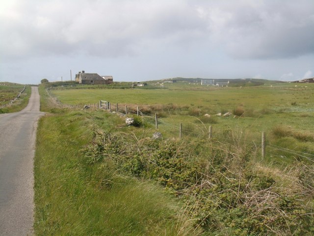
Due to its scenic beauty and wildlife, Carraig Chas is a popular destination for outdoor enthusiasts. Hikers and nature lovers can explore the rugged coastal paths, which offer panoramic views of the sea and the surrounding countryside. The headland is easily accessible by foot, with a well-maintained trail leading to the top of the cliffs.

Overall, Carraig Chas is a stunning coastal feature that offers visitors a chance to immerse themselves in Scotland's natural beauty. Its towering cliffs, diverse wildlife, and breathtaking views make it a must-visit destination for anyone exploring Argyllshire.

If you have any feedback on the listing, please let us know in the comments section below.
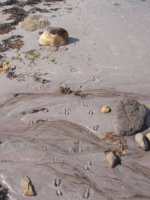
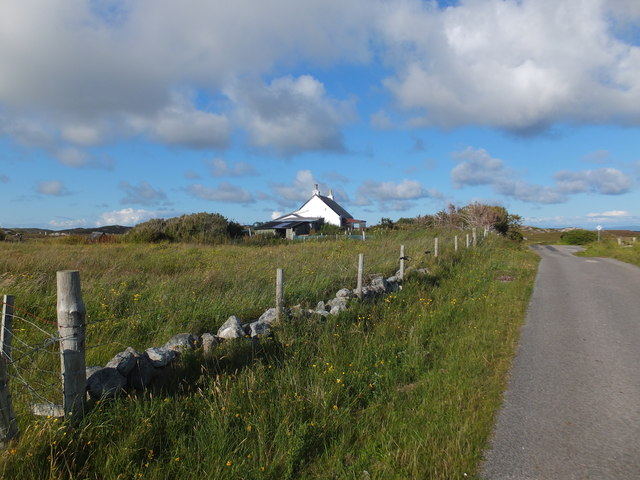
Carraig Chas Images

Images are sourced within 2km of 56.586705/-6.586817 or Grid Reference NM1853. Thanks to Geograph Open Source API. All images are credited.

Tidal channel to the north of Eilean Dubh An hour after low water, it was still possible to ford this channel to the island in the foreground, which lies in the inlet of Port na h-Eathar.
Tidal channel to the north of Eilean Dubh
An hour after low water, it was still possible to ford this channel to the island in the foreground, which lies in the inlet of Port na h-Eathar.
Worried sheep These sheep looked pretty worried that I had invaded their privacy by wading across the shallows to Eilean Dubh. What happened next? See <a href="https://www.geograph.org.uk/photo/1452241">NM2053 : Sheep on the move</a>.
Worried sheep
These sheep looked pretty worried that I had invaded their privacy by wading across the shallows to Eilean Dubh. What happened next? See NM2053 : Sheep on the move.
Sheep on the move Sequel to <a href="https://www.geograph.org.uk/photo/1452240">NM2053 : Worried sheep</a>. After I had invaded their island by wading across the shallows, these sheep made for the shore. What happened next? See <a href="https://www.geograph.org.uk/photo/1452242">NM2053 : Sheep fording the tidal channel</a>.
Sheep on the move
Sequel to NM2053 : Worried sheep. After I had invaded their island by wading across the shallows, these sheep made for the shore. What happened next? See NM2053 : Sheep fording the tidal channel.
Sheep fording the tidal channel Sequel to <a href="https://www.geograph.org.uk/photo/1452240">NM2053 : Worried sheep</a> and <a href="https://www.geograph.org.uk/photo/1452241">NM2053 : Sheep on the move</a>. After I had invaded their island, these sheep decided that they would be safer on the mainland and made a break for it, fording this channel which, an hour after low water, was only a few centimetres deep. Where did they go next? See <a href="https://www.geograph.org.uk/photo/1452243">NM2054 : They went thataway!</a>.
Sheep fording the tidal channel
Sequel to NM2053 : Worried sheep and NM2053 : Sheep on the move. After I had invaded their island, these sheep decided that they would be safer on the mainland and made a break for it, fording this channel which, an hour after low water, was only a few centimetres deep. Where did they go next? See NM2054 : They went thataway!.
Bogha Claidheamh A rocky islet off Eilean Dubh on the south coast of the Isle of Coll. On the horizon can be seen two of the Treshnish Islands - Lunga <a href="https://www.geograph.org.uk/gridref/NM2741">NM2741</a> to the left and Bac Mor (better known as Dutchman's Cap) <a href="https://www.geograph.org.uk/gridref/NM2438">NM2438</a>.
Bogha Claidheamh
A rocky islet off Eilean Dubh on the south coast of the Isle of Coll. On the horizon can be seen two of the Treshnish Islands - Lunga NM2741 to the left and Bac Mor (better known as Dutchman's Cap) NM2438.
Entrance to Port na h-Eathar Seen from Eilean Dubh off the south coast of the Isle of Coll.
Entrance to Port na h-Eathar
Seen from Eilean Dubh off the south coast of the Isle of Coll.
Eilean Dubh Looking south across the tidal island of Eilean Dubh off the south coast of the Isle of Coll.
Eilean Dubh
Looking south across the tidal island of Eilean Dubh off the south coast of the Isle of Coll.
Eilean Dubh A tidal island off the south coast of the Isle of Coll. An hour after low water, and the island is already cut off, although the narrows are still fordable.
Eilean Dubh
A tidal island off the south coast of the Isle of Coll. An hour after low water, and the island is already cut off, although the narrows are still fordable.
Northern beach of Eilean Dubh Seaweed strewn beach on this tidal island off the south coast of the Isle of Coll.
Northern beach of Eilean Dubh
Seaweed strewn beach on this tidal island off the south coast of the Isle of Coll.
South coast of Eilean Dubh Rocky headland on Eilean Dubh, a tidal island of the south coast of the Isle of Coll. The headland in the middle distance is a separate tidal island. The hills of  the northern part of the Isle of Mull can be seen in the distance.
South coast of Eilean Dubh
Rocky headland on Eilean Dubh, a tidal island of the south coast of the Isle of Coll. The headland in the middle distance is a separate tidal island. The hills of the northern part of the Isle of Mull can be seen in the distance.
Approaching Acha This placename is possibly a version of the Gaelic word "achadh", meaning "field".
Approaching Acha
This placename is possibly a version of the Gaelic word "achadh", meaning "field".
Looking south from Ceann Fasachd Looking due south, and the next bit of land is Islay.
Looking south from Ceann Fasachd
Looking due south, and the next bit of land is Islay.
Looking south-west from Ceann Fasachd The island of Soa and outlying skerries in the distance.
Looking south-west from Ceann Fasachd
The island of Soa and outlying skerries in the distance.
Small rock outcrop on Ceann Fasachd
Inlet at the east side of Loch Breachacha
Kilbride Farm, Isle of Coll
Roadside cottage near Uig, Isle of Coll
Show me another place!

Carraig Chas is located at Grid Ref: NM1853 (Lat: 56.586705, Lng: -6.586817)

Unitary Authority: Argyll and Bute

Police Authority: Argyll and West Dunbartonshire

What 3 Words

///contoured.galaxies.stand. Near Arinagour, Argyll & Bute

Related Wikis

Dùn an Achaidh

Dùn an Achaidh, sometimes Anglicised as Dun Acha, is a dun located near the village of Acha on the Inner Hebridean island of Coll. It is considered the...

Acha, Coll

Acha (Gaelic: An t-Achadh, tranlsating to "The Field") is a small hamlet on the Scottish island of Coll. == References == == See also == Dùn an Achaidh...

Coll Airport

Coll Island Airport (IATA: COL, ICAO: EGEL) (Scottish Gaelic: Port-adhair Cholla) is located 5 NM (9.3 km; 5.8 mi) west southwest of Arinagour on the island...

Breachacha Castle

Breachacha Castle (also spelled Breacachadh) is either of two structures on the shore of Loch Breachacha, on the Inner Hebridean island of Coll, Scotland...

Nearby Amenities

Located within 500m of 56.586705,-6.586817
Natural: rock
Source: OS7
Tidal: yes
Lat/Long: 56.5835137/-6.5886638
Natural: rock
Source: OS7
Tidal: yes
Lat/Long: 56.5881778/-6.584536
Natural: rock
Source: OS7
Tidal: yes
Lat/Long: 56.5863881/-6.5852731
Natural: rock
Source: OS7
Tidal: yes
Lat/Long: 56.5863339/-6.5816858
Natural: rock
Source: OS7
Tidal: yes
Lat/Long: 56.5861441/-6.5822755
Natural: rock
Source: OS7
Tidal: yes
Lat/Long: 56.5856831/-6.582472
Natural: rock
Source: OS7
Tidal: yes
Lat/Long: 56.5847882/-6.5813418
Natural: rock
Source: OS7
Tidal: yes
Lat/Long: 56.5844899/-6.5808013
Natural: rock
Source: OS7
Tidal: yes
Lat/Long: 56.5840289/-6.5806538
Friesland Bay
Name Gd: Bàgh Fhreaslain
Natural: bay
Lat/Long: 56.586983/-6.5831644
The data included in this document is from www.openstreetmap.org. The data is made available under ODbL.

Have you been to Carraig Chas?

Leave your review of Carraig Chas below (or comments, questions and feedback).