Grianan Mòr
Coastal Feature, Headland, Point in Ross-shire
Scotland
Grianan Mòr

Grianan Mòr is a prominent coastal feature located in Ross-shire, Scotland. It is a headland that juts out into the North Atlantic Ocean, forming a distinct point along the rugged coastline. Rising to an elevation of around 120 meters (394 feet), it offers breathtaking panoramic views of the surrounding seascape.
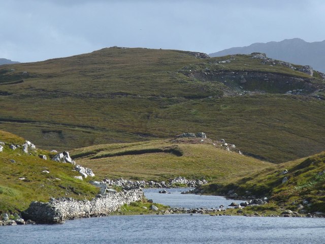
The headland is characterized by its steep cliffs, which are composed of ancient sandstone and shale formations. These cliffs provide a nesting habitat for various seabird species, including guillemots, razorbills, and fulmars. The area is also home to a diverse range of marine life, with seals often spotted basking on the rocks below.
Grianan Mòr is a popular destination for hikers and nature enthusiasts, who are drawn to its dramatic coastal scenery and abundant wildlife. There are several walking trails that wind their way along the headland, offering visitors the opportunity to explore its rugged beauty. Along the paths, one can find wildflowers and grasses, adding a splash of color to the otherwise rocky landscape.
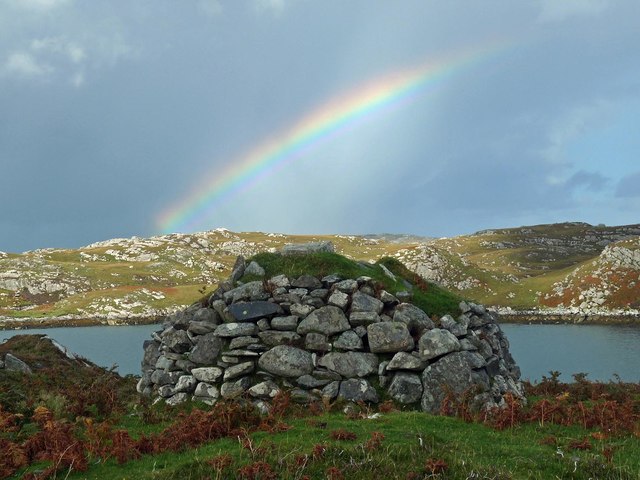
In addition to its natural beauty, Grianan Mòr also holds historical significance. The headland is home to the ruins of an ancient fort, believed to date back to the Iron Age. The fort, known as Grianan of Aileach, is thought to have been a strategic stronghold and ceremonial site. Its remains consist of circular stone walls, providing a glimpse into Scotland's rich ancient past.
Overall, Grianan Mòr is a captivating coastal feature that combines natural splendor with historical intrigue. Whether it's for a leisurely hike, birdwatching, or exploring ancient ruins, this headland offers a captivating experience for all who visit.
If you have any feedback on the listing, please let us know in the comments section below.
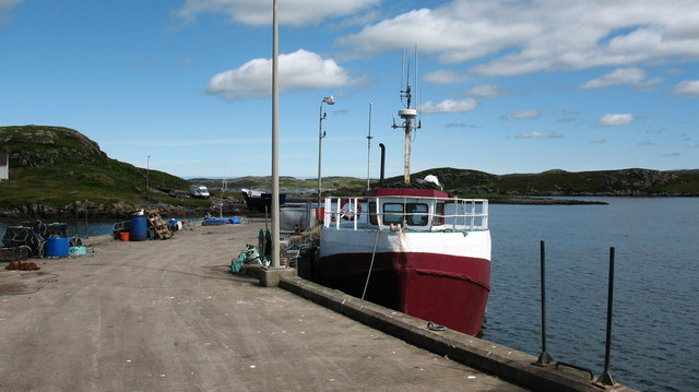
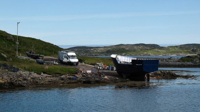
Grianan Mòr Images
Images are sourced within 2km of 58.217573/-6.7973897 or Grid Reference NB1835. Thanks to Geograph Open Source API. All images are credited.


Grianan Mòr is located at Grid Ref: NB1835 (Lat: 58.217573, Lng: -6.7973897)
Unitary Authority: Na h-Eileanan an Iar
Police Authority: Highlands and Islands
What 3 Words
///enlighten.rungs.second. Near Carloway, Na h-Eileanan Siar
Related Wikis

Ceabhaigh
Ceabhaigh is a small island in an arm of Loch Ròg on the west coast of Lewis in the Outer Hebrides of Scotland. It is about 25 hectares (62 acres) in extent...

Callanish VIII
The Callanish VIII stone setting is one of many megalithic structures around the better-known (and larger) Calanais I on the west coast of the Isle of...
Eilean Chearstaidh
Eilean Kearstay (Scottish Gaelic: Eilean Chearstaigh) is an uninhabited island in Loch Roag in the Outer Hebrides of Scotland. It lies south east of Great...

Breaclete
Breacleit (or Roulanish; Scottish Gaelic: Breacleit; Old Norse: Breiðiklettr) is the central village on Great Bernera in the Outer Hebrides, Scotland....

Tolsta Chaolais
Tolsta Chaolais (also Tolastadh Chaolais, Tolstadh a' Chaolais) is a village on the Isle of Lewis, Scotland. It consists of about forty houses, clustered...

Dun Bharabhat, Great Bernera
Dun Bharabhat (or Dun Baravat) is an Iron Age galleried dun or "semi-broch" situated on the island of Great Bernera near Lewis in Scotland (grid reference...

Breasclete
Breasclete (Scottish Gaelic: Brèascleit) is a village and community on the west side of the Isle of Lewis, in the Outer Hebrides, Scotland. Breasclete...
Great Bernera
Great Bernera (; Scottish Gaelic: Beàrnaraigh Mòr), often known just as Bernera (Scottish Gaelic: Beàrnaraigh), is an island and community in the Outer...
Nearby Amenities
Located within 500m of 58.217573,-6.7973897Have you been to Grianan Mòr?
Leave your review of Grianan Mòr below (or comments, questions and feedback).