Geodha Mhic Eòin Riabhaich
Coastal Feature, Headland, Point in Argyllshire
Scotland
Geodha Mhic Eòin Riabhaich

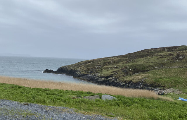
Geodha Mhic Eòin Riabhaich is a prominent headland located in Argyllshire, Scotland. Situated along the picturesque coastline, this coastal feature is known for its rugged beauty and stunning views of the surrounding landscape.
The headland is characterized by steep cliffs that rise dramatically from the sea, providing a dramatic backdrop to the crashing waves below. These cliffs are composed of sedimentary rocks, revealing layers of geological history that have been shaped by centuries of erosion.
Geodha Mhic Eòin Riabhaich is a popular destination for nature enthusiasts and hikers, offering a variety of walking trails that showcase the area's natural beauty. The headland is home to a diverse range of flora and fauna, including seabirds, wildflowers, and even occasional sightings of marine mammals such as seals and dolphins.
The panoramic views from the headland are truly breathtaking, allowing visitors to admire the vast expanse of the Atlantic Ocean and the nearby islands that dot the coastline. On a clear day, it is even possible to catch a glimpse of the distant mountains on the mainland.
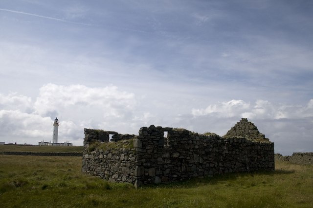
In addition to its natural beauty, Geodha Mhic Eòin Riabhaich also holds cultural significance. The headland is named after the MacEwan clan, who once inhabited the area. Their presence is still felt through the remnants of ancient settlements and ruins that can be found scattered throughout the landscape.
Overall, Geodha Mhic Eòin Riabhaich is a must-visit destination for those seeking to immerse themselves in the rugged beauty of Scotland's coastal scenery. With its stunning cliffs, diverse wildlife, and rich cultural history, this headland offers a truly unforgettable experience for all who visit.
If you have any feedback on the listing, please let us know in the comments section below.
Geodha Mhic Eòin Riabhaich Images
Images are sourced within 2km of 55.673859/-6.4827593 or Grid Reference NR1851. Thanks to Geograph Open Source API. All images are credited.


Geodha Mhic Eòin Riabhaich is located at Grid Ref: NR1851 (Lat: 55.673859, Lng: -6.4827593)
Unitary Authority: Argyll and Bute
Police Authority: Argyll and West Dunbartonshire
What 3 Words
///decimal.dispenser.peroxide. Near Portnahaven, Argyll & Bute
Related Wikis

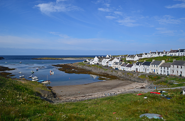
Portnahaven
Portnahaven (Scottish Gaelic: Port na h-Abhainne, meaning river port) is a village on Islay in the Inner Hebrides, Scotland. The village is within the...

Orsay, Inner Hebrides
Orsay (Scottish Gaelic: Orasaigh) is a small island in the Inner Hebrides of Scotland. It lies a short distance off the west coast of the island of Islay...

Eilean Mhic Coinnich
Eilean Mhic Coinnich, also known as Mackenzie Island (although recorded on the Land Register as McKenseys Island), is an uninhabited island of 17.3 hectares...

Easter Ellister
Easter Ellister (Aolastradh) is a settlement on the Rinns of Islay on Islay in the Inner Hebrides of Scotland. It lies just off the A847 road between Portnahaven...
Nearby Amenities
Located within 500m of 55.673859,-6.4827593Have you been to Geodha Mhic Eòin Riabhaich?
Leave your review of Geodha Mhic Eòin Riabhaich below (or comments, questions and feedback).