Eilean nan Gobhar
Island in Argyllshire
Scotland
Eilean nan Gobhar

Eilean nan Gobhar is a small uninhabited island located off the west coast of Scotland in Argyllshire. The island is part of the Inner Hebrides archipelago and lies in the Sound of Islay, between the islands of Islay and Jura.
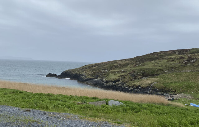
Covering an area of approximately 10 hectares, Eilean nan Gobhar is characterized by rugged and rocky terrain, with steep cliffs rising from the shoreline. The island is predominantly composed of basalt, a volcanic rock, which gives it a distinctive appearance.
The name "Eilean nan Gobhar" translates to "Island of the Goats" in Gaelic, reflecting the presence of feral goats that inhabit the island. These goats were believed to have been introduced centuries ago and have since adapted to the harsh conditions of the island, grazing on the sparse vegetation.
Due to its remote location and lack of facilities, Eilean nan Gobhar is rarely visited by humans. However, it is a popular destination for birdwatchers, as the island provides nesting sites for various seabirds, including guillemots, razorbills, and shags.
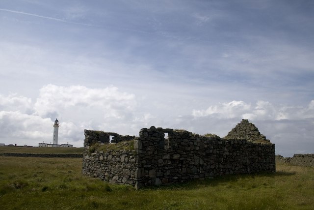
In addition to its natural beauty and wildlife, Eilean nan Gobhar holds historical significance. There are remnants of ancient buildings on the island, including a ruined chapel and a burial ground, indicating human occupation in the past. These remnants offer insights into the island's history and its importance as a site of cultural heritage.
If you have any feedback on the listing, please let us know in the comments section below.
Eilean nan Gobhar Images
Images are sourced within 2km of 55.672451/-6.4818977 or Grid Reference NR1851. Thanks to Geograph Open Source API. All images are credited.


Eilean nan Gobhar is located at Grid Ref: NR1851 (Lat: 55.672451, Lng: -6.4818977)
Unitary Authority: Argyll and Bute
Police Authority: Argyll and West Dunbartonshire
What 3 Words
///trip.servers.affirming. Near Portnahaven, Argyll & Bute
Related Wikis

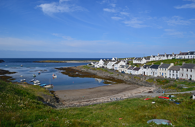
Portnahaven
Portnahaven (Scottish Gaelic: Port na h-Abhainne, meaning river port) is a village on Islay in the Inner Hebrides, Scotland. The village is within the...

Orsay, Inner Hebrides
Orsay (Scottish Gaelic: Orasaigh) is a small island in the Inner Hebrides of Scotland. It lies a short distance off the west coast of the island of Islay...

Eilean Mhic Coinnich
Eilean Mhic Coinnich, also known as Mackenzie Island (although recorded on the Land Register as McKenseys Island), is an uninhabited island of 17.3 hectares...

Easter Ellister
Easter Ellister (Aolastradh) is a settlement on the Rinns of Islay on Islay in the Inner Hebrides of Scotland. It lies just off the A847 road between Portnahaven...
Nearby Amenities
Located within 500m of 55.672451,-6.4818977Have you been to Eilean nan Gobhar?
Leave your review of Eilean nan Gobhar below (or comments, questions and feedback).