Leac Mhurchaidh
Coastal Feature, Headland, Point in Argyllshire
Scotland
Leac Mhurchaidh

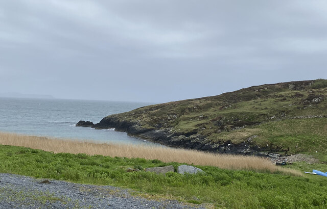
Leac Mhurchaidh is a prominent headland located in Argyllshire, a county in western Scotland. Situated along the picturesque coastline, this coastal feature attracts visitors with its stunning natural beauty and rich historical significance.
The headland of Leac Mhurchaidh is characterized by its rugged cliffs, which offer breathtaking panoramic views of the surrounding area. The cliffs are composed of a mix of sedimentary rock formations, providing a glimpse into the geological history of the region.
Leac Mhurchaidh is renowned for its diverse wildlife. The surrounding waters are teeming with marine life, making it an ideal spot for birdwatching and observing seals, dolphins, and occasionally even whales. The headland's vegetation is also notable, with a variety of wildflowers and grasses adding vibrant colors to the landscape.
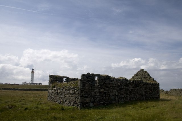
In addition to its natural beauty, Leac Mhurchaidh holds historical significance. It is believed to have been an important vantage point for ancient settlers, who used the headland to survey the coastline and protect their territories. Evidence of ancient settlements, such as stone structures and burial sites, have been discovered in the vicinity.
Visitors to Leac Mhurchaidh can enjoy various outdoor activities. The headland offers excellent opportunities for hiking, with several well-marked trails to explore. Fishing and boating are also popular activities in the surrounding waters, attracting both locals and tourists alike.
Overall, Leac Mhurchaidh is a captivating coastal feature that showcases the natural beauty and cultural heritage of Argyllshire. Its stunning cliffs, diverse wildlife, and historical significance make it a must-visit destination for nature enthusiasts and history buffs alike.
If you have any feedback on the listing, please let us know in the comments section below.
Leac Mhurchaidh Images
Images are sourced within 2km of 55.672186/-6.4903828 or Grid Reference NR1751. Thanks to Geograph Open Source API. All images are credited.


Leac Mhurchaidh is located at Grid Ref: NR1751 (Lat: 55.672186, Lng: -6.4903828)
Unitary Authority: Argyll and Bute
Police Authority: Argyll and West Dunbartonshire
What 3 Words
///admits.spires.simulations. Near Portnahaven, Argyll & Bute
Nearby Locations
Related Wikis

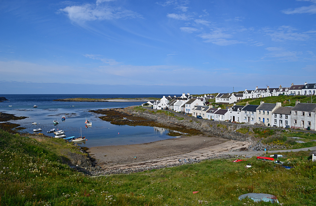
Portnahaven
Portnahaven (Scottish Gaelic: Port na h-Abhainne, meaning river port) is a village on Islay in the Inner Hebrides, Scotland. The village is within the...

Orsay, Inner Hebrides
Orsay (Scottish Gaelic: Orasaigh) is a small island in the Inner Hebrides of Scotland. It lies a short distance off the west coast of the island of Islay...

Eilean Mhic Coinnich
Eilean Mhic Coinnich, also known as Mackenzie Island (although recorded on the Land Register as McKenseys Island), is an uninhabited island of 17.3 hectares...

Islay LIMPET
Islay LIMPET was the world's first commercial wave power device and was connected to the United Kingdom's National Grid. == History == Islay LIMPET (Land...

Easter Ellister
Easter Ellister (Aolastradh) is a settlement on the Rinns of Islay on Islay in the Inner Hebrides of Scotland. It lies just off the A847 road between Portnahaven...

Rhinns complex
The Rhinns complex is a deformed Palaeoproterozoic igneous complex that is considered to form the basement to the Colonsay Group of metasedimentary rocks...

Nerabus
Nerabus (otherwise Nereabolls) is a hamlet in the west of the isle of Islay in Scotland. The vicinity is noted for its scenic qualities and diverse birdlife...

Rinns of Islay
The Rinns of Islay (Scottish Gaelic: Na Roinn Ìleach; alternative English spelling Rhinns of Islay) is an area on the west of the island of Islay in the...
Nearby Amenities
Located within 500m of 55.672186,-6.4903828Have you been to Leac Mhurchaidh?
Leave your review of Leac Mhurchaidh below (or comments, questions and feedback).