Creagan Dubh

Coastal Feature, Headland, Point in Ross-shire

Scotland

Creagan Dubh

Shieling at the head of Loch Strome Ruined shieling (Airigh nan Carn) with the remains of the township of Strome on the water's edge, and the hill Stromacleit behind.
Shieling at the head of Loch Strome Credit: Sarah Egan

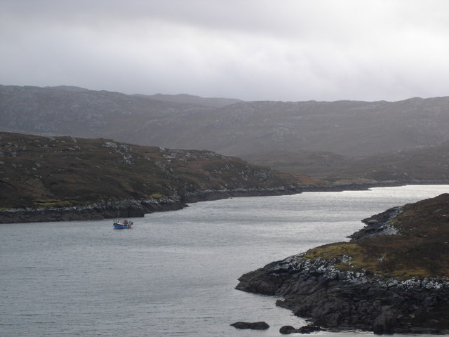
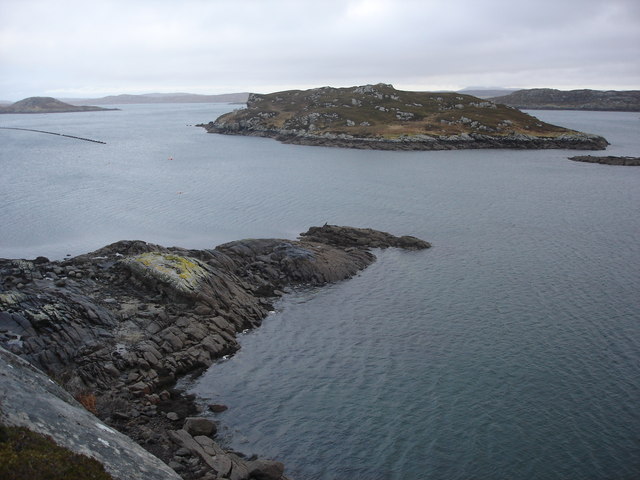
Creagan Dubh is a prominent coastal feature located in Ross-shire, Scotland. It is a headland that juts out into the sea, forming a distinctive point along the coast. The name "Creagan Dubh" translates to "black rocks" in English, which accurately describes the dark-colored rocks that make up the headland.

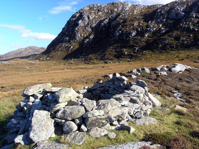
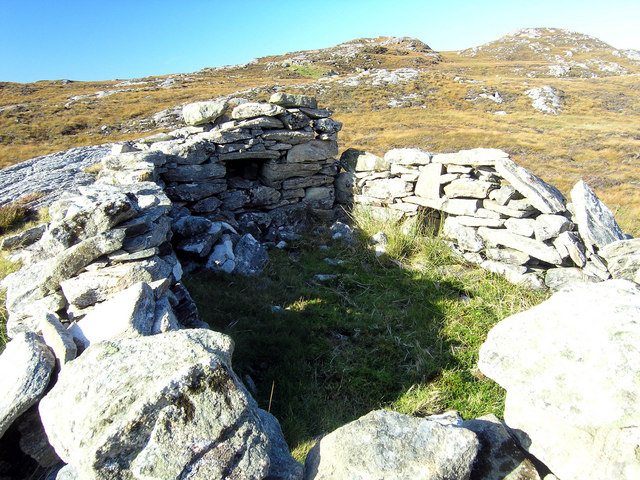
This coastal feature is known for its rugged and dramatic scenery. The headland is characterized by steep cliffs that rise from the crashing waves below. The cliffs are composed of ancient rock formations, providing a glimpse into the geological history of the area. Visitors to Creagan Dubh can witness the sheer power of the ocean as it relentlessly pounds against the rocks, creating a mesmerizing display of spray and foam.

The headland also offers stunning panoramic views of the surrounding coastline. From the top, one can see the vast expanse of the sea merging with the sky on the horizon, while the rugged coastline stretches out in both directions. On clear days, it is even possible to spot wildlife such as seabirds, seals, and occasionally dolphins or whales.

Creagan Dubh is a popular destination for nature enthusiasts and photographers who are drawn to its natural beauty and scenic vistas. The headland provides ample opportunities for hiking, exploring, and taking in the breathtaking sights. It is a place where visitors can immerse themselves in the untamed beauty of the Scottish coast and experience the raw power of nature.

If you have any feedback on the listing, please let us know in the comments section below.

Creagan Dubh Images

Images are sourced within 2km of 58.184661/-6.8587729 or Grid Reference NB1432. Thanks to Geograph Open Source API. All images are credited.

Shieling at the head of Loch Strome Ruined shieling (Airigh nan Carn) with the remains of the township of Strome on the water's edge, and the hill Stromacleit behind.
Shieling at the head of Loch Strome
Ruined shieling (Airigh nan Carn) with the remains of the township of Strome on the water's edge, and the hill Stromacleit behind.
Village of Strome Ruined blackhouses in the village of Strome at the head of Loch Strome.
Village of Strome
Ruined blackhouses in the village of Strome at the head of Loch Strome.
Loch Strome Ruins in the deserted village of Strome, looking down Loch Strome towards Loch Roag.
Loch Strome
Ruins in the deserted village of Strome, looking down Loch Strome towards Loch Roag.
Shieling below Sron Mhor Ruined shieling near Strome.
Shieling below Sron Mhor
Ruined shieling near Strome.
Shieling near Strome Ruined shieling (and another visible in the distance) on moorland below Sron Mhor.
Shieling near Strome
Ruined shieling (and another visible in the distance) on moorland below Sron Mhor.
Cliatasay On the island of Cliatasay in Loch Roag, on the site of a kelp kiln.  Vuia Mhor is visible in the distance.  The Geshader crofters used to graze their bull on this island.
Cliatasay
On the island of Cliatasay in Loch Roag, on the site of a kelp kiln. Vuia Mhor is visible in the distance. The Geshader crofters used to graze their bull on this island.
Cliatasay The rather featureless west-side of Cliatasay in Loch Roag; evidence of an old peat-cutting.
Cliatasay
The rather featureless west-side of Cliatasay in Loch Roag; evidence of an old peat-cutting.
Loch an Strom and Aird Orasaigh Loch an Strom (Norse = Straumr meaning a tidal current) and Aird Orasaigh (Norse = Orfirsey meaning a tidal island)
Loch an Strom and Aird Orasaigh
Loch an Strom (Norse = Straumr meaning a tidal current) and Aird Orasaigh (Norse = Orfirsey meaning a tidal island)
An Sruth A lonely lobster boat at the mouth of Little Loch Roag known as An Sruth.  A typical fjord being shallower and narrower at the mouth than further in as the glacier deposited its accumulated muck on its way out to the open sea.
An Sruth
A lonely lobster boat at the mouth of Little Loch Roag known as An Sruth. A typical fjord being shallower and narrower at the mouth than further in as the glacier deposited its accumulated muck on its way out to the open sea.
Ganstotal and Garbh Eilean A rock fishing mark at the cultivated area to the rear of Geisiadar known as Ganstotal.  The island of Garbh Eilean being the destination for swimming challenges for local youth.
Ganstotal and Garbh Eilean
A rock fishing mark at the cultivated area to the rear of Geisiadar known as Ganstotal. The island of Garbh Eilean being the destination for swimming challenges for local youth.
Show me another place!

Creagan Dubh is located at Grid Ref: NB1432 (Lat: 58.184661, Lng: -6.8587729)

Unitary Authority: Na h-Eileanan an Iar

Police Authority: Highlands and Islands

What 3 Words

///serious.mentioned.pairings. Near Carloway, Na h-Eileanan Siar

Related Wikis

Fuaigh Beag

Fuaigh Beag or Vuia Be(a)g is an island in the Outer Hebrides. It is off the west coast of Lewis near Great Bernera in Loch Roag. Its name means "little...

Loch Ròg

Loch Ròg or Loch Roag is a large sea loch on the west coast of Lewis, Outer Hebrides. It is broadly divided into East Loch Roag and West Loch Roag with...

Callanish VIII

The Callanish VIII stone setting is one of many megalithic structures around the better-known (and larger) Calanais I on the west coast of the Isle of...

Fuaigh Mòr

Fuaigh Mòr (sometimes anglicised as Vuia Mor) is an island in the Outer Hebrides of Scotland. It is off the west coast of Lewis near Great Bernera in...

Nearby Amenities

Located within 500m of 58.184661,-6.8587729
Loch Drobhanais
Natural: bay
Lat/Long: 58.1838779/-6.8645485
The data included in this document is from www.openstreetmap.org. The data is made available under ODbL.

Have you been to Creagan Dubh?

Leave your review of Creagan Dubh below (or comments, questions and feedback).