Croth Sithsag

Coastal Feature, Headland, Point in Ross-shire

Scotland

Croth Sithsag

Camas Bastadh/Bostadh Spelled differently on the map and gazetteer.
Camas Bastadh/Bostadh Credit: John Lucas

Croth Sithsag is a prominent coastal feature located in Ross-shire, Scotland. It is classified as a headland, also known as a point, due to its elongated and narrow shape jutting out into the sea. Situated on the northern coast of Scotland, Croth Sithsag offers breathtaking views of the surrounding landscape and the vast expanse of the North Atlantic Ocean.

The headland is characterized by its rugged cliffs, which rise steeply from the sea to a height of approximately 100 meters. These cliffs are composed of sedimentary rock formations, bearing witness to millions of years of geological history. They display intricate patterns and colors, adding to the natural beauty of the area.

Croth Sithsag is also home to a diverse range of flora and fauna. The headland's exposed position and the nutrient-rich waters of the North Atlantic create an ideal habitat for various marine species. Seabirds, such as gannets, puffins, and guillemots, can be seen nesting on the cliffs, while seals and dolphins are often spotted swimming offshore.

The headland is a popular destination for nature enthusiasts, hikers, and photographers, who are drawn to its stunning vistas and abundant wildlife. There are several walking trails that meander along the coastline, allowing visitors to explore the headland and its surroundings. Additionally, Croth Sithsag offers opportunities for fishing, rock climbing, and birdwatching.

Overall, Croth Sithsag is a remarkable coastal feature in Ross-shire, offering a captivating blend of dramatic cliffs, diverse wildlife, and breathtaking views. It is a must-visit destination for those seeking to immerse themselves in Scotland's natural beauty.

If you have any feedback on the listing, please let us know in the comments section below.

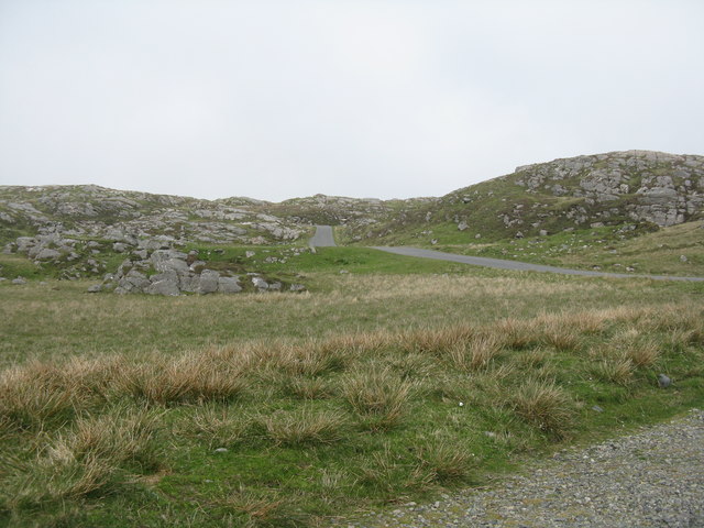
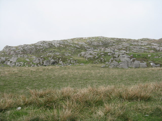
Croth Sithsag Images

Images are sourced within 2km of 58.24096/-6.8688587 or Grid Reference NB1438. Thanks to Geograph Open Source API. All images are credited.

Camas Bastadh/Bostadh Spelled differently on the map and gazetteer.
Camas Bastadh/Bostadh
Spelled differently on the map and gazetteer.
The cemetery at Bostadh Perhaps not a surprising number of burials for such a remote location, as it is a very desirable place to be laid to rest.
The cemetery at Bostadh
Perhaps not a surprising number of burials for such a remote location, as it is a very desirable place to be laid to rest.
The road to Bostadh With Siaram Bostadh in mid view on the left side.
The road to Bostadh
With Siaram Bostadh in mid view on the left side.
Bostadh Iron Age House The reconstructed house, viewed looking south.
Bostadh Iron Age House
The reconstructed house, viewed looking south.
Information about Bostadh Iron Age Village The Gaelic version.
Information about Bostadh Iron Age Village
The Gaelic version.
Information about Bostadh Iron Age Village The English version.
Information about Bostadh Iron Age Village
The English version.
Public convenience at Bostadh Near the end of the road at the cemetery and Iron Age Village.
Public convenience at Bostadh
Near the end of the road at the cemetery and Iron Age Village.
Camas Bostadh Sand dunes at Bostadh, looking to a cloud-covered Flodaigh.
Camas Bostadh
Sand dunes at Bostadh, looking to a cloud-covered Flodaigh.
Beach at Bostadh Looking across Camas Bostadh, with part of Flodaigh on the right.
Beach at Bostadh
Looking across Camas Bostadh, with part of Flodaigh on the right.
Iron Age Village at Bostadh A reconstructed house and, farther up the valley, traces of other houses.
Iron Age Village at Bostadh
A reconstructed house and, farther up the valley, traces of other houses.
View from an Iron Age house Looking over Traigh Bosdtadh to Camus Bostadh and Flodaigh, from the enclosure surrounding the reconstructed house.
View from an Iron Age house
Looking over Traigh Bosdtadh to Camus Bostadh and Flodaigh, from the enclosure surrounding the reconstructed house.
Garden Tiger Moth larva A larva of Arctia caja on the path close to the Iron Age house at Bostadh. Thin plant growth on sand, with clear signs of rabbit grazing.
Garden Tiger Moth larva
A larva of Arctia caja on the path close to the Iron Age house at Bostadh. Thin plant growth on sand, with clear signs of rabbit grazing.
Iron Age House at Bostadh The inland end. Beyond is the path down from the car park.
Iron Age House at Bostadh
The inland end. Beyond is the path down from the car park.
Entrance to the Iron Age House A gap in the surrounding wall leads to the top of steps leading down to an underground entrance.
Entrance to the Iron Age House
A gap in the surrounding wall leads to the top of steps leading down to an underground entrance.
Iron Age House Underground doorway at the foot of the entrance steps. It is possible to go inside when the site is open.
Iron Age House
Underground doorway at the foot of the entrance steps. It is possible to go inside when the site is open.
Steps at the Iron Age House Leading up from the underground entrance.
Steps at the Iron Age House
Leading up from the underground entrance.
The road from Bostadh Near the cul-de-sac by the cemetery and Iron Age Village, at the northern end of Great Bernera/Beàrnaraigh.
The road from Bostadh
Near the cul-de-sac by the cemetery and Iron Age Village, at the northern end of Great Bernera/Beàrnaraigh.
Cnoc Ruinagaidh A rocky out crop near the roadend at Bostadh.
Cnoc Ruinagaidh
A rocky out crop near the roadend at Bostadh.
Show me another place!

Croth Sithsag is located at Grid Ref: NB1438 (Lat: 58.24096, Lng: -6.8688587)

Unitary Authority: Na h-Eileanan an Iar

Police Authority: Highlands and Islands

What 3 Words

///dummy.poodle.insolvent. Near Carloway, Na h-Eileanan Siar

Related Wikis

Bernera Riot

The Bernera Riot occurred in 1874, on the island of Great Bernera, in Scotland in response to the Highland Clearances. The use of the term 'Bernera Riot...

Great Bernera

Great Bernera (; Scottish Gaelic: Beàrnaraigh Mòr), often known just as Bernera (Scottish Gaelic: Beàrnaraigh), is an island and community in the Outer...

Breaclete

Breacleit (or Roulanish; Scottish Gaelic: Breacleit; Old Norse: Breiðiklettr) is the central village on Great Bernera in the Outer Hebrides, Scotland....

Little Bernera

Little Bernera (Scottish Gaelic: Beàrnaraigh Beag) is a small island situated off the west coast of the Isle of Lewis in the Outer Hebrides.Little Bernera...

Nearby Amenities

Located within 500m of 58.24096,-6.8688587
Passing Place
Lat/Long: 58.240021/-6.8733152
Passing Place
Lat/Long: 58.2425452/-6.8671837
Passing Place
Lat/Long: 58.242085/-6.8643244
Passing Place
Lat/Long: 58.2388294/-6.8629512
Passing Place
Lat/Long: 58.2382731/-6.8620338
Tòpsann
Alt Name Gd: Tòbsun;Tobsunn
Name En: Tobson
Name Gd: Tòpsann
Place: village
Lat/Long: 58.2428063/-6.8736748
Turning Circle
Lat/Long: 58.2408917/-6.8725834
Power: pole
Lat/Long: 58.2424157/-6.8764105
Power: pole
Lat/Long: 58.2426602/-6.8761069
Power: pole
Lat/Long: 58.2429565/-6.8754531
Power: pole
Lat/Long: 58.2432793/-6.8748176
Power: pole
Lat/Long: 58.2433221/-6.8740727
Power: pole
Lat/Long: 58.2431095/-6.8733077
Power: pole
Lat/Long: 58.2428707/-6.8721926
Power: pole
Lat/Long: 58.2425737/-6.8709253
Power: pole
Lat/Long: 58.2424335/-6.8699592
Power: pole
Lat/Long: 58.2423242/-6.8690948
Power: pole
Lat/Long: 58.2421638/-6.867964
Power: pole
Lat/Long: 58.2419537/-6.8666881
Power: pole
Lat/Long: 58.2413811/-6.865963
Power: pole
Lat/Long: 58.24068/-6.8656595
Power: pole
Lat/Long: 58.2404163/-6.8651359
Power: pole
Lat/Long: 58.2400302/-6.8642737
Power: pole
Lat/Long: 58.2394718/-6.8635085
Power: pole
Lat/Long: 58.2390619/-6.862863
Power: pole
Lat/Long: 58.2386413/-6.8621227
Power: pole
Lat/Long: 58.2436152/-6.8730804
Power: pole
Lat/Long: 58.2438025/-6.8730282
Power: pole
Lat/Long: 58.244163/-6.8730716
Power: pole
Lat/Long: 58.2427989/-6.8749275
Power: pole
Lat/Long: 58.2425452/-6.874154
Power: pole
Lat/Long: 58.242171/-6.873987
Power: pole
Lat/Long: 58.2417385/-6.8737251
Power: pole
Lat/Long: 58.2413287/-6.8734994
Power: pole
Lat/Long: 58.2408772/-6.8731744
Power: pole
Lat/Long: 58.2404484/-6.8732737
Power: pole
Lat/Long: 58.2398965/-6.873183
Power: pole
Lat/Long: 58.2394641/-6.8732196
Power: pole
Lat/Long: 58.2389651/-6.8728065
Power: pole
Lat/Long: 58.242234/-6.8661187
Power: pole
Lat/Long: 58.2428352/-6.866859
Power: pole
Lat/Long: 58.2431446/-6.8672539
Power: pole
Lat/Long: 58.2431292/-6.8681847
Power: pole
Lat/Long: 58.2431183/-6.869105
Power: pole
Lat/Long: 58.2430995/-6.8698389
Generator Method: photovoltaic
Generator Output Electricity: small_installation
Generator Source: solar
Generator Type: solar_photovoltaic_panel
Power: generator
Lat/Long: 58.2399317/-6.8646669
Barrier: cattle_grid
Lat/Long: 58.242499/-6.8671949
Passing Place
Lat/Long: 58.2424042/-6.8653561
Barrier: cattle_grid
Lat/Long: 58.2424404/-6.8664117
Barrier: cattle_grid
Lat/Long: 58.2434611/-6.8731038
Passing Place
Lat/Long: 58.2430038/-6.8704274
Barrier: cattle_grid
Lat/Long: 58.2430898/-6.8703707
Barrier: cattle_grid
Lat/Long: 58.2427758/-6.8686009
Passing Place
Lat/Long: 58.2424893/-6.8746869
Barrier: cattle_grid
Lat/Long: 58.2424233/-6.8746393
Generator Method: photovoltaic
Generator Output Electricity: small_installation
Generator Source: solar
Generator Type: solar_photovoltaic_panel
Power: generator
Lat/Long: 58.2387265/-6.8721918
Power: pole
Lat/Long: 58.2421901/-6.8763299
Power: pole
Lat/Long: 58.2420059/-6.8769884
Passing Place
Lat/Long: 58.2399208/-6.863548
Passing Place
Lat/Long: 58.2412724/-6.8642375
Great Bernera Walk
Hiking: yes
Information: guidepost
Tourism: information
Lat/Long: 58.2381731/-6.8743635
Great Bernera Walk
Hiking: yes
Information: guidepost
Tourism: information
Lat/Long: 58.2375798/-6.873574
Great Bernera Walk
Hiking: yes
Information: guidepost
Tourism: information
Lat/Long: 58.2369888/-6.8727561
The data included in this document is from www.openstreetmap.org. The data is made available under ODbL.

Have you been to Croth Sithsag?

Leave your review of Croth Sithsag below (or comments, questions and feedback).