Achavandra Muir

Settlement in Sutherland

Scotland

Achavandra Muir

Footbridge across Skelbo Burn Visited whilst geocaching.
Footbridge across Skelbo Burn Credit: David Bremner

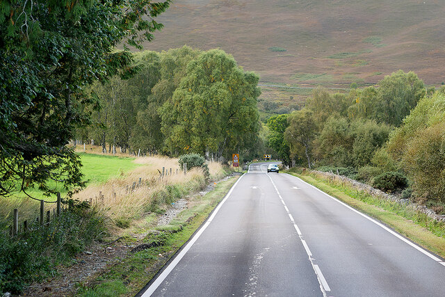
Achavandra Muir is a small rural area located in the county of Sutherland, in the northern part of Scotland. Situated in the Highland region, this tranquil place is known for its breathtaking natural beauty and picturesque landscapes.

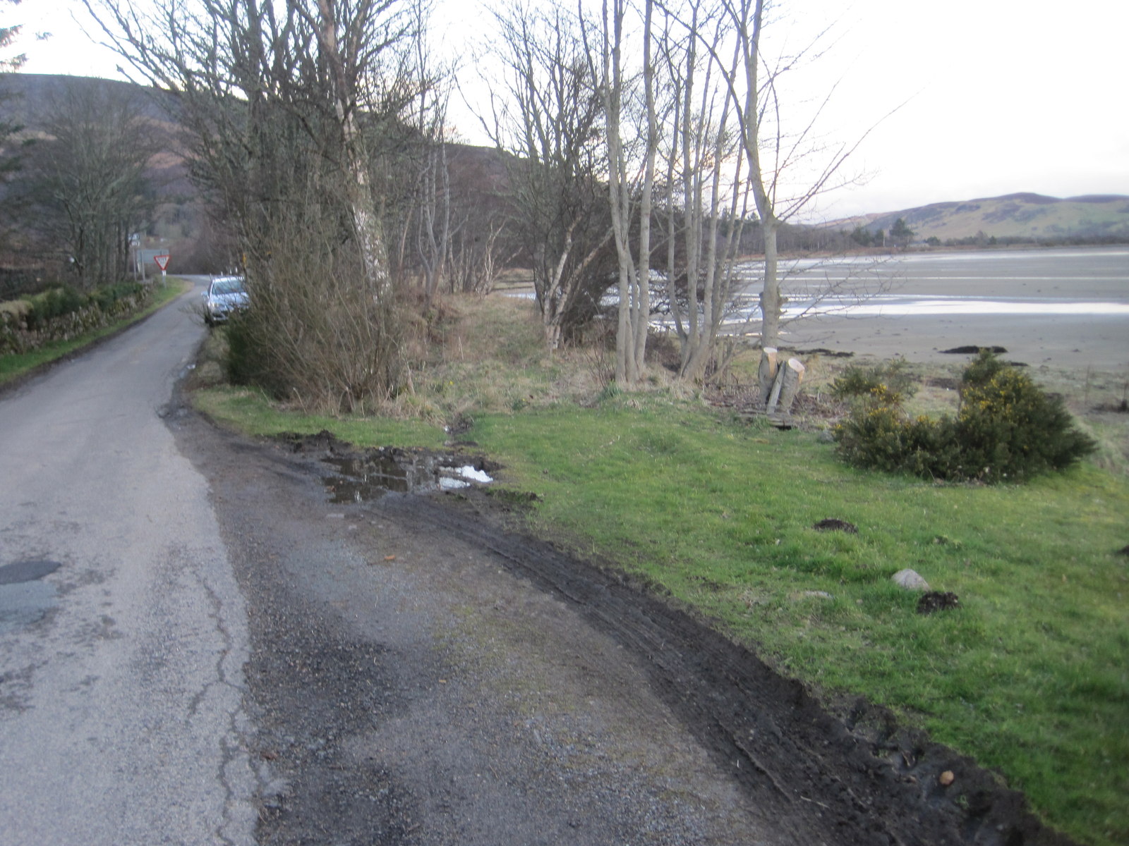
The area is characterized by vast open fields, rolling hills, and meandering rivers. It is surrounded by lush greenery, making it an ideal destination for nature lovers and outdoor enthusiasts. Achavandra Muir is also home to a diverse range of wildlife, including various bird species and mammals.

The peacefulness and serenity of Achavandra Muir attract many visitors who seek a break from the hustle and bustle of city life. The area offers numerous opportunities for outdoor activities, such as hiking, cycling, and fishing. Its scenic beauty also makes it a popular spot for photography and painting enthusiasts.

Achavandra Muir is sparsely populated, with only a handful of residential properties and farms dotted across the landscape. The community here is known for its friendly and welcoming nature, creating a warm and inviting atmosphere for both residents and visitors alike.

Despite its rural setting, Achavandra Muir is easily accessible by road, with nearby towns and villages providing amenities such as shops, restaurants, and accommodation options. The area's remote location and untouched beauty make it a hidden gem in the Scottish Highlands, offering a peaceful retreat for those seeking tranquility and natural splendor.

If you have any feedback on the listing, please let us know in the comments section below.

Achavandra Muir Images

Images are sourced within 2km of 57.918927/-4.076717 or Grid Reference NH7794. Thanks to Geograph Open Source API. All images are credited.

Footbridge across Skelbo Burn Visited whilst geocaching.
Footbridge across Skelbo Burn
Visited whilst geocaching.
A9, northbound The A9 is a strategic link between the Highlands of Scotland and the Central Belt. It runs 279 miles from junction 5 of the M9 at Polmont to Scrabster. Originally it ran from Edinburgh.
<span class="nowrap"><a title="https://www.sabre-roads.org.uk/wiki/index.php?title=A9" rel="nofollow ugc noopener" href="https://www.sabre-roads.org.uk/wiki/index.php?title=A9">Link</a><img style="margin-left:2px;" alt="External link" title="External link - shift click to open in new window" src="https://s1.geograph.org.uk/img/external.png" width="10" height="10"/></span>
A9, northbound
The A9 is a strategic link between the Highlands of Scotland and the Central Belt. It runs 279 miles from junction 5 of the M9 at Polmont to Scrabster. Originally it ran from Edinburgh. LinkExternal link
Northbound A9 near Tamiang The A9 is a strategic link between the Highlands of Scotland and the Central Belt. Running for 273 miles, it is the longest road in Scotland and the fifth-longest A-road in the United Kingdom. Historically it was the main road between Edinburgh and John o' Groats but its importance has been eclipsed somewhat in the south by the A90 across the Forth Road Bridge and the M90 motorway, which now links Edinburgh more directly with Perth, and the M9, which is now the main road between Edinburgh and Bridge of Allan.
Northbound A9 near Tamiang
The A9 is a strategic link between the Highlands of Scotland and the Central Belt. Running for 273 miles, it is the longest road in Scotland and the fifth-longest A-road in the United Kingdom. Historically it was the main road between Edinburgh and John o' Groats but its importance has been eclipsed somewhat in the south by the A90 across the Forth Road Bridge and the M90 motorway, which now links Edinburgh more directly with Perth, and the M9, which is now the main road between Edinburgh and Bridge of Allan.
Northbound A9 The A9 is a strategic link between the Highlands of Scotland and the Central Belt. Running for 273 miles, it is the longest road in Scotland and the fifth-longest A-road in the United Kingdom. Historically it was the main road between Edinburgh and John o' Groats but its importance has been eclipsed somewhat in the south by the A90 across the Forth Road Bridge and the M90 motorway, which now links Edinburgh more directly with Perth, and the M9, which is now the main road between Edinburgh and Bridge of Allan.
Northbound A9
The A9 is a strategic link between the Highlands of Scotland and the Central Belt. Running for 273 miles, it is the longest road in Scotland and the fifth-longest A-road in the United Kingdom. Historically it was the main road between Edinburgh and John o' Groats but its importance has been eclipsed somewhat in the south by the A90 across the Forth Road Bridge and the M90 motorway, which now links Edinburgh more directly with Perth, and the M9, which is now the main road between Edinburgh and Bridge of Allan.
Northbound A9 near Poles The A9 is a strategic link between the Highlands of Scotland and the Central Belt. Running for 273 miles, it is the longest road in Scotland and the fifth-longest A-road in the United Kingdom. Historically it was the main road between Edinburgh and John o' Groats but its importance has been eclipsed somewhat in the south by the A90 across the Forth Road Bridge and the M90 motorway, which now links Edinburgh more directly with Perth, and the M9, which is now the main road between Edinburgh and Bridge of Allan.
Northbound A9 near Poles
The A9 is a strategic link between the Highlands of Scotland and the Central Belt. Running for 273 miles, it is the longest road in Scotland and the fifth-longest A-road in the United Kingdom. Historically it was the main road between Edinburgh and John o' Groats but its importance has been eclipsed somewhat in the south by the A90 across the Forth Road Bridge and the M90 motorway, which now links Edinburgh more directly with Perth, and the M9, which is now the main road between Edinburgh and Bridge of Allan.
A9 north of Poles The A9 is a strategic link between the Highlands of Scotland and the Central Belt. Running for 273 miles, it is the longest road in Scotland and the fifth-longest A-road in the United Kingdom. Historically it was the main road between Edinburgh and John o' Groats but its importance has been eclipsed somewhat in the south by the A90 across the Forth Road Bridge and the M90 motorway, which now links Edinburgh more directly with Perth, and the M9, which is now the main road between Edinburgh and Bridge of Allan.
A9 north of Poles
The A9 is a strategic link between the Highlands of Scotland and the Central Belt. Running for 273 miles, it is the longest road in Scotland and the fifth-longest A-road in the United Kingdom. Historically it was the main road between Edinburgh and John o' Groats but its importance has been eclipsed somewhat in the south by the A90 across the Forth Road Bridge and the M90 motorway, which now links Edinburgh more directly with Perth, and the M9, which is now the main road between Edinburgh and Bridge of Allan.
Northbound A9 The A9 is a strategic link between the Highlands of Scotland and the Central Belt. Running for 273 miles, it is the longest road in Scotland and the fifth-longest A-road in the United Kingdom. Historically it was the main road between Edinburgh and John o' Groats but its importance has been eclipsed somewhat in the south by the A90 across the Forth Road Bridge and the M90 motorway, which now links Edinburgh more directly with Perth, and the M9, which is now the main road between Edinburgh and Bridge of Allan.
Northbound A9
The A9 is a strategic link between the Highlands of Scotland and the Central Belt. Running for 273 miles, it is the longest road in Scotland and the fifth-longest A-road in the United Kingdom. Historically it was the main road between Edinburgh and John o' Groats but its importance has been eclipsed somewhat in the south by the A90 across the Forth Road Bridge and the M90 motorway, which now links Edinburgh more directly with Perth, and the M9, which is now the main road between Edinburgh and Bridge of Allan.
A9, Skelbo Wood The A9 is a strategic link between the Highlands of Scotland and the Central Belt. Running for 273 miles, it is the longest road in Scotland and the fifth-longest A-road in the United Kingdom. Historically it was the main road between Edinburgh and John o' Groats but its importance has been eclipsed somewhat in the south by the A90 across the Forth Road Bridge and the M90 motorway, which now links Edinburgh more directly with Perth, and the M9, which is now the main road between Edinburgh and Bridge of Allan.
A9, Skelbo Wood
The A9 is a strategic link between the Highlands of Scotland and the Central Belt. Running for 273 miles, it is the longest road in Scotland and the fifth-longest A-road in the United Kingdom. Historically it was the main road between Edinburgh and John o' Groats but its importance has been eclipsed somewhat in the south by the A90 across the Forth Road Bridge and the M90 motorway, which now links Edinburgh more directly with Perth, and the M9, which is now the main road between Edinburgh and Bridge of Allan.
Skelbo Wood, Northbound A9 The A9 is a strategic link between the Highlands of Scotland and the Central Belt. Running for 273 miles, it is the longest road in Scotland and the fifth-longest A-road in the United Kingdom. Historically it was the main road between Edinburgh and John o' Groats but its importance has been eclipsed somewhat in the south by the A90 across the Forth Road Bridge and the M90 motorway, which now links Edinburgh more directly with Perth, and the M9, which is now the main road between Edinburgh and Bridge of Allan.
Skelbo Wood, Northbound A9
The A9 is a strategic link between the Highlands of Scotland and the Central Belt. Running for 273 miles, it is the longest road in Scotland and the fifth-longest A-road in the United Kingdom. Historically it was the main road between Edinburgh and John o' Groats but its importance has been eclipsed somewhat in the south by the A90 across the Forth Road Bridge and the M90 motorway, which now links Edinburgh more directly with Perth, and the M9, which is now the main road between Edinburgh and Bridge of Allan.
A9 near to Ardshave The A9 is a strategic link between the Highlands of Scotland and the Central Belt. Running for 273 miles, it is the longest road in Scotland and the fifth-longest A-road in the United Kingdom. Historically it was the main road between Edinburgh and John o' Groats but its importance has been eclipsed somewhat in the south by the A90 across the Forth Road Bridge and the M90 motorway, which now links Edinburgh more directly with Perth, and the M9, which is now the main road between Edinburgh and Bridge of Allan.
A9 near to Ardshave
The A9 is a strategic link between the Highlands of Scotland and the Central Belt. Running for 273 miles, it is the longest road in Scotland and the fifth-longest A-road in the United Kingdom. Historically it was the main road between Edinburgh and John o' Groats but its importance has been eclipsed somewhat in the south by the A90 across the Forth Road Bridge and the M90 motorway, which now links Edinburgh more directly with Perth, and the M9, which is now the main road between Edinburgh and Bridge of Allan.
Northbound A9 near Ardshave The A9 is a strategic link between the Highlands of Scotland and the Central Belt. Running for 273 miles, it is the longest road in Scotland and the fifth-longest A-road in the United Kingdom. Historically it was the main road between Edinburgh and John o' Groats but its importance has been eclipsed somewhat in the south by the A90 across the Forth Road Bridge and the M90 motorway, which now links Edinburgh more directly with Perth, and the M9, which is now the main road between Edinburgh and Bridge of Allan.
Northbound A9 near Ardshave
The A9 is a strategic link between the Highlands of Scotland and the Central Belt. Running for 273 miles, it is the longest road in Scotland and the fifth-longest A-road in the United Kingdom. Historically it was the main road between Edinburgh and John o' Groats but its importance has been eclipsed somewhat in the south by the A90 across the Forth Road Bridge and the M90 motorway, which now links Edinburgh more directly with Perth, and the M9, which is now the main road between Edinburgh and Bridge of Allan.
Warning of deer - A9 northbound
Junction signage - A9 northbound
Access point to property off A9
Chevrons of A9 northbound
Skelbo Wood signage
Skelbo Wood signage
Junction to Balvraid - A9 northbound
Show me another place!

Achavandra Muir is located at Grid Ref: NH7794 (Lat: 57.918927, Lng: -4.076717)

Unitary Authority: Highland

Police Authority: Highlands and Islands

What 3 Words

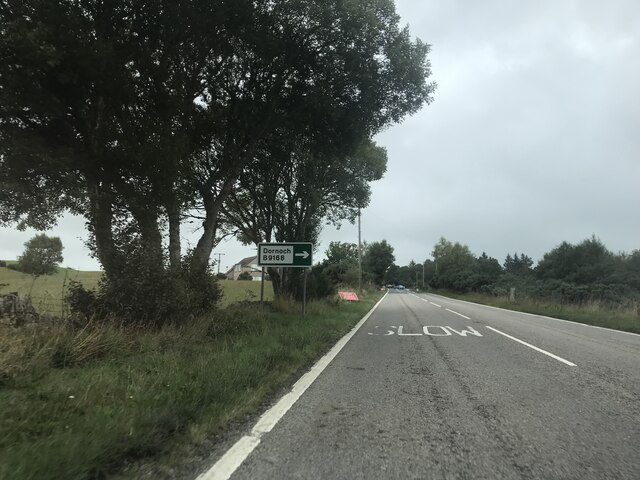
///evolution.forum.drop. Near Dornoch, Highland

Related Wikis

Achavandra Muir

Achavandra Muir (Scottish Gaelic: Achadh Anndra - Andrew's Field) is a hamlet in the Scottish Highlands in northeastern Scotland, about 7 kilometres from...

Badninish

Badninish is a small crofting hamlet in Dornoch, Sutherland, Highland, Scotland. == References ==

Proncycroy

Proncycroy (Scottish Gaelic: Prannsaidh Cruaidh) is a settlement in the Sutherland region in the Scottish council area of Highland, and is located less...

Cambusavie Platform railway station

Cambusavie platform formerly served Cambusavie in Sutherland, Scotland. == History == The station was opened in 1902. It was a request stop only. The station...

Skelbo railway station

Skelbo railway station was a halt on the Dornoch Light Railway serving the village of Skelbo in Sutherland, Scotland. == History == The station was opened...

Rearquhar

Rearquhar is a township, which lies in the valley of the River Evelix, 4 miles northwest from Dornoch, in Sutherland, Scottish Highlands and is in the...

Evelix

Evelix or Evelick (Scottish Gaelic: Èibhleag) is a village near Dornoch in south east Sutherland, Scotland. The River Evelix runs through it. Evelix is...

Battle of Skibo and Strathfleet

The Battle of Skibo and Strathfleet was prompted by Clan Donald's invasion of the area around Dornoch in northern Scotland in 1480. Two attacks were repulsed...

Nearby Amenities

Located within 500m of 57.918927,-4.076717
Achavandra Muir
Name Gd: Achadh Anndra
Place: hamlet
Lat/Long: 57.9173945/-4.0688473
Power: pole
Lat/Long: 57.9181012/-4.0811863
Power: pole
Lat/Long: 57.918003/-4.0800067
Power: pole
Lat/Long: 57.9178876/-4.0789955
Power: pole
Lat/Long: 57.9177863/-4.0779844
Power: pole
Lat/Long: 57.9175533/-4.0758383
Power: pole
Lat/Long: 57.9174336/-4.0746261
Power: pole
Lat/Long: 57.917301/-4.0733937
Power: pole
Lat/Long: 57.9172136/-4.0724678
Power: pole
Lat/Long: 57.9171964/-4.0712029
Power: pole
Lat/Long: 57.9171985/-4.0703988
Power: pole
Lat/Long: 57.9171964/-4.0692435
Power: pole
Lat/Long: 57.9183573/-4.0809873
Power: pole
Lat/Long: 57.9183616/-4.0799082
Power: pole
Lat/Long: 57.9184123/-4.0794727
The data included in this document is from www.openstreetmap.org. The data is made available under ODbL.

Have you been to Achavandra Muir?

Leave your review of Achavandra Muir below (or comments, questions and feedback).