Sgeir Dhubh

Coastal Feature, Headland, Point in Ross-shire

Scotland

Sgeir Dhubh

Heronry on cliff face, Loch Rog Beag, North Harris These herons are very unusual nesting on the open cliff face rather than in tree tops.  The eggs are very vulnerable to predation by Buzzards and Ravens.  Despite our guided tour RIB remaining well away we observed 2 eggs being taken by groups of Ravens attacking, distracting the parents and "sneaking in".  Nature is hard to observe sometimes.
Heronry on cliff face, Loch Rog Beag, North Harris Credit: Hazel Hambidge

Sgeir Dhubh, located in Ross-shire, Scotland, is a prominent coastal feature known for its striking headland and point. Situated along the rugged and picturesque coastline, Sgeir Dhubh offers breathtaking views of the surrounding landscape and the vast Atlantic Ocean.

This headland is characterized by its rocky cliffs, which jut out into the sea, creating a dramatic and imposing sight. The cliffs are composed of rugged, weathered rocks, adding to the grandeur of the location. Sgeir Dhubh's height and position make it an ideal spot for observing marine wildlife, including seabirds, seals, and occasionally dolphins.

The point of Sgeir Dhubh is marked by a distinctive rock formation that juts out into the water. This point is often used as a navigational landmark by sailors and fishermen, as it is easily visible from a distance. The rock formation is composed of basalt, giving it a dark and rugged appearance, which contrasts with the pale blue waters of the ocean.

Due to its prominent location and stunning natural beauty, Sgeir Dhubh has become a popular attraction for tourists and nature enthusiasts. Visitors can hike along the coastal path, taking in the panoramic views and enjoying the fresh sea breeze. The headland also offers opportunities for rock climbing and birdwatching, providing a diverse range of activities for outdoor enthusiasts.

Overall, Sgeir Dhubh is a captivating coastal feature, with its impressive headland and striking rock formation. It offers a unique opportunity to experience the rugged beauty of the Scottish coastline and immerse oneself in the natural wonders of the area.

If you have any feedback on the listing, please let us know in the comments section below.
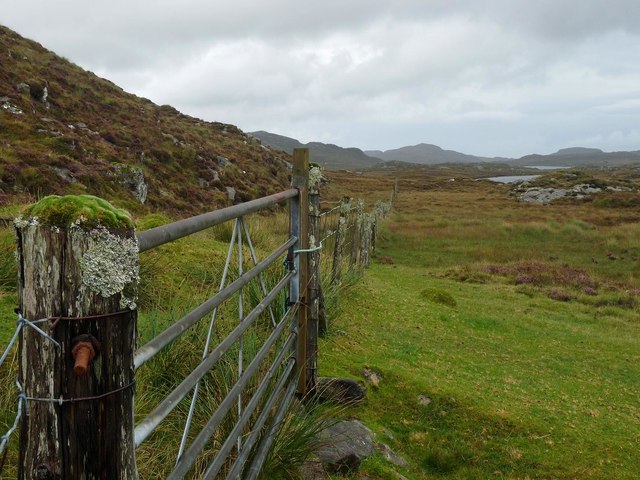
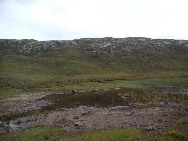
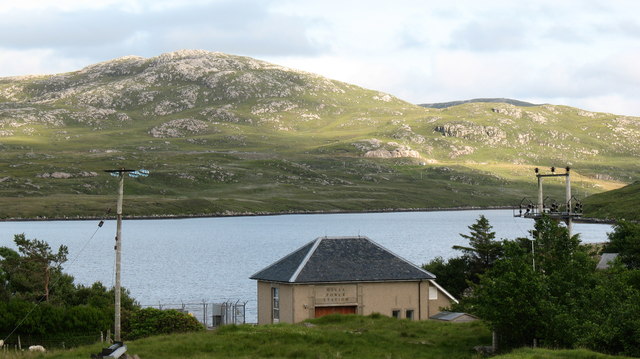
Sgeir Dhubh Images

Images are sourced within 2km of 58.127216/-6.8692794 or Grid Reference NB1325. Thanks to Geograph Open Source API. All images are credited.

Heronry on cliff face, Loch Rog Beag, North Harris These herons are very unusual nesting on the open cliff face rather than in tree tops.  The eggs are very vulnerable to predation by Buzzards and Ravens.  Despite our guided tour RIB remaining well away we observed 2 eggs being taken by groups of Ravens attacking, distracting the parents and "sneaking in".  Nature is hard to observe sometimes.
Heronry on cliff face, Loch Rog Beag, North Harris
These herons are very unusual nesting on the open cliff face rather than in tree tops. The eggs are very vulnerable to predation by Buzzards and Ravens. Despite our guided tour RIB remaining well away we observed 2 eggs being taken by groups of Ravens attacking, distracting the parents and "sneaking in". Nature is hard to observe sometimes.
West Bank, Loch Rog Beag, North Harris View almost south from RIB towards west bank of this narrow sea loch.
West Bank, Loch Rog Beag, North Harris
View almost south from RIB towards west bank of this narrow sea loch.
Gisla Power Station Small HEP station on the western shore of Loch Rog Beag at Giosla.
Gisla Power Station
Small HEP station on the western shore of Loch Rog Beag at Giosla.
B8011 cut through the hillside By the bottom of Loch Ròg Beag
B8011 cut through the hillside
By the bottom of Loch Ròg Beag
Gisla Power Station A small hydroelectric power station, using water piped from Loch Coirceabhat.
Gisla Power Station
A small hydroelectric power station, using water piped from Loch Coirceabhat.
Enaclete: rainbow over Loch Ròg Beag Having visited the Flannan Isles today, in fine weather, it was clear as we approached the Lewis coast on our return that Lewis itself had not fared so fortunately. However, sunshine did break through as we approached Miavaig harbour and, by the time we set foot ashore the sun was shining brightly.

This would be a shortlived break in the showers, though, as this rainbow across the Loch testifies.

The B8011 has very recently been upgraded (not yet included on the 1:50,000 mapping but updated at 1:25,000 scale) and Enaclete village is now bypassed by a two-carriageway road. I am not certain but the track immediately in front of us may derive from the course of the old road.
Enaclete: rainbow over Loch Ròg Beag
Having visited the Flannan Isles today, in fine weather, it was clear as we approached the Lewis coast on our return that Lewis itself had not fared so fortunately. However, sunshine did break through as we approached Miavaig harbour and, by the time we set foot ashore the sun was shining brightly. This would be a shortlived break in the showers, though, as this rainbow across the Loch testifies. The B8011 has very recently been upgraded (not yet included on the 1:50,000 mapping but updated at 1:25,000 scale) and Enaclete village is now bypassed by a two-carriageway road. I am not certain but the track immediately in front of us may derive from the course of the old road.
View From Bridge View from the road bridge towards Loch Rog Beag.
View From Bridge
View from the road bridge towards Loch Rog Beag.
Old road bridge at Giosla
The B8011 road from Ardroil An excellent stretch of full width road - the only road which connects Ardroil to the rest of the island.
The B8011 road from Ardroil
An excellent stretch of full width road - the only road which connects Ardroil to the rest of the island.
Gate below Sgeun, Isle of Lewis Looking towards Loch Mòr Ruadh.
Gate below Sgeun, Isle of Lewis
Looking towards Loch Mòr Ruadh.
Rock on moorland near Loch Fuarail, Isle of Lewis Looking towards Loch Fuarail and Coduinn.
Rock on moorland near Loch Fuarail, Isle of Lewis
Looking towards Loch Fuarail and Coduinn.
Loch Sùrstabhat at sunset Although looking almost due north, the sun was setting just off the left of this view, taken after 10 pm (summer time). The sunset hadn't yet developed the spectacular underlit cloudscape that followed 20 minutes or so later, but the little loch caught our eye as we became increasingly distracted from the road looking for a suitable foreground. Fortunately, there are sections of the old road to safely get off the highway and wander about with a camera !
Loch Sùrstabhat at sunset
Although looking almost due north, the sun was setting just off the left of this view, taken after 10 pm (summer time). The sunset hadn't yet developed the spectacular underlit cloudscape that followed 20 minutes or so later, but the little loch caught our eye as we became increasingly distracted from the road looking for a suitable foreground. Fortunately, there are sections of the old road to safely get off the highway and wander about with a camera !
Sunset over Loch Sùrstabhat As the sky cleared from the west, the sun started to underlight the cloud cover as we passed by the upper end of Loch Sùrstabhat. The perspective and the direction of clearance has produced one of those views where the horizon looks tilted one way when seen "broad-brush" but then seems tilted the other way when the water is looked at more closely. I find the effect somewhat disturbing, but have tried to get the real horizon as level as possible. It's not helped by those electric poles all leaning towards the long span of cable across the loch...
Sunset over Loch Sùrstabhat
As the sky cleared from the west, the sun started to underlight the cloud cover as we passed by the upper end of Loch Sùrstabhat. The perspective and the direction of clearance has produced one of those views where the horizon looks tilted one way when seen "broad-brush" but then seems tilted the other way when the water is looked at more closely. I find the effect somewhat disturbing, but have tried to get the real horizon as level as possible. It's not helped by those electric poles all leaning towards the long span of cable across the loch...
Looking towards Giosla from the B8011
Giosla Looking towards Giosla across little loch roag
Giosla
Looking towards Giosla across little loch roag
Loch Beag Ruadh with ridge of Sgeun behind
Heading along the B8011 The B8011 is a scenic road leading to remote communities in west Lewis. Much of it has been upgraded in recent years.
Heading along the B8011
The B8011 is a scenic road leading to remote communities in west Lewis. Much of it has been upgraded in recent years.
Power Station at Giosla. This appears to be a small hydro-electric plant using water from Loch More Coirgavat, which is half a mile away and 50 metres higher up the hillside.
Power Station at Giosla.
This appears to be a small hydro-electric plant using water from Loch More Coirgavat, which is half a mile away and 50 metres higher up the hillside.
Show me another place!

Sgeir Dhubh is located at Grid Ref: NB1325 (Lat: 58.127216, Lng: -6.8692794)

Unitary Authority: Na h-Eileanan an Iar

Police Authority: Highlands and Islands

What 3 Words

///parent.sues.olive. Near Carloway, Na h-Eileanan Siar

Related Wikis

Gisla Hydro-Electric Scheme

Gisla Hydro-Electric Scheme was a small scheme promoted by the North of Scotland Hydro-Electric Board on the Isle of Lewis, Outer Hebrides, Scotland. It...

Fuaigh Beag

Fuaigh Beag or Vuia Be(a)g is an island in the Outer Hebrides. It is off the west coast of Lewis near Great Bernera in Loch Roag. Its name means "little...

Flodaigh, Lewis

Flodaigh is a small island in Loch Roag on the west coast of Lewis in the Outer Hebrides of Scotland. It is about 33 hectares (82 acres) in extent and...

Loch Ròg

Loch Ròg or Loch Roag is a large sea loch on the west coast of Lewis, Outer Hebrides. It is broadly divided into East Loch Roag and West Loch Roag with...

Nearby Amenities

Located within 500m of 58.127216,-6.8692794
Created By: dmgroom_coastlines
Lat/Long: 58.1249/-6.86548
Power: pole
Lat/Long: 58.1235969/-6.8737624
Power: pole
Lat/Long: 58.124215/-6.8750373
Power: pole
Lat/Long: 58.124796/-6.8761797
Power: pole
Lat/Long: 58.1236751/-6.8745005
Power: pole
Lat/Long: 58.1242366/-6.8755022
The data included in this document is from www.openstreetmap.org. The data is made available under ODbL.

Have you been to Sgeir Dhubh?

Leave your review of Sgeir Dhubh below (or comments, questions and feedback).