Lag Rainich

Coastal Marsh, Saltings in Ross-shire

Scotland

Lag Rainich

Gisla Power Station Small HEP station on the western shore of Loch Rog Beag at Giosla.
Gisla Power Station Credit: Colin Smith

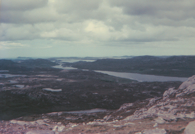
Lag Rainich, located in Ross-shire, Scotland, is a coastal marshland characterized by its stunning saltings. Spanning over a vast area, this unique ecosystem is a haven for a diverse range of plant and animal species.

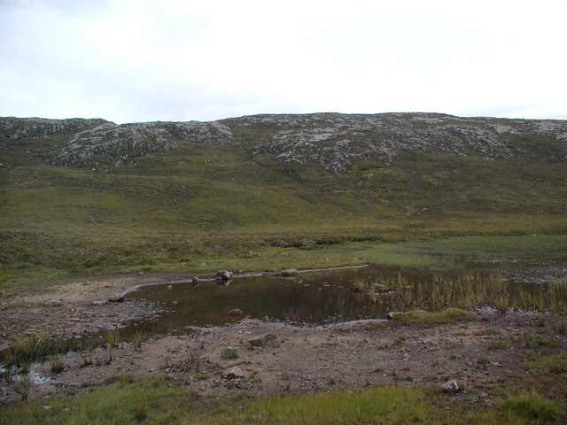
The marshland is situated along the picturesque coastline, offering breathtaking views of the surrounding landscape. Lag Rainich is known for its extensive salt marshes, which are formed by the regular flooding and subsequent drying of the area. These saltings are home to a variety of halophytic plants, such as sea lavender, saltmarsh grass, and sea aster, which have adapted to thrive in the high salt content of the soil.

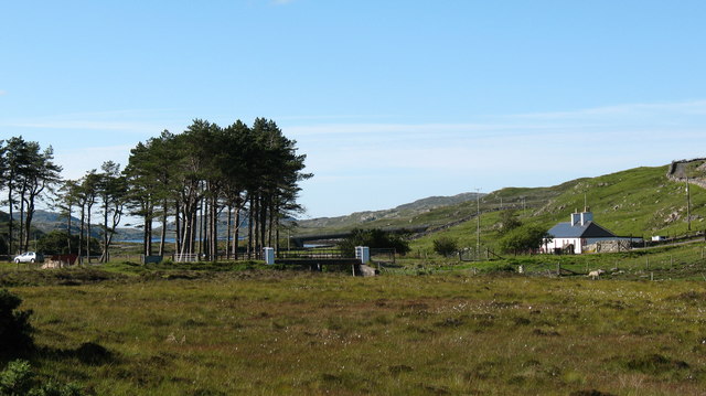
The marshland is also a vital habitat for numerous bird species, making it a popular destination for birdwatchers and nature enthusiasts. Visitors can spot a wide range of avian residents, including waders like redshanks, curlews, and oystercatchers, as well as migratory birds such as dunlins and knot during the breeding seasons.

Lag Rainich is more than just a natural paradise; it also plays a critical role in coastal protection. The salt marshes act as a buffer zone against erosion caused by tidal action and storms, safeguarding the surrounding land from damage.

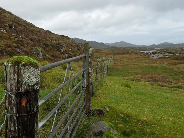
To explore Lag Rainich, visitors can follow designated trails and boardwalks that allow for easy access while minimizing disturbance to the delicate ecosystem. The marshland offers a serene and tranquil experience, providing a unique opportunity to observe and appreciate the beauty of this coastal marsh and its remarkable inhabitants.

If you have any feedback on the listing, please let us know in the comments section below.

Lag Rainich Images

Images are sourced within 2km of 58.122124/-6.8652847 or Grid Reference NB1325. Thanks to Geograph Open Source API. All images are credited.

Gisla Power Station Small HEP station on the western shore of Loch Rog Beag at Giosla.
Gisla Power Station
Small HEP station on the western shore of Loch Rog Beag at Giosla.
B8011 cut through the hillside By the bottom of Loch Ròg Beag
B8011 cut through the hillside
By the bottom of Loch Ròg Beag
Gisla Power Station A small hydroelectric power station, using water piped from Loch Coirceabhat.
Gisla Power Station
A small hydroelectric power station, using water piped from Loch Coirceabhat.
On the northern slopes of Coduinn The rocky hillside offers a view over Loch Ròg Beag, a long sea loch, and, to its west, moorland lochs and lochans.
On the northern slopes of Coduinn
The rocky hillside offers a view over Loch Ròg Beag, a long sea loch, and, to its west, moorland lochs and lochans.
Caultrashal Beag [Coltraiseal Beag] First HuMP of four today with Michael Earnshaw, Jim Bloomer and Martin Richardson in mixed weather.

Name: Caultrashal Beag [Coltraiseal Beag]
Hill number: 4941
Height: 226m / 741ft
Area: 24A: Lewis and Nearby Islands
Class: Hu,2
Grid ref: NB149241 (est)
Drop: 108m
Col: 118m  NB161233
Caultrashal Beag [Coltraiseal Beag]
First HuMP of four today with Michael Earnshaw, Jim Bloomer and Martin Richardson in mixed weather. Name: Caultrashal Beag [Coltraiseal Beag] Hill number: 4941 Height: 226m / 741ft Area: 24A: Lewis and Nearby Islands Class: Hu,2 Grid ref: NB149241 (est) Drop: 108m Col: 118m NB161233
View From Bridge View from the road bridge towards Loch Rog Beag.
View From Bridge
View from the road bridge towards Loch Rog Beag.
River Morsgail View A tributary joins the River Morsgail at a strange angle.
River Morsgail View
A tributary joins the River Morsgail at a strange angle.
Old road bridge at Giosla
The B8011 road from Ardroil An excellent stretch of full width road - the only road which connects Ardroil to the rest of the island.
The B8011 road from Ardroil
An excellent stretch of full width road - the only road which connects Ardroil to the rest of the island.
Gate below Sgeun, Isle of Lewis Looking towards Loch Mòr Ruadh.
Gate below Sgeun, Isle of Lewis
Looking towards Loch Mòr Ruadh.
Rock on moorland near Loch Fuarail, Isle of Lewis Looking towards Loch Fuarail and Coduinn.
Rock on moorland near Loch Fuarail, Isle of Lewis
Looking towards Loch Fuarail and Coduinn.
Loch Sùrstabhat at sunset Although looking almost due north, the sun was setting just off the left of this view, taken after 10 pm (summer time). The sunset hadn't yet developed the spectacular underlit cloudscape that followed 20 minutes or so later, but the little loch caught our eye as we became increasingly distracted from the road looking for a suitable foreground. Fortunately, there are sections of the old road to safely get off the highway and wander about with a camera !
Loch Sùrstabhat at sunset
Although looking almost due north, the sun was setting just off the left of this view, taken after 10 pm (summer time). The sunset hadn't yet developed the spectacular underlit cloudscape that followed 20 minutes or so later, but the little loch caught our eye as we became increasingly distracted from the road looking for a suitable foreground. Fortunately, there are sections of the old road to safely get off the highway and wander about with a camera !
Sunset over Loch Sùrstabhat As the sky cleared from the west, the sun started to underlight the cloud cover as we passed by the upper end of Loch Sùrstabhat. The perspective and the direction of clearance has produced one of those views where the horizon looks tilted one way when seen "broad-brush" but then seems tilted the other way when the water is looked at more closely. I find the effect somewhat disturbing, but have tried to get the real horizon as level as possible. It's not helped by those electric poles all leaning towards the long span of cable across the loch...
Sunset over Loch Sùrstabhat
As the sky cleared from the west, the sun started to underlight the cloud cover as we passed by the upper end of Loch Sùrstabhat. The perspective and the direction of clearance has produced one of those views where the horizon looks tilted one way when seen "broad-brush" but then seems tilted the other way when the water is looked at more closely. I find the effect somewhat disturbing, but have tried to get the real horizon as level as possible. It's not helped by those electric poles all leaning towards the long span of cable across the loch...
Looking towards Giosla from the B8011
Road leading to Mhorsgail Lodge
Giosla Looking towards Giosla across little loch roag
Giosla
Looking towards Giosla across little loch roag
Loch Beag Ruadh with ridge of Sgeun behind
Old road bridge near Giosla. This bridge once carried the B8011 over the river that issues from Loch Morsgail. A new concrete bridge can be seen in the background.
Old road bridge near Giosla.
This bridge once carried the B8011 over the river that issues from Loch Morsgail. A new concrete bridge can be seen in the background.
Show me another place!

Lag Rainich is located at Grid Ref: NB1325 (Lat: 58.122124, Lng: -6.8652847)

Unitary Authority: Na h-Eileanan an Iar

Police Authority: Highlands and Islands

What 3 Words

///videos.postage.positives. Near Carloway, Na h-Eileanan Siar

Related Wikis

Gisla Hydro-Electric Scheme

Gisla Hydro-Electric Scheme was a small scheme promoted by the North of Scotland Hydro-Electric Board on the Isle of Lewis, Outer Hebrides, Scotland. It...

Fuaigh Beag

Fuaigh Beag or Vuia Be(a)g is an island in the Outer Hebrides. It is off the west coast of Lewis near Great Bernera in Loch Roag. Its name means "little...

Eilean Mòr, Loch Langavat

Eilean Mòr is an island in Loch Langavat on the Isle of Lewis in the Outer Hebrides of Scotland. == Footnotes ==

Flodaigh, Lewis

Flodaigh is a small island in Loch Roag on the west coast of Lewis in the Outer Hebrides of Scotland. It is about 33 hectares (82 acres) in extent and...

Nearby Amenities

Located within 500m of 58.122124,-6.8652847
Created By: dmgroom_coastlines
Lat/Long: 58.1249/-6.86548
Power: pole
Lat/Long: 58.1184772/-6.8666165
Power: pole
Lat/Long: 58.1192258/-6.8673275
Power: pole
Lat/Long: 58.1200686/-6.8681333
Power: pole
Lat/Long: 58.1205955/-6.868544
Power: pole
Lat/Long: 58.1212857/-6.8690677
Power: pole
Lat/Long: 58.1218388/-6.8701985
Power: pole
Lat/Long: 58.1223716/-6.8712661
Power: pole
Lat/Long: 58.123013/-6.8725819
Power: pole
Lat/Long: 58.1180005/-6.8681935
Power: pole
Lat/Long: 58.1194739/-6.8683273
Power: pole
Lat/Long: 58.1189371/-6.8682791
Power: pole
Lat/Long: 58.1199119/-6.8684102
Power: pole
Lat/Long: 58.1206464/-6.8691163
Power: pole
Lat/Long: 58.1210519/-6.8698305
Power: pole
Lat/Long: 58.1214799/-6.8706035
Power: pole
Lat/Long: 58.121955/-6.8714309
Power: pole
Lat/Long: 58.1225265/-6.8724728
Power: pole
Lat/Long: 58.1230951/-6.873488
The data included in this document is from www.openstreetmap.org. The data is made available under ODbL.

Have you been to Lag Rainich?

Leave your review of Lag Rainich below (or comments, questions and feedback).