Sgeir Ghobhlach

Coastal Feature, Headland, Point in Argyllshire

Scotland

Sgeir Ghobhlach

Plocaid Bo buoy, Gunna Sound
Plocaid Bo buoy, Gunna Sound Credit: Alpin Stewart

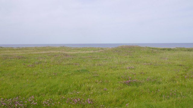
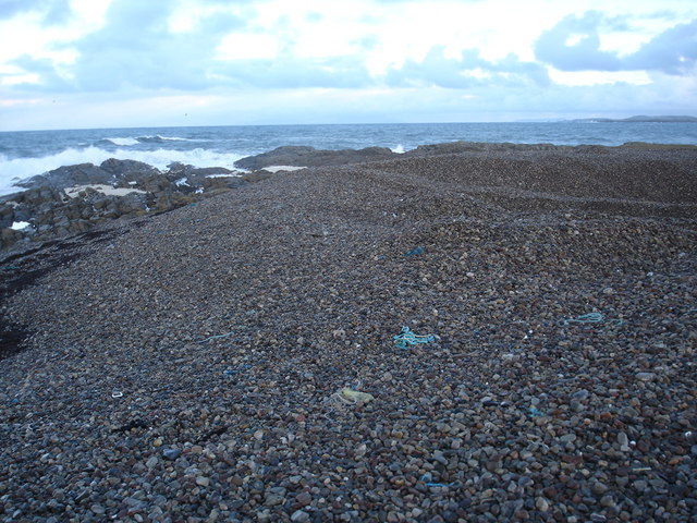
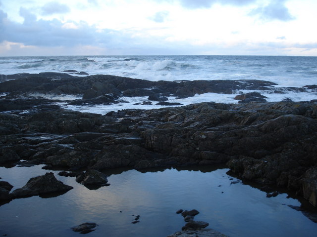
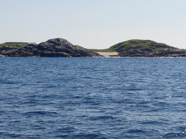
Sgeir Ghobhlach is a prominent coastal feature located in Argyllshire, Scotland. It is a headland that extends into the Atlantic Ocean, forming a distinct point along the rugged coastline. This geographical formation is characterized by its steep cliffs and rocky terrain, creating a visually striking landscape.

The headland of Sgeir Ghobhlach is situated in a remote and wild part of Argyllshire, offering breathtaking views of the surrounding area. It is known for its dramatic coastal scenery, with the crashing waves of the Atlantic Ocean meeting the imposing cliffs. The point provides an ideal vantage point to observe marine wildlife, such as seals, dolphins, and various seabird species, making it a popular spot for nature enthusiasts and birdwatchers.

Access to Sgeir Ghobhlach is mainly provided by boat or by following coastal trails. The headland is part of a designated nature reserve, ensuring its protection and preservation. Visitors to the area can enjoy hiking along the rugged coastal path, taking in the stunning vistas and immersing themselves in the unspoiled beauty of the landscape.

Due to its exposed location, Sgeir Ghobhlach is often subject to strong winds and rough seas, making it important for visitors to exercise caution and be prepared for changing weather conditions. Nonetheless, this coastal feature offers a unique and awe-inspiring experience for those seeking to explore the untamed beauty of Argyllshire's coastline.

If you have any feedback on the listing, please let us know in the comments section below.

Sgeir Ghobhlach Images

Images are sourced within 2km of 56.549022/-6.7475356 or Grid Reference NM0849. Thanks to Geograph Open Source API. All images are credited.

Plocaid Bo buoy, Gunna Sound
Port Chunn Nèill, Isle of Tiree
Northeastern corner of Tiree Coastal heath and rock at Urvaig. The basking shark tour boat is off shore with several snorkelling passengers and a couple of basking sharks.  Saw the boat from Coll the previous day but no sharks.
Northeastern corner of Tiree
Coastal heath and rock at Urvaig. The basking shark tour boat is off shore with several snorkelling passengers and a couple of basking sharks. Saw the boat from Coll the previous day but no sharks.
East coast of Tiree View past Gunna, along the coast of Coll towards the Sgùrr of Eigg.
East coast of Tiree
View past Gunna, along the coast of Coll towards the Sgùrr of Eigg.
Machair, Urvaig The northeast tip of Tiree.
Machair, Urvaig
The northeast tip of Tiree.
Urvaig, Tiree Storm beach, looking north from Urvaig, Tiree
Urvaig, Tiree
Storm beach, looking north from Urvaig, Tiree
Watching for sharks off the Sound Of Gunna Looking north from Urvaig, Tiree, across Sound of Gunna towards Isle of Coll
Watching for sharks off the Sound Of Gunna
Looking north from Urvaig, Tiree, across Sound of Gunna towards Isle of Coll
Rocky coast of the most northerly part of Tiree The house in the distance on the 1:25000 is named Urvaig, but then so is the tip of the peninsula.
Rocky coast of the most northerly part of Tiree
The house in the distance on the 1:25000 is named Urvaig, but then so is the tip of the peninsula.
Across the Gunna Sound Unsurprising it is Gunna to be seen across the sound.  Coll can be made out behind Gunna.
Across the Gunna Sound
Unsurprising it is Gunna to be seen across the sound. Coll can be made out behind Gunna.
Foam on the rocks at Urvaig Roughs seas had generated foam which has collected here, much to the amusement of the dog.
Foam on the rocks at Urvaig
Roughs seas had generated foam which has collected here, much to the amusement of the dog.
Pebble beach at Urvaig The dip in the pebbles at the right hand side is where some have been removed and probably crushed and used as aggregate.
Pebble beach at Urvaig
The dip in the pebbles at the right hand side is where some have been removed and probably crushed and used as aggregate.
Rock pool reflection at Urvaig Rough seas contrast with the flat calm on the rock pool.
Rock pool reflection at Urvaig
Rough seas contrast with the flat calm on the rock pool.
Rocks and pebble bank at Urvaig
The beach at Port Chunn Neill The Sound of Gunna and the island of Gunna in the distance.
The beach at Port Chunn Neill
The Sound of Gunna and the island of Gunna in the distance.
McNeil's Bay, Gunna
McNeil's Bay, Gunna
West end of Gunna
West end of Gunna
Port Chunn Nèill An eider creche off Tiree.
Port Chunn Nèill
An eider creche off Tiree.
Port Chunn Nèill, Tiree
Show me another place!

Sgeir Ghobhlach is located at Grid Ref: NM0849 (Lat: 56.549022, Lng: -6.7475356)

Unitary Authority: Argyll and Bute

Police Authority: Argyll and West Dunbartonshire

What 3 Words

///pans.earlobes.nobody. Near Scarinish, Argyll & Bute

Related Wikis

Gunna, Scotland

Gunna (Gaelic: Gunnaigh) is an island in the Inner Hebrides of Scotland. == Geography and geology == Gunna lies between Coll and Tiree, closer to Coll...

Dun Mor Vaul

Dun Mor Vaul (or simply Dun Mor; Scottish Gaelic: Dùn Mòr) is an iron-age broch located on the north coast of the island of Tiree, in Scotland. ��2�...

Tiree

Tiree (; Scottish Gaelic: Tiriodh, pronounced [ˈtʲʰiɾʲəɣ]) is the most westerly island in the Inner Hebrides of Scotland. The low-lying island, southwest...

Scarinish

Scarinish (Scottish Gaelic: Sgairinis [ˈs̪kaɾʲɪnɪʃ]) is the main village on the island of Tiree, in the Inner Hebrides of Scotland. It is located on the...

Nearby Amenities

Located within 500m of 56.549022,-6.7475356
Source: PGS
Lat/Long: 56.5481714/-6.7401808
Source: PGS
Lat/Long: 56.5483721/-6.7405909
Source: PGS
Lat/Long: 56.5485953/-6.7409651
Source: PGS
Lat/Long: 56.5486688/-6.7411189
Source: PGS
Lat/Long: 56.5487818/-6.7398527
Source: PGS
Lat/Long: 56.5484964/-6.7397655
Source: PGS
Lat/Long: 56.5476416/-6.742075
Source: PGS
Lat/Long: 56.5478083/-6.7419853
Source: PGS
Lat/Long: 56.5478125/-6.7418546
Source: PGS
Lat/Long: 56.5477334/-6.7420955
Source: PGS
Lat/Long: 56.5476967/-6.7421699
Source: PGS
Lat/Long: 56.5478139/-6.7419366
Source: PGS
Lat/Long: 56.5476797/-6.7418982
Source: PGS
Lat/Long: 56.5477673/-6.7417623
Source: PGS
Lat/Long: 56.5477193/-6.7417546
Source: PGS
Lat/Long: 56.5476924/-6.7418008
Barrier: cattle_grid
Lat/Long: 56.5492771/-6.7528162
Barrier: cattle_grid
Lat/Long: 56.5473998/-6.7500459
Barrier: cattle_grid
Lat/Long: 56.5449382/-6.7473305
Power: pole
Lat/Long: 56.5502729/-6.7546392
Power: pole
Lat/Long: 56.5511925/-6.7541215
Power: pole
Lat/Long: 56.547962/-6.7517477
Power: pole
Lat/Long: 56.5476619/-6.7514125
Power: pole
Lat/Long: 56.5473647/-6.751104
Power: pole
Lat/Long: 56.5470719/-6.7508009
Power: pole
Lat/Long: 56.5466756/-6.751686
Power: pole
Lat/Long: 56.5493562/-6.7551595
Power: pole
Lat/Long: 56.5486229/-6.754497
Power: pole
Lat/Long: 56.547758/-6.7537352
Power: pole
Lat/Long: 56.5470837/-6.7531157
Power: pole
Lat/Long: 56.5463385/-6.7524505
Power: pole
Lat/Long: 56.5455194/-6.7517048
Passing Place
Lat/Long: 56.5495973/-6.7529477
Passing Place
Lat/Long: 56.5462922/-6.7485667
The data included in this document is from www.openstreetmap.org. The data is made available under ODbL.

Have you been to Sgeir Ghobhlach?

Leave your review of Sgeir Ghobhlach below (or comments, questions and feedback).