Creag Toraigh

Coastal Feature, Headland, Point in Ross-shire

Scotland

Creag Toraigh

Cleitean nam Bothan Ruadha Looking northeast to Beinn a' Tuath from Cleitean nam Bothan Ruadha.
Cleitean nam Bothan Ruadha Credit: Marc Calhoun

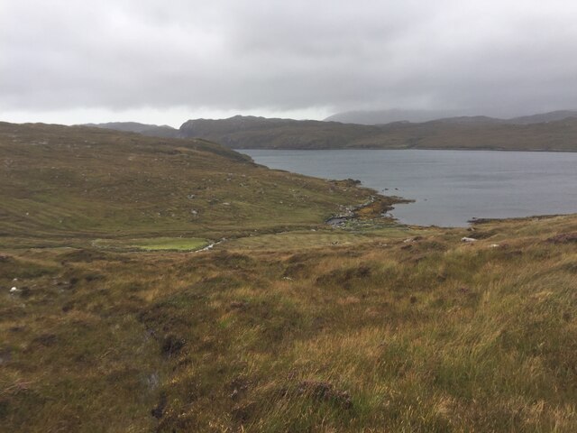
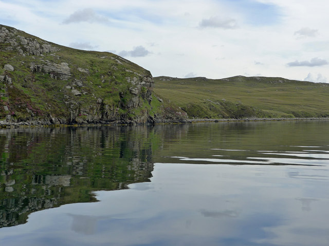
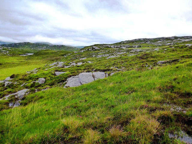
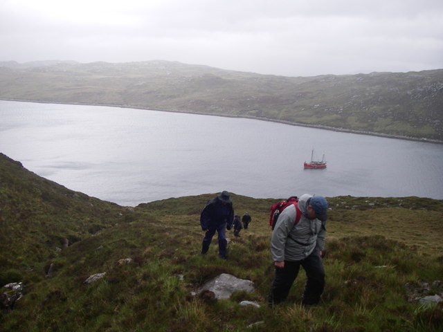
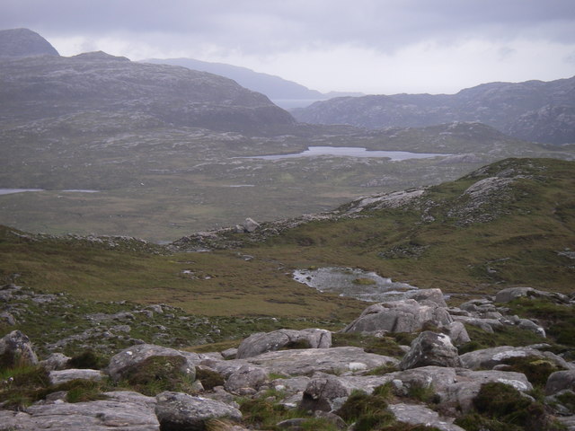
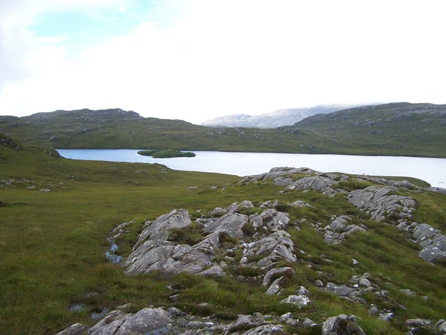
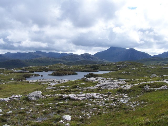
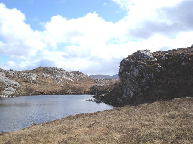
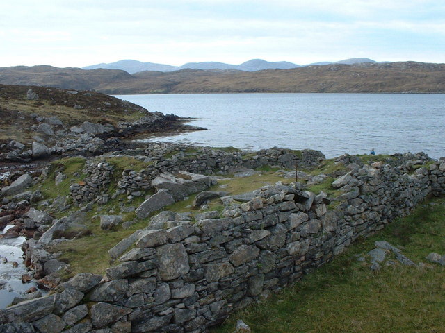
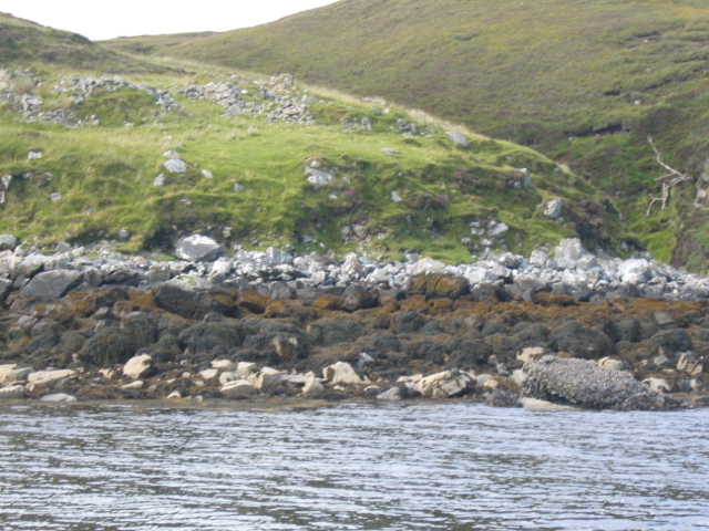
Creag Toraigh is a prominent coastal feature located in Ross-shire, Scotland. It is a stunning headland that extends into the North Sea, forming a point that juts out into the water. The headland is characterized by its rugged and rocky terrain, with cliffs rising dramatically from the sea. It offers breathtaking views of the surrounding coastline and the vast expanse of the ocean.

The name Creag Toraigh is derived from Scottish Gaelic, with "creag" meaning rock and "toraigh" meaning bull. This name is fitting, as the headland is known for its rocky outcrops and the strength and power it exudes. The cliffs at Creag Toraigh are often battered by crashing waves and strong winds, adding to its dramatic and wild beauty.

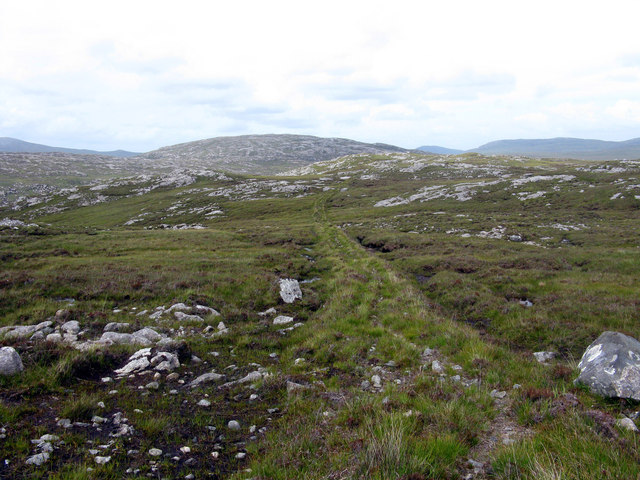
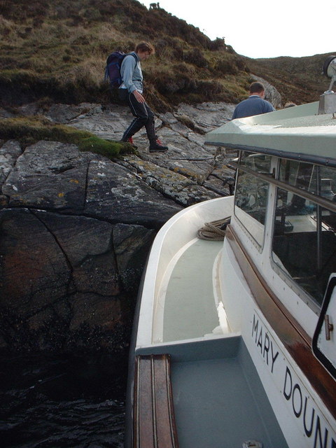
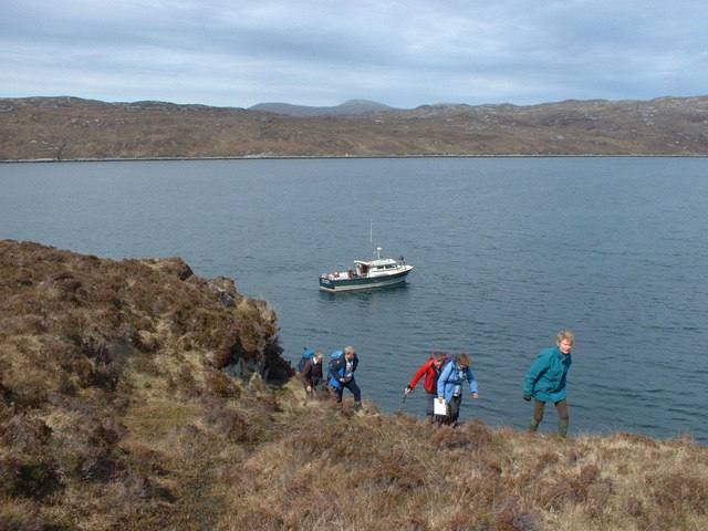
The headland is a popular destination for nature enthusiasts and hikers, offering numerous paths and trails that allow visitors to explore its rugged terrain. It is home to a diverse range of flora and fauna, including seabirds, wildflowers, and various marine species. The headland also provides nesting sites for several bird species, making it a significant area for birdwatching.

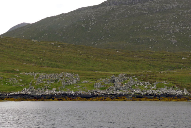
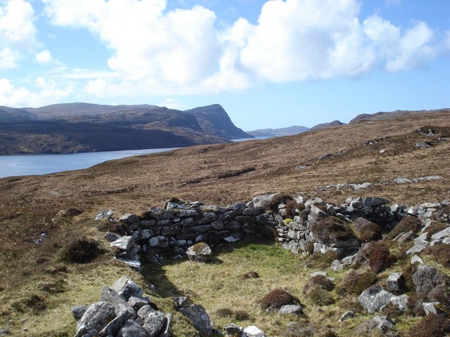
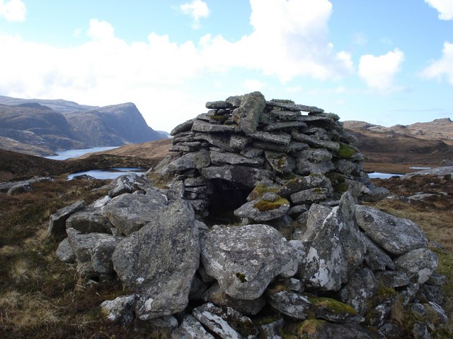
Creag Toraigh is not only known for its natural beauty but also for its historical and cultural significance. It has been a site of human activity for centuries, with archaeological remains and ancient structures found in the vicinity. These remnants provide insight into the lives of previous inhabitants and their connection to the coastal landscape.

Overall, Creag Toraigh is a captivating and awe-inspiring coastal feature that offers a unique blend of natural beauty, historical significance, and opportunities for outdoor exploration.

If you have any feedback on the listing, please let us know in the comments section below.

Creag Toraigh Images

Images are sourced within 2km of 58.052373/-6.9645015 or Grid Reference NB0717. Thanks to Geograph Open Source API. All images are credited.

Cleitean nam Bothan Ruadha Looking northeast to Beinn a' Tuath from Cleitean nam Bothan Ruadha.
Cleitean nam Bothan Ruadha
Looking northeast to Beinn a' Tuath from Cleitean nam Bothan Ruadha.
East end of Loch Bodabhat Looking southwest over the east end of Loch Bodabhat. The hill Ceartabhal above loch a' Ghlinne in the far distance.
East end of Loch Bodabhat
Looking southwest over the east end of Loch Bodabhat. The hill Ceartabhal above loch a' Ghlinne in the far distance.
Old Shielings at Dirascal Abandoned shielings at Dirascal between Cravadale and Loch Reasort (water in background).
Old Shielings at Dirascal
Abandoned shielings at Dirascal between Cravadale and Loch Reasort (water in background).
Creag an Fhithich The coastline of Loch Resort becomes less rugged on its northern side as you venture further up the loch, and beyond this point evidence appears sporadically of shielings, lazybeds and once used buildings.
Creag an Fhithich
The coastline of Loch Resort becomes less rugged on its northern side as you venture further up the loch, and beyond this point evidence appears sporadically of shielings, lazybeds and once used buildings.
The derelict houses at Dirascal This would have been a very harsh environment to make a living.
The derelict houses at Dirascal
This would have been a very harsh environment to make a living.
The path from Direascal to Kinlochresort The path from Direascal to Kinlochresort was an ambitious undertaking that had not been completed when they had to abandon Direascal in 1900. When they started building the path, workers from Luachair and Direascal met at the halfway point, and each group started building a path back to their respective villages. By the time they left in 1900, the Direascal men had made good progress; the path ended on the hillside, 200 yards east of the village. But work stopped on the other section a half mile from Luachair.
The path from Direascal to Kinlochresort
The path from Direascal to Kinlochresort was an ambitious undertaking that had not been completed when they had to abandon Direascal in 1900. When they started building the path, workers from Luachair and Direascal met at the halfway point, and each group started building a path back to their respective villages. By the time they left in 1900, the Direascal men had made good progress; the path ended on the hillside, 200 yards east of the village. But work stopped on the other section a half mile from Luachair.
Southwest slopes of Corcasmol Rocky outcrops and wet peat on the slopes of Corcasmol. (The photograph also shows some of the adjacent square <a href="https://www.geograph.org.uk/gridref/NB0518">NB0518</a> - the loch in the western corner is the southern corner of Loch Bodabhat where the Abhainn Sgianuillt flows out)
Southwest slopes of Corcasmol
Rocky outcrops and wet peat on the slopes of Corcasmol. (The photograph also shows some of the adjacent square NB0518 - the loch in the western corner is the southern corner of Loch Bodabhat where the Abhainn Sgianuillt flows out)
Above Loch Resort Climbing alongside the Allt nan Uidhean Burn
Above Loch Resort
Climbing alongside the Allt nan Uidhean Burn
Mullach an Ron View towards Scarp from Mullach an Ron.
Mullach an Ron
View towards Scarp from Mullach an Ron.
Loch Bodabhat
Loch Bodabhat
Loch a Fhraoich Aptly named translates as the Heather Loch.
Loch a Fhraoich
Aptly named translates as the Heather Loch.
Shielings above Loch Resort A view of the shielings shown on the map at this location
Shielings above Loch Resort
A view of the shielings shown on the map at this location
Beehive cairn at NB 06572 17806 This cairn is similar but smaller to the ones on the Airigh a' Chlair Mhoir  <a href="https://www.geograph.org.uk/gridref/NB120160">NB120160</a>, and is likely to be associated with the nearby shielings. Might they be smokehouses or drying houses for fish meat or grain?
Beehive cairn at NB 06572 17806
This cairn is similar but smaller to the ones on the Airigh a' Chlair Mhoir NB120160, and is likely to be associated with the nearby shielings. Might they be smokehouses or drying houses for fish meat or grain?
Loch A Fhraoich
Loch A Fhraoich
Dirascal on shore of Loch Reasort How isolated can you get!
Dirascal on shore of Loch Reasort
How isolated can you get!
Makeshift jetty on south side of Loch Reasort One of the few places where we could land without using the inflatable.
Makeshift jetty on south side of Loch Reasort
One of the few places where we could land without using the inflatable.
South shore of Loch Reasort A useful location to start an expedition over the Forest of Harris.
South shore of Loch Reasort
A useful location to start an expedition over the Forest of Harris.
Ruins at Creag an Fhithich Creag an Fhithich translates as "Rock of the Raven"
Ruins at Creag an Fhithich
Creag an Fhithich translates as "Rock of the Raven"
Show me another place!

Creag Toraigh is located at Grid Ref: NB0717 (Lat: 58.052373, Lng: -6.9645015)

Unitary Authority: Na h-Eileanan an Iar

Police Authority: Highlands and Islands

What 3 Words

///permanent.brilliant.renewals. Near Tarbert, Na h-Eileanan Siar

Related Wikis

Uladail

Uladail is a location near Amhuinnsuidhe, on Harris in the Outer Hebrides, Scotland. Sron Ulladail is a sheer cliff which at 370 metres (1,210 ft) is one...

Tiorga Mor

Tiorga Mor (679 m) is a mountain in Harris, in the Outer Hebrides of Scotland. The most westerly peak of the high mountains of Harris, it is a very rugged...

Oireabhal

Oireabhal (662 m) is a mountain in Harris, in the Outer Hebrides of Scotland. The peak is the highest point on a complex ridge that runs from north to...

Chliostair Hydro-Electric Scheme

Chliostair Hydro-Electric Scheme is a small scheme promoted by the North of Scotland Hydro-Electric Board on Harris, Outer Hebrides. It consists of a single...

Have you been to Creag Toraigh?

Leave your review of Creag Toraigh below (or comments, questions and feedback).