Loch na Cartach

Lake, Pool, Pond, Freshwater Marsh in Ross-shire

Scotland

Loch na Cartach

East end of Loch Bodabhat Looking southwest over the east end of Loch Bodabhat. The hill Ceartabhal above loch a' Ghlinne in the far distance.
East end of Loch Bodabhat Credit: Marc Calhoun

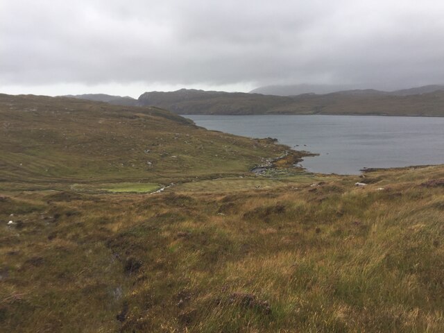
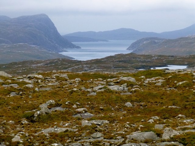
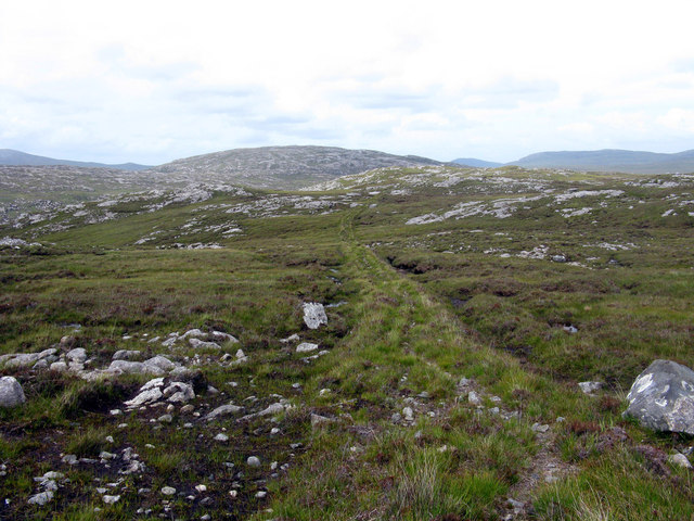
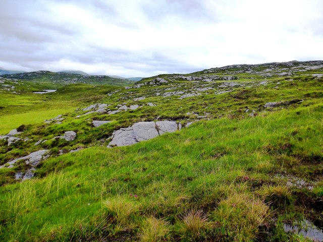
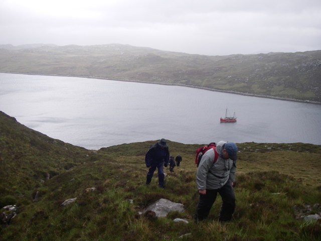
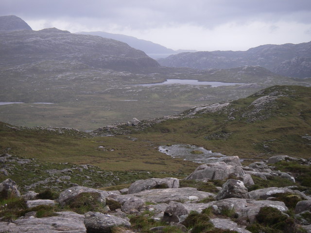
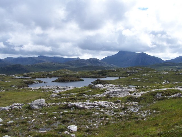
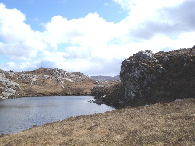
Loch na Cartach is a picturesque freshwater loch located in Ross-shire, Scotland. It is nestled among the stunning hills and mountains of the Scottish Highlands, offering visitors a tranquil escape in a beautiful natural setting. With an area of approximately 20 hectares, the loch is surrounded by lush vegetation and is home to a diverse range of flora and fauna.

The water in Loch na Cartach is crystal clear and supports a variety of aquatic life, including fish species such as brown trout and Arctic char. Anglers often flock to the loch to enjoy fishing in this serene environment. The loch also attracts waterfowl, making it a popular spot for birdwatchers.

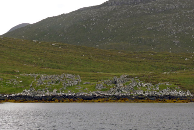
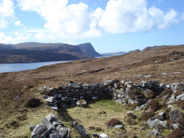
Surrounding the loch, there is a mix of wetland habitats including freshwater marshes and ponds. These wetland areas provide an important breeding ground and sanctuary for various bird species, including waterfowl, waders, and marshland birds. The presence of these wetlands also contributes to the overall biodiversity of the region, supporting a range of plant species adapted to wet conditions.

For nature enthusiasts, Loch na Cartach offers opportunities for walking and hiking along its shores, allowing visitors to admire the scenic beauty of the surrounding landscape. The loch serves as a peaceful retreat for those seeking solace in nature, providing a serene atmosphere away from the hustle and bustle of city life.

In conclusion, Loch na Cartach is a picturesque freshwater loch nestled in the Scottish Highlands. With its clear waters, diverse aquatic life, and surrounding wetlands, it serves as a haven for nature lovers and offers visitors a chance to immerse themselves in the beauty and tranquility of the Scottish countryside.

If you have any feedback on the listing, please let us know in the comments section below.

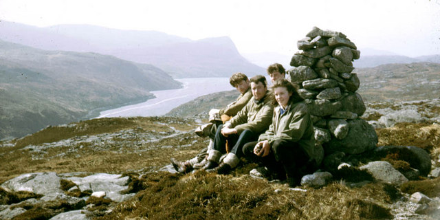
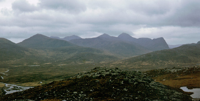
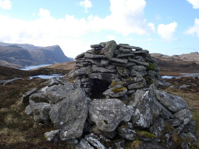
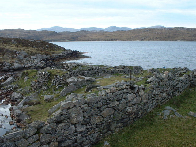
Loch na Cartach Images

Images are sourced within 2km of 58.052489/-6.9536907 or Grid Reference NB0717. Thanks to Geograph Open Source API. All images are credited.

East end of Loch Bodabhat Looking southwest over the east end of Loch Bodabhat. The hill Ceartabhal above loch a' Ghlinne in the far distance.
East end of Loch Bodabhat
Looking southwest over the east end of Loch Bodabhat. The hill Ceartabhal above loch a' Ghlinne in the far distance.
Fishing boat at Loch Beninisbhal Fishing boat on north shore of Loch Beninisbhal.
Fishing boat at Loch Beninisbhal
Fishing boat on north shore of Loch Beninisbhal.
Old Shielings at Dirascal Abandoned shielings at Dirascal between Cravadale and Loch Reasort (water in background).
Old Shielings at Dirascal
Abandoned shielings at Dirascal between Cravadale and Loch Reasort (water in background).
The derelict houses at Dirascal This would have been a very harsh environment to make a living.
The derelict houses at Dirascal
This would have been a very harsh environment to make a living.
Benisval Cairn and Trig Point Benisval is a remote on the Isle of Lewis to the north of Loch Resort.  It is a HuMP with a prominence of 108 metres and a height of 189 metres.  We used a RIB to motor down Loch Resort from Huisinis.
Benisval Cairn and Trig Point
Benisval is a remote on the Isle of Lewis to the north of Loch Resort. It is a HuMP with a prominence of 108 metres and a height of 189 metres. We used a RIB to motor down Loch Resort from Huisinis.
View Towards Taran Mòr A photo from below the trig point towards a distant Taran Mòr, the entrance to Loch Resort and beyond.
View Towards Taran Mòr
A photo from below the trig point towards a distant Taran Mòr, the entrance to Loch Resort and beyond.
A View Towards Teinnasval A view from Benisval towards three hills climbed earlier on the trip. Left to right, Tamanaisval, 467 metres, a HuMP and a P108 hill; Teinnasval, 497 metres, a HuMP and a P131 hill and Tahaval, 515 metres, a Marilyn and a P252 hill.
A View Towards Teinnasval
A view from Benisval towards three hills climbed earlier on the trip. Left to right, Tamanaisval, 467 metres, a HuMP and a P108 hill; Teinnasval, 497 metres, a HuMP and a P131 hill and Tahaval, 515 metres, a Marilyn and a P252 hill.
The path from Direascal to Kinlochresort The path from Direascal to Kinlochresort was an ambitious undertaking that had not been completed when they had to abandon Direascal in 1900. When they started building the path, workers from Luachair and Direascal met at the halfway point, and each group started building a path back to their respective villages. By the time they left in 1900, the Direascal men had made good progress; the path ended on the hillside, 200 yards east of the village. But work stopped on the other section a half mile from Luachair.
The path from Direascal to Kinlochresort
The path from Direascal to Kinlochresort was an ambitious undertaking that had not been completed when they had to abandon Direascal in 1900. When they started building the path, workers from Luachair and Direascal met at the halfway point, and each group started building a path back to their respective villages. By the time they left in 1900, the Direascal men had made good progress; the path ended on the hillside, 200 yards east of the village. But work stopped on the other section a half mile from Luachair.
Southwest slopes of Corcasmol Rocky outcrops and wet peat on the slopes of Corcasmol. (The photograph also shows some of the adjacent square <a href="https://www.geograph.org.uk/gridref/NB0518">NB0518</a> - the loch in the western corner is the southern corner of Loch Bodabhat where the Abhainn Sgianuillt flows out)
Southwest slopes of Corcasmol
Rocky outcrops and wet peat on the slopes of Corcasmol. (The photograph also shows some of the adjacent square NB0518 - the loch in the western corner is the southern corner of Loch Bodabhat where the Abhainn Sgianuillt flows out)
Above Loch Resort Climbing alongside the Allt nan Uidhean Burn
Above Loch Resort
Climbing alongside the Allt nan Uidhean Burn
Mullach an Ron View towards Scarp from Mullach an Ron.
Mullach an Ron
View towards Scarp from Mullach an Ron.
Summit cairn of Beinisbhal This small hill gives a good viewpoint both up and down Loch Resort.
Summit cairn of Beinisbhal
This small hill gives a good viewpoint both up and down Loch Resort.
Benisval and southwest to the Forest of Harris Stulaval and Strone Scourst are the nearer large hills and Clisham, the highest hill of Harris peeps over the flank of Stulaval.  Benisval provides good views in all directions.
Benisval and southwest to the Forest of Harris
Stulaval and Strone Scourst are the nearer large hills and Clisham, the highest hill of Harris peeps over the flank of Stulaval. Benisval provides good views in all directions.
Loch a Fhraoich Aptly named translates as the Heather Loch.
Loch a Fhraoich
Aptly named translates as the Heather Loch.
Shielings above Loch Resort A view of the shielings shown on the map at this location
Shielings above Loch Resort
A view of the shielings shown on the map at this location
Beehive cairn at NB 06572 17806 This cairn is similar but smaller to the ones on the Airigh a' Chlair Mhoir  <a href="https://www.geograph.org.uk/gridref/NB120160">NB120160</a>, and is likely to be associated with the nearby shielings. Might they be smokehouses or drying houses for fish meat or grain?
Beehive cairn at NB 06572 17806
This cairn is similar but smaller to the ones on the Airigh a' Chlair Mhoir NB120160, and is likely to be associated with the nearby shielings. Might they be smokehouses or drying houses for fish meat or grain?
Loch A Fhraoich
Loch A Fhraoich
Dirascal on shore of Loch Reasort How isolated can you get!
Dirascal on shore of Loch Reasort
How isolated can you get!
Show me another place!

Loch na Cartach is located at Grid Ref: NB0717 (Lat: 58.052489, Lng: -6.9536907)

Unitary Authority: Na h-Eileanan an Iar

Police Authority: Highlands and Islands

What 3 Words

///afraid.ferried.cope. Near Tarbert, Na h-Eileanan Siar

Related Wikis

Uladail

Uladail is a location near Amhuinnsuidhe, on Harris in the Outer Hebrides, Scotland. Sron Ulladail is a sheer cliff which at 370 metres (1,210 ft) is one...

Tiorga Mor

Tiorga Mor (679 m) is a mountain in Harris, in the Outer Hebrides of Scotland. The most westerly peak of the high mountains of Harris, it is a very rugged...

Oireabhal

Oireabhal (662 m) is a mountain in Harris, in the Outer Hebrides of Scotland. The peak is the highest point on a complex ridge that runs from north to...

Chliostair Hydro-Electric Scheme

Chliostair Hydro-Electric Scheme is a small scheme promoted by the North of Scotland Hydro-Electric Board on Harris, Outer Hebrides. It consists of a single...

Have you been to Loch na Cartach?

Leave your review of Loch na Cartach below (or comments, questions and feedback).