Sròn Choilleigear

Coastal Feature, Headland, Point in Ross-shire

Scotland

Sròn Choilleigear

Footbridge over the Abhainn Ghascleit This footbridge over the Abhainn Ghascleit is a welcome sight to a weary hiker. The stream is often difficult to ford, and the bridge can be the only safe way across.
Footbridge over the Abhainn Ghascleit Credit: Marc Calhoun

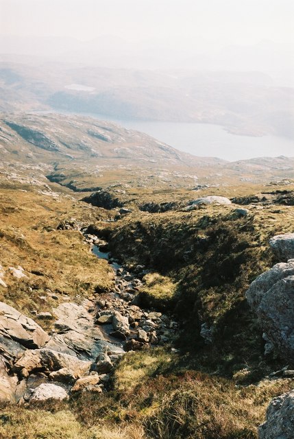
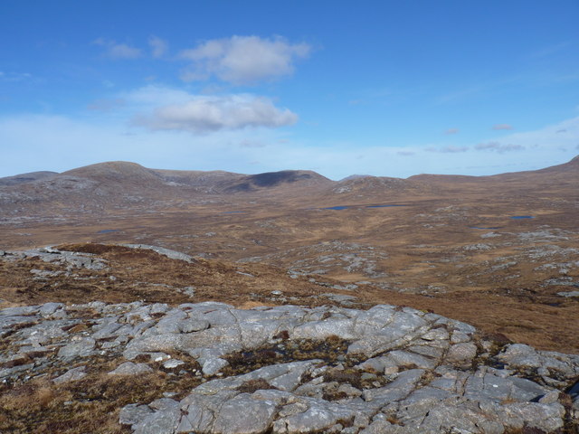
Sròn Choilleigear is a prominent headland located in Ross-shire, Scotland. Situated along the coast, this coastal feature extends into the North Sea, offering breathtaking views and unique geological formations. With an elevation of approximately 100 meters above sea level, it stands as a remarkable landmark in the area.

The headland is characterized by its rugged cliffs, which have been shaped by years of coastal erosion. The rock formations showcase a variety of colors, ranging from deep reds to light yellows, creating a visually striking landscape. These cliffs also provide nesting grounds for a diverse range of seabirds, including puffins, guillemots, and razorbills, making it a popular spot for birdwatchers.

Sròn Choilleigear is accessible via a network of footpaths and trails, allowing visitors to explore the area and appreciate its natural beauty. The headland is home to a rich variety of flora and fauna, with wildflowers, grasses, and shrubs dotting the landscape. In addition, the surrounding waters are teeming with marine life, making it an ideal location for fishing and snorkeling.

The headland offers stunning panoramic views of the surrounding coastline and the vast expanse of the North Sea. On clear days, it is even possible to catch a glimpse of nearby islands such as Skye and the Outer Hebrides. With its dramatic cliffs, diverse wildlife, and captivating vistas, Sròn Choilleigear is a must-visit destination for nature enthusiasts and those seeking a tranquil coastal experience in Ross-shire.

If you have any feedback on the listing, please let us know in the comments section below.

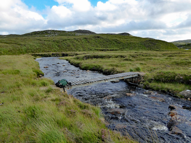
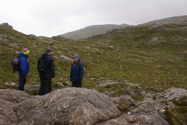
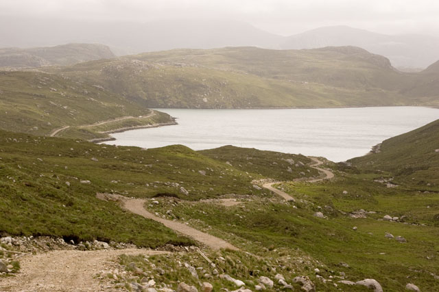
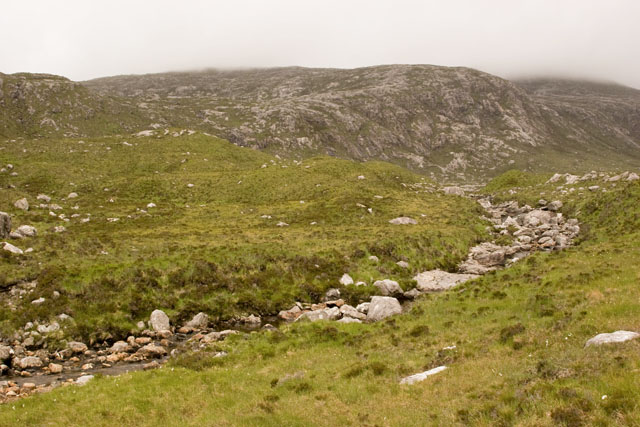
Sròn Choilleigear Images

Images are sourced within 2km of 58.082385/-7.0242701 or Grid Reference NB0321. Thanks to Geograph Open Source API. All images are credited.

Footbridge over the Abhainn Ghascleit This footbridge over the Abhainn Ghascleit is a welcome sight to a weary hiker. The stream is often difficult to ford, and the bridge can be the only safe way across.
Footbridge over the Abhainn Ghascleit
This footbridge over the Abhainn Ghascleit is a welcome sight to a weary hiker. The stream is often difficult to ford, and the bridge can be the only safe way across.
View Across Loch Gruineabhat View across Loch Gruineabhat and beyond to the subHuMP Aineabhal which is the next hill on our bagging list today.
View Across Loch Gruineabhat
View across Loch Gruineabhat and beyond to the subHuMP Aineabhal which is the next hill on our bagging list today.
House and Outbuildings at Tamnabhaigh
Loch Tamnabhaigh Aird Bheag to left of image and Tamana Sear to right
Loch Tamnabhaigh
Aird Bheag to left of image and Tamana Sear to right
Loch Cheann Chuisil This sheltered loch offers anchorage during stormy weather
Loch Cheann Chuisil
This sheltered loch offers anchorage during stormy weather
Sgaladal on the east ridge of Griomabhal
Sgaladal
on the east ridge of Griomabhal
The road down to Loch Cheann Chuisil The standard access roads on the island of Lewis are graded gravel. Though they may appear straight on an OS map, local rocky outcrops mean that they meander for short distances. The road can be seen descending down to the loch, and continuing around the bay to the left.
The road down to Loch Cheann Chuisil
The standard access roads on the island of Lewis are graded gravel. Though they may appear straight on an OS map, local rocky outcrops mean that they meander for short distances. The road can be seen descending down to the loch, and continuing around the bay to the left.
Abhainn Cheann Chuisil stream The rocky curve is the stream running down from the mountains on the island of Lewis in the Outer Hebrides. The surrounding vegetation is soft peat and bog amongst the rocks. In the distance the hills can be seen to be misty due to rainfall.
Abhainn Cheann Chuisil stream
The rocky curve is the stream running down from the mountains on the island of Lewis in the Outer Hebrides. The surrounding vegetation is soft peat and bog amongst the rocks. In the distance the hills can be seen to be misty due to rainfall.
Road down to Loch Cheann Chuisil This gravel road is the standard access road through difficult areas of the island of Lewis. Peat moor, bog and boulders can be seen on either side. In the distance are the hills of Aird Bheag beyond the loch (which cannot be seen from here).
Road down to Loch Cheann Chuisil
This gravel road is the standard access road through difficult areas of the island of Lewis. Peat moor, bog and boulders can be seen on either side. In the distance are the hills of Aird Bheag beyond the loch (which cannot be seen from here).
Abhainn Cheann Chuisil stream This stream in the island of Lewis is flowing down to the sea Loch Cheann Chuisil. The pink rocks in the foreground are granite. Peat bog is growing above the stream; being too acidic to rot this locks carbon into a deep brown soil. This is deposited year on year by the plants, and forms the main natural fuel source of the Hebrides.
Abhainn Cheann Chuisil stream
This stream in the island of Lewis is flowing down to the sea Loch Cheann Chuisil. The pink rocks in the foreground are granite. Peat bog is growing above the stream; being too acidic to rot this locks carbon into a deep brown soil. This is deposited year on year by the plants, and forms the main natural fuel source of the Hebrides.
South end of Tamanasbhal towards Aird Bheag
North Harris from Laibhal
Burn flowing into Gleann Sgaladail
The head of Gleann Sgaladail The lower picture shows ruined shielings with a burn running through.
The head of Gleann Sgaladail
The lower picture shows ruined shielings with a burn running through.
Ruined shielings in Gleann Sgaladail
Gleann Sgaladail burn meets Loch Tamnabhaigh
Bridge over Abhainn Tamnabhaig
The large expanse of moorland north of Aireabhal
Show me another place!

Sròn Choilleigear is located at Grid Ref: NB0321 (Lat: 58.082385, Lng: -7.0242701)

Unitary Authority: Na h-Eileanan an Iar

Police Authority: Highlands and Islands

What 3 Words

///proof.continued.attending. Near Tarbert, Na h-Eileanan Siar

Related Wikis

Mealista

Mealista (Scottish Gaelic: Mealasta) was a township in the west of the Isle of Lewis. It is currently largely uninhabited due to the Highland Clearances...

Game pieces of the Lewis chessmen hoard

Game pieces of the Lewis chessmen hoard include the ninety-three game pieces of the Lewis chessmen hoard found on the Isle of Lewis in the Outer Hebrides...

Eilean Mhealasta

Eilean Mhealasta (Mealista Island) is an uninhabited island off the west coast of Lewis in the Outer Hebrides of Scotland. It takes its name from Mealista...

Brenish

Brenish (Scottish Gaelic: Brèinis) is a small village situated on the west coast of the Isle of Lewis, which is part of the Outer Hebrides of Scotland...

Gasker

Gasker is a small uninhabited islet in the Outer Hebrides of Scotland, 8 kilometres (4+1⁄2 nautical miles) southwest of Scarp, off the west coast of Harris...

Scarp, Scotland

Scarp (Scottish Gaelic: An Sgarp) is an uninhabited island in the Outer Hebrides of Scotland, west of Hushinish on Harris. Once inhabited, the island was...

Uladail

Uladail is a location near Amhuinnsuidhe, on Harris in the Outer Hebrides, Scotland. Sron Ulladail is a sheer cliff which at 370 metres (1,210 ft) is one...

Abhainn Dearg distillery

Abhainn Dearg distillery ( AV-in JAIRG) or Red River distillery is a Scotch whisky distillery in Uig, on the west coast of the Isle of Lewis in the Outer...

Nearby Amenities

Located within 500m of 58.082385,-7.0242701
Created By: dmgroom_coastlines
Lat/Long: 58.08148/-7.03097
Ceann Chuisil
Place: locality
Lat/Long: 58.0821876/-7.0315954
Airigh Ghlas
Place: locality
Lat/Long: 58.0837659/-7.0283985
The data included in this document is from www.openstreetmap.org. The data is made available under ODbL.

Have you been to Sròn Choilleigear?

Leave your review of Sròn Choilleigear below (or comments, questions and feedback).