Geo an Tairbh
Coastal Feature, Headland, Point in Inverness-shire
Scotland
Geo an Tairbh
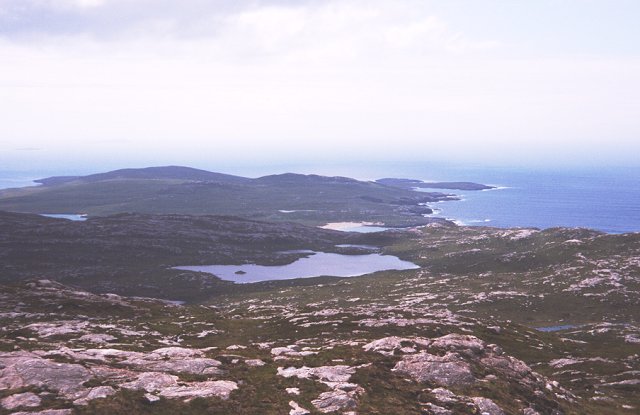
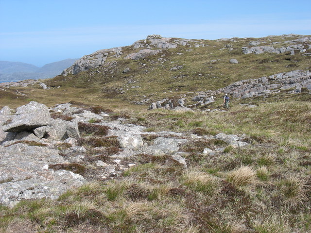
![Ben Raah [Beinn RÃ ] Pabbay, Scarp and Taransay with Sea Harris. Landed to the south and climbed the Marilyn with Martin Richardson, Jim Bloomer, Alex Cameron and Jonathan Whitehead on a lovely afternoon.
Name: Ben Raah [Beinn Rà]
Hill number: 1606
Height: 267m / 876ft
Area: 24B: Harris and Nearby Islands
Class: Ma,2
Grid ref: NB 03438 01900
Summit feature: small pile of stones 35m E of trig point
Drop: 267m
Col: Sea](https://s3.geograph.org.uk/geophotos/03/68/48/3684811_56ded9c9.jpg)
Geo an Tairbh is a prominent coastal feature located in Inverness-shire, Scotland. It is classified as a headland, also known as a point, due to its geographical characteristics. This stunning natural formation is situated on the western coast of Scotland, overlooking the North Atlantic Ocean.
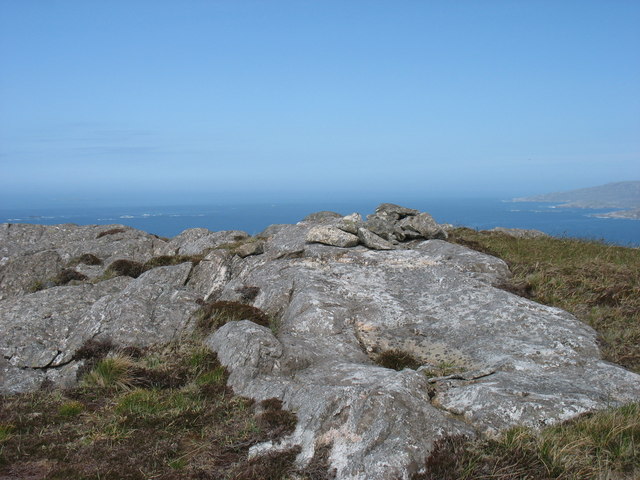
The headland is characterized by its towering cliffs and rugged terrain, providing breathtaking panoramic views of the surrounding landscape. It is made up of a combination of sedimentary rocks, including sandstone and limestone, which have been eroded over millions of years by the relentless force of the sea. This erosion has created a series of dramatic sea caves and arches within the headland, adding to its allure.
Geo an Tairbh is a haven for wildlife enthusiasts, as it is home to a diverse range of flora and fauna. Birdwatchers can spot various seabird species, including puffins, gannets, and guillemots, nesting and foraging along the cliffs. The headland also attracts marine mammals such as seals and dolphins, which can often be seen swimming in the surrounding waters.
Given its picturesque landscape and natural beauty, Geo an Tairbh is a popular destination for outdoor activities. Visitors can indulge in coastal walks along the cliff-top paths, enjoying the fresh sea breeze and scenic vistas. The headland is also a favored spot for rock climbing, with its challenging rock formations providing an exhilarating experience for climbers of all levels.
Overall, Geo an Tairbh is a captivating coastal feature that offers both natural beauty and recreational opportunities. Its rugged cliffs, sea caves, and abundant wildlife make it a must-visit location for nature lovers and adventure seekers alike.
If you have any feedback on the listing, please let us know in the comments section below.
Geo an Tairbh Images
Images are sourced within 2km of 57.921346/-7.002025 or Grid Reference NB0303. Thanks to Geograph Open Source API. All images are credited.
Geo an Tairbh is located at Grid Ref: NB0303 (Lat: 57.921346, Lng: -7.002025)
Unitary Authority: Na h-Eileanan an Iar
Police Authority: Highlands and Islands
What 3 Words
///regress.buyers.opponent. Near Tarbert, Na h-Eileanan Siar
Nearby Locations
Related Wikis

Taransay
Taransay (Scottish Gaelic: Tarasaigh, pronounced [ˈt̪ʰaɾas̪aj]) is an island in the Outer Hebrides of Scotland. It was the host of the British television...

Soay Beag
Soay Beag (Scottish Gaelic: Sòdhaigh Beag) is a small, uninhabited tidal island in West Loch Tarbert, between the northern and southern parts of Harris...

Soay Mòr
Soay Mòr (Scottish Gaelic: Sòdhaigh Mòr) is an island in West Loch Tarbert, between the northern and southern parts of Harris. The uninhabited island is...

Soay Sound
Soay Sound (Scottish Gaelic: Caolas Shòdhaigh) is a strait separating the islands of Soay Mòr and Soay Beag from the northern part of Harris. The sound...
Nearby Amenities
Located within 500m of 57.921346,-7.002025Have you been to Geo an Tairbh?
Leave your review of Geo an Tairbh below (or comments, questions and feedback).