Geodha na Gile
Coastal Feature, Headland, Point in Ross-shire
Scotland
Geodha na Gile
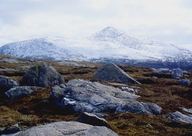
Geodha na Gile, located in Ross-shire, Scotland, is a captivating coastal feature that encompasses a headland and point. This stunning natural site is situated along the rugged coastline, overlooking the tumultuous waters of the North Atlantic.
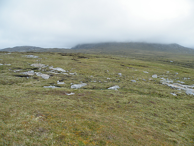
Known for its dramatic cliffs, Geodha na Gile offers breathtaking views of the surrounding landscape. The headland juts out into the sea, providing a vantage point for observing the crashing waves and the abundant marine life that inhabits the area. The point, characterized by its rocky terrain and exposed rock formations, adds to the allure of this coastal feature.
The geology of Geodha na Gile is diverse and fascinating. The cliffs display layers of sedimentary rock, showcasing the area's geological history. These rock formations provide a glimpse into the forces that have shaped this rugged coastline over millions of years.
The headland and point of Geodha na Gile are also home to a rich array of flora and fauna. The exposed cliffs support a variety of seabirds, including gulls, fulmars, and kittiwakes, which nest on the ledges and provide a spectacle of aerial acrobatics. The surrounding waters teem with marine life, with seals often seen basking on the rocks and dolphins occasionally seen frolicking in the waves.
Geodha na Gile is a popular destination for outdoor enthusiasts and nature lovers. Hiking trails wind along the coastline, allowing visitors to explore the area's natural beauty up close. The sheer cliffs and crashing waves create a sense of awe and wonder, making it an ideal spot for photographers and artists seeking inspiration.
In conclusion, Geodha na Gile is a captivating coastal feature in Ross-shire, Scotland. Its headland and point offer stunning views, diverse geology, and a thriving ecosystem, making it a must-visit destination for those seeking a connection with nature and the raw power of the North Atlantic.
If you have any feedback on the listing, please let us know in the comments section below.
Geodha na Gile Images
Images are sourced within 2km of 58.144057/-7.1094944 or Grid Reference NA9928. Thanks to Geograph Open Source API. All images are credited.


Geodha na Gile is located at Grid Ref: NA9928 (Lat: 58.144057, Lng: -7.1094944)
Unitary Authority: Na h-Eileanan an Iar
Police Authority: Highlands and Islands
What 3 Words
///brief.importing.curated. Near Carloway, Na h-Eileanan Siar
Nearby Locations
Related Wikis

Brenish
Brenish (Scottish Gaelic: Brèinis) is a small village situated on the west coast of the Isle of Lewis, which is part of the Outer Hebrides of Scotland...

Stac Dhòmhnaill Chaim
Stac Dhòmnuill Chaim, or Stac Dhòmhnaill Chaim, or Stac Domhnuill Chaim, is a fortified promontory located near Mangursta (or Mangersta, Scottish Gaelic...

Gasker
Gasker is a small uninhabited islet in the Outer Hebrides of Scotland, 8 kilometres (4+1⁄2 nautical miles) southwest of Scarp, off the west coast of Harris...

Game pieces of the Lewis chessmen hoard
Game pieces of the Lewis chessmen hoard include the ninety-three game pieces of the Lewis chessmen hoard found on the Isle of Lewis in the Outer Hebrides...

Mealista
Mealista (Scottish Gaelic: Mealasta) was a township in the west of the Isle of Lewis. It is currently largely uninhabited due to the Highland Clearances...

Abhainn Dearg distillery
Abhainn Dearg distillery ( AV-in JAIRG) or Red River distillery is a Scotch whisky distillery in Uig, on the west coast of the Isle of Lewis in the Outer...

Ardroil
Ardroil (Scottish Gaelic: Eadar Dhà Fhadhail) is a village on the Isle of Lewis in the Outer Hebrides, Scotland. Ardroil is within the parish of Uig....

Uig, Lewis
Uig (Scottish Gaelic: Ùig [uːkʲ]), also known as Sgìr' Ùig, is a civil parish and community in the west of the Isle of Lewis in the Outer Hebrides, Scotland...
Nearby Amenities
Located within 500m of 58.144057,-7.1094944Have you been to Geodha na Gile?
Leave your review of Geodha na Gile below (or comments, questions and feedback).