Staca Biorach

Island in Ross-shire

Scotland

Staca Biorach

Rocks on Druim Raois Outcropping rock and boulders litter the moorland below Mealaisbhal.
Rocks on Druim Raois Credit: Alan Reid

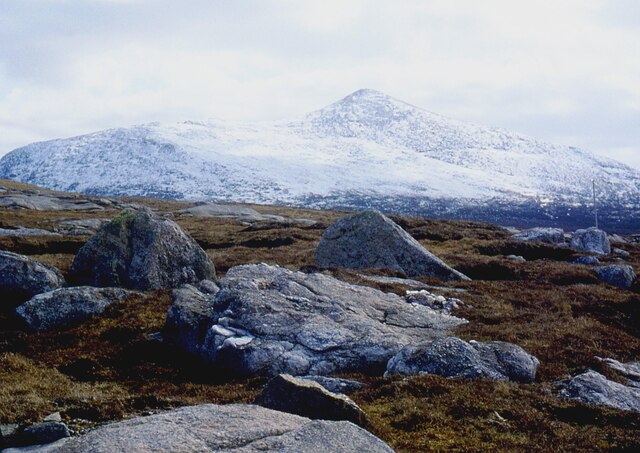
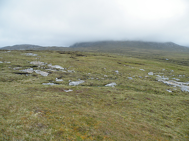
Staca Biorach is a small island located off the coast of Ross-shire, Scotland. It is situated in the North Atlantic Ocean, approximately 3 miles northwest of the mainland. The island is known for its rugged and picturesque landscape, with steep cliffs and rocky shores that provide breathtaking views.

Measuring just half a mile in length and a quarter mile in width, Staca Biorach is relatively small but attracts visitors due to its unique natural features. The island is uninhabited and lacks any substantial infrastructure, making it a remote and tranquil destination for nature enthusiasts and adventurers.

The cliffs of Staca Biorach are home to a diverse range of seabirds, including puffins, guillemots, and razorbills, making it a popular spot for birdwatching. The surrounding waters are rich in marine life, and visitors may spot seals, dolphins, and even whales in the area.

Access to Staca Biorach is mainly by boat, and there are no regular ferry services to the island. However, private boat tours or chartered vessels can be arranged for those wishing to explore its natural beauty. Visitors are advised to bring their own provisions, as there are no amenities or accommodations on the island.

Staca Biorach is a hidden gem for those seeking solitude and a connection with nature. Its untouched landscapes and abundant wildlife make it an ideal destination for outdoor activities such as hiking, birdwatching, and photography. With its remote location and rugged beauty, Staca Biorach offers a truly unforgettable experience for adventurous travelers.

If you have any feedback on the listing, please let us know in the comments section below.

Staca Biorach Images

Images are sourced within 2km of 58.145796/-7.1121265 or Grid Reference NA9928. Thanks to Geograph Open Source API. All images are credited.

Rocks on Druim Raois Outcropping rock and boulders litter the moorland below Mealaisbhal.
Rocks on Druim Raois
Outcropping rock and boulders litter the moorland below Mealaisbhal.
Road, Peat Cuttings and Moorland
Houses at Islibhig An interesting juxtaposition of old and new.
Houses at Islibhig
An interesting juxtaposition of old and new.
Small pond beside the road to Islibhig This probably represents the site of a small quarry cut for stone when the road was being constructed.
Small pond beside the road to Islibhig
This probably represents the site of a small quarry cut for stone when the road was being constructed.
Geodh' an Fhithich Sea Stacks
Not Much of a View In clear weather there would be a view across the square towards Mealaisbhal. It might even be worth walking another couple of hundred metres to get Loch Sanndabhat in view. As it is, cloud base is not much higher than 150 metres above sea level, and all that is visible is a swathe of wet bog interspersed with glaciated outcrops of Lewisian gneiss.
Not Much of a View
In clear weather there would be a view across the square towards Mealaisbhal. It might even be worth walking another couple of hundred metres to get Loch Sanndabhat in view. As it is, cloud base is not much higher than 150 metres above sea level, and all that is visible is a swathe of wet bog interspersed with glaciated outcrops of Lewisian gneiss.
A pretty lochan This is Lochan Mealabhat, two thirds of which is in this square. It is a pleasing geograph photo, because it clearly shows what you can see on the map: I'm standing on a little tongue of land that sticks out into the lochan, the tongue is in the square, and I'm looking across to a similar tongue.
A pretty lochan
This is Lochan Mealabhat, two thirds of which is in this square. It is a pleasing geograph photo, because it clearly shows what you can see on the map: I'm standing on a little tongue of land that sticks out into the lochan, the tongue is in the square, and I'm looking across to a similar tongue.
Rubh' an Taroin headland
Rubh' an Taroin
Rubh' an Taroin
Coastal moor at Mullach an Tàroin
Aird Feinis A deep rock pool in a cleft on the top of Aird Feinis.
Aird Feinis
A deep rock pool in a cleft on the top of Aird Feinis.
Cairn on Aird Feinis A cairn marks the highest point on the relatively level summit of Aird Feinis, with Aird Mangarstadh in the background.
Cairn on Aird Feinis
A cairn marks the highest point on the relatively level summit of Aird Feinis, with Aird Mangarstadh in the background.
Boulder-strewn Hillside These strange rounded boulders lie on the hill slope above the road opposite Aird Feinis. They have been rounded and polished by the movement of ice during the last Ice Age, which ended about 10,000 years ago.
Boulder-strewn Hillside
These strange rounded boulders lie on the hill slope above the road opposite Aird Feinis. They have been rounded and polished by the movement of ice during the last Ice Age, which ended about 10,000 years ago.
Geodha an Fhithich Several ridges of rock have been eroded to form a series of jagged rock stacks north of Aird Feinis.
Geodha an Fhithich
Several ridges of rock have been eroded to form a series of jagged rock stacks north of Aird Feinis.
Geodha an Fhithich Several ridges of rock have been eroded to form a series of jagged rock stacks north of Aird Feinis.
Geodha an Fhithich
Several ridges of rock have been eroded to form a series of jagged rock stacks north of Aird Feinis.
Geodha an Fhithich The sea north of Aird Feinis is studded with jagged sea stacks formed from granite intruded into the local Lewisian gneiss.
Geodha an Fhithich
The sea north of Aird Feinis is studded with jagged sea stacks formed from granite intruded into the local Lewisian gneiss.
Roseroot (Sedum rosea) This plant needs the shelter of the crevices between the stones on the clifftop at Aird Feinis.
Roseroot (Sedum rosea)
This plant needs the shelter of the crevices between the stones on the clifftop at Aird Feinis.
Aird Feinis The vegetation on this patch on the clifftop has been blown clean away by storms. Thrift (Armeria maritima) is recolonising the sand, and will eventually form a new sward.
Aird Feinis
The vegetation on this patch on the clifftop has been blown clean away by storms. Thrift (Armeria maritima) is recolonising the sand, and will eventually form a new sward.
Show me another place!

Staca Biorach is located at Grid Ref: NA9928 (Lat: 58.145796, Lng: -7.1121265)

Unitary Authority: Na h-Eileanan an Iar

Police Authority: Highlands and Islands

What 3 Words

///consoles.fields.glue. Near Carloway, Na h-Eileanan Siar

Related Wikis

Brenish

Brenish (Scottish Gaelic: Brèinis) is a small village situated on the west coast of the Isle of Lewis, which is part of the Outer Hebrides of Scotland...

Stac Dhòmhnaill Chaim

Stac Dhòmnuill Chaim, or Stac Dhòmhnaill Chaim, or Stac Domhnuill Chaim, is a fortified promontory located near Mangursta (or Mangersta, Scottish Gaelic...

Gasker

Gasker is a small uninhabited islet in the Outer Hebrides of Scotland, 8 kilometres (4+1⁄2 nautical miles) southwest of Scarp, off the west coast of Harris...

Game pieces of the Lewis chessmen hoard

Game pieces of the Lewis chessmen hoard include the ninety-three game pieces of the Lewis chessmen hoard found on the Isle of Lewis in the Outer Hebrides...

Nearby Amenities

Located within 500m of 58.145796,-7.1121265
Tourism: viewpoint
Lat/Long: 58.1492253/-7.1086855
Toirisgeo
Natural: bay
Lat/Long: 58.1469918/-7.1111905
Aird Feinis
Natural: cape
Lat/Long: 58.1496507/-7.11639
Geodha Dubh
Natural: bay
Lat/Long: 58.1491921/-7.1135307
Rubha Loisgte
Natural: cape
Lat/Long: 58.1488354/-7.1142496
Geodha an t-Searraich
Natural: bay
Lat/Long: 58.148575/-7.1134395
Rubha Sith
Natural: cape
Lat/Long: 58.1472416/-7.1147806
The data included in this document is from www.openstreetmap.org. The data is made available under ODbL.

Have you been to Staca Biorach?

Leave your review of Staca Biorach below (or comments, questions and feedback).