Lag a' Chomanachaidh

Coastal Feature, Headland, Point in Inverness-shire

Scotland

Lag a' Chomanachaidh

Machair on Berneray
Machair on Berneray Credit: Hugh Venables

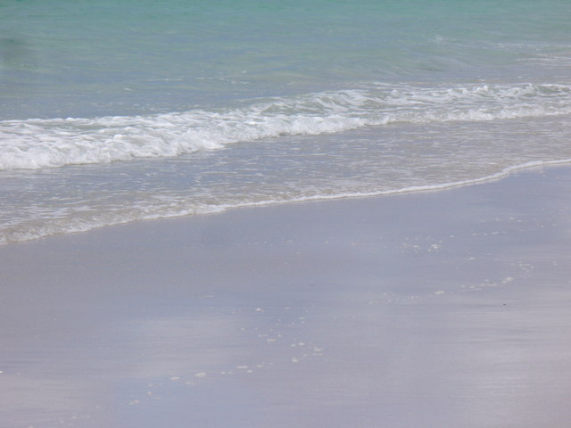
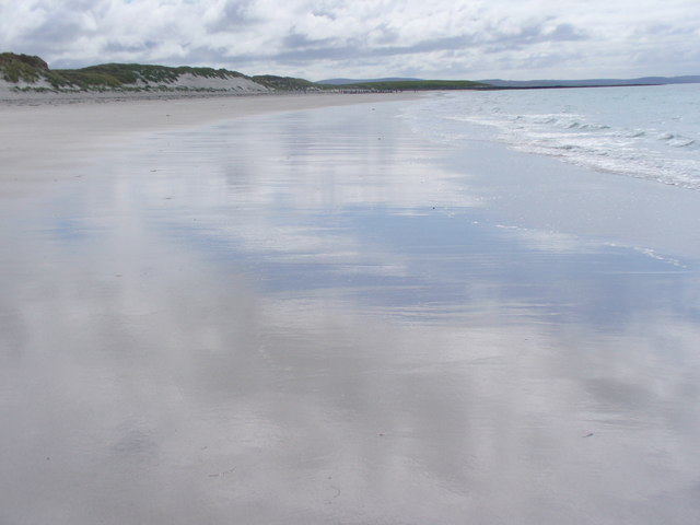
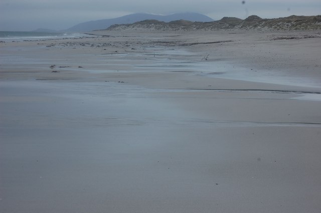
Lag a' Chomanachaidh is a prominent coastal feature located in Inverness-shire, Scotland. It is a stunning headland that extends into the North Sea, forming a point that offers breathtaking views of the surrounding area.

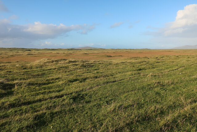
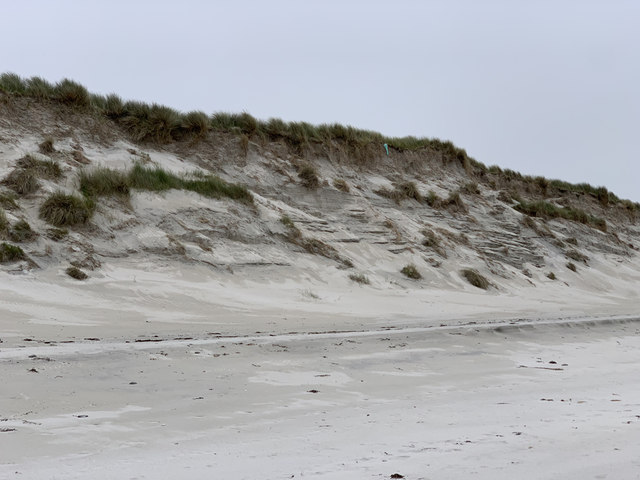
The headland is characterized by rugged cliffs that rise majestically from the sea. These cliffs are composed of various types of rock formations, including sandstone and limestone, which have been shaped over millions of years by the forces of erosion. The result is a dramatic landscape that attracts both locals and tourists alike.

At the top of Lag a' Chomanachaidh, visitors can enjoy panoramic vistas of the sea and the rugged coastline. On clear days, it is even possible to spot marine wildlife such as seals, dolphins, and seabirds from this vantage point. The headland is also a popular spot for birdwatching, as it provides an ideal habitat for several species of coastal birds.

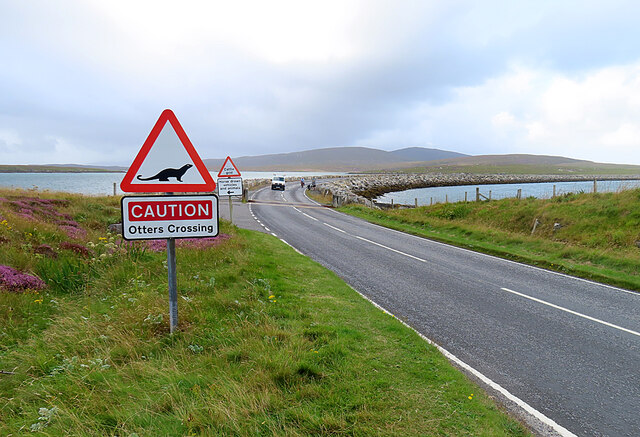
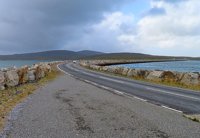
Access to Lag a' Chomanachaidh is relatively easy, with a well-maintained path leading from a nearby parking area. However, caution is advised when exploring the headland, as the cliffs can be dangerous and prone to erosion. Visitors are encouraged to stay on designated paths and to adhere to any safety signage in the area.

Overall, Lag a' Chomanachaidh is a natural coastal feature that offers a unique and awe-inspiring experience for those who visit. Its stunning cliffs, breathtaking views, and diverse wildlife make it a must-see destination for nature lovers and outdoor enthusiasts in Inverness-shire.

If you have any feedback on the listing, please let us know in the comments section below.

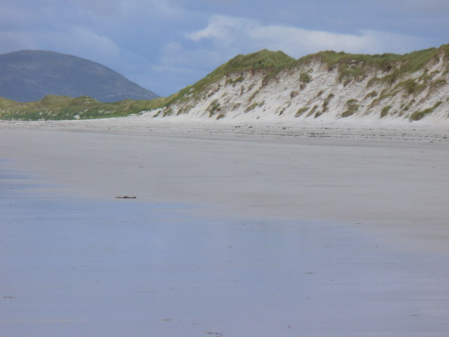
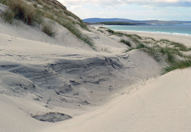
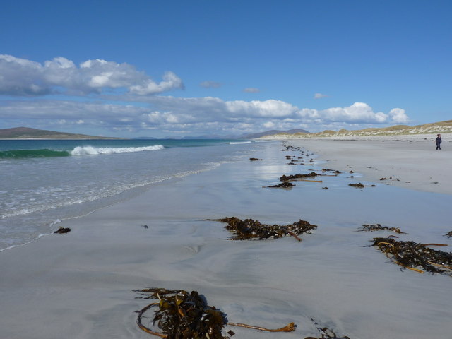
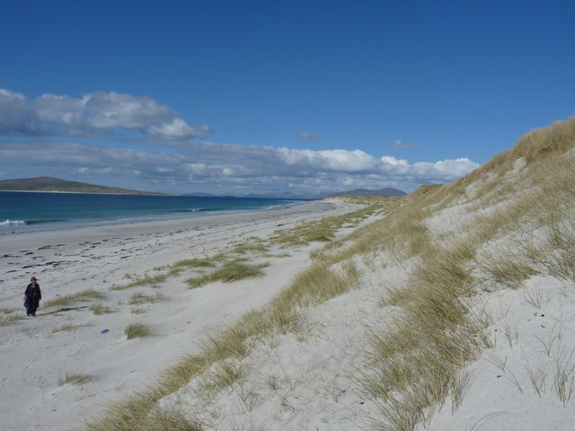
Lag a' Chomanachaidh Images

Images are sourced within 2km of 57.719304/-7.1790228 or Grid Reference NF9181. Thanks to Geograph Open Source API. All images are credited.

Machair on Berneray
Machair on Berneray
Dunes, Berneray West Beach
Approaching Berneray/Bearnaraigh
Berneray Pier Seen from the deck of MV 'Lochportain'.
Berneray Pier
Seen from the deck of MV 'Lochportain'.
Berneray Causeway The construction of the causeway linking the island to North Uist in the 1990s made life much easier for the human residents of Berneray, but possibly not for the otter population.
Berneray Causeway
The construction of the causeway linking the island to North Uist in the 1990s made life much easier for the human residents of Berneray, but possibly not for the otter population.
Berneray Causeway The causeway linking the island of Berneray to North Uist was officially opened in 1998. See <span class="nowrap"><a title="https://www.cne-siar.gov.uk/roads-travel-and-parking/bridges-causeways-and-ferries/berneray-causeway/" rel="nofollow ugc noopener" href="https://www.cne-siar.gov.uk/roads-travel-and-parking/bridges-causeways-and-ferries/berneray-causeway/">Link</a><img style="margin-left:2px;" alt="External link" title="External link - shift click to open in new window" src="https://s1.geograph.org.uk/img/external.png" width="10" height="10"/></span> for details.
Berneray Causeway
The causeway linking the island of Berneray to North Uist was officially opened in 1998. See LinkExternal link for details.
Commemorative Plaque The plaque is self-explanatory, though I am a little surprised to see that it gives HRH his English title rather than his Scottish one, Duke of Rothesay.
Commemorative Plaque
The plaque is self-explanatory, though I am a little surprised to see that it gives HRH his English title rather than his Scottish one, Duke of Rothesay.
MV 'Lochportain' at Berneray The ferry from Leverburgh is just approaching the slipway at Aird Ma-Ruibhe on Berneray.
MV 'Lochportain' at Berneray
The ferry from Leverburgh is just approaching the slipway at Aird Ma-Ruibhe on Berneray.
A Deluge I was enjoying wandering about with the camera when it began to rain, and I barely made it back to the shelter of the car before the heavens opened, threatening to drown me and anyone else out in it. This was the view through the windscreen as I waited to board the Sound of Harris ferry.
A Deluge
I was enjoying wandering about with the camera when it began to rain, and I barely made it back to the shelter of the car before the heavens opened, threatening to drown me and anyone else out in it. This was the view through the windscreen as I waited to board the Sound of Harris ferry.
Àird Ma-Ruibhe ferry terminal, Berneray For the service to Leverburgh, South Harris.
Àird Ma-Ruibhe ferry terminal, Berneray
For the service to Leverburgh, South Harris.
Low Water Mark, Berneray Huge expanses of flat white shell sand on the west coast of Berneray.
<span class="nowrap"><a title="http://www.isleofberneray.com/" rel="nofollow ugc noopener" href="http://www.isleofberneray.com/">Link</a><img style="margin-left:2px;" alt="External link" title="External link - shift click to open in new window" src="https://s1.geograph.org.uk/img/external.png" width="10" height="10"/></span>
Low Water Mark, Berneray
Huge expanses of flat white shell sand on the west coast of Berneray. LinkExternal link
Sea and Sand The waterline at low tide on West Beach, Berneray.
<span class="nowrap"><a title="http://www.isleofberneray.com/" rel="nofollow ugc noopener" href="http://www.isleofberneray.com/">Link</a><img style="margin-left:2px;" alt="External link" title="External link - shift click to open in new window" src="https://s1.geograph.org.uk/img/external.png" width="10" height="10"/></span>
Sea and Sand
The waterline at low tide on West Beach, Berneray. LinkExternal link
West Beach, Berneray Sky and cloud reflected on the wet white shell sand on Berneray's magnificent and deserted West Beach.
West Beach, Berneray
Sky and cloud reflected on the wet white shell sand on Berneray's magnificent and deserted West Beach.
Berneray, West Beach Backed by sand dunes rising to some 6-9 metres high.
<span class="nowrap"><a title="http://www.isleofberneray.com/" rel="nofollow ugc noopener" href="http://www.isleofberneray.com/">Link</a><img style="margin-left:2px;" alt="External link" title="External link - shift click to open in new window" src="https://s1.geograph.org.uk/img/external.png" width="10" height="10"/></span>
Berneray, West Beach
Backed by sand dunes rising to some 6-9 metres high. LinkExternal link
Dunes behind the long west beach of Berneray Positioned by GPS - the most dynamic element of this grid square.
Dunes behind the long west beach of Berneray
Positioned by GPS - the most dynamic element of this grid square.
Uprooted kelp on the beach The hill on Pabaigh (Beinn a' Charnain) just makes it into the shot on the left.
Uprooted kelp on the beach
The hill on Pabaigh (Beinn a' Charnain) just makes it into the shot on the left.
Dunes behind the west beach of Berneray The island of Pabaigh lurks just offshore from Berneray, with the hills of South Harris in the distance.
Dunes behind the west beach of Berneray
The island of Pabaigh lurks just offshore from Berneray, with the hills of South Harris in the distance.
Sand, Berneray Very little of this square is dry; just this small corner, and I needed to use GPS to ensure I was in it.
Sand, Berneray
Very little of this square is dry; just this small corner, and I needed to use GPS to ensure I was in it.
Show me another place!

Lag a' Chomanachaidh is located at Grid Ref: NF9181 (Lat: 57.719304, Lng: -7.1790228)

Unitary Authority: Na h-Eileanan an Iar

Police Authority: Highlands and Islands

What 3 Words

///deriving.liver.moral. Near Leverburgh, Na h-Eileanan Siar

Related Wikis

Berneray (North Uist)

Berneray (Scottish Gaelic: Beàrnaraigh na Hearadh) is an island and community in the Sound of Harris, Scotland. It is one of fifteen inhabited islands...

Otternish

Otternish is the former North Uist terminal for the ferry to Berneray, in the Outer Hebrides, Scotland. The slipway lies 6 miles (10 km) north of Lochmaddy...

Sound of Harris

The Sound of Harris (Scottish Gaelic: Caolas na Hearadh) is a channel between the islands of Harris and North Uist in the Outer Hebrides of Scotland....

Newtonferry

Newtonferry (Scottish Gaelic: Port nan Long, "the harbour of the ships") is a small crofting community on the island of North Uist in the Western Isles...

Nearby Amenities

Located within 500m of 57.719304,-7.1790228
Source: PGS
Lat/Long: 57.7196921/-7.1708657
Source: PGS
Lat/Long: 57.7193219/-7.1709539
Source: PGS
Lat/Long: 57.7193361/-7.1712452
Source: PGS
Lat/Long: 57.7193899/-7.1721183
Source: PGS
Lat/Long: 57.7188396/-7.1724587
Source: PGS
Lat/Long: 57.718502/-7.1721706
Source: PGS
Lat/Long: 57.7177131/-7.1731764
Source: PGS
Lat/Long: 57.7170713/-7.1724415
Passing Place
Lat/Long: 57.717043/-7.1733929
Turning Circle
Lat/Long: 57.7198248/-7.1743092
Seal View B&B
Addr City: Uibhist a Tuath
Addr City En: Isle of North Uist
Addr Country: GB
Addr Housenumber: 16
Addr Postcode: HS6 5BD
Addr Street: Backhill
Addr Suburb: Berneray
Beds: 3-6
Fhrs Id: 806622
Internet Access: wlan
Rooms: 2
Tourism: guest_house
Website: http://www.sealview.com/
Lat/Long: 57.7187993/-7.1733631
Historic: memorial
Material: granite
Memorial: war_memorial
Lat/Long: 57.7192523/-7.1734312
Man Made: sheep_dip
Lat/Long: 57.7211596/-7.1865901
Cnoc Bhuirgh
Ele: 85
Name En: Borve Hill
Name Gd: Cnoc Bhuirgh
Natural: peak
Wikidata: Q894293
Lat/Long: 57.7162175/-7.1797022
Waste Basket
Lat/Long: 57.7196656/-7.172687
Post Box
Operator: Royal Mail
Operator Wikidata: Q638098
Post Box Mounting: pier
Post Box Type: lamp
Ref: HS6 24
Royal Cypher: scottish_crown
Lat/Long: 57.7196676/-7.1726723
Cul na Beinne
Name En: Backhill
Name Gd: Cul na Beinne
Place: hamlet
Lat/Long: 57.7166852/-7.1732247
Barrier: cattle_grid
Lat/Long: 57.717705/-7.173753
Passing Place
Lat/Long: 57.7183498/-7.1740321
Generator Method: wind_turbine
Generator Source: wind
Power: generator
Lat/Long: 57.7175301/-7.173163
Power: pole
Lat/Long: 57.7204434/-7.1730155
Power: pole
Lat/Long: 57.720654/-7.1721786
Power: pole
Lat/Long: 57.720919/-7.1711969
Man Made: mast
Lat/Long: 57.7205782/-7.1793334
Man Made: mast
Lat/Long: 57.7208073/-7.178683
Power: pole
Lat/Long: 57.7165395/-7.1727654
Power: pole
Lat/Long: 57.7168693/-7.1730284
Power: pole
Lat/Long: 57.7172003/-7.1732894
Power: pole
Lat/Long: 57.7176873/-7.1736512
Power: pole
Lat/Long: 57.7178203/-7.1736639
Power: pole
Lat/Long: 57.7182106/-7.1738899
Power: pole
Lat/Long: 57.7189256/-7.1740292
Power: pole
Lat/Long: 57.7196338/-7.1750365
Power: pole
Lat/Long: 57.7200759/-7.1758115
Power: pole
Lat/Long: 57.7204221/-7.1749246
Power: pole
Lat/Long: 57.7201875/-7.172587
Power: pole
Lat/Long: 57.7201346/-7.171932
Power: pole
Lat/Long: 57.7201073/-7.1709369
Power: pole
Lat/Long: 57.7196932/-7.1715437
Power: pole
Lat/Long: 57.7196703/-7.1721846
Power: pole
Lat/Long: 57.7195637/-7.1744557
Power: pole
Lat/Long: 57.719934/-7.1707628
Power: pole
Lat/Long: 57.7195117/-7.1737855
The data included in this document is from www.openstreetmap.org. The data is made available under ODbL.

Have you been to Lag a' Chomanachaidh?

Leave your review of Lag a' Chomanachaidh below (or comments, questions and feedback).