Beàrnaraigh

Island in Inverness-shire

Scotland

Beàrnaraigh

Machair on Berneray
Machair on Berneray Credit: Hugh Venables

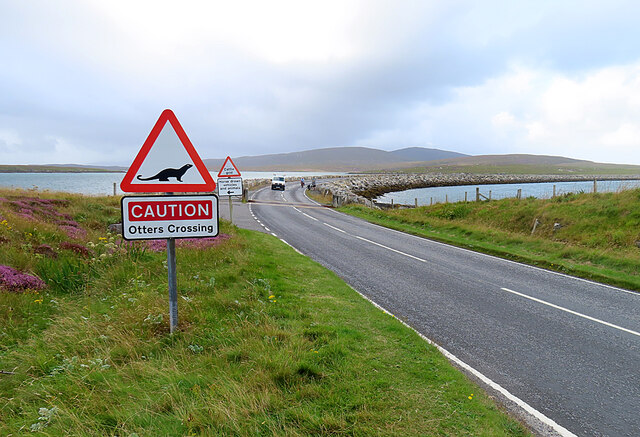
Beàrnaraigh, also known as Berneray, is a small island located off the northwest coast of Scotland in Inverness-shire. It is part of the Outer Hebrides, a remote archipelago renowned for its rugged beauty and rich Gaelic heritage. Beàrnaraigh covers an area of approximately 10 square kilometers and has a population of around 130 people.

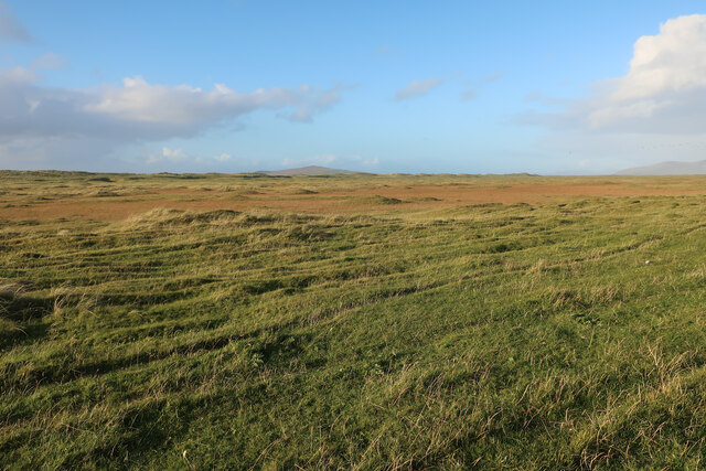
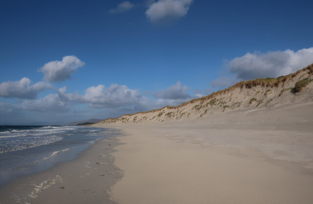
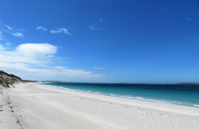
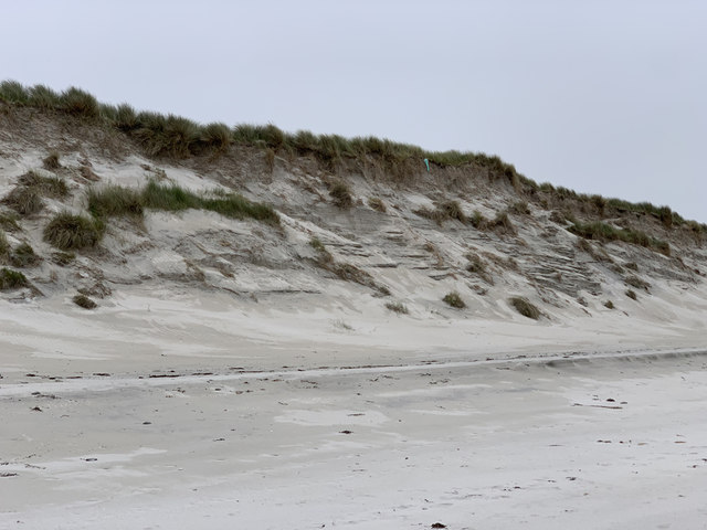
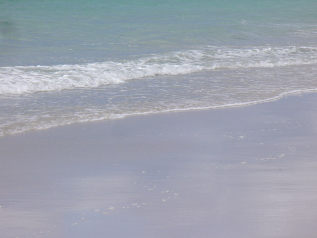
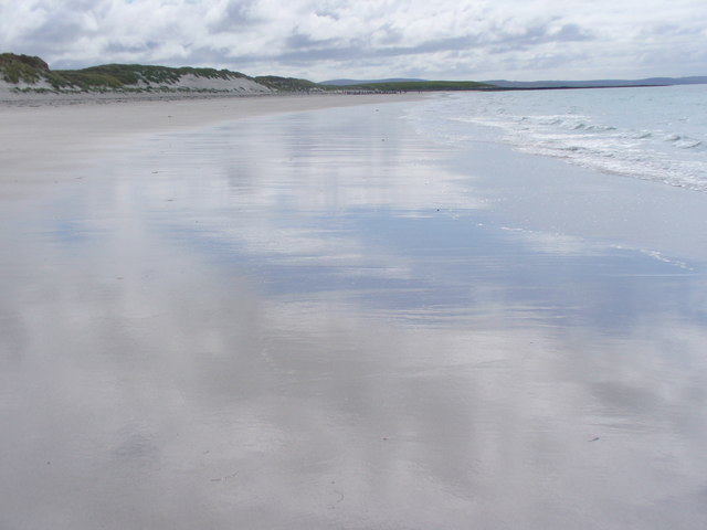
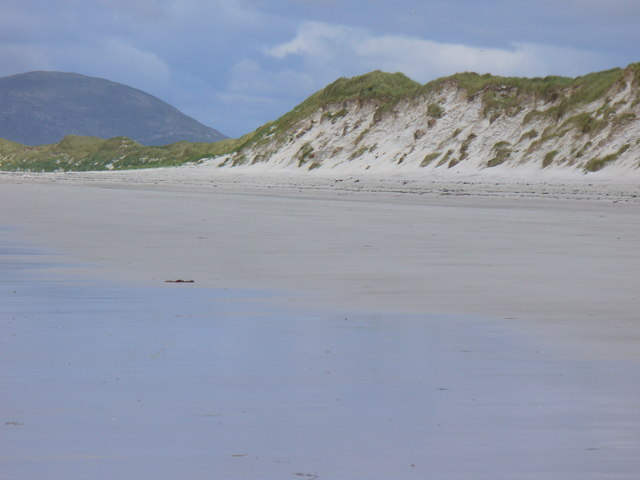
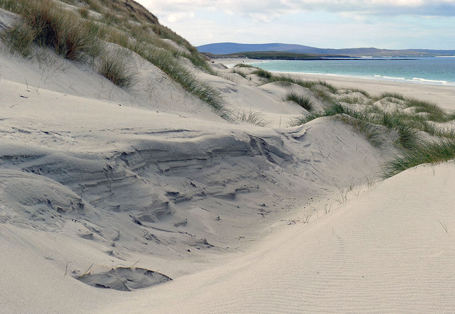
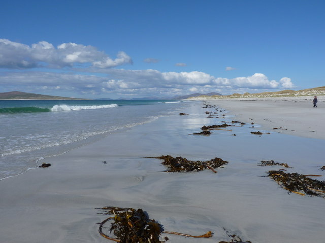
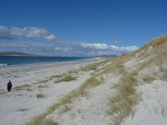
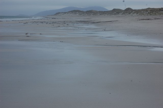
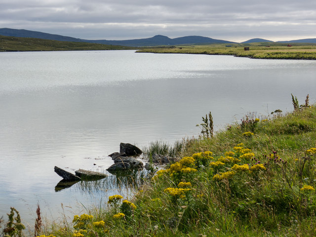
The island boasts stunning natural landscapes, characterized by picturesque beaches, rolling hills, and vibrant machair grasslands. Visitors to Beàrnaraigh can enjoy breathtaking views of the surrounding Atlantic Ocean and the neighboring islands of North Uist and Harris.

Beàrnaraigh is home to a diverse range of flora and fauna, including several species of birds, such as the elusive corncrake and the majestic white-tailed eagle. The island's coastal waters are teeming with marine life, making it a popular spot for fishing and wildlife enthusiasts.

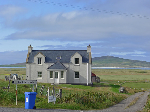
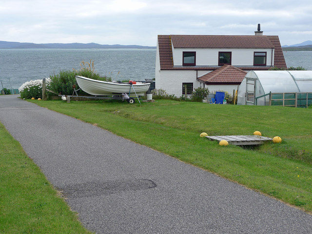
The main settlement on Beàrnaraigh is a small village called Borve, where most of the island's residents reside. The village has a community hall, a primary school, and a post office, providing essential services to the local population.

Tourism plays a significant role in Beàrnaraigh's economy, with visitors attracted by its unspoiled landscapes and tranquility. The island offers opportunities for hiking, birdwatching, and beachcombing. Tourists can also immerse themselves in the island's rich cultural heritage by exploring archaeological sites, such as the ancient standing stones and Iron Age forts.

Overall, Beàrnaraigh is a hidden gem in the Scottish Highlands, offering visitors a chance to experience the untamed beauty of the Outer Hebrides and connect with its rich history and natural wonders.

If you have any feedback on the listing, please let us know in the comments section below.

Beàrnaraigh Images

Images are sourced within 2km of 57.720545/-7.181454 or Grid Reference NF9181. Thanks to Geograph Open Source API. All images are credited.

Machair on Berneray
Machair on Berneray
West Beach, Berneray
Berneray west beach Looking south. Boreray is off to the right, but looks insignificant in this wide angle shot.
Berneray west beach
Looking south. Boreray is off to the right, but looks insignificant in this wide angle shot.
Dunes, Berneray West Beach
Berneray Causeway The construction of the causeway linking the island to North Uist in the 1990s made life much easier for the human residents of Berneray, but possibly not for the otter population.
Berneray Causeway
The construction of the causeway linking the island to North Uist in the 1990s made life much easier for the human residents of Berneray, but possibly not for the otter population.
Commemorative Plaque The plaque is self-explanatory, though I am a little surprised to see that it gives HRH his English title rather than his Scottish one, Duke of Rothesay.
Commemorative Plaque
The plaque is self-explanatory, though I am a little surprised to see that it gives HRH his English title rather than his Scottish one, Duke of Rothesay.
A Deluge I was enjoying wandering about with the camera when it began to rain, and I barely made it back to the shelter of the car before the heavens opened, threatening to drown me and anyone else out in it. This was the view through the windscreen as I waited to board the Sound of Harris ferry.
A Deluge
I was enjoying wandering about with the camera when it began to rain, and I barely made it back to the shelter of the car before the heavens opened, threatening to drown me and anyone else out in it. This was the view through the windscreen as I waited to board the Sound of Harris ferry.
Low Water Mark, Berneray Huge expanses of flat white shell sand on the west coast of Berneray.
<span class="nowrap"><a title="http://www.isleofberneray.com/" rel="nofollow ugc noopener" href="http://www.isleofberneray.com/">Link</a><img style="margin-left:2px;" alt="External link" title="External link - shift click to open in new window" src="https://s1.geograph.org.uk/img/external.png" width="10" height="10"/></span>
Low Water Mark, Berneray
Huge expanses of flat white shell sand on the west coast of Berneray. LinkExternal link
Sea and Sand The waterline at low tide on West Beach, Berneray.
<span class="nowrap"><a title="http://www.isleofberneray.com/" rel="nofollow ugc noopener" href="http://www.isleofberneray.com/">Link</a><img style="margin-left:2px;" alt="External link" title="External link - shift click to open in new window" src="https://s1.geograph.org.uk/img/external.png" width="10" height="10"/></span>
Sea and Sand
The waterline at low tide on West Beach, Berneray. LinkExternal link
West Beach, Berneray Sky and cloud reflected on the wet white shell sand on Berneray's magnificent and deserted West Beach.
West Beach, Berneray
Sky and cloud reflected on the wet white shell sand on Berneray's magnificent and deserted West Beach.
Berneray, West Beach Backed by sand dunes rising to some 6-9 metres high.
<span class="nowrap"><a title="http://www.isleofberneray.com/" rel="nofollow ugc noopener" href="http://www.isleofberneray.com/">Link</a><img style="margin-left:2px;" alt="External link" title="External link - shift click to open in new window" src="https://s1.geograph.org.uk/img/external.png" width="10" height="10"/></span>
Berneray, West Beach
Backed by sand dunes rising to some 6-9 metres high. LinkExternal link
Dunes behind the long west beach of Berneray Positioned by GPS - the most dynamic element of this grid square.
Dunes behind the long west beach of Berneray
Positioned by GPS - the most dynamic element of this grid square.
Uprooted kelp on the beach The hill on Pabaigh (Beinn a' Charnain) just makes it into the shot on the left.
Uprooted kelp on the beach
The hill on Pabaigh (Beinn a' Charnain) just makes it into the shot on the left.
Dunes behind the west beach of Berneray The island of Pabaigh lurks just offshore from Berneray, with the hills of South Harris in the distance.
Dunes behind the west beach of Berneray
The island of Pabaigh lurks just offshore from Berneray, with the hills of South Harris in the distance.
Sand, Berneray Very little of this square is dry; just this small corner, and I needed to use GPS to ensure I was in it.
Sand, Berneray
Very little of this square is dry; just this small corner, and I needed to use GPS to ensure I was in it.
New house above Loch Bhrusda on Berneray At the junction with the track to Trealigarry (or in Gaelic as displayed on the road sign).  The Sound of Pabbay and Pabbay lie beyond the coastline of Berneray.
New house above Loch Bhrusda on Berneray
At the junction with the track to Trealigarry (or in Gaelic as displayed on the road sign). The Sound of Pabbay and Pabbay lie beyond the coastline of Berneray.
Loch Bhrusda The loch lies between hills and the machair and is backed from this viewpoint by the hills of North Uist.
Loch Bhrusda
The loch lies between hills and the machair and is backed from this viewpoint by the hills of North Uist.
Modern house on Berneray Now Berneray is no longer an island and not reliant on a car ferry to reach North Uist there has been a spate of house building.
Modern house on Berneray
Now Berneray is no longer an island and not reliant on a car ferry to reach North Uist there has been a spate of house building.
Show me another place!

Beàrnaraigh is located at Grid Ref: NF9181 (Lat: 57.720545, Lng: -7.181454)

Unitary Authority: Na h-Eileanan an Iar

Police Authority: Highlands and Islands

Also known as: Berneray

What 3 Words

///enveloped.loads.joyously. Near Leverburgh, Na h-Eileanan Siar

Related Wikis

Berneray (North Uist)

Berneray (Scottish Gaelic: Beàrnaraigh na Hearadh) is an island and community in the Sound of Harris, Scotland. It is one of fifteen inhabited islands...

Otternish

Otternish is the former North Uist terminal for the ferry to Berneray, in the Outer Hebrides, Scotland. The slipway lies 6 miles (10 km) north of Lochmaddy...

Sound of Harris

The Sound of Harris (Scottish Gaelic: Caolas na Hearadh) is a channel between the islands of Harris and North Uist in the Outer Hebrides of Scotland....

Newtonferry

Newtonferry (Scottish Gaelic: Port nan Long, "the harbour of the ships") is a small crofting community on the island of North Uist in the Western Isles...

Nearby Amenities

Located within 500m of 57.720545,-7.181454
Turning Circle
Lat/Long: 57.7198248/-7.1743092
Historic: memorial
Material: granite
Memorial: war_memorial
Lat/Long: 57.7192523/-7.1734312
Man Made: sheep_dip
Lat/Long: 57.7211596/-7.1865901
Cnoc Bhuirgh
Ele: 85
Name En: Borve Hill
Name Gd: Cnoc Bhuirgh
Natural: peak
Wikidata: Q894293
Lat/Long: 57.7162175/-7.1797022
Man Made: mast
Lat/Long: 57.7205782/-7.1793334
Man Made: mast
Lat/Long: 57.7208073/-7.178683
Power: pole
Lat/Long: 57.7189256/-7.1740292
Power: pole
Lat/Long: 57.7196338/-7.1750365
Power: pole
Lat/Long: 57.7200759/-7.1758115
Power: pole
Lat/Long: 57.7204221/-7.1749246
Power: pole
Lat/Long: 57.7195637/-7.1744557
Power: pole
Lat/Long: 57.7195117/-7.1737855
The data included in this document is from www.openstreetmap.org. The data is made available under ODbL.

Have you been to Beàrnaraigh?

Leave your review of Beàrnaraigh below (or comments, questions and feedback).