Barrel of Butter

Coastal Feature, Headland, Point in Cornwall

England

Barrel of Butter

Rock formations at Peninnis Head
Rock formations at Peninnis Head Credit: Bob Ford

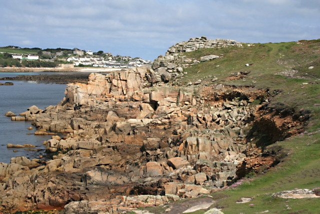
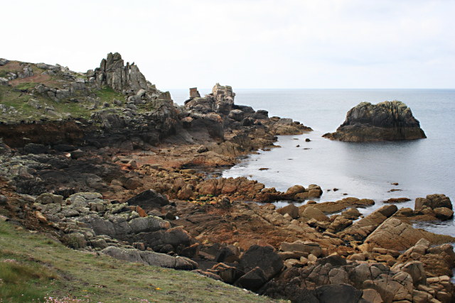
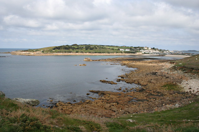
Barrel of Butter is a prominent coastal feature located in Cornwall, England. It is a headland or point that juts out into the Atlantic Ocean, offering breathtaking views of the surrounding coastline.

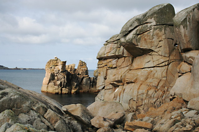
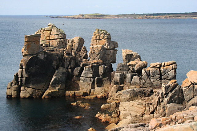
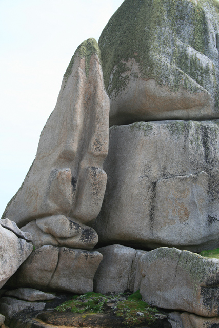
The name "Barrel of Butter" is derived from the unique shape of the headland, which is said to resemble a barrel or cask of butter. This distinctive formation makes it easily recognizable from both land and sea.

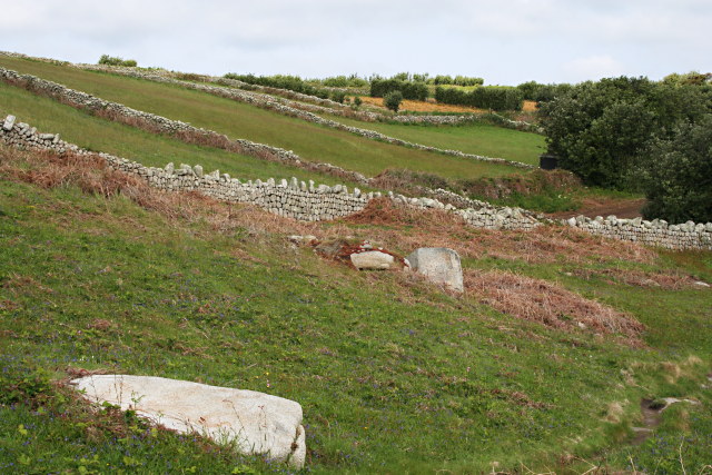
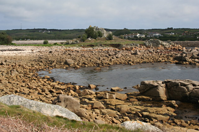
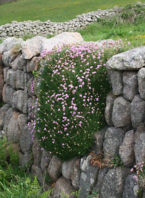
The headland is formed primarily of rugged cliffs composed of sedimentary rocks, including sandstone and slate. These cliffs provide a dramatic backdrop to the crashing waves below, creating a stunning natural spectacle.

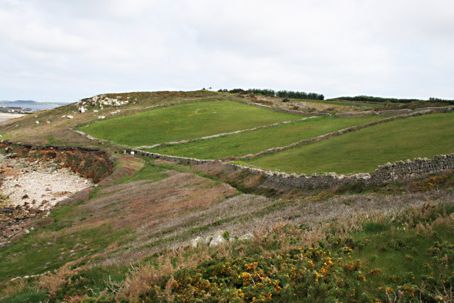
At the top of the headland, there is a grassy plateau that offers a perfect vantage point for visitors to admire the panoramic views of the ocean and the picturesque coastline. From here, one can see the waves crashing against the cliffs, as well as the vast expanse of the Atlantic stretching out into the horizon.

Barrel of Butter is also home to a variety of flora and fauna, with the cliffs providing nesting sites for seabirds such as gulls and fulmars. The surrounding waters are teeming with marine life, and it is not uncommon to spot seals or dolphins swimming in the distance.

Due to its stunning natural beauty and unique shape, Barrel of Butter has become a popular destination for hikers, photographers, and nature enthusiasts. It offers a serene and picturesque spot to escape from the hustle and bustle of everyday life and immerse oneself in the beauty of nature.

If you have any feedback on the listing, please let us know in the comments section below.

Barrel of Butter Images

Images are sourced within 2km of 49.915915/-6.3249427 or Grid Reference SV8910. Thanks to Geograph Open Source API. All images are credited.

Rock formations at Peninnis Head
Morning Point, the Garrison Looking SE to the offshore rocks Wras and (behind and smaller) Biggal; Inner Head <a href="https://www.geograph.org.uk/gridref/SV908093">SV908093</a> (part of Peninnis Head) is just visible to the far left, on the other side of Porth Cressa bay. Note the passing storm on the horizon...
Morning Point, the Garrison
Looking SE to the offshore rocks Wras and (behind and smaller) Biggal; Inner Head SV908093 (part of Peninnis Head) is just visible to the far left, on the other side of Porth Cressa bay. Note the passing storm on the horizon...
Old Town Bay from Peninnis There is a former Battery on the island to the right of the pine tree.
Old Town Bay from Peninnis
There is a former Battery on the island to the right of the pine tree.
Lighthouse at Peninnis Head, St. Mary's The lighthouse guides shipping passing through St. Mary's Sound, between the islands of Agnes and St. Mary's.  The lattice-work construction reduces its wind resistance.
Lighthouse at Peninnis Head, St. Mary's
The lighthouse guides shipping passing through St. Mary's Sound, between the islands of Agnes and St. Mary's. The lattice-work construction reduces its wind resistance.
St. Mary’s: Peninnis Point Viewed from the ferry from Penzance shortly before arrival on the island.
St. Mary’s: Peninnis Point
Viewed from the ferry from Penzance shortly before arrival on the island.
Carn Leh, St. Mary's, Scilly Isles
Footpath on Peninnis Head, St. Mary's, Scilly Isles
Granite Stone Walls Granite is pretty much the only rock there is on the Scillies and there's plenty of it, so it makes sense to build your field walls out of it.
Granite Stone Walls
Granite is pretty much the only rock there is on the Scillies and there's plenty of it, so it makes sense to build your field walls out of it.
Fields on the eastern side of Peninnis The field at the bottom of the hill on the right is being used for bulb growing, the others look as though they have been left to grass.
Fields on the eastern side of Peninnis
The field at the bottom of the hill on the right is being used for bulb growing, the others look as though they have been left to grass.
Carn Leh Cove The headland of Carn Leh separates this small cove from the larger Old Town Bay.
Carn Leh Cove
The headland of Carn Leh separates this small cove from the larger Old Town Bay.
Rock Formations on Inner Head Around Peninnis Head the granite rock has been worn to fantastic shapes by the waves and weather.
Rock Formations on Inner Head
Around Peninnis Head the granite rock has been worn to fantastic shapes by the waves and weather.
Rocky Promontory on Inner Head In the background is the island of Gugh.
Rocky Promontory on Inner Head
In the background is the island of Gugh.
The Foreshore North of Inner Head Lots of pink granite exposed on the foreshore at low tide.
The Foreshore North of Inner Head
Lots of pink granite exposed on the foreshore at low tide.
Inner Head from the South
Across Porth Cressa from Stony Porth A lot of rock is exposed on the foreshore here at low tide. Over the bay is The Garrison.
Across Porth Cressa from Stony Porth
A lot of rock is exposed on the foreshore here at low tide. Over the bay is The Garrison.
Fields on the North Side of the Peninnis Peninsula Surrounded by granite stone walls, the grass in these fields is in marked contrast to the coastal heathland surrounding them.
Fields on the North Side of the Peninnis Peninsula
Surrounded by granite stone walls, the grass in these fields is in marked contrast to the coastal heathland surrounding them.
Thrift on a Stone Wall A large clump of thrift, aka Sea Pink, latin name Armeria maritima, is draped over this granite stone wall close to the coastline.
Thrift on a Stone Wall
A large clump of thrift, aka Sea Pink, latin name Armeria maritima, is draped over this granite stone wall close to the coastline.
Tooth Rock, Peninnis Like a granite canine, Tooth Rock is about 25 feet high.
Tooth Rock, Peninnis
Like a granite canine, Tooth Rock is about 25 feet high.
Show me another place!

Barrel of Butter is located at Grid Ref: SV8910 (Lat: 49.915915, Lng: -6.3249427)

Division: Isles of Scilly

Unitary Authority: Isles of Scilly

Police Authority: Devon and Cornwall

What 3 Words

///enchanted.painted.pump. Near St Mary's, Isles of Scilly

Related Wikis

Star Castle, Isles of Scilly

Star Castle is a fortress on St Mary's, Isles of Scilly, built in 1593 by Robert Adams, Surveyor of the Royal Works (d.1595) and Francis Godolphin, Captain...

Garrison Tower

Garrison Tower is a Grade II listed structure on St Mary's, Isles of Scilly The tower was built in the 17th century as a windmill. By 1750 it was abandoned...

Tregarthen's Hotel

Tregarthen's Hotel is a hotel in Hugh Town on St Mary's in the Isles of Scilly. Tregarthen's was the very first hotel to be established on the Isles of...

Tamarisk, Isles of Scilly

Tamarisk, or Tamarisk House, is a house belonging to the Duchy of Cornwall, on St Mary's in the Isles of Scilly, in the United Kingdom off the coast of...

Nearby Amenities

Located within 500m of 49.915915,-6.3249427
Barrier: stile
Lat/Long: 49.9132511/-6.324409
Telephone
Booth: KX100
Check Date: 2022-10-28
Covered: booth
Phone: +44 1720 422027
Lat/Long: 49.9155841/-6.3179863
calico jack
Shop: gift
Lat/Long: 49.9157896/-6.3179903
Leisure: swimming_pool
Sport: swimming
Lat/Long: 49.9144558/-6.3211981
Bar
Dungeon Bar
Lat/Long: 49.915453/-6.3210047
Historic: memorial
Lat/Long: 49.9142425/-6.3187962
Tourism: viewpoint
Lat/Long: 49.9143284/-6.3187784
Mount Hollis
Place: locality
Lat/Long: 49.9152426/-6.3181367
Tourism: camp_site
Lat/Long: 49.9118631/-6.3220085
Restaurant
The Pilots Gig
Lat/Long: 49.915892/-6.318042
Parking
Parking: surface
Lat/Long: 49.9159809/-6.3184231
Bench
Backrest: yes
Lat/Long: 49.9155372/-6.3207527
Information: board
Tourism: information
Lat/Long: 49.9160029/-6.3231427
Bench
Lat/Long: 49.9123714/-6.3257982
King Charles' Battery
Historic: fort
Lat/Long: 49.9158911/-6.3235238
Direction: 175
Generator Method: photovoltaic
Generator Output Electricity: yes
Generator Solar Modules: 14
Generator Source: solar
Generator Type: solar_photovoltaic_panel
Location: roof
Power: generator
Lat/Long: 49.9146244/-6.3185538
Newman Battery
Place: locality
Lat/Long: 49.91693/-6.3214557
Barrier: entrance
Lat/Long: 49.9154283/-6.3193762
Steval Point
Place: locality
Lat/Long: 49.9126923/-6.326914
Seamark Buoy Lateral Category: starboard
Seamark Buoy Lateral Colour: green
Seamark Buoy Lateral Shape: conical
Seamark Buoy Lateral System: iala-a
Seamark Light Character: Fl
Seamark Light Colour: green
Seamark Light Group: 2
Seamark Light Period: 5
Seamark Name: Newman
Seamark Type: buoy_lateral
Lat/Long: 49.9190395/-6.3212988
The data included in this document is from www.openstreetmap.org. The data is made available under ODbL.

Have you been to Barrel of Butter?

Leave your review of Barrel of Butter below (or comments, questions and feedback).