Newman

Island in Cornwall

England

Newman

Rock formations at Peninnis Head
Rock formations at Peninnis Head Credit: Bob Ford

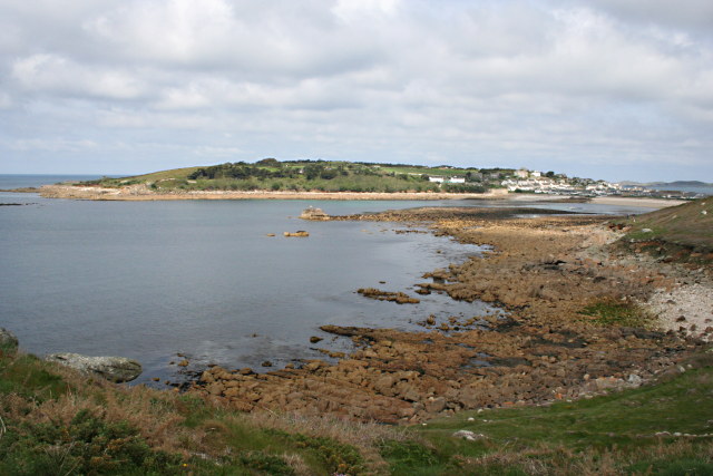
Newman, Cornwall is a small island located off the southwestern coast of England. Situated in the Celtic Sea, it is part of the Isles of Scilly archipelago. With an area of approximately 0.5 square kilometers, Newman is one of the smaller islands in the group.

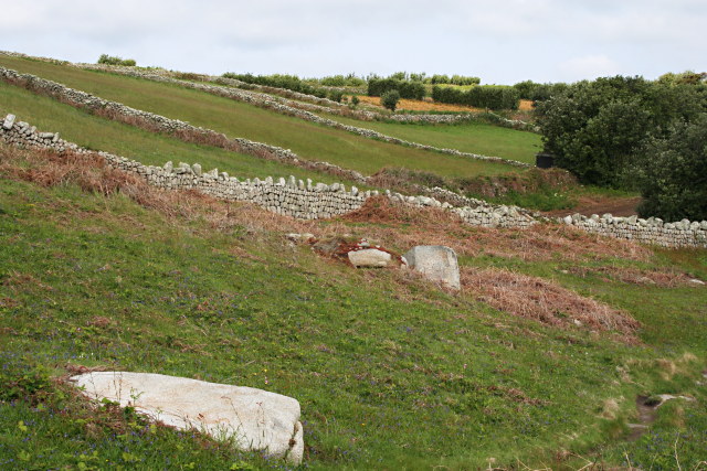
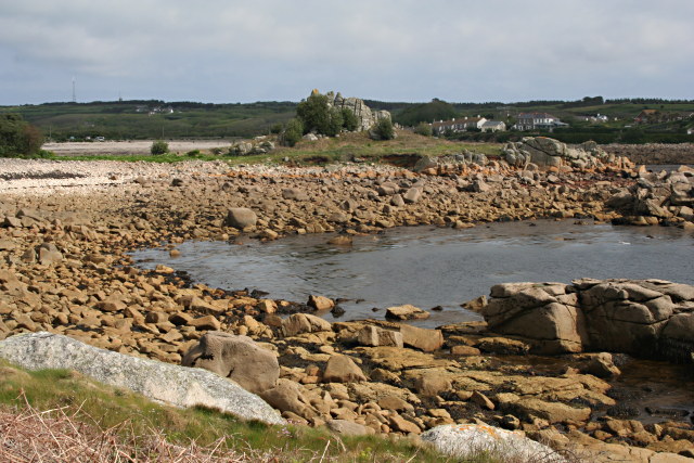
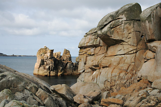
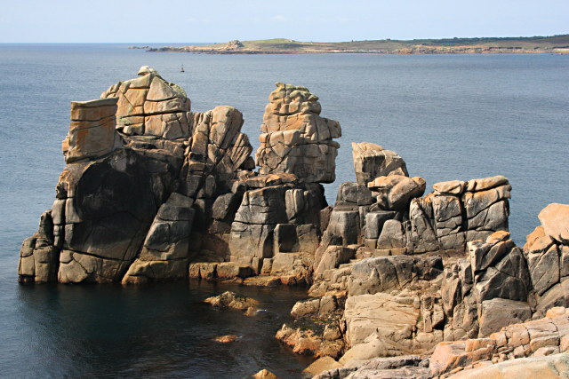
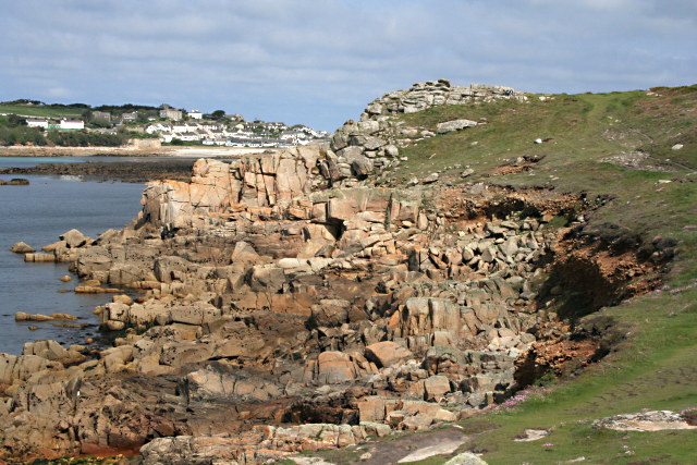
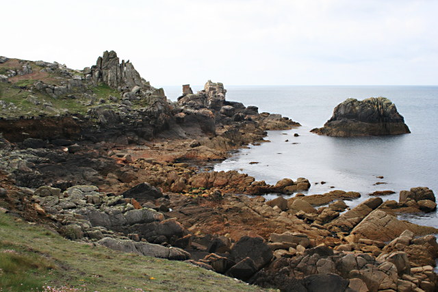
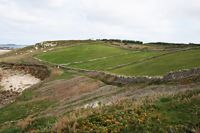
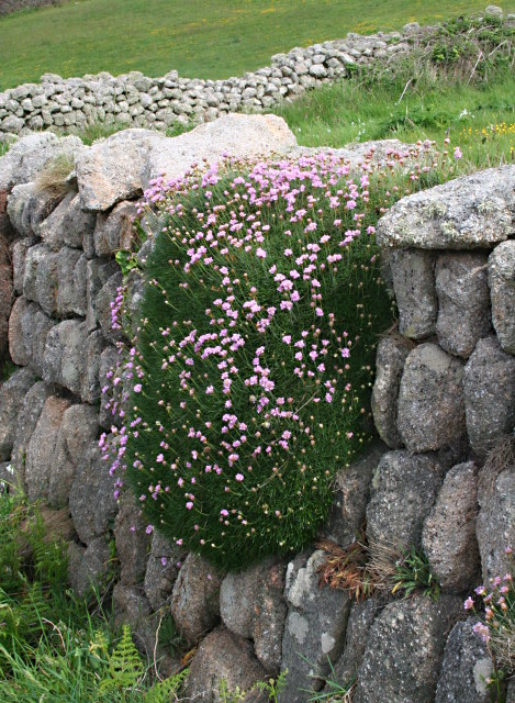
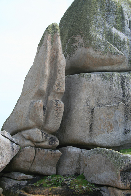
The island is characterized by its rugged coastline, featuring towering cliffs and rocky shores. The landscape is mainly comprised of heathland, dotted with patches of grass and wildflowers. Despite its small size, Newman offers breathtaking views of the surrounding turquoise waters, making it a popular spot for photography and nature lovers.

Newman is uninhabited, lacking any permanent human population. However, it serves as an important breeding ground for seabirds, including various species of gulls and puffins. The island is also home to a diverse range of flora and fauna, with several rare plant species found in its vicinity.

Access to Newman is limited, with no regular ferry or boat services available. However, private boats or chartered tours can be arranged to visit the island. Its remote and untouched nature makes it a haven for those seeking tranquility and solitude.

Due to its small size and lack of amenities, there are no facilities or accommodations on the island. Visitors are advised to bring their own supplies and take necessary precautions, as there are no medical or emergency services available.

Overall, Newman, Cornwall is a rugged and untouched island, showcasing the natural beauty of the Isles of Scilly archipelago. Its picturesque landscapes and abundant wildlife make it a hidden gem for nature enthusiasts.

If you have any feedback on the listing, please let us know in the comments section below.

Newman Images

Images are sourced within 2km of 49.9178/-6.3226727 or Grid Reference SV8910. Thanks to Geograph Open Source API. All images are credited.

Rock formations at Peninnis Head
Morning Point, the Garrison Looking SE to the offshore rocks Wras and (behind and smaller) Biggal; Inner Head <a href="https://www.geograph.org.uk/gridref/SV908093">SV908093</a> (part of Peninnis Head) is just visible to the far left, on the other side of Porth Cressa bay. Note the passing storm on the horizon...
Morning Point, the Garrison
Looking SE to the offshore rocks Wras and (behind and smaller) Biggal; Inner Head SV908093 (part of Peninnis Head) is just visible to the far left, on the other side of Porth Cressa bay. Note the passing storm on the horizon...
Old Town Bay from Peninnis There is a former Battery on the island to the right of the pine tree.
Old Town Bay from Peninnis
There is a former Battery on the island to the right of the pine tree.
Tolman Point Viewed from the north on the very edge of the square; note the WW2 pillbox.
Tolman Point
Viewed from the north on the very edge of the square; note the WW2 pillbox.
Lighthouse at Peninnis Head, St. Mary's The lighthouse guides shipping passing through St. Mary's Sound, between the islands of Agnes and St. Mary's.  The lattice-work construction reduces its wind resistance.
Lighthouse at Peninnis Head, St. Mary's
The lighthouse guides shipping passing through St. Mary's Sound, between the islands of Agnes and St. Mary's. The lattice-work construction reduces its wind resistance.
Carn Leh, St. Mary's, Scilly Isles
Footpath on Peninnis Head, St. Mary's, Scilly Isles
Granite Stone Walls Granite is pretty much the only rock there is on the Scillies and there's plenty of it, so it makes sense to build your field walls out of it.
Granite Stone Walls
Granite is pretty much the only rock there is on the Scillies and there's plenty of it, so it makes sense to build your field walls out of it.
Fields on the eastern side of Peninnis The field at the bottom of the hill on the right is being used for bulb growing, the others look as though they have been left to grass.
Fields on the eastern side of Peninnis
The field at the bottom of the hill on the right is being used for bulb growing, the others look as though they have been left to grass.
Carn Leh Cove The headland of Carn Leh separates this small cove from the larger Old Town Bay.
Carn Leh Cove
The headland of Carn Leh separates this small cove from the larger Old Town Bay.
Rock Formations on Inner Head Around Peninnis Head the granite rock has been worn to fantastic shapes by the waves and weather.
Rock Formations on Inner Head
Around Peninnis Head the granite rock has been worn to fantastic shapes by the waves and weather.
Rocky Promontory on Inner Head In the background is the island of Gugh.
Rocky Promontory on Inner Head
In the background is the island of Gugh.
The Foreshore North of Inner Head Lots of pink granite exposed on the foreshore at low tide.
The Foreshore North of Inner Head
Lots of pink granite exposed on the foreshore at low tide.
Inner Head from the South
Across Porth Cressa from Stony Porth A lot of rock is exposed on the foreshore here at low tide. Over the bay is The Garrison.
Across Porth Cressa from Stony Porth
A lot of rock is exposed on the foreshore here at low tide. Over the bay is The Garrison.
Fields on the North Side of the Peninnis Peninsula Surrounded by granite stone walls, the grass in these fields is in marked contrast to the coastal heathland surrounding them.
Fields on the North Side of the Peninnis Peninsula
Surrounded by granite stone walls, the grass in these fields is in marked contrast to the coastal heathland surrounding them.
Thrift on a Stone Wall A large clump of thrift, aka Sea Pink, latin name Armeria maritima, is draped over this granite stone wall close to the coastline.
Thrift on a Stone Wall
A large clump of thrift, aka Sea Pink, latin name Armeria maritima, is draped over this granite stone wall close to the coastline.
Tooth Rock, Peninnis Like a granite canine, Tooth Rock is about 25 feet high.
Tooth Rock, Peninnis
Like a granite canine, Tooth Rock is about 25 feet high.
Show me another place!

Newman is located at Grid Ref: SV8910 (Lat: 49.9178, Lng: -6.3226727)

Division: Isles of Scilly

Unitary Authority: Isles of Scilly

Police Authority: Devon and Cornwall

What 3 Words

///inherit.lime.piled. Near St Mary's, Isles of Scilly

Related Wikis

Star Castle, Isles of Scilly

Star Castle is a fortress on St Mary's, Isles of Scilly, built in 1593 by Robert Adams, Surveyor of the Royal Works (d.1595) and Francis Godolphin, Captain...

Tregarthen's Hotel

Tregarthen's Hotel is a hotel in Hugh Town on St Mary's in the Isles of Scilly. Tregarthen's was the very first hotel to be established on the Isles of...

Tamarisk, Isles of Scilly

Tamarisk, or Tamarisk House, is a house belonging to the Duchy of Cornwall, on St Mary's in the Isles of Scilly, in the United Kingdom off the coast of...

Wesleyan Methodist Church, Hugh Town

Wesleyan Methodist Church, Hugh Town, Isles of Scilly was a Wesleyan Methodist church in Hugh Town, Isles of Scilly from 1790. It is currently Grade II...

Nearby Amenities

Located within 500m of 49.9178,-6.3226727
Source: PGS
Lat/Long: 49.9157029/-6.3167873
Barrier: toll_booth
Lat/Long: 49.9178587/-6.3171371
Pharmacy
R. Douglas
Healthcare: pharmacy
Shop: chemist
Source: survey
Lat/Long: 49.9158712/-6.3178841
Rat Island
Place: locality
Lat/Long: 49.9177279/-6.3179072
Telephone
Booth: KX100
Check Date: 2022-10-28
Covered: booth
Phone: +44 1720 422027
Lat/Long: 49.9155841/-6.3179863
calico jack
Shop: gift
Lat/Long: 49.9157896/-6.3179903
Crossing
Crossing Ref: zebra
Lat/Long: 49.9179303/-6.3172547
Pub
Atlantic Inn
Lat/Long: 49.9152692/-6.3171615
Seamark Light 1 Character: Fl
Seamark Light 1 Colour: red
Seamark Light 1 Height: 5
Seamark Light 1 Period: 2
Seamark Light 1 Range: 4
Seamark Light 1 Sector End: 100
Seamark Light 1 Sector Start: 70
Seamark Light 2 Character: Fl
Seamark Light 2 Colour: white
Seamark Light 2 Height: 5
Seamark Light 2 Period: 2
Seamark Light 2 Range: 4
Seamark Light 2 Sector End: 130
Seamark Light 2 Sector Start: 100
Seamark Light 3 Character: Fl
Seamark Light 3 Colour: green
Seamark Light 3 Height: 5
Seamark Light 3 Period: 2
Seamark Light 3 Range: 4
Seamark Light 3 Sector End: 70
Seamark Light 3 Sector Start: 130
Seamark Light Reference: A 0008
Seamark Type: light_minor
Source: US NGA Pub. 114. 2011-05-26.
Lat/Long: 49.9184667/-6.3164667
Ferry Terminal
Ferry: yes
Public Transport: station
Lat/Long: 49.9183008/-6.3165345
Atlantic Hotel
Tourism: hotel
Wikidata: Q26433987
Lat/Long: 49.9153901/-6.317258
Source: PGS
Lat/Long: 49.9162909/-6.3177019
Bank
Lloyds Bank
Addr Country: GB
Addr Street: Hugh Street
Atm: yes
Brand: Lloyds Bank
Brand Wikidata: Q1152847
Brand Wikipedia: en:Lloyds Bank
Contact Website: https://branches.lloydsbank.com/st-mary's/hugh-street
Wikidata: Q26433985
Lat/Long: 49.9151649/-6.3173978
Leisure: swimming_pool
Sport: swimming
Lat/Long: 49.9144558/-6.3211981
Leisure: slipway
Lat/Long: 49.9156101/-6.3171353
Leisure: slipway
Lat/Long: 49.9161627/-6.3178435
Bar
Dungeon Bar
Lat/Long: 49.915453/-6.3210047
Historic: memorial
Lat/Long: 49.9142425/-6.3187962
Tourism: viewpoint
Lat/Long: 49.9143284/-6.3187784
Mount Hollis
Place: locality
Lat/Long: 49.9152426/-6.3181367
Cafe
Kavorna
Lat/Long: 49.9150942/-6.3172733
Recycling
Recycling Glass Bottles: yes
Recycling Type: container
Lat/Long: 49.9154981/-6.3173483
Restaurant
The Pilots Gig
Lat/Long: 49.915892/-6.318042
Parking
Parking: surface
Lat/Long: 49.9159809/-6.3184231
Toilets
Lat/Long: 49.9177118/-6.3172307
Shelter
Waiting Room
Lat/Long: 49.9175018/-6.3173196
Cafe
Lat/Long: 49.9176051/-6.3172747
Seamark Small Craft Facility Category: fuel_station
Seamark Type: small_craft_facility
Waterway: fuel
Lat/Long: 49.9172073/-6.317278
Bench
Backrest: yes
Lat/Long: 49.9155372/-6.3207527
Information: board
Tourism: information
Lat/Long: 49.9160029/-6.3231427
King Charles' Battery
Historic: fort
Lat/Long: 49.9158911/-6.3235238
Direction: 175
Generator Method: photovoltaic
Generator Output Electricity: yes
Generator Solar Modules: 14
Generator Source: solar
Generator Type: solar_photovoltaic_panel
Location: roof
Power: generator
Lat/Long: 49.9146244/-6.3185538
Generator Method: photovoltaic
Generator Output Electricity: yes
Generator Source: solar
Generator Type: solar_photovoltaic_panel
Location: roof
Power: generator
Lat/Long: 49.9148096/-6.3178517
Generator Method: photovoltaic
Generator Output Electricity: yes
Generator Source: solar
Generator Type: solar_photovoltaic_panel
Location: roof
Power: generator
Lat/Long: 49.914558/-6.3182541
Generator Method: photovoltaic
Generator Output Electricity: yes
Generator Source: solar
Generator Type: solar_photovoltaic_panel
Location: roof
Power: generator
Lat/Long: 49.9145605/-6.3181984
Generator Method: photovoltaic
Generator Output Electricity: yes
Generator Source: solar
Generator Type: solar_photovoltaic_panel
Location: roof
Power: generator
Lat/Long: 49.9144894/-6.318244
Generator Method: photovoltaic
Generator Output Electricity: yes
Generator Source: solar
Generator Type: solar_photovoltaic_panel
Location: roof
Power: generator
Lat/Long: 49.9144928/-6.3181857
Generator Method: photovoltaic
Generator Output Electricity: yes
Generator Source: solar
Generator Type: solar_photovoltaic_panel
Location: roof
Power: generator
Lat/Long: 49.9147667/-6.3179097
Post Box
Brand: Royal Mail
Brand Wikidata: Q638098
Brand Wikipedia: en:Royal Mail
Collection Times: Mo-Fr 13:00; Sa 08:00; Su off
Operator: Royal Mail
Operator Wikidata: Q638098
Post Box Mounting: building
Post Box Type: lamp
Ref: TR21 71
Royal Cypher: EIIR
Royal Cypher Wikidata: Q33102113
Source: aerial imagery;streetlevel imagery
Lat/Long: 49.9178044/-6.3171743
Newman Battery
Place: locality
Lat/Long: 49.91693/-6.3214557
Barrier: entrance
Lat/Long: 49.9154283/-6.3193762
Seamark Light Category: vertical
Seamark Light Character: F
Seamark Light Colour: green
Lat/Long: 49.9186371/-6.3162281
Seamark Buoy Lateral Category: starboard
Seamark Buoy Lateral Colour: green
Seamark Buoy Lateral Shape: conical
Seamark Buoy Lateral System: iala-a
Seamark Light Character: Fl
Seamark Light Colour: green
Seamark Light Group: 2
Seamark Light Period: 5
Seamark Name: Newman
Seamark Type: buoy_lateral
Lat/Long: 49.9190395/-6.3212988
Seamark Buoy Lateral Category: port
Seamark Buoy Lateral Colour: red
Seamark Buoy Lateral Shape: can
Seamark Buoy Lateral System: iala-a
Seamark Light Character: Fl
Seamark Light Colour: red
Seamark Light Group: 4
Seamark Light Period: 5
Seamark Name: Bacon Buoy
Seamark Type: buoy_lateral
Lat/Long: 49.9203296/-6.3207436
The data included in this document is from www.openstreetmap.org. The data is made available under ODbL.

Have you been to Newman?

Leave your review of Newman below (or comments, questions and feedback).