Eilean nan Gamhna

Coastal Feature, Headland, Point in Inverness-shire

Scotland

Eilean nan Gamhna

A burn drains the southeast side of Eabhal Islands litter the east coast waters off Uist
A burn drains the southeast side of Eabhal Credit: Alan Reid

Eilean nan Gamhna, located in Inverness-shire, Scotland, is a prominent coastal feature known for its stunning headland and point. This natural wonder captivates visitors with its awe-inspiring beauty and rich history.

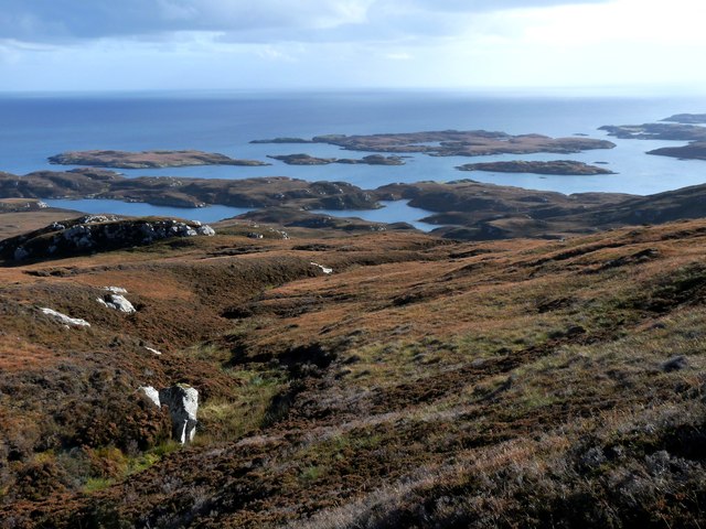
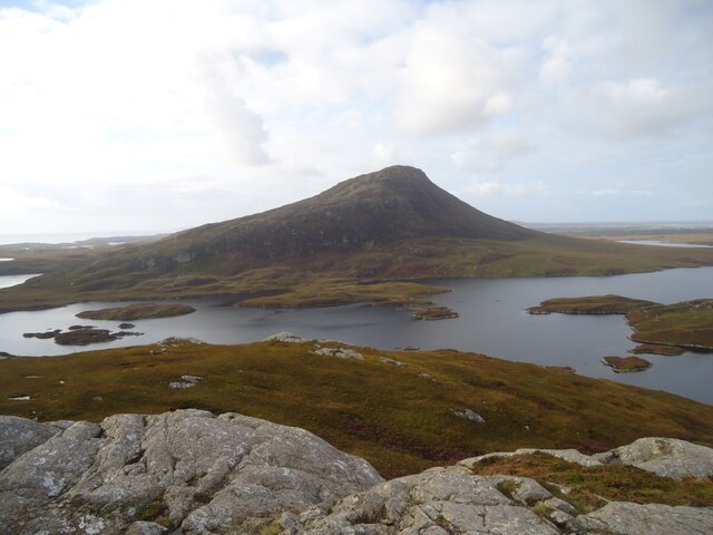
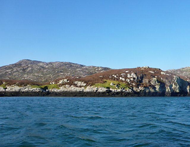
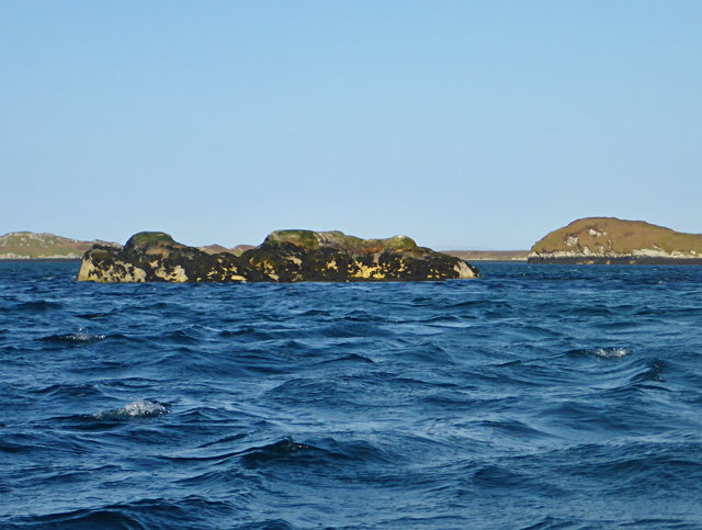
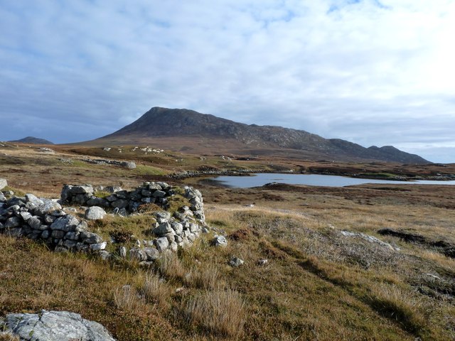
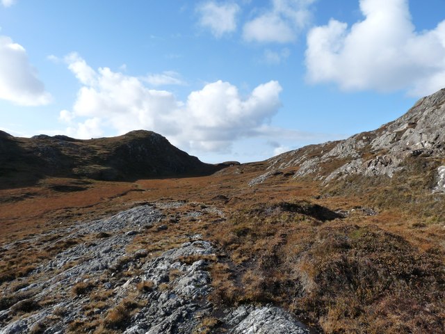
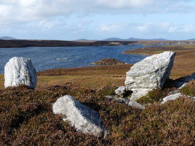
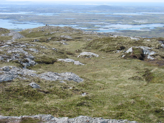
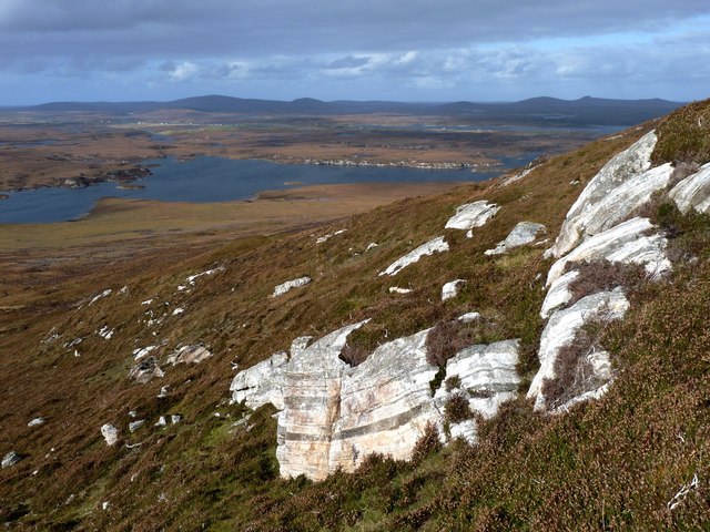
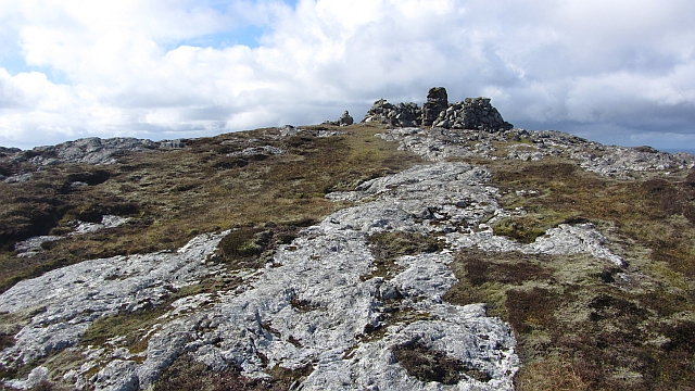
Situated on the western coast, Eilean nan Gamhna boasts breathtaking panoramic views of the surrounding landscape, including the vast Atlantic Ocean. The headland extends out into the sea, forming a distinct point that juts into the water, creating a dramatic and scenic setting. The rugged cliffs that characterize the headland are composed of ancient rock formations, showcasing the geological diversity of the region.

The area surrounding Eilean nan Gamhna is teeming with diverse wildlife, making it a popular spot for nature enthusiasts and birdwatchers. Seabird colonies, such as gulls and fulmars, can be spotted nesting on the cliffs, while seals can often be seen basking on nearby rocks. The coastal waters are also home to a variety of marine life, including dolphins and porpoises, adding to the area's natural splendor.

In addition to its natural beauty, Eilean nan Gamhna holds historical significance. The headland and point have been used as navigational landmarks for centuries, guiding sailors and fishermen along the coast. The ancient ruins of a historic lighthouse can still be seen atop the headland, serving as a reminder of its maritime past.

Overall, Eilean nan Gamhna is a captivating coastal feature, renowned for its picturesque headland, breathtaking views, and historical importance. Whether exploring its rugged cliffs, observing the abundant wildlife, or appreciating its rich heritage, visitors are sure to be enchanted by the natural wonders of Eilean nan Gamhna.

If you have any feedback on the listing, please let us know in the comments section below.

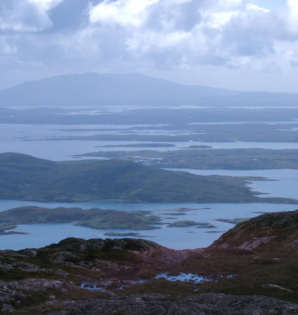
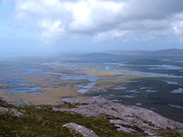
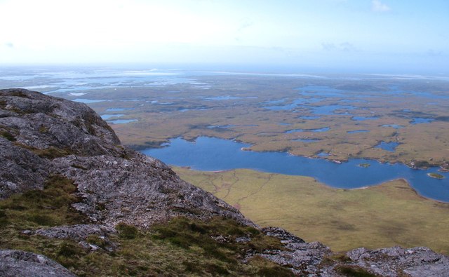
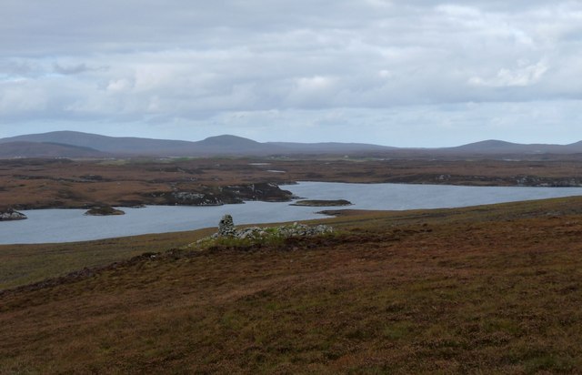
Eilean nan Gamhna Images

Images are sourced within 2km of 57.512503/-7.1979794 or Grid Reference NF8858. Thanks to Geograph Open Source API. All images are credited.

A burn drains the southeast side of Eabhal Islands litter the east coast waters off Uist
A burn drains the southeast side of Eabhal
Islands litter the east coast waters off Uist
Eaval (Eabhal) from Burabhal, North Uist Eaval, 347m, is the highest point on North Uist. Loch Obasaraigh, seen here, is a major obstacle to the ascent of Eaval, and there are basically two routes: a very awkward one from the south-west*, and this one from the north. This starts at Saighdinis <a href="https://www.geograph.org.uk/gridref/NF8863">NF8863</a> and involves a long sweep round the east side of the loch, passing Burabhal on the way. Climbing Burabhal, 141m, is an optional extra! Once the hill is reached, at the extreme left of this photo, things become easier and the ridge can be followed to the top.

* For an indication of the problems, see my <a href="https://www.geograph.org.uk/photo/2538382">NF8960 : Eaval summit, looking to the south-west cairn</a>. Imagine trying to thread your way through all those lochans, without even the benefit of a view from above!
Eaval (Eabhal) from Burabhal, North Uist
Eaval, 347m, is the highest point on North Uist. Loch Obasaraigh, seen here, is a major obstacle to the ascent of Eaval, and there are basically two routes: a very awkward one from the south-west*, and this one from the north. This starts at Saighdinis NF8863 and involves a long sweep round the east side of the loch, passing Burabhal on the way. Climbing Burabhal, 141m, is an optional extra! Once the hill is reached, at the extreme left of this photo, things become easier and the ridge can be followed to the top. * For an indication of the problems, see my NF8960 : Eaval summit, looking to the south-west cairn. Imagine trying to thread your way through all those lochans, without even the benefit of a view from above!
Rubh' an t-Sagairt
Rubh' an t-Sagairt
Eilean na Hoe
Eilean na Hoe
Eilean Buidhe
Eilean Buidhe
Eilean nan Gearr The background hill is Eabhal.
Eilean nan Gearr
The background hill is Eabhal.
Islet off Eilean Dubh an Uan
Airigh an Obain Sheilings with a view
Airigh an Obain
Sheilings with a view
A high col through the Eabhal ridge
South end of Loch Obasaraigh
Eaval summit, looking to the south-west cairn Taken from the trig point at the summit.
Eaval summit, looking to the south-west cairn
Taken from the trig point at the summit.
South from Eabhal summit The south ridge of Eabhal looking towards the hills of South Uist. In the middle distance the buildings at Kallin on Grimsay are visible.
South from Eabhal summit
The south ridge of Eabhal looking towards the hills of South Uist. In the middle distance the buildings at Kallin on Grimsay are visible.
North west from Eabhal Sunshine picks out the settlements along the south side of Loch Euphort, whilst below there appears to be as much water as land.
North west from Eabhal
Sunshine picks out the settlements along the south side of Loch Euphort, whilst below there appears to be as much water as land.
West from Eabhal Eabhal is a very fine hill, its sharp profile dominating the scene across much of North Uist, Benbecula and Grimsay, whilst it also stands out in silhouette from Skye. The bog and loch landscape below is like a jigsaw with pieces missing, and progress on foot across such terrain is very difficult. To the west the sandy shores of Kirkibost and Baleshare can just be seen.
West from Eabhal
Eabhal is a very fine hill, its sharp profile dominating the scene across much of North Uist, Benbecula and Grimsay, whilst it also stands out in silhouette from Skye. The bog and loch landscape below is like a jigsaw with pieces missing, and progress on foot across such terrain is very difficult. To the west the sandy shores of Kirkibost and Baleshare can just be seen.
Loch Obasaraigh An old cairn stands out in the moorland overlooking the loch
Loch Obasaraigh
An old cairn stands out in the moorland overlooking the loch
Southwest flank of Eabhal Banded rock outcrop
Southwest flank of Eabhal
Banded rock outcrop
Summit , Eabhal The highest point of North Uist.
Summit , Eabhal
The highest point of North Uist.
Triangulation pillar, Eabhal North Uist's high point, a hill which looks hard to get at due to the surrounding lochs.
Triangulation pillar, Eabhal
North Uist's high point, a hill which looks hard to get at due to the surrounding lochs.
Show me another place!

Eilean nan Gamhna is located at Grid Ref: NF8858 (Lat: 57.512503, Lng: -7.1979794)

Unitary Authority: Na h-Eileanan an Iar

Police Authority: Highlands and Islands

What 3 Words

///abstracts.butter.renew. Near Lochmaddy, Na h-Eileanan Siar

Related Wikis

Fraoch-Eilean

Fraoch-eilean is a small island with an uncertain population north of Benbecula in the Outer Hebrides of Scotland. It is about 55 hectares (140 acres...

Flodaigh Mòr

Flodaigh Mòr (or Floddaymore) is an uninhabited island in the Outer Hebrides of Scotland. == Geography and geology == Flodaigh Mòr lies east of North Uist...

Ronay

Ronay (Scottish Gaelic: Rònaigh) is an island in the Outer Hebrides of Scotland, which lies a short distance off the east coast of Grimsay. == Geography... ==

Grimsay

Grimsay (Scottish Gaelic: Griomasaigh) is a tidal island in the Outer Hebrides of Scotland. == Geography == Grimsay is the largest of the low-lying stepping...

Nearby Amenities

Located within 500m of 57.512503,-7.1979794
Created By: dmgroom_coastlines
Lat/Long: 57.50863/-7.20015
Created By: dmgroom_coastlines
Lat/Long: 57.50889/-7.20013
Created By: dmgroom_coastlines
Lat/Long: 57.50888/-7.19966
Created By: dmgroom_coastlines
Lat/Long: 57.50863/-7.19967
The data included in this document is from www.openstreetmap.org. The data is made available under ODbL.

Have you been to Eilean nan Gamhna?

Leave your review of Eilean nan Gamhna below (or comments, questions and feedback).