Leac na Gruagaich

Coastal Feature, Headland, Point in Inverness-shire

Scotland

Leac na Gruagaich

Small bay on east coast of Ronay Small bay backed by a shallow valley, close to the headland of Rubha Creag Mhic Fhionnlaidh.
Small bay on east coast of Ronay Credit: Gordon Hatton

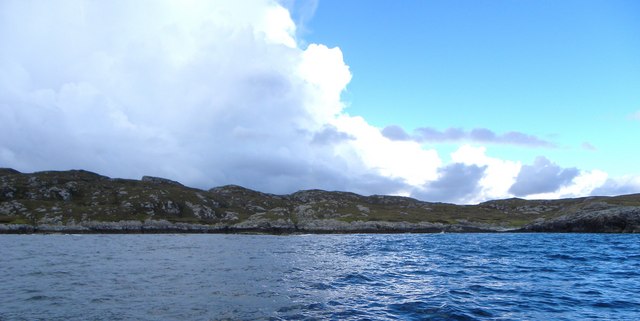
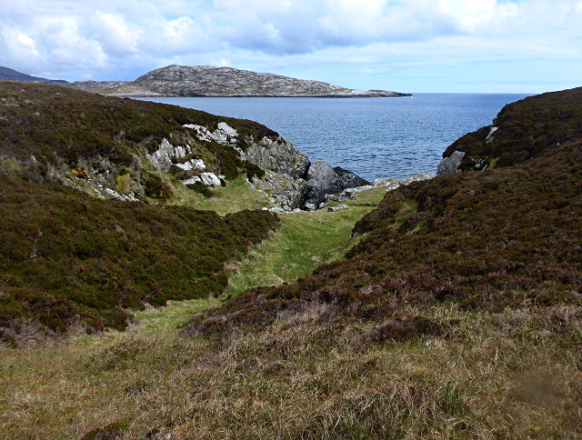
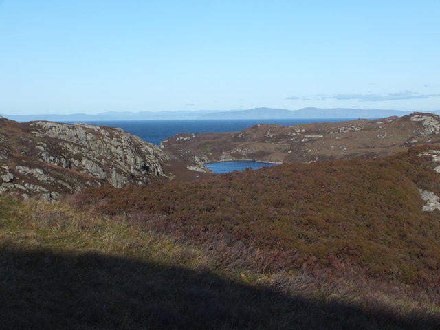
Leac na Gruagaich is a prominent coastal feature located in Inverness-shire, Scotland. It is a headland or point that juts out into the North Sea, offering breathtaking panoramic views of the surrounding landscape.

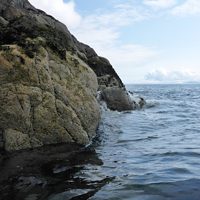
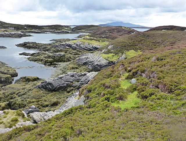
Situated on the eastern coast of Inverness-shire, Leac na Gruagaich is characterized by its rugged cliffs, rocky outcrops, and dramatic coastline. The name "Leac na Gruagaich" translates to "the rock of the maidens" in Scottish Gaelic, which is a reference to the folklore and legends associated with the area.

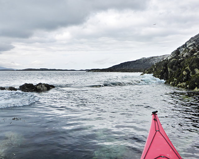
The headland is known for its rich biodiversity, with a variety of plant and animal species inhabiting the cliffs and surrounding waters. Birdwatchers frequent the area, as it provides an excellent vantage point for observing seabirds such as puffins, guillemots, and razorbills. Additionally, grey seals can often be spotted basking on the rocks or swimming in the nearby waters.

Leac na Gruagaich is also popular among hikers and outdoor enthusiasts, offering a network of coastal paths and trails that showcase the stunning natural beauty of the region. The headland is easily accessible by foot, with parking facilities available nearby.

Visitors to Leac na Gruagaich can experience the raw power of the North Sea, as crashing waves and spectacular sunsets create a captivating atmosphere. The headland is a picturesque destination, providing a unique blend of natural wonders, folklore, and outdoor activities for all to enjoy.

If you have any feedback on the listing, please let us know in the comments section below.

Leac na Gruagaich Images

Images are sourced within 2km of 57.476693/-7.2011809 or Grid Reference NF8854. Thanks to Geograph Open Source API. All images are credited.

Small bay on east coast of Ronay Small bay backed by a shallow valley, close to the headland of Rubha Creag Mhic Fhionnlaidh.
Small bay on east coast of Ronay
Small bay backed by a shallow valley, close to the headland of Rubha Creag Mhic Fhionnlaidh.
A small tide-race by Rònaigh The flow here was slightly intimidating to me in a kayak, but I made it through without harm.
A small tide-race by Rònaigh
The flow here was slightly intimidating to me in a kayak, but I made it through without harm.
Rubha na Rodagrich I'm not sure of the correct spelling of the island's name - the spelling given by the OS is inconsistent with conventional Gaelic orthography.
Rubha na Rodagrich
I'm not sure of the correct spelling of the island's name - the spelling given by the OS is inconsistent with conventional Gaelic orthography.
Maragaidh Beag One of many low-lying islands east of the Long Isle.
Maragaidh Beag
One of many low-lying islands east of the Long Isle.
Maragaidh Beag In the background is Beinn Rodagrich, on Rònaigh.
Maragaidh Beag
In the background is Beinn Rodagrich, on Rònaigh.
Ruined buildings at Buaile-mhòr
Bagh Sgotbheinn Not all Hebridean buildings fall into disrepair. I note that Dave Fergusson's 2007 photograph includes this small building, but now, twelve years later it has a new roof and is looking well cared for.
Bagh Sgotbheinn
Not all Hebridean buildings fall into disrepair. I note that Dave Fergusson's 2007 photograph includes this small building, but now, twelve years later it has a new roof and is looking well cared for.
Kallin Harbour, Grimsay
Old harbour, Grimsay A crofthouse sitting on a reclaimed piece of land at Baymore (Bagh mor) which was the main harbour on the island before the Kallin (Ceallan) development.  The harbour is littered with lots of old creels and other flotsam and there are many old stone piers.
Old harbour, Grimsay
A crofthouse sitting on a reclaimed piece of land at Baymore (Bagh mor) which was the main harbour on the island before the Kallin (Ceallan) development. The harbour is littered with lots of old creels and other flotsam and there are many old stone piers.
Kallin Harbour The smaller vessels in the harbour are inshore lobster boats which use creels to trap crabs and lobsters.  The larger vessels are offshore prawn boats which use trawl nets to catch the shellfish.
Kallin Harbour
The smaller vessels in the harbour are inshore lobster boats which use creels to trap crabs and lobsters. The larger vessels are offshore prawn boats which use trawl nets to catch the shellfish.
Cottage on Ronay Ronay
Cottage on Ronay
Ronay
Isle of Ronay View of the Isle of Skye across the Minch.
Isle of Ronay
View of the Isle of Skye across the Minch.
Vallastrome, Kallin The view along the Vallastrome channel towards the biggest hill on the island of Ronaigh. The trig point at 115m can just be seen.
Vallastrome, Kallin
The view along the Vallastrome channel towards the biggest hill on the island of Ronaigh. The trig point at 115m can just be seen.
Coming in to harbour Small fishing boat entering Kallin harbour on a summer evening. This little boat has a 'FY' registration for Fowey in Cornwall, but arrived at Kallin on the back of a lorry. The 'Stelimar'is a local boat based here.
Coming in to harbour
Small fishing boat entering Kallin harbour on a summer evening. This little boat has a 'FY' registration for Fowey in Cornwall, but arrived at Kallin on the back of a lorry. The 'Stelimar'is a local boat based here.
Baymore: postbox № HS6 15 One of four postboxes on the island of Grimsay. Apart from the one on the main road close to the post office, they are emptied at 11:45am on weekdays and at 9:30am on Saturdays.
Baymore: postbox № HS6 15
One of four postboxes on the island of Grimsay. Apart from the one on the main road close to the post office, they are emptied at 11:45am on weekdays and at 9:30am on Saturdays.
Kallin: postbox № HS6 25 One of four postboxes on the island of Grimsay. Apart from the one on the main road close to the post office, they are emptied at 11:45am on weekdays and at 9:30am on Saturdays.
Kallin: postbox № HS6 25
One of four postboxes on the island of Grimsay. Apart from the one on the main road close to the post office, they are emptied at 11:45am on weekdays and at 9:30am on Saturdays.
Kallin: a deer He spotted me as soon as I spotted him!
Kallin: a deer
He spotted me as soon as I spotted him!
Kallin: the harbour Looking across the harbour from the road above.
Kallin: the harbour
Looking across the harbour from the road above.
Show me another place!

Leac na Gruagaich is located at Grid Ref: NF8854 (Lat: 57.476693, Lng: -7.2011809)

Unitary Authority: Na h-Eileanan an Iar

Police Authority: Highlands and Islands

What 3 Words

///pulps.original.beyond. Near Balivanich, Na h-Eileanan Siar

Related Wikis

Ronay

Ronay (Scottish Gaelic: Rònaigh) is an island in the Outer Hebrides of Scotland, which lies a short distance off the east coast of Grimsay. == Geography... ==

Grimsay

Grimsay (Scottish Gaelic: Griomasaigh) is a tidal island in the Outer Hebrides of Scotland. == Geography == Grimsay is the largest of the low-lying stepping...

Flodaigh

Flodaigh is a tidal island lying to the north of Benbecula and south of Grimsay in the Outer Hebrides, Scotland. It is connected to Benbecula by a causeway...

Flodaigh Mòr

Flodaigh Mòr (or Floddaymore) is an uninhabited island in the Outer Hebrides of Scotland. == Geography and geology == Flodaigh Mòr lies east of North Uist...

Nearby Amenities

Located within 500m of 57.476693,-7.2011809
Created By: dmgroom_coastlines
Lat/Long: 57.47546/-7.20843
Passing Place
Lat/Long: 57.4785401/-7.2080637
Passing Place
Lat/Long: 57.4774803/-7.2042931
Historic: memorial
Memorial: blue_plaque
Lat/Long: 57.4807688/-7.2046404
Kallin Shellfish Shop
Addr City: Uibhist a Tuath
Addr City En: Isle of North Uist
Addr Country: GB
Addr Housenumber: 8
Addr Postcode: HS6 5HY
Addr Suburb: Grimsay
Opening Hours: Mo-Fr 09:00-16:00; Sa 10:00-15:00
Shop: seafood
Website: http://www.kallinshellfish.co.uk
Lat/Long: 57.4783071/-7.2053153
Cafe
Seafood Cafe
Fhrs Id: 1025638
Lat/Long: 57.4808195/-7.204158
Harbour: yes
Port Of Entry: no
Seamark Type: harbour
Lat/Long: 57.4782923/-7.2034371
Seamark Rock Water Level: submerged
Seamark Type: rock
Lat/Long: 57.4796305/-7.1961844
Seamark Rock Water Level: submerged
Seamark Type: rock
Lat/Long: 57.478673/-7.2028685
Seamark Rock Water Level: submerged
Seamark Type: rock
Lat/Long: 57.4787047/-7.2013503
Power: pole
Lat/Long: 57.4776054/-7.2047432
Power: pole
Lat/Long: 57.4774598/-7.2058596
Power: pole
Lat/Long: 57.4773041/-7.2069452
Power: pole
Lat/Long: 57.4779275/-7.2079651
Power: pole
Lat/Long: 57.4783691/-7.2087266
Power: pole
Lat/Long: 57.4768993/-7.2076452
Power: pole
Lat/Long: 57.4766145/-7.2081254
Barrier: cattle_grid
Lat/Long: 57.477455/-7.2044891
Generator Method: photovoltaic
Generator Output Electricity: small_installation
Generator Source: solar
Generator Type: solar_photovoltaic_panel
Power: generator
Lat/Long: 57.4778105/-7.2063548
Turning Circle
Turning Circle: knuckle
Lat/Long: 57.476268/-7.2075604
The data included in this document is from www.openstreetmap.org. The data is made available under ODbL.

Have you been to Leac na Gruagaich?

Leave your review of Leac na Gruagaich below (or comments, questions and feedback).