Scrifearnach

Coastal Feature, Headland, Point in Inverness-shire

Scotland

Scrifearnach
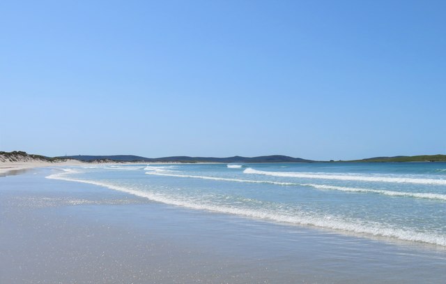
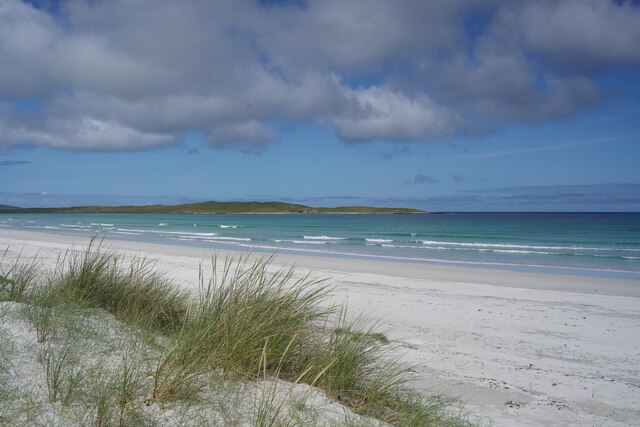
Traigh Iar Looking south west along this superb beach. In the distance, right of centre, are the outlines of the ruins on Vallay, one of which must be Vallay House.
Traigh Iar Credit: Gordon Hatton

The requested URL returned error: 429 Too Many Requests

If you have any feedback on the listing, please let us know in the comments section below.

Scrifearnach Images

Images are sourced within 2km of 57.668897/-7.3750499 or Grid Reference NF7977. Thanks to Geograph Open Source API. All images are credited.

Traigh Iar Looking south west along this superb beach. In the distance, right of centre, are the outlines of the ruins on Vallay, one of which must be Vallay House.
Traigh Iar
Looking south west along this superb beach. In the distance, right of centre, are the outlines of the ruins on Vallay, one of which must be Vallay House.
Tràigh Iar looking towards Vallay
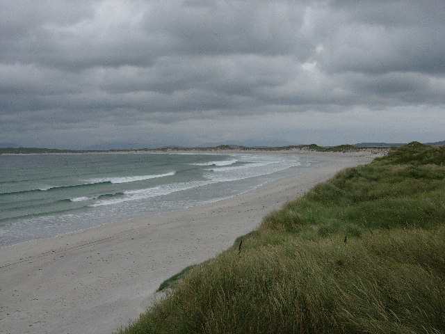
North Uist Beach They're just so long, and so empty
North Uist Beach
They're just so long, and so empty
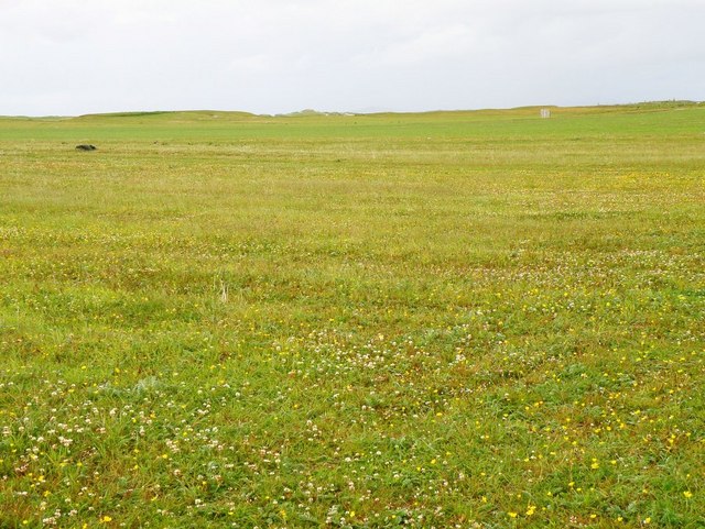
Machair Leathann This is perhaps one of the most boring pictures I've submitted, I only wish there was some way of adding the tremendous amount of bird calls you could hear, here on the Machair
Machair Leathann
This is perhaps one of the most boring pictures I've submitted, I only wish there was some way of adding the tremendous amount of bird calls you could hear, here on the Machair
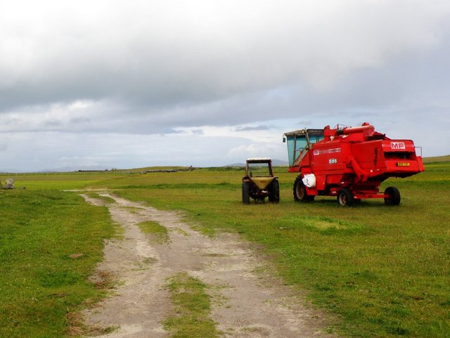
Machair Leathann Tractor and Combine Harvester used to cultivate the Machair
Machair Leathann
Tractor and Combine Harvester used to cultivate the Machair
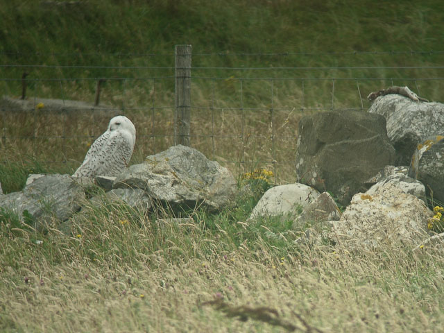
Snowy owl (Bubo scandiacus) This bird hung around for a long time.
Snowy owl (Bubo scandiacus)
This bird hung around for a long time.
Tràigh lar Reflections on the sands at Tràigh lar.
Tràigh lar
Reflections on the sands at Tràigh lar.
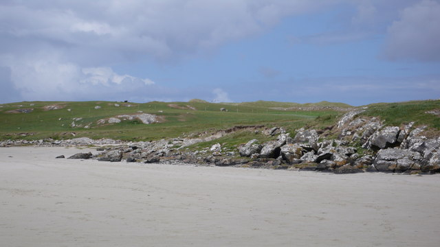
Graveyard at Solas A metalled road leads to the remote cemetery on the dunes, which is still used.
Graveyard at Solas
A metalled road leads to the remote cemetery on the dunes, which is still used.
Machair and dunes from Solas graveyard The cemetery forms a notable mound above the surrounding machair
Machair and dunes from Solas graveyard
The cemetery forms a notable mound above the surrounding machair
Traigh Bhalaigh [Vallay Beach] Looking across the sands at low tide towards the island of Vallay.
Traigh Bhalaigh [Vallay Beach]
Looking across the sands at low tide towards the island of Vallay.
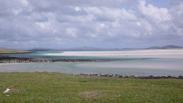
Aird Mhic Caoilt Peninsula extending into the incredible vastness of Vallay Strand.
Aird Mhic Caoilt
Peninsula extending into the incredible vastness of Vallay Strand.
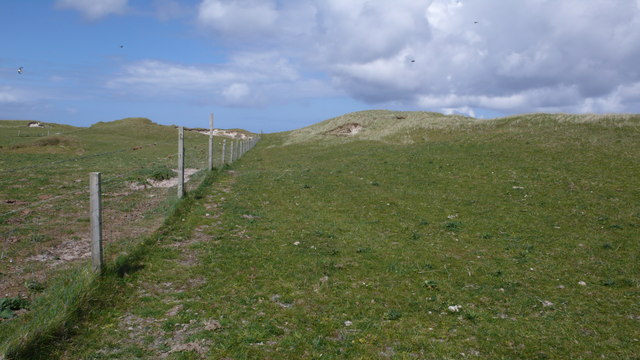
Stock fence on Bhalaigh Very easy walking on this island on short cropped turf.
Stock fence on Bhalaigh
Very easy walking on this island on short cropped turf.
Grazing land on Bhalaigh
Stock fencing, Bhalaigh A maze of fencing on this pasture.  Thankfully all gated but just don't expect to open them!  They were all securely tied with many pieces of rope!
Stock fencing, Bhalaigh
A maze of fencing on this pasture. Thankfully all gated but just don't expect to open them! They were all securely tied with many pieces of rope!
Cattle on the pasture There was a lot of cattle on Bhalaigh but thankfully no sheep and the ticks that go along with them.
Cattle on the pasture
There was a lot of cattle on Bhalaigh but thankfully no sheep and the ticks that go along with them.
Wet and Dry on Bhalaigh The fence separates the damp ground to the left while on the right the ground is perfect for the many cattle on this island.
Wet and Dry on Bhalaigh
The fence separates the damp ground to the left while on the right the ground is perfect for the many cattle on this island.
East coast of Bhalaigh Threading its way through this vast expanse of sand is this burn which hugs the coastline.  Sea Trout (Salmo Trutta) were seen pursuing food in here.
East coast of Bhalaigh
Threading its way through this vast expanse of sand is this burn which hugs the coastline. Sea Trout (Salmo Trutta) were seen pursuing food in here.
Traigh Bhalaigh Dry for about 5 hours you get ample time to spend on the island.  The sand is firm enough to drive across and a few cars took advantage of this - the walk will take about 20 minutes.
Traigh Bhalaigh
Dry for about 5 hours you get ample time to spend on the island. The sand is firm enough to drive across and a few cars took advantage of this - the walk will take about 20 minutes.
Show me another place!

Scrifearnach is located at Grid Ref: NF7977 (Lat: 57.668897, Lng: -7.3750499)

Unitary Authority: Na h-Eileanan an Iar

Police Authority: Highlands and Islands

What 3 Words

///marine.radio.delay. Near Lochmaddy, Na h-Eileanan Siar

Nearby Locations

Scrifearnach

Related Wikis

Vallay

Vallay (Scottish Gaelic: Bhàlaigh) is an uninhabited tidal island in the Scottish Outer Hebrides. It can be reached from North Uist by a long beach at...

Sollas

Sollas (Scottish Gaelic: Solas) is a small crofting township on the northern coast of the island of North Uist, Scotland. == History == === The Battle... ===

Oronsay, Outer Hebrides

Oronsay (Gaelic Orasaigh) is a tidal island off North Uist in the Outer Hebrides. Lying to the north of Vallaquie Strand, the island has been uninhabited...

Eilean Dòmhnuill

Ian Armit identifies the islet of Eilean Dòmhnuill (Scottish Gaelic: Eilean Dòmhnaill, Scottish Gaelic pronunciation: [elan ˈt̪õː.ɪʎ], "The Isle of Donald...

Nearby Amenities

Located within 500m of 57.668897,-7.3750499
Scrifearnach
Natural: cape
Lat/Long: 57.6688896/-7.3736292
The data included in this document is from www.openstreetmap.org. The data is made available under ODbL.

Have you been to Scrifearnach?

Leave your review of Scrifearnach below (or comments, questions and feedback).