Sloc an Uisge

Coastal Feature, Headland, Point in Inverness-shire

Scotland

Sloc an Uisge

Stream junction
Stream junction Credit: Mick Garratt

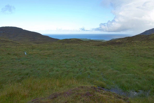
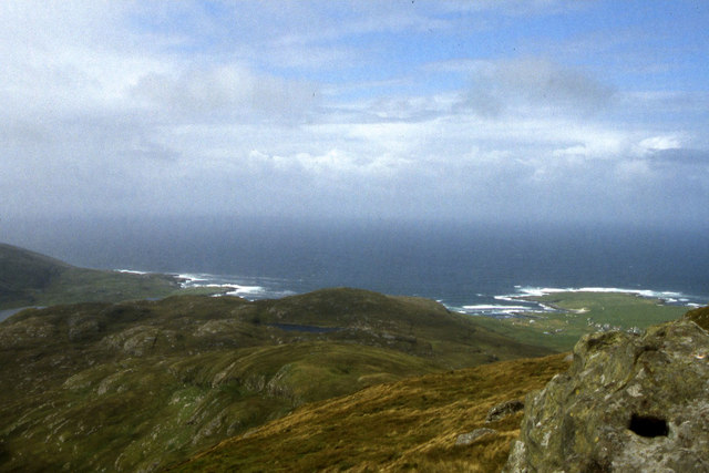
Sloc an Uisge is a prominent coastal feature located in Inverness-shire, Scotland. Specifically, it is a headland or point that offers stunning views of the surrounding landscape and the nearby sea. The name "Sloc an Uisge" translates to "Gorge of the Water" in English, which is fitting given its geographical characteristics.

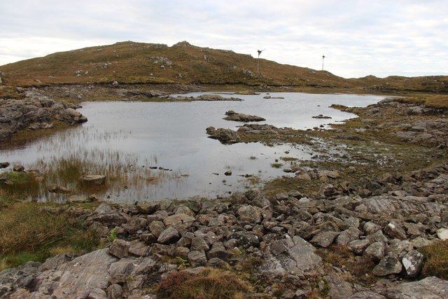
Situated along the rugged coastline of Inverness-shire, Sloc an Uisge juts out into the North Sea, providing a commanding presence in the area. Its position offers visitors a unique vantage point to observe the natural beauty of the region, including the expansive ocean, rocky cliffs, and diverse marine life. The headland is often characterized by its steep and craggy cliffs, which have been shaped by the ceaseless pounding of waves over countless years.

Sloc an Uisge is also known for its rich history and cultural significance. It has long been a landmark for sailors navigating the treacherous waters of the North Sea, serving as a crucial reference point for centuries. The headland has witnessed numerous historical events, including battles and maritime activities, making it a place of historical importance in the region.

Visitors to Sloc an Uisge can enjoy a range of activities, such as hiking along the coastal paths, birdwatching, or simply taking in the awe-inspiring scenery. The headland is often a popular spot for photographers, nature enthusiasts, and those seeking a peaceful escape amidst the beauty of nature.

In summary, Sloc an Uisge is a striking headland located in Inverness-shire, Scotland. With its captivating views, historical significance, and natural splendor, it is a coastal feature that attracts visitors from near and far.

If you have any feedback on the listing, please let us know in the comments section below.

Sloc an Uisge Images

Images are sourced within 2km of 56.955388/-7.4923161 or Grid Reference NL6698. Thanks to Geograph Open Source API. All images are credited.

Stream junction
Stream junction
Loch Uisge, Barra
Loch Uisge, Barra
View towards Cadha Mor from Heabhal
Castle in the bay View of Caisteal Chiosmuil from Castlebay.
Castle in the bay
View of Caisteal Chiosmuil from Castlebay.
The Madonna and Child statue on Sheabhal Looking over Castlebay on Barra - quite awe inspiring!
The Madonna and Child statue on Sheabhal
Looking over Castlebay on Barra - quite awe inspiring!
MV Claymore at Castlebay The Caledonian MacBrayne car ferry arrives at Castlebay pier on a still misty Wednesday evening at the end of her 5-hour passage from Oban.  In the 1980s she maintained the triangular route between Lochboisdale, Barra and the mainland, but Uist, being the larger and more populous island, enjoyed many more direct sailings.  The next return sailing on this route will not be until Saturday.

Claymore perpetuated the name of the last of the classic MacBrayne steamers built in 1955 - see <a href="https://www.geograph.org.uk/photo/2341322">NM6797 : SS Claymore at Mallaig bound for Stornoway</a>.  After withdrawal from the CalMac fleet Claymore, in a new livery and by then looking rather dated with her awkward side-loading ramps, saw service on the short-lived Kintyre-Antrim route <a href="https://www.geograph.org.uk/photo/2177551">D1241 : The Campbeltown ferry, Ballycastle</a> and later on the short Pentland Firth crossing from John o' Groats to St Margaret's Hope <a href="https://www.geograph.org.uk/photo/488872">ND4093 : The Bu, Hoxa Head</a>.  She was finally sold to the Danes who renamed her Sia and use her as a cable-laying and supply ship.
MV Claymore at Castlebay
The Caledonian MacBrayne car ferry arrives at Castlebay pier on a still misty Wednesday evening at the end of her 5-hour passage from Oban. In the 1980s she maintained the triangular route between Lochboisdale, Barra and the mainland, but Uist, being the larger and more populous island, enjoyed many more direct sailings. The next return sailing on this route will not be until Saturday. Claymore perpetuated the name of the last of the classic MacBrayne steamers built in 1955 - see NM6797 : SS Claymore at Mallaig bound for Stornoway. After withdrawal from the CalMac fleet Claymore, in a new livery and by then looking rather dated with her awkward side-loading ramps, saw service on the short-lived Kintyre-Antrim route D1241 : The Campbeltown ferry, Ballycastle and later on the short Pentland Firth crossing from John o' Groats to St Margaret's Hope ND4093 : The Bu, Hoxa Head. She was finally sold to the Danes who renamed her Sia and use her as a cable-laying and supply ship.
West slopes of Sheabhal
Bagh a' Chaisteil, Barra
Gleann, Castlebay
Gleann, Castlebay
Camping by the old road to Gleann The southern isles of the Hebrides stretch away to Mingulay and Berneray.
Camping by the old road to Gleann
The southern isles of the Hebrides stretch away to Mingulay and Berneray.
The 'Claymore' berthed at Castlebay, Barra
Trig Point on Heaval, Barra
'Claymore' at Castlebay, Barra
Rivet on rock near Gleann, Barra One of many rivet benchmarks on the island. For full description of benchmark, see <span class="nowrap"><a title="http://www.bench-marks.org.uk/bm76328" rel="nofollow ugc noopener" href="http://www.bench-marks.org.uk/bm76328">Link</a><img style="margin-left:2px;" alt="External link" title="External link - shift click to open in new window" src="https://s1.geograph.org.uk/img/external.png" width="10" height="10"/></span>. See also <a href="https://www.geograph.org.uk/photo/4996737">NL6798 : House near Gleann, Barra</a>.
Rivet on rock near Gleann, Barra
One of many rivet benchmarks on the island. For full description of benchmark, see LinkExternal link. See also NL6798 : House near Gleann, Barra.
House near Gleann, Barra The house and woodland are on the eastern side of the circular road which goes round the island. In the foreground is a rock and just visible in the photo is the Ordnance Survey rivet benchmark which has been borne into the rock. See also <a href="https://www.geograph.org.uk/photo/4996733">NL6798 : Rivet on rock near Gleann, Barra</a>.
House near Gleann, Barra
The house and woodland are on the eastern side of the circular road which goes round the island. In the foreground is a rock and just visible in the photo is the Ordnance Survey rivet benchmark which has been borne into the rock. See also NL6798 : Rivet on rock near Gleann, Barra.
The road to Vatersay The road descends steeply after the war memorial as it heads towards the causeway to Vatersay.
The road to Vatersay
The road descends steeply after the war memorial as it heads towards the causeway to Vatersay.
Castlebay harbour on Barra The Caledonian Macbrayne ferry and the lifeboat berthed in Castlebay harbour on the island of Barra, Western Isles.
Castlebay harbour on Barra
The Caledonian Macbrayne ferry and the lifeboat berthed in Castlebay harbour on the island of Barra, Western Isles.
Barra, from over the Sea of the Hebrides With the Atlantic Ocean beyond. South Uist is at upper right. Traigh Mhor beach, which also serves as the airfield, is in the indented bay by the isthmus just right of centre - not active at the time of the photograph, as the tide appears to be in.
Barra, from over the Sea of the Hebrides
With the Atlantic Ocean beyond. South Uist is at upper right. Traigh Mhor beach, which also serves as the airfield, is in the indented bay by the isthmus just right of centre - not active at the time of the photograph, as the tide appears to be in.
Show me another place!

Sloc an Uisge is located at Grid Ref: NL6698 (Lat: 56.955388, Lng: -7.4923161)

Unitary Authority: Na h-Eileanan an Iar

Police Authority: Highlands and Islands

What 3 Words

///offer.mixing.courts. Near CastleBay, Na h-Eileanan Siar

Related Wikis

Barrathon

The Barrathon is an annual half marathon which takes place on the Isle of Barra, which is the southernmost inhabited isle of the Outer Hebrides in Scotland...

Castlebay Community School

Castlebay Community School is a bilingual Gaelic/English school for ages 3–18 on the Scottish island of Barra.In September 2007, it hosted a major tribute...
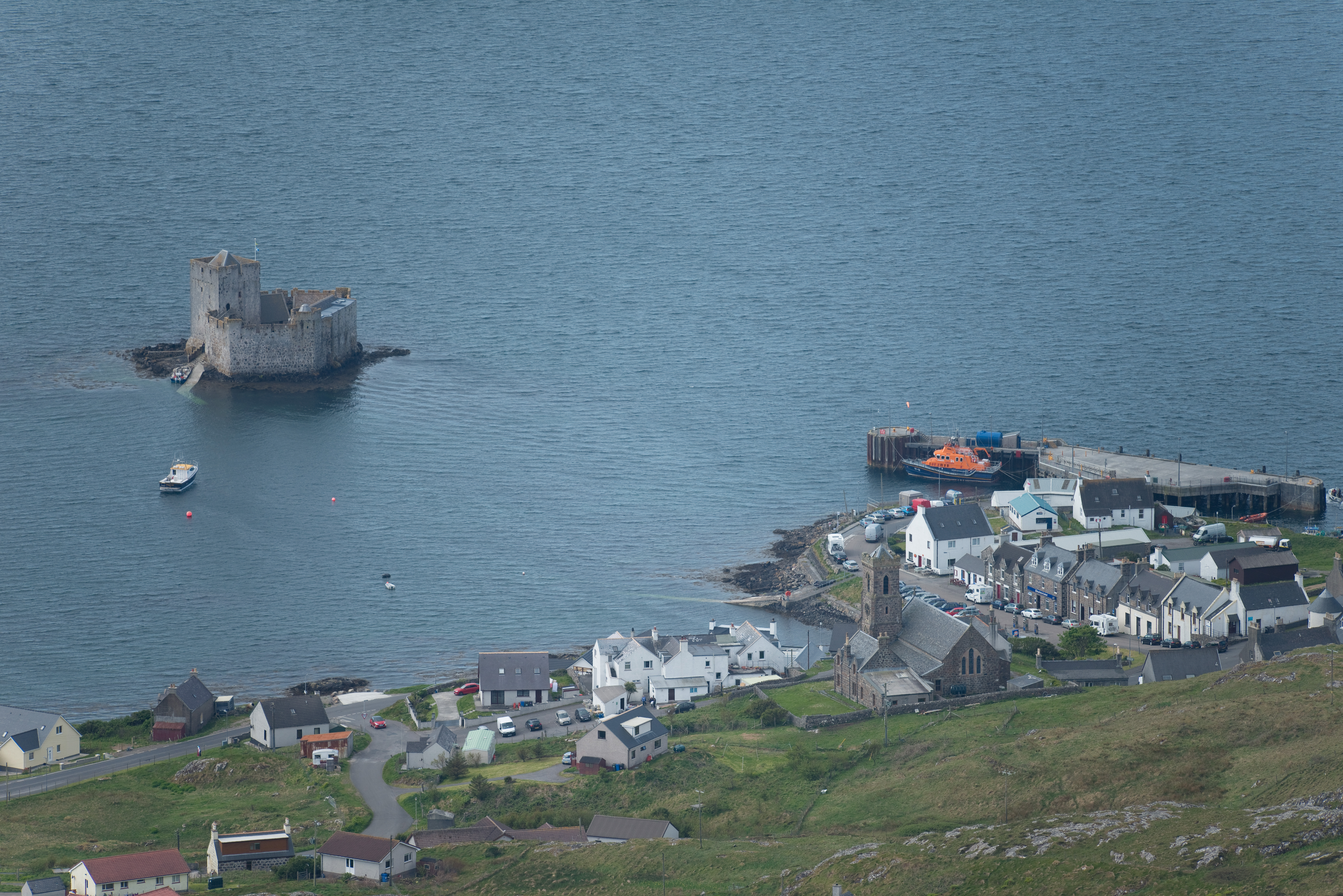
Castlebay

Castlebay (Scottish Gaelic: Bàgh a' Chaisteil [baːɣ ə ˈxaʃtʲɪl]) is the main village and a community council area on the island of Barra in the Outer Hebrides...

St Brendan's Hospital, Castlebay

St Brendan's Hospital is a hospital in Castlebay on the island of Barra, Eileanan Siar. It is managed by NHS Western Isles. == History == The current facility...
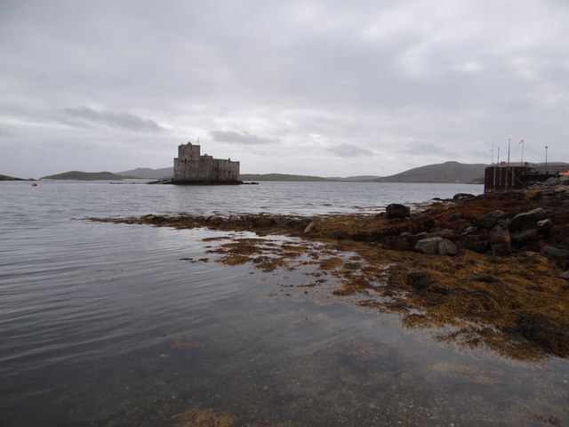
Kisimul Castle

Kisimul Castle (Scottish Gaelic: Caisteal Chiosmuil) and also known as Kiessimul Castle, is a medieval castle located on a small island off Castlebay,...
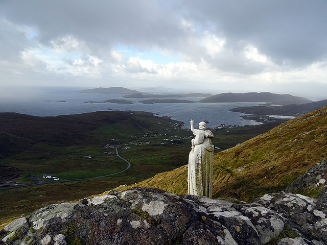
Heaval

Heaval is the highest hill on the Outer Hebridean island of Barra, Scotland. The highest point is 383 metres high above sea level and it is located 1.5...
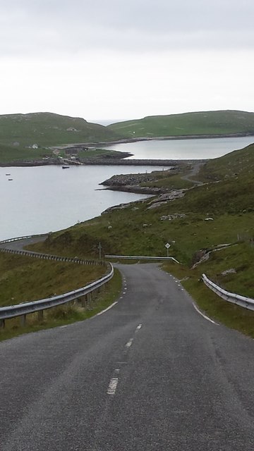
Vatersay Causeway

The Vatersay Causeway (Scottish Gaelic: Rathad Bhàgh Bhatarsaigh) is a 250-metre-long causeway that links the Scottish Hebridean Islands of Vatersay and...

Brevig, Barra

Brevig (Scottish Gaelic: Brèibhig) is a village on the island of Barra, in the Outer Hebrides, Scotland. The settlement is situated on the A888, which...

Nearby Amenities

Located within 500m of 56.955388,-7.4923161
Bagh a Chaisteil
Name En: Castlebay
Name Gd: Bagh a Chaisteil
Traffic Sign: city_limit
Lat/Long: 56.9561409/-7.4988749
Crossing
Crossing: uncontrolled
Lat/Long: 56.9558249/-7.496211
Telephone
Booth: KX100
Covered: booth
Source: survey
Lat/Long: 56.9550235/-7.4858146
Turning Circle
Lat/Long: 56.953571/-7.4983452
Crossing
Crossing: uncontrolled
Lat/Long: 56.9559356/-7.4971505
Turning Circle
Lat/Long: 56.9550288/-7.4986596
Turning Circle
Lat/Long: 56.9561171/-7.4941828
Bàgh a' Chaisteil
Loc Name: Baile MhicNèill
Name En: Castlebay
Name Gd: Bàgh a' Chaisteil
Name Sco: Castleby
Place: village
Population: 434
Wikidata: Q1049581
Wikipedia: en:Castlebay
Lat/Long: 56.9551221/-7.4859693
Ferry Terminal
Lat/Long: 56.9523141/-7.4869121
Ferry Terminal
Cargo: passengers
Lat/Long: 56.9539521/-7.4862161
Leisure: slipway
Seamark Information: by car
Seamark Small Craft Facility Category: slipway
Seamark Type: small_craft_facility
Lat/Long: 56.9543533/-7.4881397
Noexit: yes
Lat/Long: 56.9549774/-7.4988085
Noexit: yes
Lat/Long: 56.9550003/-7.4985171
Turning Circle
Turning Circle: knuckle
Lat/Long: 56.9562177/-7.4927382
Restaurant
Cafe Kisimul
Cuisine: curry
Fhrs Id: 806506
Website: https://www.cafekisimul.co.uk/
Lat/Long: 56.9543016/-7.48665
Pub
Castlebay Bar
Lat/Long: 56.9553934/-7.4872449
Restaurant
Restaurant at Castlebay Hotel
Lat/Long: 56.9554843/-7.4878291
Bank
Banca Rìoghail na h-Alba
Addr City: Bàgh a' Chaisteil
Atm: yes
Brand: Royal Bank of Scotland
Name En: Royal Bank of Scotland
Name Gd: Banca Rìoghail na h-Alba
Not Addr Postcode: HS9 5XA
Operator: Royal Bank of Scotland
Website: https://locator-rbs.co.uk/Branch/831703-Castlebay.html
Lat/Long: 56.9545055/-7.4865143
Cafe
The Deck
Comment: Al Fresco (outside) only
Lat/Long: 56.9551442/-7.4897032
Operator: Caledonian MacBrayne
Shop: travel_agency
Website: https://www.calmac.co.uk/ports/castlebay
Lat/Long: 56.9540986/-7.4875145
Post Office
Oifis a' Phuist Bàgh a' Chaisteil
Addr City: Eilean Bharraigh
Addr City En: Isle of Barra
Addr Country: GB
Addr Postcode: HS9 5XD
Addr Suburb: Bàgh a' Chaisteil
Addr Suburb En: Castlebay
Brand: Post Office
Brand Wikidata: Q1783168
Facebook: https://www.facebook.com/CastlebayPostOffice/
Name En: Castlebay Post Office
Name Gd: Oifis a' Phuist Bàgh a' Chaisteil
Opening Hours: Mo 08:30-17:30; Tu-Fr 09:00-17:30; Sa 09:00-12:30
Ref Pol Id: 3013
Website: https://www.postoffice.co.uk/branch-finder/1528696/castlebay
Lat/Long: 56.9541366/-7.4867402
Hebridean Toffee
Addr City: Eilean Bharraigh
Addr City En: Isle of Barra
Addr Country: GB
Addr Postcode: HS9 5XD
Addr Suburb: Bàgh a' Chaisteil
Addr Suburb En: Castlebay
Fhrs Id: 806505
Shop: confectionery
Website: https://www.hebrideantoffeecompany.com/
Lat/Long: 56.9551299/-7.489541
Post Box
Collection Times: Mo-Fr 10:00; Sa 08:00
Operator: Royal Mail
Post Box Type: pillar
Ref: HS9 13
Royal Cypher: scottish_crown
Lat/Long: 56.9541027/-7.4866295
Post Box
Collection Times: Mo-Fr 09:45; Sa 09:45
Note: front panel messed up, collection times and ref not clear
Operator: Royal Mail
Post Box Type: lamp
Ref: HS9 5
Royal Cypher: scottish_crown
Lat/Long: 56.9533621/-7.4988329
Toilets
Drinking Water: yes
Fee: no
Wheelchair: yes
Lat/Long: 56.9551971/-7.4862309
Pub
Craigard Bar
Lat/Long: 56.9548117/-7.4845193
Cafe
Tartan Tables Cafe
Addr City: Eilean Bharraigh
Addr City En: Isle of Barra
Addr Country: GB
Addr Postcode: HS9 5XD
Addr Suburb: Bàgh a' Chaisteil
Addr Suburb En: Castlebay
Facebook: https://www.facebook.com/TartanTableCafe/
Fhrs Id: 806512
Lat/Long: 56.9558865/-7.4983884
Fuel
A&C Maclean
Addr City: Eilean Bharraigh
Addr City En: Isle of Barra
Addr Country: GB
Addr Postcode: HS9 5XD
Addr Suburb: Bàgh a' Chaisteil
Addr Suburb En: Castlebay
Brand: Gulf
Brand Wikidata: Q5617505
Fhrs Id: 806504
Lat/Long: 56.9545794/-7.4861344
A&C MacLeans
Shop: convenience
Lat/Long: 56.9546232/-7.4864482
Doctors
Clach Mhile Surgery
Website: https://www.barramedicalpractice.co.uk/
Lat/Long: 56.9548855/-7.486335
Charging Station
Access: yes
Capacity: 2
Fee: yes
Operator: ChargePlace Scotland
Operator Wikidata: Q105359316
Ref: 50255
Socket Type2: 1
Socket Type2 Output: 22 kW
Website: https://chargeplacescotland.org/cpmap/chargepoint/1448307/
Lat/Long: 56.9550581/-7.4871199
Ferry Terminal
Ferry: yes
Public Transport: station
Lat/Long: 56.9541171/-7.4884668
Charging Station
Access: yes
Capacity: 2
Fee: yes
Operator: ChargePlace Scotland
Operator Wikidata: Q105359316
Ref: 50646
Website: https://chargeplacescotland.org/cpmap/chargepoint/621126/
Lat/Long: 56.9537995/-7.4873308
Barra Bike Hire
Service Bicycle Rental: yes
Shop: bicycle
Website: https://www.barrabikehire.co.uk
Lat/Long: 56.9552799/-7.488106
Atm
Brand: Royal Bank of Scotland
Operator: Royal Bank of Scotland
Lat/Long: 56.9545274/-7.4864274
Library
Leabharlann Coimhearsnachd Bàgh a' Chaisteil
Alt Name Gd: Leabharlann Bàgh a' Chaisteil
Name En: Castlebay Community Library
Name Gd: Leabharlann Coimhearsnachd Bàgh a' Chaisteil
Website: https://www.cne-siar.gov.uk/leisure-sport-and-culture/libraries-and-archives/leabharlannan-nan-eilean-siar/your-library/castlebay-community-library/
Lat/Long: 56.95622/-7.4968439
Castlebay
Leisure: marina
Seamark Harbour Category: marina
Seamark Type: harbour
Lat/Long: 56.9543596/-7.4896288
Social Facility
St Brendan’s Care Home
Operator: Comhairle nan Eilean Siar
Phone: +44 1871 810465
Social Facility: group_home
Social Facility For: senior
Website: https://www.cne-siar.gov.uk/social-care-and-health/community-care-and-criminal-justice/community-care/island-care-homes/st-brendan-s-care-home/
Lat/Long: 56.9520471/-7.4971215
Information: office
Operator: Buth Bharraigh
Tourism: information
Lat/Long: 56.9553034/-7.4882507
Cafe
Macroon's Tea Room
Outdoor Seating: yes
Lat/Long: 56.9541541/-7.4866902
Top Shop
Operator: A&C MacLean
Shop: convenience
Lat/Long: 56.9552628/-7.4859397
Toilets
Lat/Long: 56.954178/-7.4875298
Power: pole
Lat/Long: 56.9559575/-7.4848183
Power: pole
Lat/Long: 56.9559955/-7.4857382
Power: pole
Lat/Long: 56.957126/-7.4989052
Power: pole
Lat/Long: 56.9569725/-7.4979718
Power: pole
Lat/Long: 56.9567948/-7.4968748
Power: pole
Lat/Long: 56.9566953/-7.4961707
Power: pole
Lat/Long: 56.9567516/-7.4950495
Power: pole
Lat/Long: 56.9568057/-7.4940839
Power: pole
Lat/Long: 56.9566449/-7.4931157
Power: pole
Lat/Long: 56.9564716/-7.4920227
Power: pole
Lat/Long: 56.9562617/-7.49064
Power: pole
Lat/Long: 56.9561491/-7.4899332
Power: pole
Lat/Long: 56.9561176/-7.4888979
Power: pole
Lat/Long: 56.9560971/-7.488163
Power: pole
Lat/Long: 56.9560489/-7.4872899
Power: pole
Lat/Long: 56.9560182/-7.486563
Power: pole
Lat/Long: 56.9554624/-7.4865228
Power: pole
Lat/Long: 56.9559304/-7.4992043
Power: pole
Lat/Long: 56.9563238/-7.4994859
Power: pole
Lat/Long: 56.9566259/-7.4992472
Generator Method: photovoltaic
Generator Source: solar
Generator Type: solar_photovoltaic_panel
Location: roof
Power: generator
Lat/Long: 56.9569787/-7.495468
Library
Source: OS_Opendata_StreetView
Lat/Long: 56.9562211/-7.4981563
Shelter
Shelter Type: public_transport
Lat/Long: 56.9539471/-7.487139
Edna Windsor
Water Rescue
Emergency: water_rescue
Lifeboat: offshore
Lifeboat Class: RNLI Severn
Operator: Royal National Lifeboat Institution
Operator Short: RNLI
Ref: 17-12
Seamark Name: Edna Windsor
Seamark Radio Station Category: ais
Seamark Radio Station Mmsi: 232003050
Seamark Rescue Station Category: lifeboat_on_mooring
Seamark Source: Bing; https://rnli.org/find-my-nearest
Seamark Type: rescue_station
Website: https://rnli.org/find-my-nearest/lifeboat-stations/barra-island-lifeboat-station/barra-island-lifeboat
Lat/Long: 56.9534915/-7.4877794
Entrance: yes
Lat/Long: 56.9554766/-7.4969627
Generator Method: wind_turbine
Generator Source: wind
Power: generator
Lat/Long: 56.9565641/-7.4976667
Traffic Calming: choker
Lat/Long: 56.9559198/-7.4969941
Traffic Calming: choker
Lat/Long: 56.9560876/-7.4985351
Crossing
Lat/Long: 56.9560734/-7.4984164
Material: wood
Power: pole
Lat/Long: 56.9559291/-7.4896434
Material: wood
Power: pole
Lat/Long: 56.955309/-7.489807
Material: wood
Power: pole
Lat/Long: 56.9557266/-7.4896968
Material: wood
Power: pole
Lat/Long: 56.9558589/-7.488305
Power: pole
Lat/Long: 56.9554519/-7.4843186
Generator Method: wind_turbine
Generator Source: wind
Generator Type: horizontal_axis
Power: generator
Lat/Long: 56.9577557/-7.4913818
Power: pole
Lat/Long: 56.9520996/-7.4961942
Power: pole
Lat/Long: 56.9522953/-7.4964033
Power: pole
Lat/Long: 56.9526028/-7.4967242
Power: pole
Lat/Long: 56.9529033/-7.4970621
Power: pole
Lat/Long: 56.9529874/-7.4990323
Power: pole
Lat/Long: 56.9533697/-7.4994271
Power: pole
Lat/Long: 56.9538119/-7.4999097
Power: pole
Lat/Long: 56.9551972/-7.4949494
Power: pole
Lat/Long: 56.9556405/-7.495112
Power: pole
Lat/Long: 56.956131/-7.4952788
Power: pole
Lat/Long: 56.9563083/-7.4955216
Telephone
Booth: KX100
Covered: booth
Source: survey
Lat/Long: 56.9550116/-7.485833
Telephone
Booth: K6
Covered: booth
Operator: BT
Phone: +44 1871 810217
Lat/Long: 56.9552156/-7.4996944
Bus Stop
Co-Op
Bus: yes
Public Transport: platform
Lat/Long: 56.9551339/-7.4879515
Bus Stop
The Square
Bus: yes
Naptan AtcoCode: 601058
Naptan NaptanCode: 94724593
Public Transport: platform
Lat/Long: 56.9549551/-7.4860914
Turning Circle
Turning Circle: hammer
Lat/Long: 56.9565084/-7.4985511
Waste Basket
Lat/Long: 56.9550114/-7.4858797
Waste Basket
Lat/Long: 56.9550708/-7.4865337
Bus Stop
Craigard Hotel
Bus: yes
Public Transport: platform
Lat/Long: 56.9548793/-7.4853575
Bus Stop
Craigard Hotel
Bus: yes
Public Transport: platform
Lat/Long: 56.954911/-7.4852514
Bus Stop
Post Office
Bus: yes
Public Transport: platform
Lat/Long: 56.9540803/-7.4864731
Bus Stop
School
Bus: yes
Public Transport: platform
Lat/Long: 56.9560945/-7.4980069
Bus Stop
School
Bus: yes
Public Transport: platform
Lat/Long: 56.9559972/-7.4981017
Bus Stop
Horve Rd End
Bus: yes
Public Transport: platform
Lat/Long: 56.9557277/-7.4934571
Bus Stop
Horve Rd End
Bus: yes
Public Transport: platform
Lat/Long: 56.9557847/-7.4934683
Bus Stop
Horve Road
Bus: yes
Public Transport: platform
Lat/Long: 56.9542297/-7.4958446
Bus Stop
Horve Rd End
Bus: yes
Public Transport: platform
Lat/Long: 56.9543397/-7.4959175
Bus Stop
Hospital Rd End
Bus: yes
Public Transport: platform
Lat/Long: 56.953013/-7.4977584
Bus Stop
Hospital Rd End
Bus: yes
Public Transport: platform
Lat/Long: 56.953069/-7.4978724
Bus Stop
Fire Station
Bus: yes
Public Transport: platform
Lat/Long: 56.954591/-7.5004101
The data included in this document is from www.openstreetmap.org. The data is made available under ODbL.

Have you been to Sloc an Uisge?

Leave your review of Sloc an Uisge below (or comments, questions and feedback).