Leaba nan Aigheann
Coastal Feature, Headland, Point in Inverness-shire
Scotland
Leaba nan Aigheann
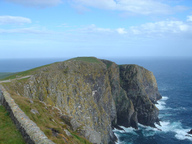
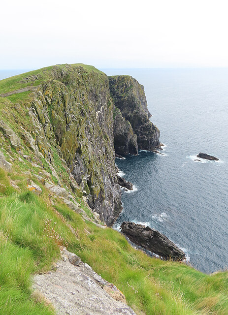
Leaba nan Aigheann, located in Inverness-shire, is a stunning coastal feature that encompasses a headland and point. Situated along the rugged and picturesque Scottish coastline, this natural formation is a sight to behold.
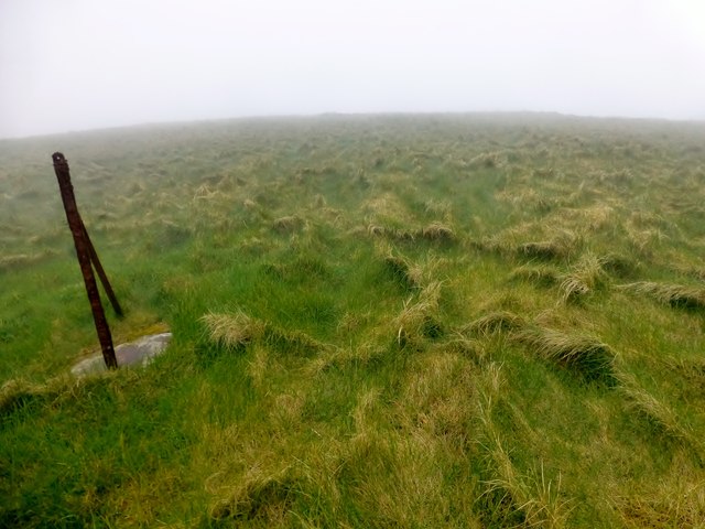
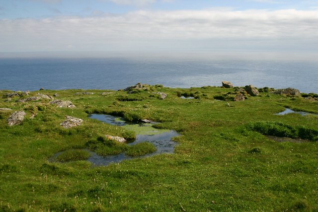
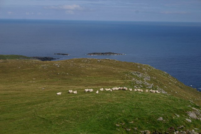
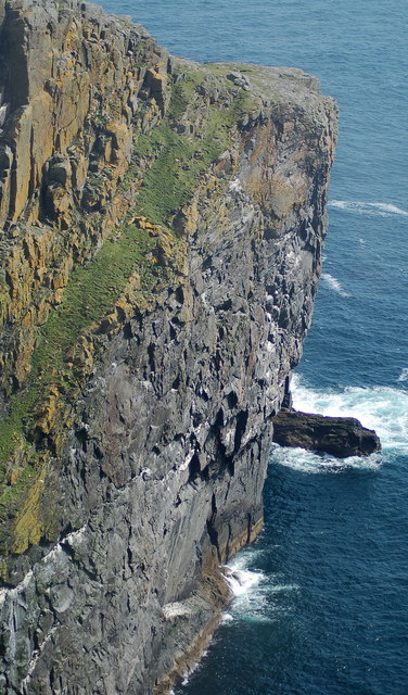
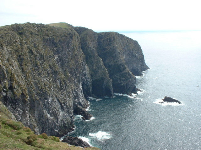
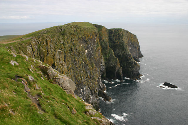
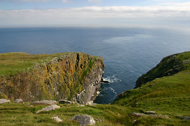
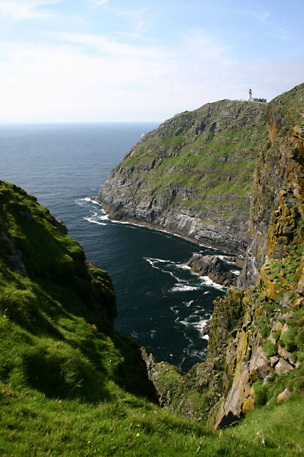
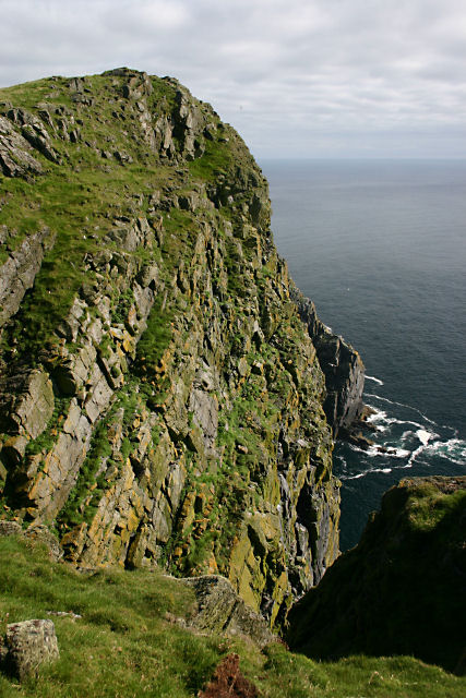
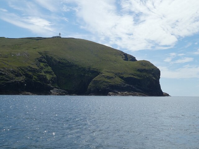
Leaba nan Aigheann is characterized by its towering cliffs, which offer breathtaking views of the surrounding landscape. The headland juts out into the sparkling waters of the North Sea, providing a dramatic contrast between the deep blue sea and the rugged coastal terrain. The point, extending beyond the headland, forms a narrow strip of land that is often exposed at low tide and can be explored by adventurous visitors.
The area surrounding Leaba nan Aigheann is rich in biodiversity. The cliffs serve as nesting grounds for various species of seabirds, including puffins, guillemots, and razorbills. The region's marine life is equally diverse, with seals and dolphins often spotted swimming in the waters below.
Leaba nan Aigheann is a popular destination for outdoor enthusiasts and nature lovers. Its rugged coastline offers opportunities for hiking, birdwatching, and photography. Visitors can follow the coastal trails that wind along the cliffs, providing panoramic views of the surrounding landscape. In addition to its natural beauty, the area is steeped in history, with ancient ruins and archaeological sites scattered throughout the region.
Overall, Leaba nan Aigheann is a captivating coastal feature that showcases the raw beauty of Scotland's coastline. With its stunning cliffs, diverse wildlife, and rich history, it is a must-visit destination for anyone seeking an immersive and unforgettable coastal experience.
If you have any feedback on the listing, please let us know in the comments section below.
Leaba nan Aigheann Images
Images are sourced within 2km of 56.778752/-7.6305694 or Grid Reference NL5679. Thanks to Geograph Open Source API. All images are credited.


Leaba nan Aigheann is located at Grid Ref: NL5679 (Lat: 56.778752, Lng: -7.6305694)
Unitary Authority: Na h-Eileanan an Iar
Police Authority: Highlands and Islands
What 3 Words
///rush.storybook.spend. Near CastleBay, Na h-Eileanan Siar
Nearby Locations
Related Wikis

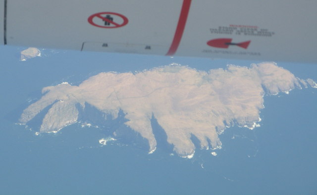
Barra Head
Barra Head, also known as Berneray (Scottish Gaelic: Beàrnaraigh; Scots: Barra Heid), is the southernmost island of the Outer Hebrides in Scotland. Within...

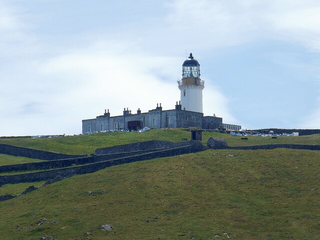
Barra Head Lighthouse
Barra Head Lighthouse on Barra Head identifies the southern entrance to The Minch, roughly halfway between the Eilean Glas and Rinns of Islay lighthouses...

Arnamul
Arnamul (Scottish Gaelic: Arnamuil) is a stack off the west coast of Mingulay in the Western Isles, Scotland. Although precipitous, sheep were grazed on...

Barra Isles
The Barra Isles, also known as the Bishop's Isles, are a small archipelago in the Outer Hebrides of Scotland. They lie south of the island of Barra, for...
Nearby Amenities
Located within 500m of 56.778752,-7.6305694Have you been to Leaba nan Aigheann?
Leave your review of Leaba nan Aigheann below (or comments, questions and feedback).