Barthorp's Creek

Sea, Estuary, Creek in Suffolk East Suffolk

England

Barthorp's Creek

Suffolk Punch Trust, Sink Farm, Hollesley This building houses the museum, cafe and reception area. The Trust is dedicated to the preservation and promotion of the Suffolk Punch, a breed of draught horse which in recent years has been in danger of extinction.

See <span class="nowrap"><a title="http://suffolkpunchtrust.org/" rel="nofollow ugc noopener" href="http://suffolkpunchtrust.org/">Link</a><img style="margin-left:2px;" alt="External link" title="External link - shift click to open in new window" src="https://s1.geograph.org.uk/img/external.png" width="10" height="10"/></span>
Suffolk Punch Trust, Sink Farm, Hollesley Credit: David Kemp

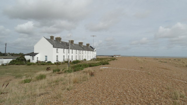
Barthorp's Creek is a picturesque waterway located in Suffolk, England. It is a tidal creek that runs inland from the North Sea, forming an estuary as it reaches the mainland. The creek covers an area of approximately 4 square kilometers and is surrounded by beautiful marshlands and rolling hills.

The creek is known for its rich biodiversity and serves as a vital habitat for a variety of plant and animal species. The surrounding marshes are home to numerous bird species, including wading birds like herons and egrets. The creek itself is teeming with fish, making it a popular spot for anglers.

The tidal nature of Barthorp's Creek means that its water levels fluctuate throughout the day, creating a dynamic and ever-changing environment. At high tide, the creek is a deep and navigable waterway, allowing boats to access the mainland. During low tide, however, the creek transforms into a shallow and muddy expanse, revealing extensive mudflats.

The creek also has historical significance, with evidence of human activity dating back to the Roman era. The nearby village of Barthorp's Creek was once a thriving port, serving as a trading hub for the surrounding area.

Today, Barthorp's Creek attracts visitors who are drawn to its natural beauty and tranquility. It offers opportunities for boating, birdwatching, and leisurely walks along its banks. The creek provides a peaceful escape from the hustle and bustle of modern life, allowing visitors to immerse themselves in the serene and untouched natural surroundings.

If you have any feedback on the listing, please let us know in the comments section below.

Barthorp's Creek Images

Images are sourced within 2km of 52.045753/1.4602269 or Grid Reference TM3744. Thanks to Geograph Open Source API. All images are credited.

Suffolk Punch Trust, Sink Farm, Hollesley This building houses the museum, cafe and reception area. The Trust is dedicated to the preservation and promotion of the Suffolk Punch, a breed of draught horse which in recent years has been in danger of extinction.

See <span class="nowrap"><a title="http://suffolkpunchtrust.org/" rel="nofollow ugc noopener" href="http://suffolkpunchtrust.org/">Link</a><img style="margin-left:2px;" alt="External link" title="External link - shift click to open in new window" src="https://s1.geograph.org.uk/img/external.png" width="10" height="10"/></span>
Suffolk Punch Trust, Sink Farm, Hollesley
This building houses the museum, cafe and reception area. The Trust is dedicated to the preservation and promotion of the Suffolk Punch, a breed of draught horse which in recent years has been in danger of extinction. See LinkExternal link
Suffolk Punch Trust, Hollesley This building houses the stables and training school. The Trust is dedicated to the preservation and promotion of the Suffolk Punch, a breed of draught horse which in recent years has been in danger of extinction.

See <span class="nowrap"><a title="http://suffolkpunchtrust.org/" rel="nofollow ugc noopener" href="http://suffolkpunchtrust.org/">Link</a><img style="margin-left:2px;" alt="External link" title="External link - shift click to open in new window" src="https://s1.geograph.org.uk/img/external.png" width="10" height="10"/></span>
Suffolk Punch Trust, Hollesley
This building houses the stables and training school. The Trust is dedicated to the preservation and promotion of the Suffolk Punch, a breed of draught horse which in recent years has been in danger of extinction. See LinkExternal link
Suffolk Punch Trust This is Besthorpe Achilles, one of the resident Suffolk Punches. The Trust is dedicated to the preservation and promotion of the Suffolk Punch, a breed of draught horse which in recent years has been in danger of extinction.

See <span class="nowrap"><a title="http://suffolkpunchtrust.org/" rel="nofollow ugc noopener" href="http://suffolkpunchtrust.org/">Link</a><img style="margin-left:2px;" alt="External link" title="External link - shift click to open in new window" src="https://s1.geograph.org.uk/img/external.png" width="10" height="10"/></span>
Suffolk Punch Trust
This is Besthorpe Achilles, one of the resident Suffolk Punches. The Trust is dedicated to the preservation and promotion of the Suffolk Punch, a breed of draught horse which in recent years has been in danger of extinction. See LinkExternal link
Shingle bar near the mouth of the Ore
World War II pill box near the mouth of the Ore
Road Near HMP Hollesley Bay The sign on the left reads "Think Keys!"
Road Near HMP Hollesley Bay
The sign on the left reads "Think Keys!"
Footpath in Hollesley
Footpath in woodland near Glebe House
View towards Hollesley Hollesley church tower is in the far distance
View towards Hollesley
Hollesley church tower is in the far distance
Bridge over the river near the pumping station
Yacht heading into Orford Haven
Martello Tower Shingle Street
Shingle Street - Coastguard Cottages
Road to Shingle Street
Pill box
Pill box
Hidden Pill box
Hidden Pill box
Footpath towards Shingle Street
Ephemeral Art This white line of shells stretched many metres across Shingle Street
Ephemeral Art
This white line of shells stretched many metres across Shingle Street
Show me another place!

Barthorp's Creek is located at Grid Ref: TM3744 (Lat: 52.045753, Lng: 1.4602269)

Administrative County: Suffolk

District: East Suffolk

Police Authority: Suffolk

What 3 Words

///inversely.applause.curtail. Near Rendlesham, Suffolk

Related Wikis

River Alde

The River Alde and River Ore form a river system in Suffolk, England passing by Snape and Aldeburgh. The River Alde and River Ore meet northwest of Blaxhall...

HM Prison Hollesley Bay

HM Prison Hollesley Bay, known locally as Hollesley Bay Colony (to which signposts still point) or simply The Colony, is a Category D men's prison and...

HM Prison Warren Hill

HM Prison Warren Hill is a male prison located near the village of Hollesley in Suffolk, England. The prison is operated by His Majesty's Prison Service...

Simpson's Saltings

Simpson's Saltings is a 25 hectare nature reserve on the Suffolk coast east of Hollesley. It is managed by the Suffolk Wildlife Trust. It is in the Suffolk...

Nearby Amenities

Located within 500m of 52.045753,1.4602269
Source: PGS
Lat/Long: 52.0476271/1.466802
Source: PGS
Lat/Long: 52.0468089/1.4662441
Source: PGS
Lat/Long: 52.0458191/1.4654931
Source: PGS
Lat/Long: 52.0449613/1.465021
Source: PGS
Lat/Long: 52.0438131/1.4644202
Source: PGS
Lat/Long: 52.0429288/1.4639052
Source: PGS
Lat/Long: 52.042938/1.460632
Source: PGS
Lat/Long: 52.0432852/1.4605578
Source: PGS
Lat/Long: 52.0452865/1.461361
Source: PGS
Lat/Long: 52.0466128/1.4621335
Source: PGS
Lat/Long: 52.0485989/1.4638608
Source: PGS
Lat/Long: 52.0487705/1.464408
The data included in this document is from www.openstreetmap.org. The data is made available under ODbL.

Have you been to Barthorp's Creek?

Leave your review of Barthorp's Creek below (or comments, questions and feedback).