Bartonhall Creek

Sea, Estuary, Creek in Essex Rochford

England

Bartonhall Creek

River Roach, looking downstream from Stannets Creek
River Roach, looking downstream from Stannets Creek Credit: Mr James D

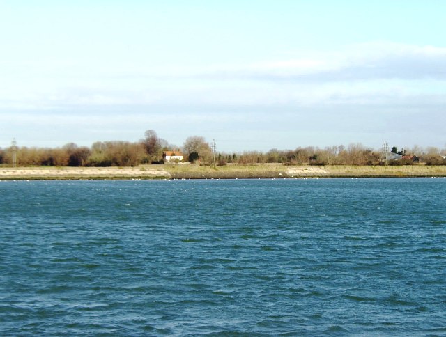
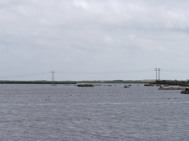
Bartonhall Creek is a notable waterbody located in the county of Essex, England. It is a small tidal creek that flows into the North Sea, forming an estuary along its course. The creek is situated near the village of St. Osyth, approximately 5 miles southeast of the town of Clacton-on-Sea.

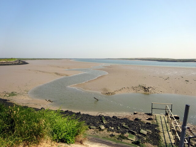
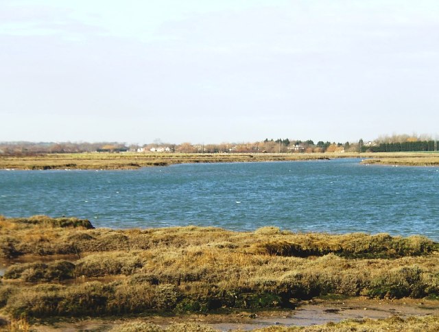
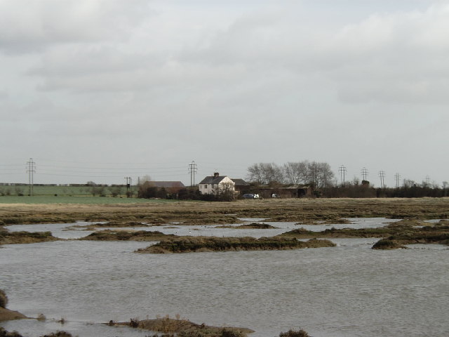
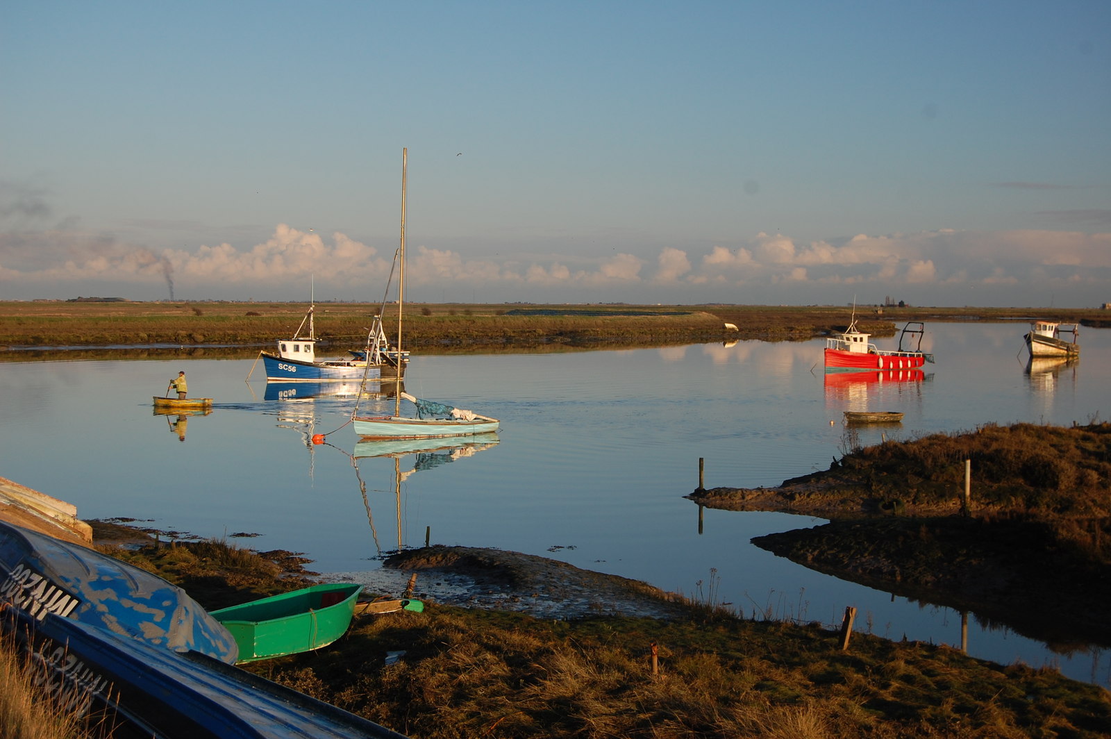
Spanning a length of approximately 4 miles, Bartonhall Creek is characterized by its meandering path through marshy lowlands and mudflats. It serves as a vital habitat for various species of flora and fauna, including wading birds, shellfish, and marine vegetation. The tidal nature of the creek allows for an ever-changing ecosystem, influenced by the ebb and flow of the sea.

The estuary formed by Bartonhall Creek is subject to tidal movements, with water levels fluctuating throughout the day. During high tides, the creek fills with seawater, creating a beautiful and serene landscape. At low tide, the water recedes, revealing vast mudflats that provide feeding grounds for migratory birds and other wildlife.

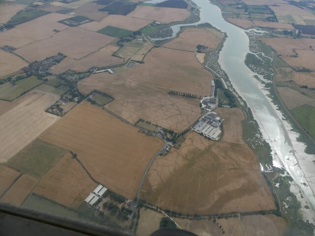
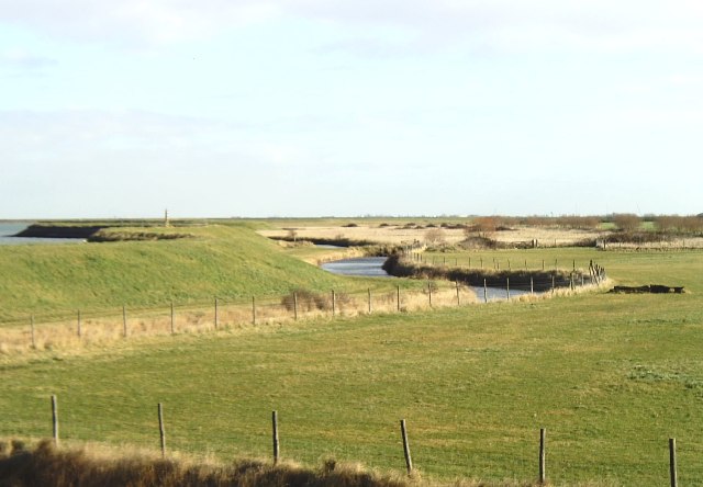
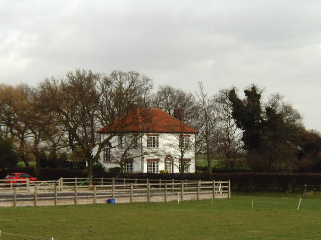
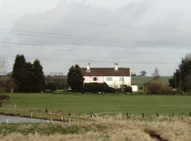
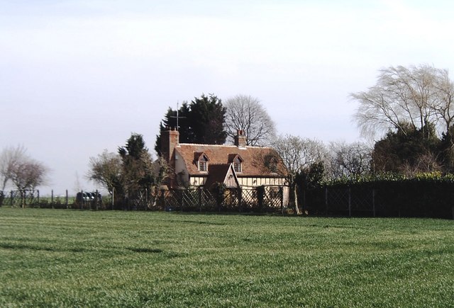
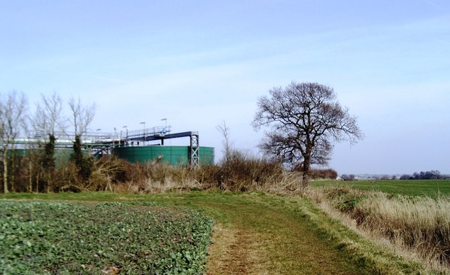
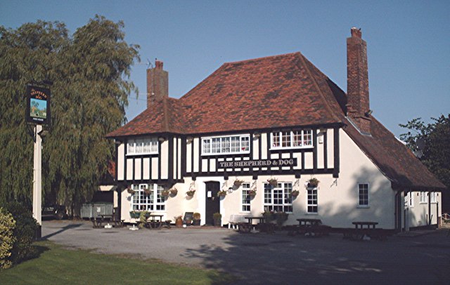
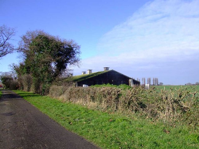
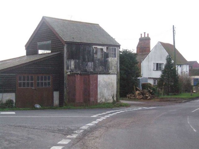
The surrounding area of Bartonhall Creek is primarily rural, with patches of farmland and salt marshes. The creek, along with its estuary, offers picturesque views and is a popular spot for nature enthusiasts, birdwatchers, and photographers. The tranquility and natural beauty of this area make it a favored destination for those seeking a peaceful escape.

Overall, Bartonhall Creek, with its estuary, is a unique and important natural feature in Essex. Its ever-changing landscape, diverse wildlife, and scenic surroundings make it an area of ecological significance and a place of interest for visitors and locals alike.

If you have any feedback on the listing, please let us know in the comments section below.

Bartonhall Creek Images

Images are sourced within 2km of 51.585267/0.75731559 or Grid Reference TQ9190. Thanks to Geograph Open Source API. All images are credited.

River Roach, looking downstream from Stannets Creek
WWI memorial plaque, St Mary and All Saints Church, Great Stambridge Located inside the church, northern wall.
WWI memorial plaque, St Mary and All Saints Church, Great Stambridge
Located inside the church, northern wall.
WWII memorial plaque, St Mary and All Saints Church, Great Stambridge Immediately beneath the WWI plaque, hence the "And in memory of..." commencement of the dedication.
Located inside the church, northern wall.
WWII memorial plaque, St Mary and All Saints Church, Great Stambridge
Immediately beneath the WWI plaque, hence the "And in memory of..." commencement of the dedication. Located inside the church, northern wall.
Soilmarks on banks of River Roach east of Rochford: aerial 2022
River Roach This river is short, and in its lower reaches wide and tidal. Taken from Barling Marsh Sluice on the southern bank facing north.
River Roach
This river is short, and in its lower reaches wide and tidal. Taken from Barling Marsh Sluice on the southern bank facing north.
River bank near Barling The River Roach is on the far left and the water at the foot of the sea wall is a drainage channel. Taken near Roper's Farm looking east.
River bank near Barling
The River Roach is on the far left and the water at the foot of the sea wall is a drainage channel. Taken near Roper's Farm looking east.
Entrance to Bartonhall Creek, River Roach Bartonhall Creek, an inlet of the River Roach, can be seen on the opposite side of the river. Taken near Bolt's Farm, Barling on the southern bank looking north.
Entrance to Bartonhall Creek, River Roach
Bartonhall Creek, an inlet of the River Roach, can be seen on the opposite side of the river. Taken near Bolt's Farm, Barling on the southern bank looking north.
Waldens, Great Stambridge The land surrounding the farmhouse is used for stabling and other equestrian activities. Taken from the sea wall looking north.
Waldens, Great Stambridge
The land surrounding the farmhouse is used for stabling and other equestrian activities. Taken from the sea wall looking north.
Barton Hall, Great Stambridge Taken looking north-east across Bartonhall Creek at Barton Hall itself.
Barton Hall, Great Stambridge
Taken looking north-east across Bartonhall Creek at Barton Hall itself.
Farm cottages at Hampton Barns, near Great Stambridge Taken from the Roach Valley Way footpath looking north.
Farm cottages at Hampton Barns, near Great Stambridge
Taken from the Roach Valley Way footpath looking north.
Moats & Springs, near Great Stambridge Moats & Springs, a farmhouse surrounded by prairie-like fields, dates back to 1136 according to a plaque on the wall.
Moats & Springs, near Great Stambridge
Moats & Springs, a farmhouse surrounded by prairie-like fields, dates back to 1136 according to a plaque on the wall.
Sewage tanks near Great Stambridge Taken looking north from a public footpath.
Sewage tanks near Great Stambridge
Taken looking north from a public footpath.
Flooded marshland, Stannets Creek, Paglesham Marshland such as this has been deliberately flooded to curb erosion elsewhere. Taken from the Roach Valley Way.
Flooded marshland, Stannets Creek, Paglesham
Marshland such as this has been deliberately flooded to curb erosion elsewhere. Taken from the Roach Valley Way.
The Shepherd and Dog, Ballards Gore Typical country inn.
The Shepherd and Dog, Ballards Gore
Typical country inn.
Outbuildings Near Great Stambridge Hall.
Outbuildings
Near Great Stambridge Hall.
Ballards Gore These farm sheds are on a three way junction leading to Paglesham, Creeksea Ferry or Stambridge.
Ballards Gore
These farm sheds are on a three way junction leading to Paglesham, Creeksea Ferry or Stambridge.
Shepherd and Dog On Gore Road.  This is a great little pub.  I went there on a bikers' day.

Here is another picture <a href="https://www.geograph.org.uk/photo/236577">TQ9092 : The Shepherd and Dog, Ballards Gore</a>
Shepherd and Dog
On Gore Road. This is a great little pub. I went there on a bikers' day. Here is another picture TQ9092 : The Shepherd and Dog, Ballards Gore
The road junction at Ballards Gore This is where Gore Road, Creeksea Ferry Road and Paglesham Road all meet. The 'Shepherd & Dog' inn can be seen at the centre of the photo.
The road junction at Ballards Gore
This is where Gore Road, Creeksea Ferry Road and Paglesham Road all meet. The 'Shepherd & Dog' inn can be seen at the centre of the photo.
Show me another place!

Bartonhall Creek is located at Grid Ref: TQ9190 (Lat: 51.585267, Lng: 0.75731559)

Administrative County: Essex

District: Rochford

Police Authority: Essex

What 3 Words

///captures.surpassed.crackles. Near Rochford, Essex

Nearby Locations

Bartonhall Creek

Related Wikis

Stambridge

Stambridge is a civil parish in the Rochford district in Essex, England. It is located north of the River Roach between Rochford and Paglesham. The parish...

Great Stambridge

Great Stambridge is a village and former civil parish, 15 miles (24 km) south east of Chelmsford, now in the parish of Stambridge, in the Rochford district...

Barling, Essex

Barling is a village and former civil parish, now in the civil parish of Barling Magna in the Rochford district, in the county of Essex, England. It is...
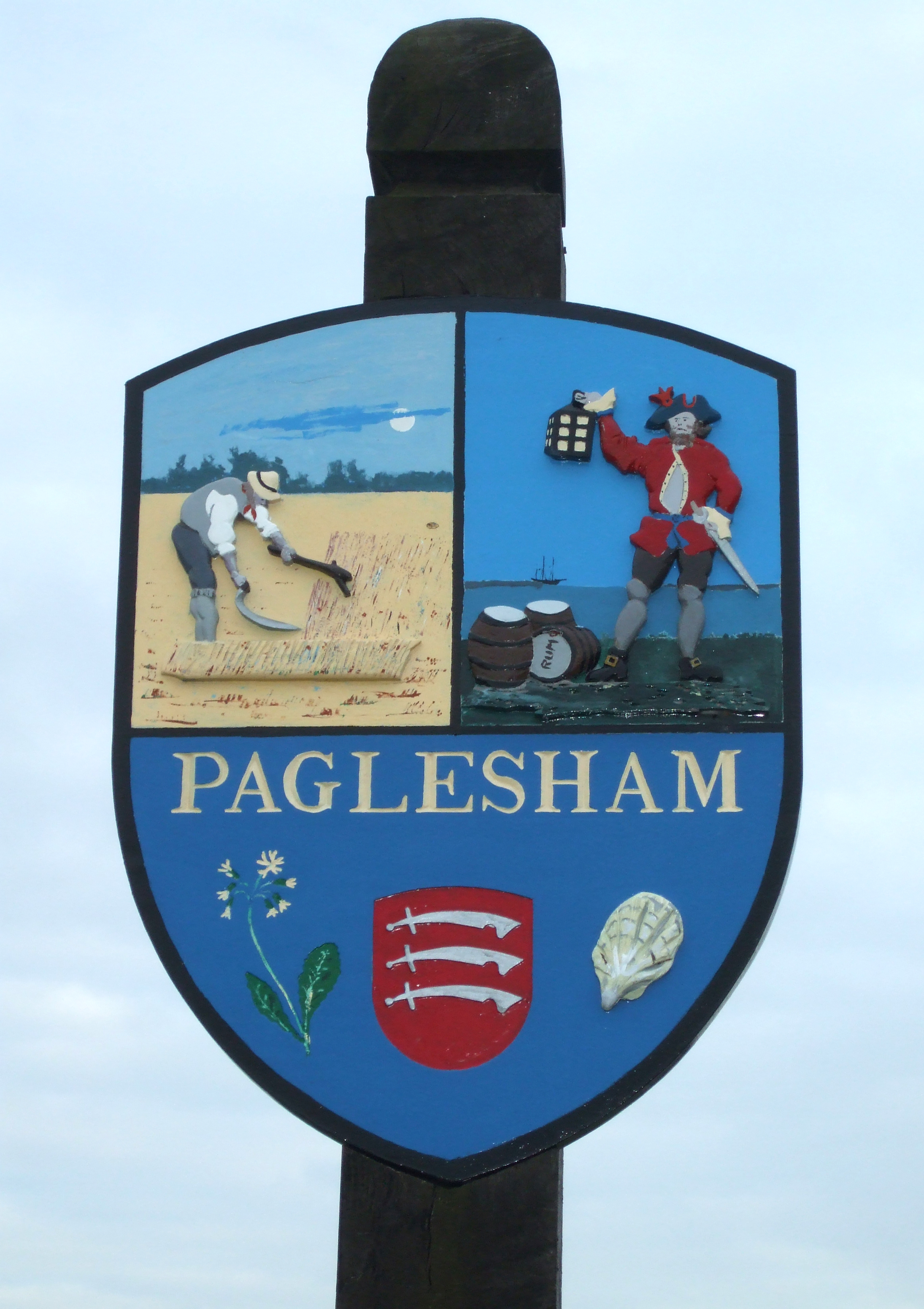
Paglesham

Paglesham ( PAG-əl-shəm) is a village and civil parish in the north east of the Rochford Rural District, Essex. The parish includes two hamlets of Eastend...

Nearby Amenities

Located within 500m of 51.585267,0.75731559
Source: PGS
Lat/Long: 51.5812238/0.7591478
Source: PGS
Lat/Long: 51.5813238/0.759695
Source: PGS
Lat/Long: 51.5815968/0.7601633
Source: PGS
Lat/Long: 51.582765/0.7605714
Source: PGS
Lat/Long: 51.583225/0.7600681
Source: PGS
Lat/Long: 51.5833677/0.7599487
Source: PGS
Lat/Long: 51.5839459/0.7600949
Source: PGS
Lat/Long: 51.5847176/0.7597087
Created By: dmgroom_coastlines
Source: PGS
Lat/Long: 51.584827/0.759091
Source: PGS
Lat/Long: 51.5849302/0.7579166
Source: PGS
Lat/Long: 51.5849535/0.7572943
Source: PGS
Lat/Long: 51.5852085/0.7559697
Source: PGS
Lat/Long: 51.5851693/0.7549183
Source: PGS
Lat/Long: 51.5855809/0.7533385
Source: PGS
Lat/Long: 51.5863252/0.7510448
Source: PGS
Lat/Long: 51.5864971/0.7509402
Source: PGS
Lat/Long: 51.5872403/0.7522116
Source: PGS
Lat/Long: 51.5875236/0.7529143
Source: PGS
Lat/Long: 51.5881569/0.7542125
Source: PGS
Lat/Long: 51.5881302/0.7543734
Created By: dmgroom_coastlines
Source: PGS
Lat/Long: 51.588077/0.754817
Source: PGS
Lat/Long: 51.587887/0.7553961
Created By: dmgroom_coastlines
Source: PGS
Lat/Long: 51.587589/0.756075
Created By: dmgroom_coastlines
Source: PGS
Lat/Long: 51.587341/0.756499
Created By: dmgroom_coastlines
Source: PGS
Lat/Long: 51.587093/0.756923
Created By: dmgroom_coastlines
Source: PGS
Lat/Long: 51.587101/0.757334
Created By: dmgroom_coastlines
Source: PGS
Lat/Long: 51.587364/0.757732
Created By: dmgroom_coastlines
Source: PGS
Lat/Long: 51.587372/0.758143
Created By: dmgroom_coastlines
Source: PGS
Lat/Long: 51.587132/0.758978
Created By: dmgroom_coastlines
Source: PGS
Lat/Long: 51.586884/0.759401
Created By: dmgroom_coastlines
Source: PGS
Lat/Long: 51.586772/0.76023
Created By: dmgroom_coastlines
Source: PGS
Lat/Long: 51.58652/0.760447
Created By: dmgroom_coastlines
Source: PGS
Lat/Long: 51.586271/0.760871
Created By: dmgroom_coastlines
Source: PGS
Lat/Long: 51.5858735/0.7612037
Source: PGS
Lat/Long: 51.5854479/0.7620147
Created By: dmgroom_coastlines
Source: PGS
Lat/Long: 51.5851769/0.7627034
Created By: dmgroom_coastlines
Source: PGS
Lat/Long: 51.584921/0.764024
Power: pole
Lat/Long: 51.588153/0.7613075
Power: pole
Lat/Long: 51.5882447/0.7585153
Power: pole
Lat/Long: 51.5883346/0.756678
Power: pole
Lat/Long: 51.588443/0.7546449
Power: pole
Lat/Long: 51.5881097/0.7531884
Power: pole
Lat/Long: 51.5877447/0.7515523
The data included in this document is from www.openstreetmap.org. The data is made available under ODbL.

Have you been to Bartonhall Creek?

Leave your review of Bartonhall Creek below (or comments, questions and feedback).