Earl Creek

Sea, Estuary, Creek in Essex Maldon

England

Earl Creek

Decoy Point at high tide From mid-river Blackwater
Decoy Point at high tide Credit: Chris Morgan

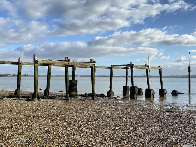
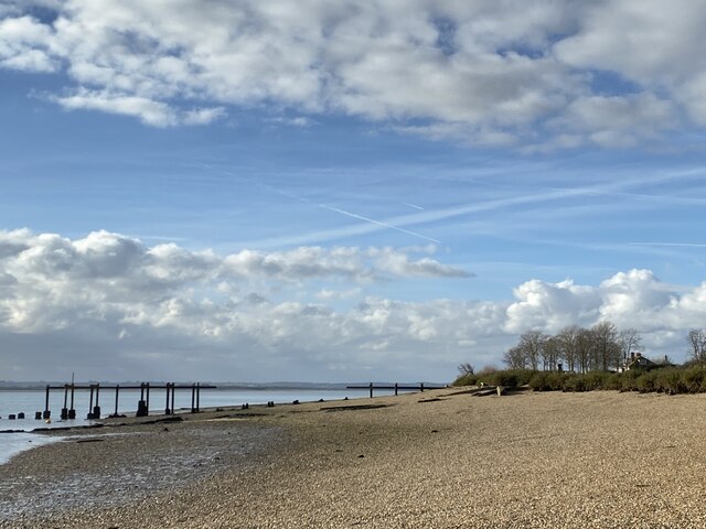
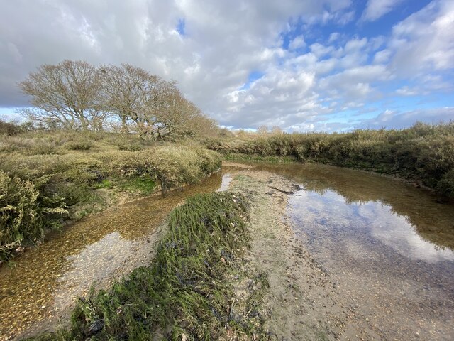
Earl Creek is a small waterway located in Essex, England. It is situated on the eastern coast of the country, specifically in the region known as the Essex estuaries. The creek runs parallel to the North Sea, providing a picturesque view of the seafront.

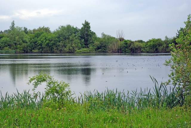
The creek is a tidal waterway, meaning the water levels rise and fall with the tides. This creates an ever-changing landscape, with mud flats and sandbanks emerging during low tide, and water flowing through the channel during high tide. The estuary environment is known for its rich biodiversity, with various species of birds, fish, and marine life calling the creek their home.

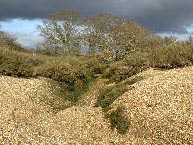
Earl Creek is surrounded by marshes and salt marsh habitats, which provide important feeding grounds and nesting sites for migratory birds. The area is a popular spot for birdwatching enthusiasts, who flock to the creek to observe species such as curlews, oystercatchers, and avocets.

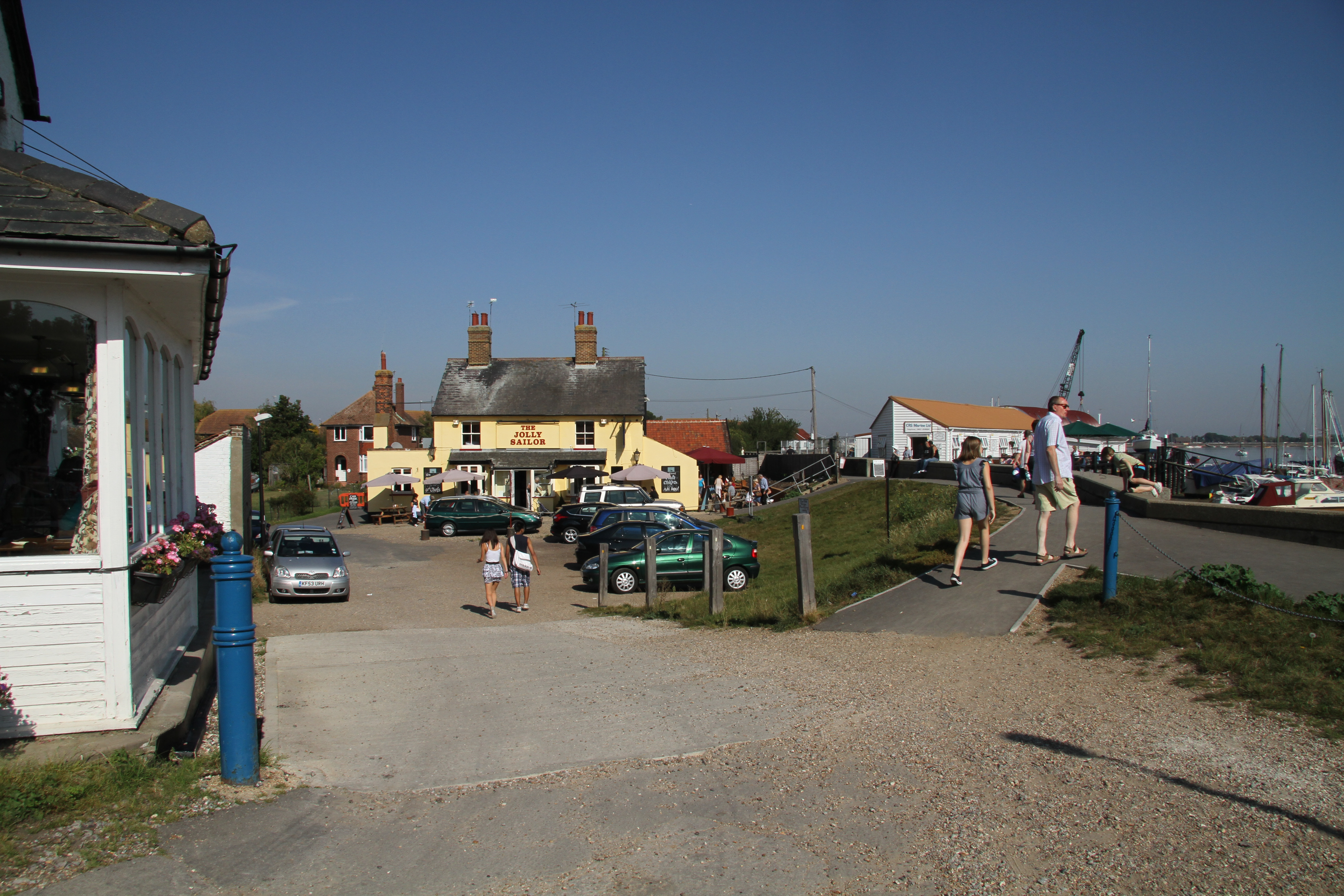
The creek is also utilized by local fishermen, who take advantage of the diverse marine life that inhabits the area. Fish such as cod, sole, and herring can be found in the waters, attracting anglers from nearby towns and villages.

In addition to its natural beauty and recreational activities, Earl Creek also has historical significance. The surrounding area is dotted with remnants of ancient settlements and Roman ruins, providing a glimpse into the region's past.

Overall, Earl Creek is a charming and vibrant waterway, offering a unique blend of natural wonders, recreational opportunities, and historical intrigue.

If you have any feedback on the listing, please let us know in the comments section below.

Earl Creek Images

Images are sourced within 2km of 51.730591/0.76283823 or Grid Reference TL9007. Thanks to Geograph Open Source API. All images are credited.

Decoy Point at high tide From mid-river Blackwater
Decoy Point at high tide
From mid-river Blackwater
Decoy Point at high tide
Seawall near Decoy Point, Heybridge The sea wall at Decoy Point, Heybridge and the tidal River Blackwater.

See also: <a href="https://www.geograph.org.uk/photo/7248938">TL8906 : Seawall near Decoy Point, Heybridge</a>
Seawall near Decoy Point, Heybridge
The sea wall at Decoy Point, Heybridge and the tidal River Blackwater. See also: TL8906 : Seawall near Decoy Point, Heybridge
Seawall near Decoy Point, Heybridge The sea wall at Decoy Point, Heybridge and the tidal River Blackwater.

See also: <a href="https://www.geograph.org.uk/photo/7248935">TL8806 : Seawall near Decoy Point, Heybridge</a>
Seawall near Decoy Point, Heybridge
The sea wall at Decoy Point, Heybridge and the tidal River Blackwater. See also: TL8806 : Seawall near Decoy Point, Heybridge
Causeway to Decoy Point Taken on Osea Island near West Point. The causeway is thought to be originally Roman. It is almost a mile long and emerges at low tide - and is the only way to access the private island (apart from by air). Taken when staying on the island to celebrate a friend's birthday.
Causeway to Decoy Point
Taken on Osea Island near West Point. The causeway is thought to be originally Roman. It is almost a mile long and emerges at low tide - and is the only way to access the private island (apart from by air). Taken when staying on the island to celebrate a friend's birthday.
Ruined landing stage, Osea Island This is near the Manor House on the southern side of the island and is on the main channel of the River Blackwater. The white building on the mainland which can just be seen through the leftmost gap in the pier, is Stansgate Abbey, the home of the  late Tony Benn. Osea Island is private and the shot was taken while staying on the island to celebrate a friend's birthday.
Ruined landing stage, Osea Island
This is near the Manor House on the southern side of the island and is on the main channel of the River Blackwater. The white building on the mainland which can just be seen through the leftmost gap in the pier, is Stansgate Abbey, the home of the late Tony Benn. Osea Island is private and the shot was taken while staying on the island to celebrate a friend's birthday.
Ruined pier/landing stage Osea Island The nomenclature varies according to which OS map you look at. See <a href="https://www.geograph.org.uk/photo/7392916">TL9105 : Ruined landing stage, Osea Island</a> for further details.
Ruined pier/landing stage Osea Island
The nomenclature varies according to which OS map you look at. See TL9105 : Ruined landing stage, Osea Island for further details.
Overgrown shingle banks near East Point, Osea Island These banks are stable (for now) being behind the island's earlier sea defences.
Osea Island is private; photo taken while staying on the island to celebrate a friend's birthday.
Overgrown shingle banks near East Point, Osea Island
These banks are stable (for now) being behind the island's earlier sea defences. Osea Island is private; photo taken while staying on the island to celebrate a friend's birthday.
On The Chase, Osea Island The Chase is the track from the causeway to the area of Osea Farm and on to the Manor House. Here I am approaching the area of farm buildings and cottages.
Osea is a private Island; the photo taken while staying on the island for a friend's birthday celebrations.
On The Chase, Osea Island
The Chase is the track from the causeway to the area of Osea Farm and on to the Manor House. Here I am approaching the area of farm buildings and cottages. Osea is a private Island; the photo taken while staying on the island for a friend's birthday celebrations.
Channel near East Point, Osea Island An interesting area of shingly saltmarsh at the eastern end of the island.
Channel near East Point, Osea Island
An interesting area of shingly saltmarsh at the eastern end of the island.
Goldhanger Creek A warm summer day (30°C) on the River Blackwater as seen from the England Coast path.

As well as boats, there are a couple of wild swimmers, presumably hoping to cool off.
Goldhanger Creek
A warm summer day (30°C) on the River Blackwater as seen from the England Coast path. As well as boats, there are a couple of wild swimmers, presumably hoping to cool off.
Adams Ale Residents in Goldhanger have a choice free mineral water from the village pump or Beer from a selection of pubs (sadly not free)!
Adams Ale
Residents in Goldhanger have a choice free mineral water from the village pump or Beer from a selection of pubs (sadly not free)!
Unleaded? No Chance! Some early petrol pumps in a long defunct garage forecourt in Goldhanger
Unleaded? No Chance!
Some early petrol pumps in a long defunct garage forecourt in Goldhanger
St. Peter's church, Goldhanger, Essex The north side of the church is Norman, 11th century, and the south side is 14th century when the aisle was added. There is evidence of much re-used Roman brick.  The tower was added in the 15th century.
St. Peter's church, Goldhanger, Essex
The north side of the church is Norman, 11th century, and the south side is 14th century when the aisle was added. There is evidence of much re-used Roman brick. The tower was added in the 15th century.
Goldhanger Creek, by Joyce's Farm. This is about an hour or two after high tide on the Essex salt marshes. There are huge expanses of marshland exposed at low tide. A dyke protects the reclaimed fields from flooding.
Goldhanger Creek, by Joyce's Farm.
This is about an hour or two after high tide on the Essex salt marshes. There are huge expanses of marshland exposed at low tide. A dyke protects the reclaimed fields from flooding.
Low Tide west of Gore Saltings. Large expanses of Goldhanger Creek beds are exposed with shingle, sands and mud evident.
Low Tide west of Gore Saltings.
Large expanses of Goldhanger Creek beds are exposed with shingle, sands and mud evident.
Salt Marsh Channel, by Gore Saltings. This is an hour or two after high tide. The dyke is on the left while the channel is running away into the distance to the Blackwater Estuary. On the right is the long spit with Gore Saltings on the other (south) side of it.
Salt Marsh Channel, by Gore Saltings.
This is an hour or two after high tide. The dyke is on the left while the channel is running away into the distance to the Blackwater Estuary. On the right is the long spit with Gore Saltings on the other (south) side of it.
Salt Marsh Channel, near Joyce's Farm. This channel parallels the sea wall (seen on the left). Reclaimed fields once occupied the land on the right of the channel but they have been allowed to revert to grazing marsh. A few cows were seen in the grass while ducks, herons and swans occupied the channel. This area was famous in Victorian times for its wildfowling. Ducks (like wigeon) were corralled into the covered inlets on the decoy ponds, caught there, killed, and then sent to the London markets.
Salt Marsh Channel, near Joyce's Farm.
This channel parallels the sea wall (seen on the left). Reclaimed fields once occupied the land on the right of the channel but they have been allowed to revert to grazing marsh. A few cows were seen in the grass while ducks, herons and swans occupied the channel. This area was famous in Victorian times for its wildfowling. Ducks (like wigeon) were corralled into the covered inlets on the decoy ponds, caught there, killed, and then sent to the London markets.
Show me another place!

Earl Creek is located at Grid Ref: TL9007 (Lat: 51.730591, Lng: 0.76283823)

Administrative County: Essex

District: Maldon

Police Authority: Essex

What 3 Words

///flickers.turkey.thunder. Near Mayland, Essex

Nearby Locations

The Stumble Earl Creek

Related Wikis

Osea Island

Osea Island (Old English: Ōsgȳþes īeg, "Osyth's island"), formerly also Osey, is an inhabited island in the estuary of the River Blackwater, Essex, East...

Blackwater Estuary

The Blackwater Estuary is the estuary of the River Blackwater between Maldon and West Mersea in Essex. It is a 5,538 hectare biological Site of Special...

Goldhanger

Goldhanger is a village and a civil parish on the B1026 road in the Maldon District, in the English county of Essex. Goldhanger had an agricultural museum...

Northey Island

Northey Island is an island in the estuary of the River Blackwater, Essex. It is linked to the south bank of the river by a causeway, covered for two hours...

Chigborough Lakes

Chigborough Lakes is an 18.6-hectare (46-acre) nature reserve in Maldon in Essex. It is managed by the Essex Wildlife Trust.This area of former gravel...

Heybridge Basin

Heybridge Basin is a village and civil parish about 1 mile from Maldon, in the Maldon district, in the county of Essex, England. In 2018 the built up area...

River Chelmer

The River Chelmer flows entirely through the county of Essex, England; it runs 40 miles (64 km) from the north-west of the county through Chelmsford to...

White House Farm murders

The White House Farm murders took place near the village of Tolleshunt D'Arcy, Essex, England, United Kingdom, during the night of 6–7 August 1985. Nevill...

Nearby Amenities

Located within 500m of 51.730591,0.76283823
The Stumble
Place: locality
Lat/Long: 51.729675/0.7659911
The data included in this document is from www.openstreetmap.org. The data is made available under ODbL.

Have you been to Earl Creek?

Leave your review of Earl Creek below (or comments, questions and feedback).